
Crusline
Good walks are even better shared.
Overview
Crusline Mountain Guide
Overview
Crusline is a hidden gem in the Scottish Highlands, where the scenery is as grand as the height you will be conquering. Located just a stone's throw from the bustling town of Callander, it's manageable enough for the novice hiker but still poses enough of a challenge to make you feel accomplished.
Geology
The hillsides tell a story, and Crusline's schist and gneiss are no exception. These ancient rocks have withstood the test of time and weather, offering a glimpse into the grandeur of our planet's geological history. Don't forget to pick up a rock; they're rock solid!
Hiking Route
The Crusline Circuit is the most popular route, with a distance of around 8.5 km and an ascent time of approximately 3.5 hours. With some rocky patches and grassy paths, it keeps you on your toes—literally! If you're looking for an adventure that won't leave you singing the blues, this route is a must.
Summit Features
When you reach the summit, take a moment to rest by the cairn. Here, you can embrace the sense of achievement, and perhaps take some selfies to make your friends envious. The views are nothing short of spectacular, and depending on your luck, you might even spot a wild deer or two.
Terrain
Be prepared for rocky and grassy terrains; don't forget, we said 'boggy' too. Whether you’re traipsing through the soft grass or gingerly stepping over stone, make sure your boots are up to the task, lest you find yourself doing an impromptu clog dance in the mud.
Access
Located conveniently close to Callander, Crusline is accessible for everyone. With a neat parking lot just off the A84, it is a short hike to the trailhead.
Facilities
Should you need comfort or sustenance, Callander boasts a fine selection of cafes and restaurants. So, if your resolve gives way to cravings, fret not! Coffee and cake are within reach.
Best Seasons
To fully appreciate Crusline, consider hiking in spring or autumn. Punchy flowers in spring and vibrant foliage in autumn offer a visual feast that is sure to lift your spirits—just keep an eye on the sky, as weather can change faster than you can say 'great Scottish scone'.
Conclusion
Crusline is more than just a mountain; it’s an experience waiting to unfold. With its stunning vistas, invigorating trails, and a bit of a challenge, this Highland beauty makes for a perfect day out. Pack your hiking gear, bring a sense of humour, and prepare to be dazzled! You might just find that the hills are alive with the sound of amazing stories waiting to be made.
Explore routes near Crusline
Public walks starting within 80 km of this hill. Nearby does not mean a route reaches the summit; check its map and access before setting out.
No public routes are currently listed within 80 km of Crusline on Walkmates. This does not mean there are no paths here. Explore the map and check local access information before planning a walk.
Route planning notes
These notes describe possible approaches, not verified navigable routes or permission to cross land. Check current paths, local access rules and conditions before setting out.
The Crusline Circuit
A well-marked route that offers stunning landscapes and an adrenaline rush as you ascend.
Make a day of it, together
Find someone to share the walk with, or organise a day out along a route you like.
Hill facts and local notes
Classifications
Elevation
355m
1,165 ft
Prominence
133m
Coordinates
52.3111, -9.6180
Q897189
OS Map
71
At the Summit
At the summit, you'll find a modest cairn and breathtaking views that will remind you why you put on your hiking boots this morning.
Terrain & Geology
Crusline is primarily composed of schist and gneiss, which provides a fantastic, albeit somewhat slippery, surface to navigate. The geological history reveals that these rocks were formed long before humans decided to hike up them, making them ancient companions for our outdoor adventures.
Views & Scenery
From the top of Crusline, you can gaze upon the stunning lengths of the Highlands, including nearby Loch Lomond and the sweeping valleys below.
History & Heritage
Name Origin
The name 'Crusline' might derive from the Gaelic for 'crest of the hill', which is rather fitting for a point that tends to boast its height.
Historical Significance
Like many summits in this region, Crusline has been part of the local culture and folklore, serving as a landmark for centuries.
Getting There & Facilities
Check current local access restrictions, parking rules and transport timetables before travelling. These notes do not confirm public access to the summit.
Parking
There is a car park at the start of the trail located just off the A84. Spaces can fill up quickly, especially on weekends, so aim to arrive early, like true early birds.
Public Transport
The nearest train station is in Callander, with occasional bus services available to nearby trailheads. A bit of a jaunt but worth the effort for the pristine scenery.
Nearby Facilities
Callander has several cafes, restaurants, and public toilets. Perfect for a hearty meal before and after your excursion.
Safety Information
Known Hazards
- Beware of sudden weather changes; the Highlands love to throw a curveball. Slippery rocks are also a hazard, especially on damp days.
General Safety Tips
- Check weather conditions before setting out
- Carry appropriate clothing and equipment
- Let someone know your planned route
- Take a map, compass, and GPS device
- Carry emergency supplies: food, water, first aid kit, torch
Hills
Some common questions about the hills answered
Are there group walks up Crusline?
Many walkers use Walkmates to join or organise walks with others. You can check for group walks around Crusline through the maps
Are there other walkers around Crusline?
Activity varies by location and time, but Walkmates lets you see whether others have shared walks or shown interest in this area. Find other people through the walking friends search walking friends for Crusline search or of course create your own walk for Crusline
Can I organise a walk to Crusline?
Yes. If there aren’t any walks listed already, you can create a walk and make it available for others to join.
If you're signed up to Walkmates, you can create a walk to Crusline.
How do I find a walk up this hill?
There are often multiple ways to walk this hill, depending on experience and route preference. Walkmates helps you explore walks and routes that others have shared.
Can I suggest a new route up Crusline?
Yes. You can suggest or create routes to share with others. Walkmates focuses on the social side of walking, so routes are used to help people organise walks and explore areas together, rather than as detailed navigation tools or route libraries.
Other uses really appreciate knowledgeable walkers sharing their routes. Share your favourite route to Crusline here
The is an error or something incorrect about this hill. How do I let you know?
We always strive to keep the information on Walkmates as accurate as possible. If you find an error, please let us know through the contact form and we'll aim to correct it as quickly as possible
Community Discussion
Comments
Location
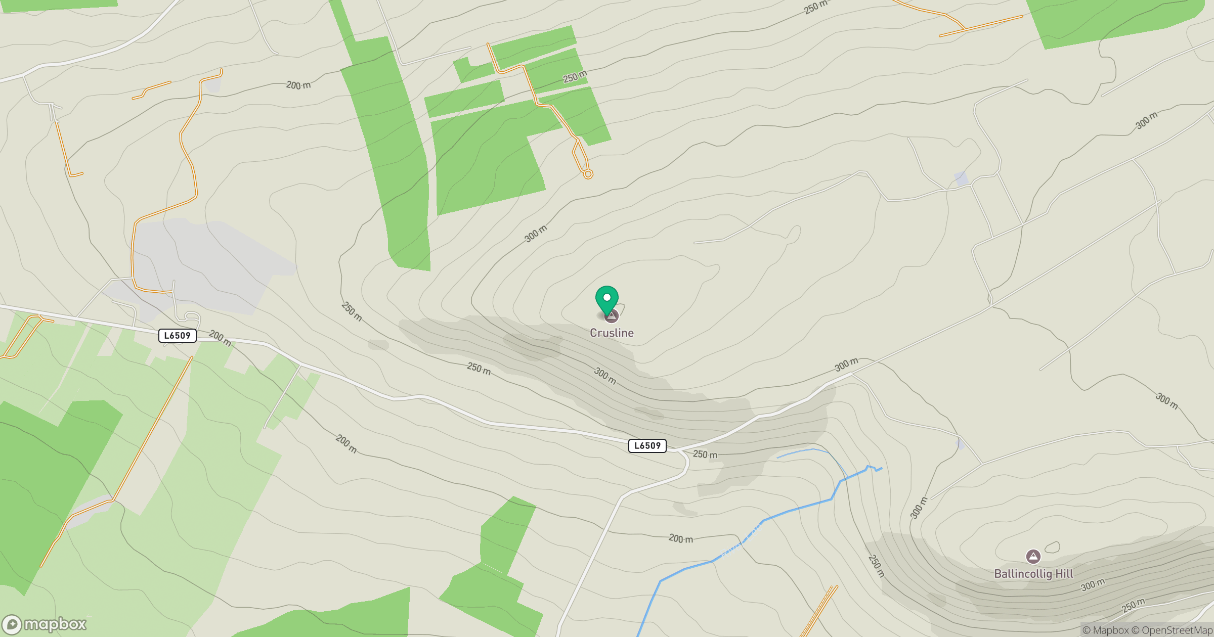
Grid reference: Q897189
View on OpenStreetMapOpens a map in a new tab, centred on the hill.
Hills within 30 km
Straight-line distance, not a walking route or confirmation of access.
Caherconree
834m
Baurtregaum [Barr Tri gCom]
850m
Knockatagglemore [Cnoc an Tseagail Mor]
330m
Maulin Mountain [Malainn]
217m
Baraveha [Knockanefune] [Barr an Bheithe]
451m
No comments yet. Be the first.