
Crucknaree
Good walks are even better shared.
Overview
Crucknaree: A Hiker's Delight
Introduction
Nestled in the picturesque Northern Ireland, Crucknaree is a magnificent mountain that offers not just a challenge, but also breathtaking views for those who dare to ascend its slopes. Spanning an elevation of 658 meters, it is classified as a Hewitt and proudly stands among its towering neighbours.
Geology
At its core, Crucknaree is built from Silurian slates and siltstones, characteristic of the region. The rock formations can be quite chameleon-like, morphing with the weather and light, offering different hues throughout the day. If you fancy yourself a geology aficionado, you'll appreciate spotting the glacial features carved into its land during the last Ice Age.
Hiking Routes
The Crucknaree Circuit is the most popular route, stretching over 10.5 km. It's a moderate hike that should take around 4 hours. Starting from the layby parking, it takes you on an engaging trek around the mountain before leading climbers to the summit. Just a heads up—it can be a bit rocky in places, so proper footwear is essential unless you fancy a surprise dip in some bogs!
Summit Features
Reaching the summit will reward you with a grand cairn, perfect for a well-deserved rest and some great photos. The view? Well, let’s just say it’s one for the albums—panoramic vistas of the Mourne Mountains, the beautiful Irish Sea, and on a clear day, the charming town of Newcastle.
Terrain and Hazards
Hikes can span rocky paths, grassy meadows, and the occasional bog, especially after a spell of rain. With delightful views come the double-edged sword of slippery rocks—take care not to redecorate your hiking boots!
Access and Facilities
Getting there is a breeze—with plenty of options for parking at the base, and good public transport links from Belfast. The friendly town of Newcastle at the foot of the mountains is well-equipped with cafes and restrooms to perk you up before or after your adventure.
History and Significance
The name 'Crucknaree', translating to 'hill of the king', paints a regal picture of its historical significance. Folklore dances around this mountain with tales from ancient history, suggesting it was once a battleground for kings.
Conclusion
So whether you’re in search of awe-inspiring views or jotting down your own chapter of mountain history, Crucknaree is ready to oblige. Make sure to pack your sense of adventure and maybe a few snacks—the summit deserves a celebratory bite! Happy hiking!
Explore routes near Crucknaree
Public walks starting within 80 km of this hill. Nearby does not mean a route reaches the summit; check its map and access before setting out.
No public routes are currently listed within 80 km of Crucknaree on Walkmates. This does not mean there are no paths here. Explore the map and check local access information before planning a walk.
Route planning notes
These notes describe possible approaches, not verified navigable routes or permission to cross land. Check current paths, local access rules and conditions before setting out.
Crucknaree Circuit
Starting from the small car park at the base, this route offers an adventurous circuit around the mountain before ascending to the summit.
Make a day of it, together
Find someone to share the walk with, or organise a day out along a route you like.
Hill facts and local notes
Classifications
Elevation
297m
974 ft
Prominence
100m
Coordinates
53.9584, -9.3124
G139018
OS Map
31
At the Summit
At the summit, you will find a sizable cairn that stands as a tribute to fellow hikers. Don’t forget to take a selfie with this stone giant!
Terrain & Geology
Crucknaree is primarily composed of Silurian-aged slates and siltstones, which give the mountain its distinctive rugged appearance. The area also features some extraordinary glacial features that hint at its icy past.
Views & Scenery
From the summit, panoramic views of the Mourne Mountains and the Irish Sea can be enjoyed on a clear day. You might even spot the bustling town of Newcastle in the distance.
History & Heritage
Name Origin
The name 'Crucknaree' is derived from the Irish 'Cruach na Rí', meaning 'hill of the king', hinting at its regal presence in the landscape.
Historical Significance
Crucknaree holds a place in local folklore, often mentioned in stories of ancient kings and battles, adding a touch of mythology to your hike.
Getting There & Facilities
Check current local access restrictions, parking rules and transport timetables before travelling. These notes do not confirm public access to the summit.
Parking
There is a small layby on the path from Newcastle to the base of Crucknaree, which can fit a few cars. Be sure not to block any access points.
Public Transport
Buses from Belfast to Newcastle run regularly. From the town centre, a short walk will bring you to the mountain's base.
Nearby Facilities
Newcastle has several cafes, restaurants, and public toilets available for hikers before or after their adventure.
Safety Information
Known Hazards
- Watch out for sudden changes in weather, and be cautious of slippery rocks and bogs, particularly after rainfall.
General Safety Tips
- Check weather conditions before setting out
- Carry appropriate clothing and equipment
- Let someone know your planned route
- Take a map, compass, and GPS device
- Carry emergency supplies: food, water, first aid kit, torch
Hills
Some common questions about the hills answered
Are there group walks up Crucknaree?
Many walkers use Walkmates to join or organise walks with others. You can check for group walks around Crucknaree through the maps
Are there other walkers around Crucknaree?
Activity varies by location and time, but Walkmates lets you see whether others have shared walks or shown interest in this area. Find other people through the walking friends search walking friends for Crucknaree search or of course create your own walk for Crucknaree
Can I organise a walk to Crucknaree?
Yes. If there aren’t any walks listed already, you can create a walk and make it available for others to join.
If you're signed up to Walkmates, you can create a walk to Crucknaree.
How do I find a walk up this hill?
There are often multiple ways to walk this hill, depending on experience and route preference. Walkmates helps you explore walks and routes that others have shared.
Can I suggest a new route up Crucknaree?
Yes. You can suggest or create routes to share with others. Walkmates focuses on the social side of walking, so routes are used to help people organise walks and explore areas together, rather than as detailed navigation tools or route libraries.
Other uses really appreciate knowledgeable walkers sharing their routes. Share your favourite route to Crucknaree here
The is an error or something incorrect about this hill. How do I let you know?
We always strive to keep the information on Walkmates as accurate as possible. If you find an error, please let us know through the contact form and we'll aim to correct it as quickly as possible
Community Discussion
Comments
Location
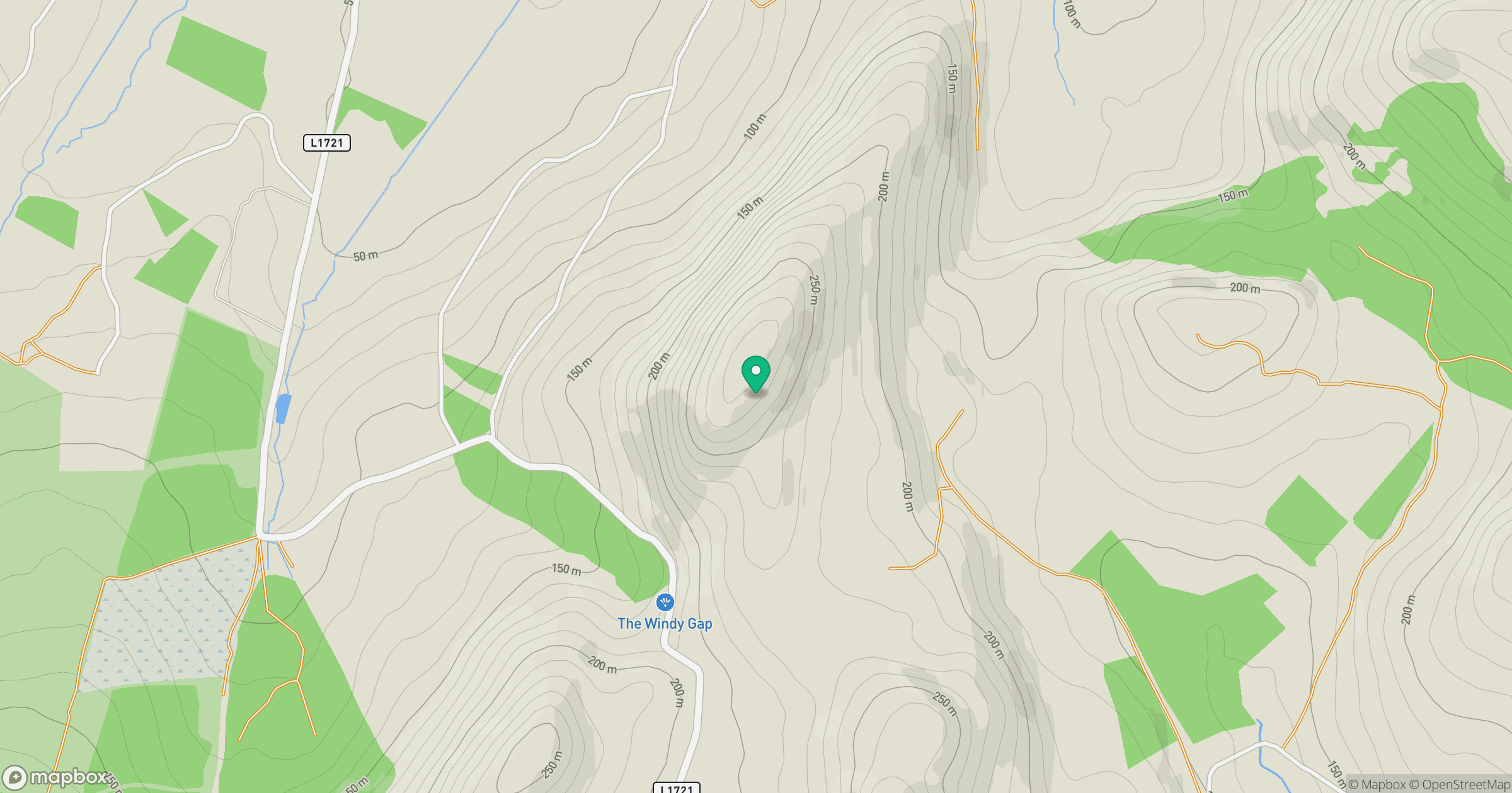
Grid reference: G139018
View on OpenStreetMapOpens a map in a new tab, centred on the hill.
Hills within 30 km
Straight-line distance, not a walking route or confirmation of access.
No comments yet. Be the first.