
Aroher Hill
Good walks are even better shared.
Overview
Aroher Hill
Nestled in the picturesque Southern Uplands, Aroher Hill rises to 473 meters, inviting outdoor enthusiasts to explore its gentle slopes and rocky outcrops. The summit is classified as a Hewitt, offering moderate challenges that can be appreciated by both seasoned and novice hikers alike.
Geology
Aroher Hill is a geological gem, predominantly composed of ancient Silurian shales and mudstones that provide the perfect backdrop for the vibrant flora that stretches across its slopes. This rich geological history can often be explored during your hike, with various textures and rock formations revealing the natural evolution of the landscape.
Routes
One of the most popular routes to the summit is the Aroher Hill Circular, which starts in the quaint village of Moniave. This route covers approximately 8.5 km and typically takes about 3.5 hours to complete. The path offers a delightful mix of gentle ascents and some more rugged sections, ensuring that everyone gets a good workout!
Summit Features
Upon reaching the summit, hikers are welcomed by a modest yet charming cairn, with a slightly rusty trig point nearby that hints at the hill's storied past. It’s a great spot to catch your breath and take in the views.
Terrain Type
The terrain here varies from grassy slopes to rocky outcrops, along with a few boggy spots that can surprise the unprepared. Sturdy boots are recommended to navigate these areas while keeping your ankles intact!
Views
The top of Aroher Hill rewards climbers with breathtaking views of the Galloway Forest Park. On clear days, you can spot the Rhinns of Galloway to the west and the beautiful Firth of Clyde in the distance. The best time to visit is in spring or early autumn, when visibility is typically at its peak.
Hazards
As with any outdoor adventure, head out prepared! Steer clear of boggy areas to avoid unexpected wet feet, and remember that the weather can change on a dime—pack a trusty waterproof jacket. And don't forget your sense of humour; it's essential for those 'unexpected' slip moments!
Nearby Summits
If you're keen on exploring more, nearby summits like Benbrack (722 m) and Criffel (564 m) offer additional adventure opportunities.
Access
Accessing Aroher Hill is straightforward. Park at the village of Moniave, where you can find free parking next to the community hall. For those relying on public transport, buses from Dumfries operate, although checking the schedule is wise to avoid confusion.
Facilities
After a rewarding day on the hill, the village of Moniave boasts a local shop and a pub perfect for refuelling and recounting the day's adventures.
History
While the exact meaning of 'Aroher' is debated, it reflects the history and culture of the region. Historically, it served as a lookout during significant events, and its fields have been maintained by dedicated farmers who’ve mastered the local landscape over centuries.
Plan your journey to Aroher Hill, enjoy the views, and most of all, have a great time exploring the beautiful Southern Uplands!
Explore routes near Aroher Hill
Public walks starting within 80 km of this hill. Nearby does not mean a route reaches the summit; check its map and access before setting out.
No public routes are currently listed within 80 km of Aroher Hill on Walkmates. This does not mean there are no paths here. Explore the map and check local access information before planning a walk.
Route planning notes
These notes describe possible approaches, not verified navigable routes or permission to cross land. Check current paths, local access rules and conditions before setting out.
Aroher Hill Circular
A scenic circular route starting from the nearby village of Moniave, offering both gentle and challenging sections.
Make a day of it, together
Find someone to share the walk with, or organise a day out along a route you like.
Hill facts and local notes
Classifications
Elevation
285m
935 ft
Prominence
112m
Coordinates
54.0010, -9.5867
F960069
OS Map
23 31
At the Summit
The summit features a modest cairn, and on clearer days, you may find a faint, slightly rusty trig point that adds character (and a hint of mystery) to the peak.
Terrain & Geology
Aroher Hill is primarily composed of Silurian shales and mudstones, lending a rich texture to its slopes and a canvas for the diverse flora that graces its terrain.
Views & Scenery
From the summit, enjoy panoramic views of the Galloway Forest Park, the distant hills of the Rhinns of Galloway, and on a good day, the glimmering Firth of Clyde.
History & Heritage
Name Origin
The meaning of 'Aroher' is somewhat shrouded in mystery, but it may derive from local dialects relating to the area's natural features.
Historical Significance
Historically significant as a lookout point during various conflicts, and many sheep farmers have fought local terrain to safeguard their flocks.
Getting There & Facilities
Check current local access restrictions, parking rules and transport timetables before travelling. These notes do not confirm public access to the summit.
Parking
There is parking available at the village of Moniave, typically beside the community hall. Parking is free of charge but may fill up on sunny weekends.
Public Transport
Buses run from Dumfries to Moniave, but service can be limited, so it's usually best to check the schedule in advance.
Nearby Facilities
Basic facilities such as a village shop and a pub in Moniave where you can grab a bite and refresh yourself post-hike.
Safety Information
Known Hazards
- Boggy paths can be deceiving, and sudden weather changes can occur, so pack a waterproof jacket and a sense of humour.
General Safety Tips
- Check weather conditions before setting out
- Carry appropriate clothing and equipment
- Let someone know your planned route
- Take a map, compass, and GPS device
- Carry emergency supplies: food, water, first aid kit, torch
Hills
Some common questions about the hills answered
Are there group walks up Aroher Hill?
Many walkers use Walkmates to join or organise walks with others. You can check for group walks around Aroher Hill through the maps
Are there other walkers around Aroher Hill?
Activity varies by location and time, but Walkmates lets you see whether others have shared walks or shown interest in this area. Find other people through the walking friends search walking friends for Aroher Hill search or of course create your own walk for Aroher Hill
Can I organise a walk to Aroher Hill?
Yes. If there aren’t any walks listed already, you can create a walk and make it available for others to join.
If you're signed up to Walkmates, you can create a walk to Aroher Hill.
How do I find a walk up this hill?
There are often multiple ways to walk this hill, depending on experience and route preference. Walkmates helps you explore walks and routes that others have shared.
Can I suggest a new route up Aroher Hill?
Yes. You can suggest or create routes to share with others. Walkmates focuses on the social side of walking, so routes are used to help people organise walks and explore areas together, rather than as detailed navigation tools or route libraries.
Other uses really appreciate knowledgeable walkers sharing their routes. Share your favourite route to Aroher Hill here
The is an error or something incorrect about this hill. How do I let you know?
We always strive to keep the information on Walkmates as accurate as possible. If you find an error, please let us know through the contact form and we'll aim to correct it as quickly as possible
Community Discussion
Comments
Location
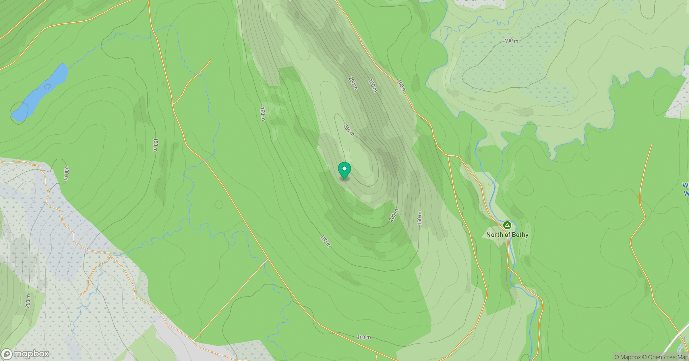
Grid reference: F960069
View on OpenStreetMapOpens a map in a new tab, centred on the hill.
Hills within 30 km
Straight-line distance, not a walking route or confirmation of access.
No comments yet. Be the first.