

Burren
Good walks are even better shared.
Overview
Burren: A Unique Landscape
Geology
The Burren is not your average mountain; it’s a limestone plateau that has been shaped by nature over thousands of years. If you're a geology enthusiast, you’re in for a treat! This region showcases a striking karst landscape filled with fascinating geological formations, including deep fissures and rock pavements. A walk through the Burren is like stepping into a natural art gallery, crafted by Mother Nature herself.
Routes
The Burren Loops is a wonderful way to experience this captivating area. Covering around 20 km, the route meanders through breathtaking scenery where you can spot a dazzling display of wildflowers, especially during the springtime. Be prepared for a moderate challenge as the terrain can be a bit uneven, so sturdy footwear is recommended.
Views
From various points throughout the Burren, hikers can expect stunning views of the Cliffs of Moher and the rugged Atlantic coastline. If you fancy being witness to this spectacle, your best bet is to hike during the spring or early summer.
Hazards
While the Burren beckons many adventurers, it’s essential to keep your eyes peeled for uneven sections of rock, particularly around those tempting limestone features. And as with any adventure, be mindful of the unpredictable Irish weather!
Access
Ballyvaughan is the closest town, offering a smattering of cafes and a friendly local atmosphere. Parking is available at several trailheads, making it an accessible spot for most outdoor enthusiasts. And if you're relying on public transport, double-check the bus times to avoid getting stuck in the middle of anywhere!
Facilities
Cafes in nearby towns serve up local delicacies, and public toilets can usually be found at visitor centres to help you plan your adventures wisely.
History
The name 'Burren' means 'great rock' in Gaelic, a fitting description for this majestic landscape. With a history rich in prehistoric sites, the Burren is dotted with ancient tombs and ruins that whisper stories of yore. You could almost say it’s history’s equivalent of a celebrity that never quite leaves the limelight.
In conclusion, the Burren is a must-visit for hikers and nature lovers alike. Whatever your skill level, it promises a unique experience that you won't forget, apart from the odd slip on some wet rock. Onward and upward—well, mostly forward, really!
Enjoy your adventure!
Explore routes near Burren
Public walks starting within 80 km of this hill. Nearby does not mean a route reaches the summit; check its map and access before setting out.
No public routes are currently listed within 80 km of Burren on Walkmates. This does not mean there are no paths here. Explore the map and check local access information before planning a walk.
Route planning notes
These notes describe possible approaches, not verified navigable routes or permission to cross land. Check current paths, local access rules and conditions before setting out.
Burren Loops
A series of trails that take you through the breathtaking limestone landscape, showcasing rare flora and fauna. The most famous loop is the 'Burren Way', a long-distance trail that runs through the region.
Make a day of it, together
Find someone to share the walk with, or organise a day out along a route you like.
Photo Gallery
View all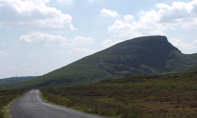 Photo could not load
M1299 : Burren (396m)
Liz McCabe
Hill facts and local notes
Classifications
Elevation
396m
1,299 ft
Prominence
102m
Coordinates
53.9385, -9.3301
M127996
OS Map
31
At the Summit
The Burren is largely flat, so there's no summit as such, but the iconic limestone features and views make it feel like you’re standing at the top of the world!
Terrain & Geology
The Burren is renowned for its unique karst limestone landscape, formed over millions of years of glacial action and chemical weathering. The limestone pavement is dotted with deep cracks, called 'grikes', that support a diverse range of flora.
Views & Scenery
Doolin, the Cliffs of Moher, and the Atlantic Ocean provide stunning panoramas.
History & Heritage
Name Origin
The name 'Burren' comes from the Gaelic 'Boireann', meaning 'great rock'.
Historical Significance
The Burren is steeped in history, with ancient tombs and monuments dotting the landscape, dating back to the Neolithic period.
Getting There & Facilities
Check current local access restrictions, parking rules and transport timetables before travelling. These notes do not confirm public access to the summit.
Parking
There are several car parks along the Burren Loops, including at various trailheads.
Public Transport
Bus services operate from Galway to that area, but availability may be limited.
Nearby Facilities
Several cafes and restaurants in nearby towns; public toilets are mostly available at visitor centres.
Safety Information
Known Hazards
- Uneven terrain, especially near limestone features. Be cautious of sudden weather changes.
General Safety Tips
- Check weather conditions before setting out
- Carry appropriate clothing and equipment
- Let someone know your planned route
- Take a map, compass, and GPS device
- Carry emergency supplies: food, water, first aid kit, torch
Hills
Some common questions about the hills answered
Are there group walks up Burren?
Many walkers use Walkmates to join or organise walks with others. You can check for group walks around Burren through the maps
Are there other walkers around Burren?
Activity varies by location and time, but Walkmates lets you see whether others have shared walks or shown interest in this area. Find other people through the walking friends search walking friends for Burren search or of course create your own walk for Burren
Can I organise a walk to Burren?
Yes. If there aren’t any walks listed already, you can create a walk and make it available for others to join.
If you're signed up to Walkmates, you can create a walk to Burren.
How do I find a walk up this hill?
There are often multiple ways to walk this hill, depending on experience and route preference. Walkmates helps you explore walks and routes that others have shared.
Can I suggest a new route up Burren?
Yes. You can suggest or create routes to share with others. Walkmates focuses on the social side of walking, so routes are used to help people organise walks and explore areas together, rather than as detailed navigation tools or route libraries.
Other uses really appreciate knowledgeable walkers sharing their routes. Share your favourite route to Burren here
The is an error or something incorrect about this hill. How do I let you know?
We always strive to keep the information on Walkmates as accurate as possible. If you find an error, please let us know through the contact form and we'll aim to correct it as quickly as possible
Community Discussion
Comments
Location
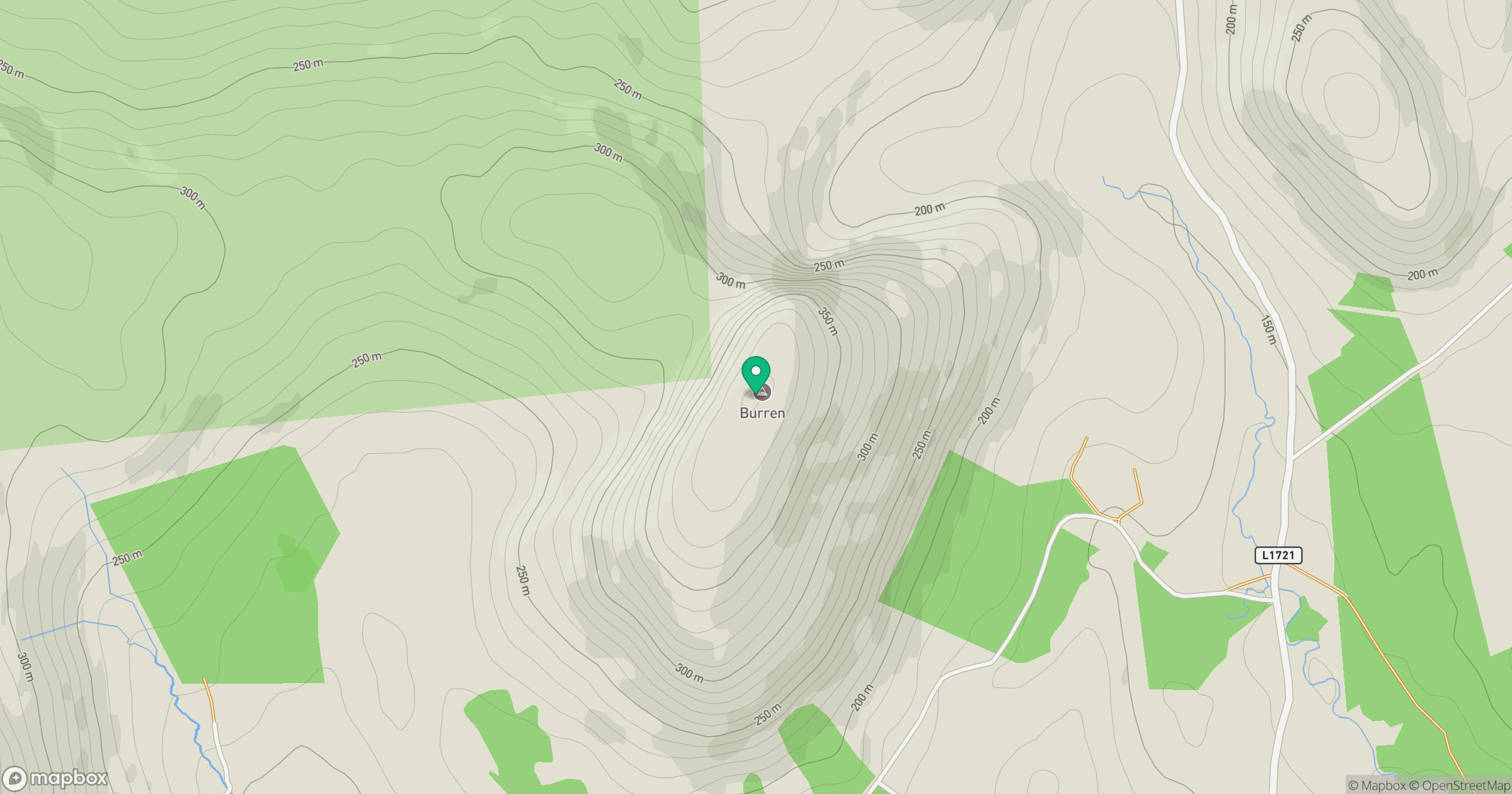
Grid reference: M127996
View on OpenStreetMapOpens a map in a new tab, centred on the hill.
Hills within 30 km
Straight-line distance, not a walking route or confirmation of access.
Croagh Patrick
764m
Crucknaree
297m
Croaghmoyle [An Chruach Mhaol]
430m
Farbreiga [Fear Breige]
395m
Nephin [Neifinn]
806m
No comments yet. Be the first.