
Cruckboeltane
Good walks are even better shared.
Overview
Cruckboeltane: A Hidden Gem
Nestled in the heart of the Southern Uplands, Cruckboeltane stands proudly at 605 meters. Often overshadowed by its larger neighbours, this Marilyn still boasts a charm that many avid walkers have come to appreciate.
Geology
Cruckboeltane's geology is primarily volcanic, which not only provides an interesting landscape but also adds a unique challenge to the hike. The rock formations give a glimpse into the ancient processes that shaped this part of Scotland, and local geologists often visit to study the area.
Routes
The most popular way to reach Cruckboeltane is via the Cruckboeltane Circuit. This moderate circular route, starting from the historic village of Sanquhar, takes about 4.5 hours to complete. It meanders through lush greenery before ascending toward the summit, where hikers can take in stunning views.
Summit Features
At the top, you'll find a heartfelt cairn, perfect for resting those weary legs after the climb. Bring along a sandwich or two, because truly, what's a summit without a little celebration of one’s accomplishments?
Terrain
Expect a mix of rocky terrain, grassy slopes, and the occasional boggy patch—perfect for testing your balance! The ever-changing landscape is not only beautiful but also offers plenty of surprises.
Views
Cruckboeltane rewards its visitors with sweeping views of the Southern Uplands. The best times to enjoy the scenery are during spring and autumn when the vibrant colours pop against the clear sky.
Hazards
As always, keep an eye on the weather. The winds can be as unpredictable as a cat on a hot tin roof, so be prepared for the unexpected. And remember, it’s not just the summit that can get a bit boggy!
Nearby Summits
Hiking enthusiasts might also fancy visiting nearby summits such as Dumgoyne or Cairnsmore of Carsphairn, particularly if you're in the mood for a longer trek. Why do one when you can do three?
Access
Sanquhar is the gateway to Cruckboeltane with nearby parking and public transport options. After your hike, feel free to explore the local shops or enjoy a pint.
Facilities
While on the trail, you might need to stop for a quick snack or toilet break; Sanquhar does have a couple of pubs and shops that cater to weary travellers and thirsty hikers alike.
Conclusion
Cruckboeltane is a cracking hike for those looking to experience the beauty of the Southern Uplands without the crowds. Grab your boots, pack your lunch, and set off for a bit of adventure—who knows what you might discover along the way!
Explore routes near Cruckboeltane
Public walks starting within 80 km of this hill. Nearby does not mean a route reaches the summit; check its map and access before setting out.
Route planning notes
These notes describe possible approaches, not verified navigable routes or permission to cross land. Check current paths, local access rules and conditions before setting out.
Cruckboeltane Circuit
A delightful circular route starting from the village of Sanquhar, featuring various terrains including gentle slopes and rocky outcrops.
Make a day of it, together
Find someone to share the walk with, or organise a day out along a route you like.
Hill facts and local notes
Classifications
Elevation
199m
653 ft
Prominence
101m
Coordinates
53.6089, -7.3466
N433623
OS Map
41
At the Summit
The summit boasts a modest cairn which offers a perfect picnic spot for weary walkers and a stunning viewpoint for the picturesque surrounding landscape.
Terrain & Geology
Cruckboeltane is primarily composed of volcanic rock which provides an interesting mix of crags and valleys. Its rugged nature is a favourite amongst local geologists.
Views & Scenery
From the summit, one can gaze across to the rolling hills of the Southern Uplands, with views extending towards the distant valleys and nearby forests.
History & Heritage
Name Origin
The name Cruckboeltane possibly originates from a fusion of Gaelic words meaning 'The mound of the bent grass', reflecting the local flora.
Historical Significance
Historically, Cruckboeltane has been a part of local folklore, often featured in tales of wanderers and wayfarers.
Getting There & Facilities
Check current local access restrictions, parking rules and transport timetables before travelling. These notes do not confirm public access to the summit.
Parking
There is a small but adequate parking area near the village of Sanquhar, just a stone's throw away from the trailhead.
Public Transport
Regular bus services connect Sanquhar with larger towns like Dumfries; a great start for your walking adventure.
Nearby Facilities
Sanquhar offers a couple of pubs and small shops for refreshments. Toilets are generally available in the village.
Safety Information
Known Hazards
- Beware of sudden weather changes; the winds can pick up rather quickly, and boggy ground may lead to less-than-dry feet!
General Safety Tips
- Check weather conditions before setting out
- Carry appropriate clothing and equipment
- Let someone know your planned route
- Take a map, compass, and GPS device
- Carry emergency supplies: food, water, first aid kit, torch
Hills
Some common questions about the hills answered
Are there group walks up Cruckboeltane?
Many walkers use Walkmates to join or organise walks with others. You can check for group walks around Cruckboeltane through the maps
Are there other walkers around Cruckboeltane?
Activity varies by location and time, but Walkmates lets you see whether others have shared walks or shown interest in this area. Find other people through the walking friends search walking friends for Cruckboeltane search or of course create your own walk for Cruckboeltane
Can I organise a walk to Cruckboeltane?
Yes. If there aren’t any walks listed already, you can create a walk and make it available for others to join.
If you're signed up to Walkmates, you can create a walk to Cruckboeltane.
How do I find a walk up this hill?
There are often multiple ways to walk this hill, depending on experience and route preference. Walkmates helps you explore walks and routes that others have shared.
Can I suggest a new route up Cruckboeltane?
Yes. You can suggest or create routes to share with others. Walkmates focuses on the social side of walking, so routes are used to help people organise walks and explore areas together, rather than as detailed navigation tools or route libraries.
Other uses really appreciate knowledgeable walkers sharing their routes. Share your favourite route to Cruckboeltane here
The is an error or something incorrect about this hill. How do I let you know?
We always strive to keep the information on Walkmates as accurate as possible. If you find an error, please let us know through the contact form and we'll aim to correct it as quickly as possible
Community Discussion
Comments
Location
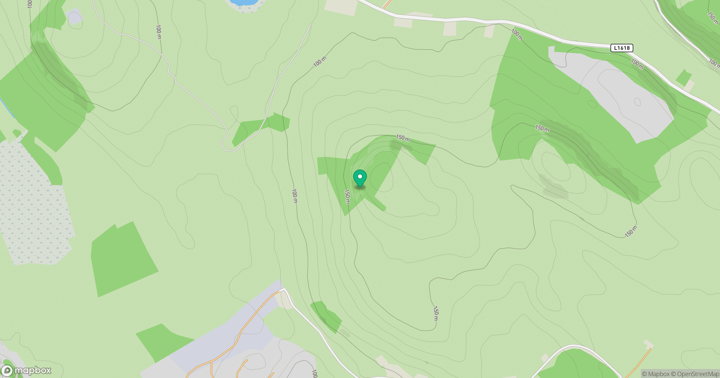
Grid reference: N433623
View on OpenStreetMapOpens a map in a new tab, centred on the hill.
Hills within 30 km
Straight-line distance, not a walking route or confirmation of access.
Knockeyon
214m
The Hill of Mael [The Hill of Moat]
241m
Mullaghmeen [Mullach Min]
261m
Slieve na Calliagh [Sliabh na Cailli]
276m
Croghan Hill [Cnoc Cruachain]
234m
No comments yet. Be the first.