
Knockastia
Good walks are even better shared.
Overview
Knockastia: A Hidden Gem in the Mournes
Knockastia, standing at 450 meters, may not be the highest peak in the Mourne Mountains but has plenty of charm and character. While it may often play second fiddle to its towering neighbours like Slieve Donard and Commedagh, it is well worth the trek. With a prominence of 65 meters, it may just surprise you with its stunning vistas.
Geology
This delightful hill is primarily granite, developed through ages of glacial action, resulting in a marvellous landscape kissed by time. The glacial striations make for some excellent photographs—so don’t leave home without your camera!
Access
Finding your way to Knockastia is as easy as pie. The nearest parking is conveniently located at the Binnian car park, ample enough for all sorts of adventurers. If you're relying on public transport, fear not, as buses run regularly from the charming town of Newcastle, perfect for grabbing those last-minute supplies!
Terrain
As you meander your way to the summit, expect a combination of grassy fields with the occasional rocky stretch. And of course, those cheeky boggy patches that might have you doing the Highland Fling!
Routes
The Mourne Way Trail is the most popular route taken by walkers. This moderate trail takes you through enchanting landscapes filled with natural beauty. It's a safe bet that you'll encounter fellow hikers, so don’t be shy; share a smile or a story!
Views
Once you reach the top, you'll be rewarded with views that will make your heart sing. Spot the Mourne Wall stretching across the landscape and perhaps catch a glimpse of the Isle of Man, should the weather be in a good mood.
Facilities
Back to earthly pursuits, the nearest town, Newcastle, has a variety of lovely cafes and necessary toilet facilities, allowing you to fuel up for the adventure ahead.
Conclusion
Knockastia may not always get the limelight it deserves but offers a delightful adventure in the heart of the Mournes. Perfect for families, casual walkers, and those searching for a quieter day out in the hills. So, pack your gear and head on out; who knows what stories the hills might whisper to you!
Remember, the mountains are calling, and you must go!
Explore routes near Knockastia
Public walks starting within 80 km of this hill. Nearby does not mean a route reaches the summit; check its map and access before setting out.
No public routes are currently listed within 80 km of Knockastia on Walkmates. This does not mean there are no paths here. Explore the map and check local access information before planning a walk.
Route planning notes
These notes describe possible approaches, not verified navigable routes or permission to cross land. Check current paths, local access rules and conditions before setting out.
Mourne Way Trail
A straightforward approach along the well-marked Mourne Way, offering beautiful views of the surrounding valleys.
Make a day of it, together
Find someone to share the walk with, or organise a day out along a route you like.
Hill facts and local notes
Classifications
Elevation
200m
656 ft
Prominence
106m
Coordinates
53.4394, -7.6321
N245433
OS Map
48
At the Summit
The summit features a small, neat cairn. From the top, you'll find an old trig point, which has seen better days but remains an excellent photo opportunity.
Terrain & Geology
Primarily composed of granite, Knockastia features glacial striations that provide a window into its geological past. The surrounding hills are primarily schist and gneiss, showcasing the ancient forces that shaped this region.
Views & Scenery
Spectacular views of the Mourne Wall, the Irish Sea, and on a clear day, the Isle of Man might even wave back at you.
History & Heritage
Name Origin
The name Knockastia derives from the Irish 'cnoc' meaning 'hill' and 'nas', possibly referring to the idea of the hill being a notable landmark or 'home of the spirits'.
Historical Significance
Knockastia is part of the traditional Mourne Mountains, steeped in folklore and history, notably associated with the legend of the giant that roamed these hills.
Getting There & Facilities
Check current local access restrictions, parking rules and transport timetables before travelling. These notes do not confirm public access to the summit.
Parking
The nearest parking is at the Binnian car park on the A55, which offers ample space and facilities for hikers.
Public Transport
Regular bus services operate from Newcastle, which is well connected to other towns. Check the local schedules before you set off.
Nearby Facilities
Nearby cafes and toilet facilities are available in Newcastle. There’s nothing like a good scone and a cup of tea after a day in the hills.
Safety Information
Known Hazards
- Be mindful of changing weather conditions; Mourne can be a fickle friend! Additionally, watch your step on the rocky sections to avoid any slips.
General Safety Tips
- Check weather conditions before setting out
- Carry appropriate clothing and equipment
- Let someone know your planned route
- Take a map, compass, and GPS device
- Carry emergency supplies: food, water, first aid kit, torch
Hills
Some common questions about the hills answered
Are there group walks up Knockastia?
Many walkers use Walkmates to join or organise walks with others. You can check for group walks around Knockastia through the maps
Are there other walkers around Knockastia?
Activity varies by location and time, but Walkmates lets you see whether others have shared walks or shown interest in this area. Find other people through the walking friends search walking friends for Knockastia search or of course create your own walk for Knockastia
Can I organise a walk to Knockastia?
Yes. If there aren’t any walks listed already, you can create a walk and make it available for others to join.
If you're signed up to Walkmates, you can create a walk to Knockastia.
How do I find a walk up this hill?
There are often multiple ways to walk this hill, depending on experience and route preference. Walkmates helps you explore walks and routes that others have shared.
Can I suggest a new route up Knockastia?
Yes. You can suggest or create routes to share with others. Walkmates focuses on the social side of walking, so routes are used to help people organise walks and explore areas together, rather than as detailed navigation tools or route libraries.
Other uses really appreciate knowledgeable walkers sharing their routes. Share your favourite route to Knockastia here
The is an error or something incorrect about this hill. How do I let you know?
We always strive to keep the information on Walkmates as accurate as possible. If you find an error, please let us know through the contact form and we'll aim to correct it as quickly as possible
Community Discussion
Comments
Location
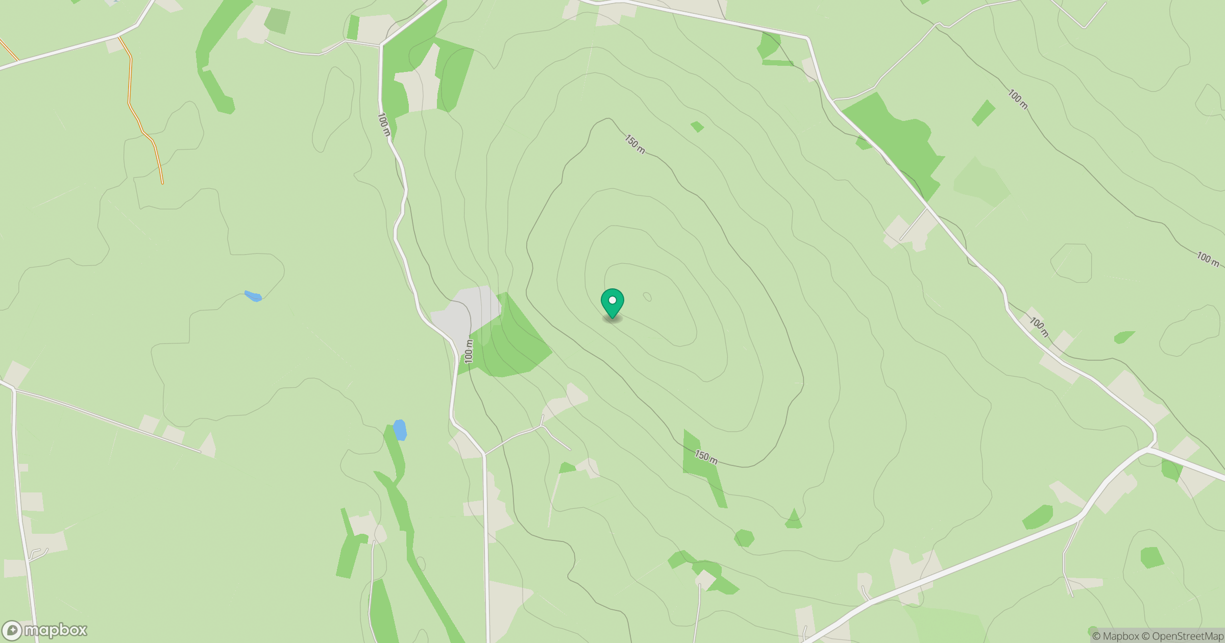
Grid reference: N245433
View on OpenStreetMapOpens a map in a new tab, centred on the hill.
Hills within 30 km
Straight-line distance, not a walking route or confirmation of access.
No comments yet. Be the first.