

Creag a' Chlachain
Good walks are even better shared.
Overview
Overview
Creag a' Chlachain looms majestically in the Scottish Highlands, a perfect choice for hikers looking for a satisfying challenge without the massive crowds. At 735 meters, it's not the tallest peak in the area, but it promises stunning views and a thrilling walk through diverse terrain.
Geology
The geology of Creag a' Chlachain is fascinating, with its bedrock predominantly composed of schist and granite. These ancient rocks tell the story of millennia of geological processes, from volcanic activity to glaciation, which have carved out the nook and crannies we see today.
Routes
There are a couple of noteworthy routes to summit this craggy beauty:
- From Inverness Roadside: A moderately demanding route that starts by the A9. It’s 6.5 km long and will take around 3.5 hours. Expect a mix of heather and rock as you make your ascent.
- Via Barracks Hill: For those seeking more adventure, this route measures 8.2 km and has a few decent ups and downs; count on 4.5 hours of hiking to reach the top.
Summit Features
Upon reaching the summit, hikers will be met by a charming little cairn perfect for snapping a celebratory selfie. The sense of achievement for making it to the top is only surpassed by the breathtaking views that unfold before you.
Terrain Type
Expect a blend of rocky paths, grassy slopes, and the occasional boggy patch—because what’s a hike without a bit of adventure, right? Traipse carefully to avoid any unexpected mudslides!
Views
Hiking Creag a' Chlachain rewards you with views that stretch far and wide. On a clear day, you might catch a glimpse of Loch Ness and the expansive Cairngorm National Park. Late spring and autumn are especially beautiful, with vibrant colours gracing the landscape.
Hazards
Keep an eagle eye on the weather! Conditions can change rapidly in the Highlands. Be wary of loose stones, especially on the steeper parts, and watch those slippery spots after rain. Being prepared is half the battle.
Nearby Summits
If you’re up for more, nearby summits such as Carn an Fhreiceadain and Heathery Hill are waiting to be explored. These provide ample opportunities for an epic mountain-hopping day!
Access and Facilities
Parking is available along the A9, though spaces are limited, and public transport options are good from Inverness, which also has all the amenities you could possibly need before you start your adventure. Facilities such as cafes and toilets can be found in the town, giving you a chance to refuel before hitting the trail.
History
The mountain's name, which translates to 'the crag of the stone', suggests its long-standing presence in Highland culture. With historical clans having traversed these hills, Creag a' Chlachain is steeped in local lore.
Whether you're a seasoned pro or just out for a weekend adventure, Creag a' Chlachain is more than just a hike—it's an opportunity to reconnect with the rugged beauty of Scotland.
Happy hiking, and remember: if you can’t see the mountain, it may be hiding behind a cloud! Don't forget to prepare and happy trails!
Explore routes near Creag a' Chlachain
Public walks starting within 80 km of this hill. Nearby does not mean a route reaches the summit; check its map and access before setting out.
Inverness: River Ness and Caledonian Canal circuit
View route
Aviemore: Loch an Eilein and the Croft Track from Rothiemurchus
View route
Rothiemurchus: Beaver Trail and Lochan Mor
View route
Great Glen Way low route: Fort Augustus to Invermoriston Old Bridge
View route
Route planning notes
These notes describe possible approaches, not verified navigable routes or permission to cross land. Check current paths, local access rules and conditions before setting out.
From Inverness Roadside
This route begins at the roadside near the A9, leading hikers through lush heather and rocky outcrops towards the summit.
Via Barracks Hill
A slightly longer approach that offers beautiful views across the Strathdearn before ascending to the summit.
Make a day of it, together
Find someone to share the walk with, or organise a day out along a route you like.
Photo Gallery
View all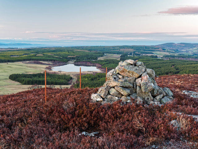 Photo could not load
NH6533 : Cairn Creag a' Chlachain
valenta
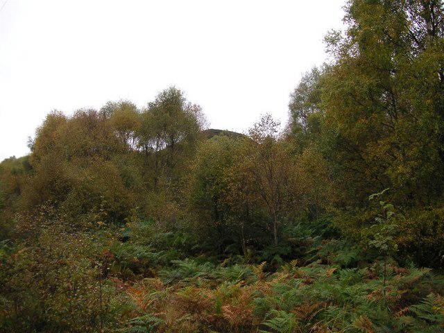 Photo could not load
NH6533 : Creag a' Chlachain from the road
Frances Watts
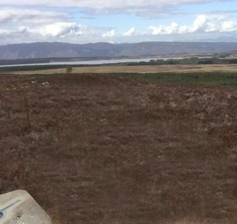 Photo could not load
NH6533 : View from Creag A Chlachain Trig Point
thejackrustles
Hill facts and local notes
Classifications
Elevation
365m
1,198 ft
Prominence
138m
Coordinates
57.3706, -4.2417
NH652333
OS Map
26
Explorer: 416N
At the Summit
The summit is topped with a small but distinguishable cairn, perfect for the obligatory photograph, and offers panoramic views that are nothing short of breathtaking.
Terrain & Geology
Creag a' Chlachain is primarily composed of schist and granite, showcasing the fascinating geological history of the Scottish Highlands, including ancient tectonic movements and glacial sculpting.
Views & Scenery
From the summit, one can see the vast expanse of the Cairngorms, Loch Ness glistening in the distance, and the stunning rolling hills surrounding Inverness.
History & Heritage
Name Origin
The name 'Creag a' Chlachain' translates to 'the crag of the stone', likely referring to the rocky terrain that characterises this majestic hill.
Historical Significance
This mountain has seen the passage of time, with historic clans traversing its slopes, making it a part of Scotland's rich tapestry of history.
Getting There & Facilities
Check current local access restrictions, parking rules and transport timetables before travelling. These notes do not confirm public access to the summit.
Parking
Parking can be found along the A9, though spaces can fill up quickly during peak season. Take care not to block access roads!
Public Transport
Regular bus services run from Inverness to nearby villages, but check the schedule as it may not accommodate those early morning starts for avid hikers.
Nearby Facilities
While no facilities exist at the base or summit, Inverness boasts cafes and public toilets aplenty for your comfort, both before and after your trek.
Safety Information
Known Hazards
- Rapid weather changes can occur, making it essential to come prepared. Watch out for loose rocks, especially in the upper sections, and the potential for slippery terrain during wet weather.
General Safety Tips
- Check weather conditions before setting out
- Carry appropriate clothing and equipment
- Let someone know your planned route
- Take a map, compass, and GPS device
- Carry emergency supplies: food, water, first aid kit, torch
Hills
Some common questions about the hills answered
Are there group walks up Creag a' Chlachain?
Many walkers use Walkmates to join or organise walks with others. You can check for group walks around Creag a' Chlachain through the maps
Are there other walkers around Creag a' Chlachain?
Activity varies by location and time, but Walkmates lets you see whether others have shared walks or shown interest in this area. Find other people through the walking friends search walking friends for Creag a' Chlachain search or of course create your own walk for Creag a' Chlachain
Can I organise a walk to Creag a' Chlachain?
Yes. If there aren’t any walks listed already, you can create a walk and make it available for others to join.
If you're signed up to Walkmates, you can create a walk to Creag a' Chlachain.
How do I find a walk up this hill?
There are often multiple ways to walk this hill, depending on experience and route preference. Walkmates helps you explore walks and routes that others have shared.
Can I suggest a new route up Creag a' Chlachain?
Yes. You can suggest or create routes to share with others. Walkmates focuses on the social side of walking, so routes are used to help people organise walks and explore areas together, rather than as detailed navigation tools or route libraries.
Other uses really appreciate knowledgeable walkers sharing their routes. Share your favourite route to Creag a' Chlachain here
The is an error or something incorrect about this hill. How do I let you know?
We always strive to keep the information on Walkmates as accurate as possible. If you find an error, please let us know through the contact form and we'll aim to correct it as quickly as possible
Community Discussion
Comments
Location
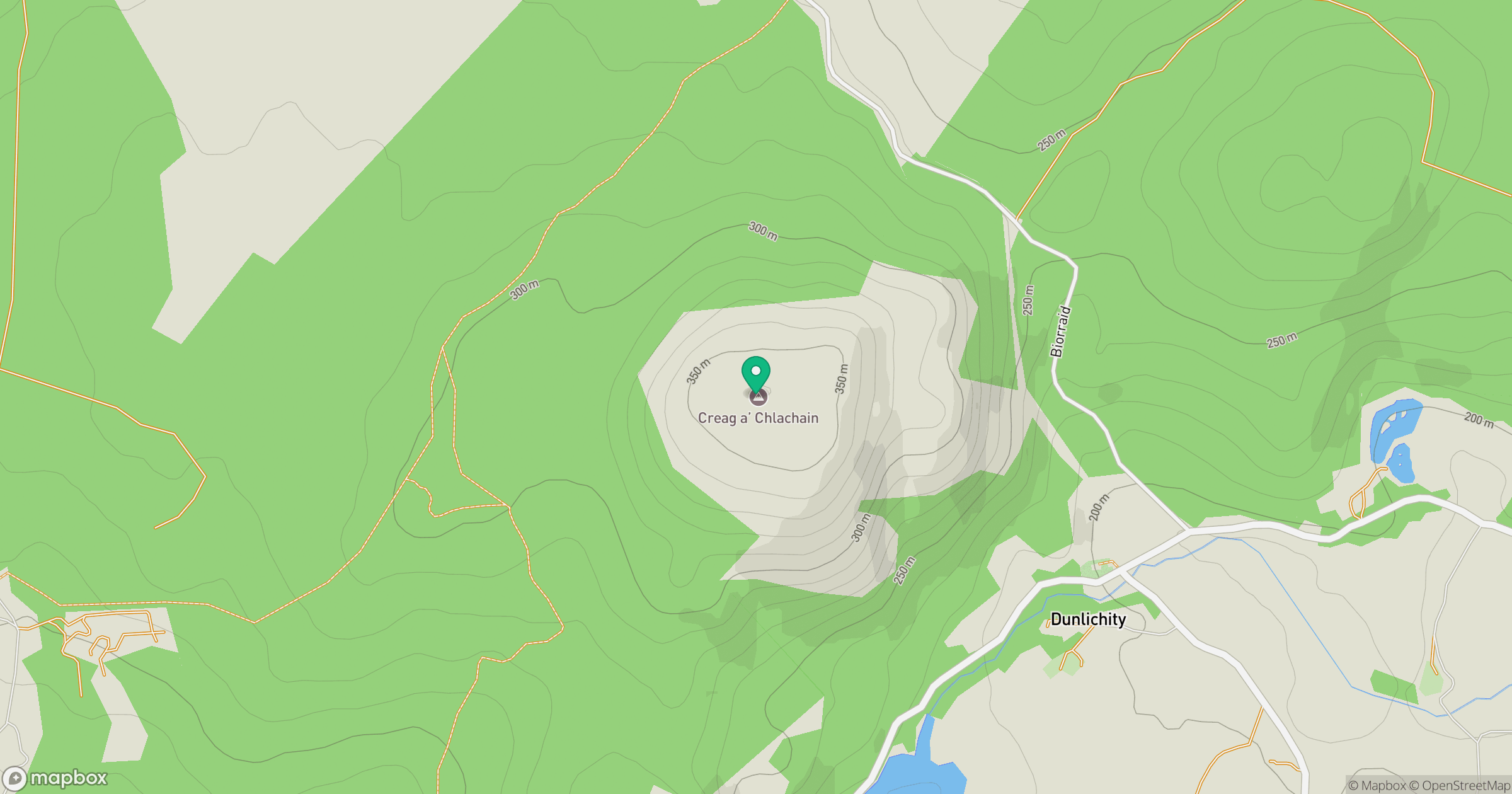
Grid reference: NH652333
View on OpenStreetMapOpens a map in a new tab, centred on the hill.
Hills within 30 km
Straight-line distance, not a walking route or confirmation of access.
No comments yet. Be the first.