

Cnoc na Tuppat
Good walks are even better shared.
Overview
Cnoc na Tuppat: A Highland Gem
Cnoc na Tuppat, standing proudly at an elevation of 505 meters, is a delightful Marilyn in the heart of the Scottish Highlands. This mountain may not be the tallest in the region, but it certainly makes up for that with its stunning vistas and fascinating geology.
Geology
While not a geological wonder in comparison to its towering siblings, Cnoc na Tuppat's volcanic rock formation offers a glimpse into the dynamic earth processes that shaped this incredible landscape. The rugged terrain and ancient outcrops are evidence of the dramatic forces that sculpted this part of the Highlands.
The Route
For those eager to explore, the Cnoc na Tuppat Loop is the recommended route. Starting from a small parking area at NH477878, this 6.5 km loop takes approximately 3.5 hours to complete. Ascend steadily through lush grasslands and navigate rocky patches—mind those occasional bogs that plan to test your balance!
Summit Features
Upon reaching the summit, hikers are greeted by a well-built cairn, perfect for a photo op. Take a moment to soak in the panoramic views. Whether it's the shimmering waters of Loch Ness or the imposing silhouette of Ben Nevis, the scenery from Cnoc na Tuppat will surely leave you awestruck.
Hazards
Be warned: while the path is generally well-defined, the terrain can be fickle, especially after rainfall. Uneven ground and hidden bogs are all part of the Highland experience. So, don’t just look at the views; keep your eyes on the path!
Nearby Summits
If you've got a taste for adventure, consider the nearby peaks—a trek to Meall na Teanga or Beinn Sgurrach could easily be on your agenda.
Access
The accessible parking area at NH477878 makes starting your hike straightforward. For those relying on public transport, Fort Augustus has local bus services, but be prepared for a bit of extra walking if you don’t have a personal vehicle. Fort Augustus itself is the closest town, brimming with local cafes and some charming sights.
Facilities
Before setting out, it’s wise to stock up on supplies. Fort Augustus has various cafes serving hearty meals and refreshments, but make sure to use the facilities here before heading into the wild.
History
The cheeky name 'Cnoc na Tuppat' might raise a few eyebrows, translating directly to 'Hill of the Buttock'. It's a reminder that the Scottish landscape is brimming with both beauty and humour. Historically, this mountain has offered refuge and resources to not just hikers but also the abundant wildlife that calls this rugged area home.
Conclusion
Cnoc na Tuppat may not be the highest peak, but it undoubtedly rewards those who venture to its summit. Whether you're a seasoned mountaineer or a casual walker looking for a new post-lockdown adventure, this Highland hill promises a wonderful excursion that is steeped in nature’s majesty and a splash of local culture.
Happy hiking!
Explore routes near Cnoc na Tuppat
Public walks starting within 80 km of this hill. Nearby does not mean a route reaches the summit; check its map and access before setting out.
Loch Migdale from Torroy: Spinningdale pinewood and loch shore walk
View route
Ben Klibreck
View route
Inverness: River Ness and Caledonian Canal circuit
View route
Culbin Forest: Hill 99, Gravel Pit Ponds and Dragonfly Pool
View route
Route planning notes
These notes describe possible approaches, not verified navigable routes or permission to cross land. Check current paths, local access rules and conditions before setting out.
Cnoc na Tuppat Loop
A scenic loop commencing from the small parking area near the foot of the hill, this route offers breathtaking views and a steady ascent to the summit.
Make a day of it, together
Find someone to share the walk with, or organise a day out along a route you like.
Photo Gallery
View all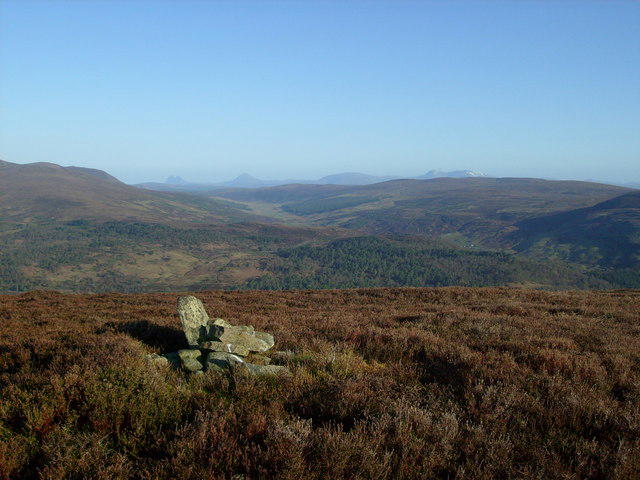 Photo could not load
NH4787 : NW from Cnoc na Tuppat
Rob Woodall
Hill facts and local notes
Classifications
Elevation
437m
1,434 ft
Prominence
124m
Coordinates
57.8538, -4.5667
NH477878
OS Map
20
Explorer: 437N
At the Summit
At the summit, you'll find a well-maintained cairn that serves as a perfect spot for a well-earned snack break, along with panoramic views that might just take your breath away.
Terrain & Geology
Cnoc na Tuppat is primarily composed of ancient volcanic rock, characterized by its rugged terrain and fascinating geological history. The crags here tell tales of magma that once flowed freely beneath the earth's crust.
Views & Scenery
From the top, enjoy sweeping vistas of the Great Glen, Loch Ness, and the surrounding highlands, with Ben Nevis looming majestically in the distance.
History & Heritage
Name Origin
The name 'Cnoc na Tuppat' roughly translates to 'Hill of the Buttock' in Gaelic. It sounds quite cheeky, doesn't it?
Historical Significance
This mountain has held cultural significance for centuries, providing shelter and resources for local wildlife, and has been a favourite spot for both seasoned hikers and the occasional curious sheep.
Getting There & Facilities
Check current local access restrictions, parking rules and transport timetables before travelling. These notes do not confirm public access to the summit.
Parking
There's a small gravel parking area at NH477878, suitable for a few cars. Be cautious though, as it can fill up quickly during the summer months.
Public Transport
The nearest public transport is in Fort Augustus, from where you can catch a local bus that stops at various points towards Inverness; be prepared for a bit of a trek.
Nearby Facilities
A few cafes and facilities are available in Fort Augustus, along with public toilets, but be sure to stock up on snacks before heading out.
Safety Information
Known Hazards
- Uneven and slippery terrain, particularly in wet conditions. Watch out for hidden bogs that might try to sneak up on you.
General Safety Tips
- Check weather conditions before setting out
- Carry appropriate clothing and equipment
- Let someone know your planned route
- Take a map, compass, and GPS device
- Carry emergency supplies: food, water, first aid kit, torch
Hills
Some common questions about the hills answered
Are there group walks up Cnoc na Tuppat?
Many walkers use Walkmates to join or organise walks with others. You can check for group walks around Cnoc na Tuppat through the maps
Are there other walkers around Cnoc na Tuppat?
Activity varies by location and time, but Walkmates lets you see whether others have shared walks or shown interest in this area. Find other people through the walking friends search walking friends for Cnoc na Tuppat search or of course create your own walk for Cnoc na Tuppat
Can I organise a walk to Cnoc na Tuppat?
Yes. If there aren’t any walks listed already, you can create a walk and make it available for others to join.
If you're signed up to Walkmates, you can create a walk to Cnoc na Tuppat.
How do I find a walk up this hill?
There are often multiple ways to walk this hill, depending on experience and route preference. Walkmates helps you explore walks and routes that others have shared.
Can I suggest a new route up Cnoc na Tuppat?
Yes. You can suggest or create routes to share with others. Walkmates focuses on the social side of walking, so routes are used to help people organise walks and explore areas together, rather than as detailed navigation tools or route libraries.
Other uses really appreciate knowledgeable walkers sharing their routes. Share your favourite route to Cnoc na Tuppat here
The is an error or something incorrect about this hill. How do I let you know?
We always strive to keep the information on Walkmates as accurate as possible. If you find an error, please let us know through the contact form and we'll aim to correct it as quickly as possible
Community Discussion
Comments
Location
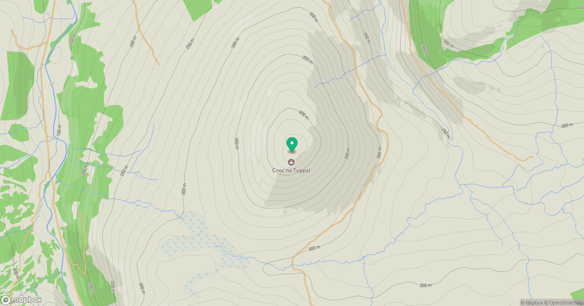
Grid reference: NH477878
View on OpenStreetMapOpens a map in a new tab, centred on the hill.
Hills within 30 km
Straight-line distance, not a walking route or confirmation of access.
No comments yet. Be the first.