

Meall Dheirgidh
Good walks are even better shared.
NH4794 : Summit of Meall Dheirgidh
Trevor Littlewood Photo source
Overview
Meall Dheirgidh: A Hiker's Gem in the Highlands
Overview
Nestled in the heart of the Scottish Highlands, Meall Dheirgidh stands at an elevation of 718 meters. Known for its rugged beauty and panoramic views, it offers an invigorating challenge for hikers looking to explore the Highlands.
Geology
Meall Dheirgidh is predominantly composed of granite and schist, leading to fascinating geological formations. The features you’ll witness are the result of significant glacial activity, leaving behind an awe-inspiring landscape of valleys and hills that beckon adventurous spirits.
Routes
- Via Glen Tarf: An 8.5 km route that merges heather-covered hills with an adventurous ascent.
- North East Ridge: A 7.0 km trek starting from Glenmore that provides a heart-pumping climb and exhilarating views.
Each route presents its own delights and challenges, making the journey to the summit just as rewarding as the destination itself.
Summit Features
Reaching the summit, you'll find a sizable cairn and a trig point—perfect for the obligatory summit selfie (don’t forget to tag your fellow hikers!). Bring your snacks for a well-deserved break here, enjoying the tranquility of this elevated haven.
Terrain
The terrain ranges from grassy slopes at the base to rocky outcrops nearer the top. Be mindful of boggy patches in footpaths, especially after rain; they add to the adventure—or the misadventure, depending on your perspective!
Views
The view from the summit is nothing short of jaw-dropping, especially if you’re lucky enough to catch a clear day. Highlights include views of Loch Ness and the imposing Ben Nevis in the distance. Ideally, plan your visit during late spring or early autumn for the best visibility and a chance to spot local wildlife.
Hazards
Keep your wits about you: the rugged terrain can be tricky, so ensure you wear sturdy footwear. As always in Scotland, prepare for quickly changing weather conditions that can make the summit seem less appealing if not properly managed.
Nearby Summits
For those looking to extend their adventure, nearby summits such as Sgor Gaibhre (748 meters) and Meall na Meoig (711 meters) provide fantastic options in the area.
Access
Parking is available at the end of Glen Tarf, but don’t dilly-dally—spaces are limited! The closest village, Fort Augustus, offers basic amenities, including a friendly café where you can rest your legs and refuel.
Facilities
In Fort Augustus, you'll find a variety of local businesses, including a café perfect for warming up with a hot drink after your trek. Clean public restrooms are also readily available for all hikers.
History
The name 'Meall Dheirgidh' speaks to its rich cultural backdrop; it translates to 'hill of the red one', enlivening the majesty of the surrounding landscape. Historical tales weave the mountain into the life of ancient clans, making this not just a hiking destination, but a place alive with stories.
In conclusion, Meall Dheirgidh is well worth the effort, whether you're chasing stunning vistas, longing for a taste of Scottish history, or simply seeking a good outlook for your next Instagram post. Embrace the challenge and enjoy every step of your adventure!
This mountain adventure is one for the books, so grab your gear, pack in some snacks, and make your way to this majestic Munro. Happy hiking!
Explore routes near Meall Dheirgidh
Walks starting near this hill. Open a route to check its map, distance and full itinerary.
Loch Migdale from Torroy: Spinningdale pinewood and loch shore walk
View route
Ben Klibreck
View route
Culbin Forest: Hill 99, Gravel Pit Ponds and Dragonfly Pool
View route
Beinn Eighe Lancaster Wreckage at Coire Mhic Fhearchair
View route
Route planning notes
These notes describe possible approaches. Check a route's map and access information when planning your walk.
Via Glen Tarf
This route begins at the end of Glen Tarf and follows a well-defined path through beautiful heather-covered moorland before ascending the southwest ridge.
North East Ridge
Starting from the car park at the head of Glenmore, this ascent is mainly on paths, climbing steadily to the summit with stunning views of the surrounding hills.
Make a day of it, together
Find someone to share the walk with, or organise a day out along a route you like.
Photo Gallery
View all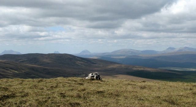 Photo could not load
NH4794 : Summit of Meall Dheirgidh
Trevor Littlewood
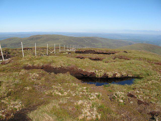 Photo could not load
NH4794 : Peat hags, Meall Dheirgidh
Richard Webb
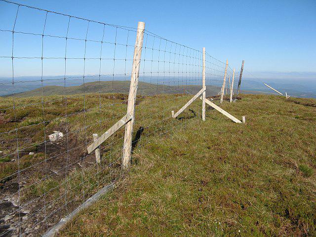 Photo could not load
NH4794 : Summit, Meall Dheirgidh
Richard Webb
Hill facts and local notes
Classifications
Elevation
506m
1,660 ft
Prominence
303m
Coordinates
57.9123, -4.5788
NH473943
OS Map
20
Explorer: 440S
At the Summit
The summit of Meall Dheirgidh features a large cairn and a trig point, both excellent spots for a celebratory photo or a wee sit down and a snack—preferably a Scottish shortbread!
Terrain & Geology
Meall Dheirgidh is predominantly composed of granite and schist, typical of the Scottish Highlands, resulting in rugged terrain and dramatic features. The surrounding area showcases glacial sculpting, with classic U-shaped valleys indicative of the region's past.
Views & Scenery
On a clear day, the summit offers spectacular views of Loch Ness and the distant peaks of the Great Glen. One can even spot the distant outline of Ben Nevis, making for a grand backdrop.
History & Heritage
Name Origin
The name 'Meall Dheirgidh' translates roughly to 'hill of the red one', likely referencing the reddish tinges of the rock visible in some areas.
Historical Significance
Like many hills in the Highlands, Meall Dheirgidh has its share of folklore, with stories of ancient clans and the dramatic landscapes that shaped their lives.
Getting There & Facilities
Parking
There is a small car park at the end of Glen Tarf, where the road meets the start of the path. Limited spaces, so arrive early on busy weekends!
Public Transport
Public transport connections are sparse; the nearest bus service operates from Inverness to Fort Augustus, with taxi services available from there to Glen Tarf.
Nearby Facilities
The nearest café is located in Fort Augustus, where you can enjoy a hot drink and perhaps a slice of cake. Public toilets are also available in the village.
Safety Information
Known Hazards
- Rugged terrain can pose risks of slips and falls; it's advisable to have good footwear. Additionally, weather conditions can change swiftly, so being prepared is key. Keep an eye out for sudden drops near the summit!
General Safety Tips
- Check weather conditions before setting out
- Carry appropriate clothing and equipment
- Let someone know your planned route
- Take a map, compass, and GPS device
- Carry emergency supplies: food, water, first aid kit, torch
Hills
Some common questions about the hills answered
Are there group walks up Meall Dheirgidh?
Many walkers use Walkmates to join or organise walks with others. You can check for group walks around Meall Dheirgidh through the maps
Are there other walkers around Meall Dheirgidh?
Activity varies by location and time, but Walkmates lets you see whether others have shared walks or shown interest in this area. Find other people through the walking friends search walking friends for Meall Dheirgidh search or of course create your own walk for Meall Dheirgidh
Can I organise a walk to Meall Dheirgidh?
Yes. If there aren’t any walks listed already, you can create a walk and make it available for others to join.
If you're signed up to Walkmates, you can create a walk to Meall Dheirgidh.
How do I find a walk up this hill?
There are often multiple ways to walk this hill, depending on experience and route preference. Walkmates helps you explore walks and routes that others have shared.
Can I suggest a new route up Meall Dheirgidh?
Yes. You can suggest or create routes to share with others. Walkmates focuses on the social side of walking, so routes are used to help people organise walks and explore areas together, rather than as detailed navigation tools or route libraries.
Other uses really appreciate knowledgeable walkers sharing their routes. Share your favourite route to Meall Dheirgidh here
The is an error or something incorrect about this hill. How do I let you know?
We always strive to keep the information on Walkmates as accurate as possible. If you find an error, please let us know through the contact form and we'll aim to correct it as quickly as possible
Community Discussion
Comments
Location
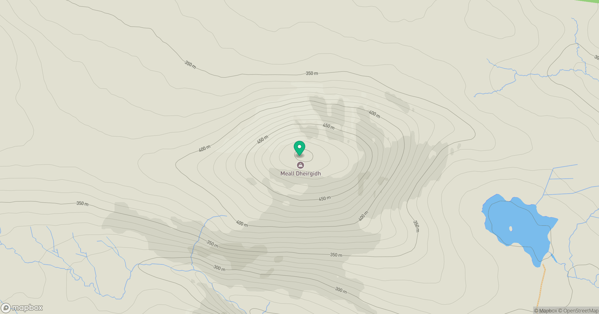
Grid reference: NH473943
View on OpenStreetMapOpens a map in a new tab, centred on the hill.
No comments yet. Be the first.