
Castle Hill
Good walks are even better shared.
Overview
Castle Hill: A Local Gem
Castle Hill stands majestically over West Yorkshire, a site that has captivated many outdoor enthusiasts and history buffs alike. Rising to an elevation of 262 meters, it is a well-loved local landmark, not merely for its height, but for its rich tapestry of history and stunning views.
Geology
One of the most interesting aspects of Castle Hill is its geology. Composed primarily of volcanic rock, specifically volcanic tuff, the hill's formation tells a story of ancient geological processes. This unique rock type results in a sturdy yet scenic terrain that is both inviting and intriguing.
Routes
Hikers have a couple of enjoyable routes to choose from:
- Castle Hill Circular Walk (2.5 km, Easy): This accessible route enchants walkers with beautiful views and a leisurely pace.
- Brighouse to Castle Hill Trail (6.5 km, Moderate): A more adventurous option, this route traverses through luscious woodlands before treating you to the splendid summit views.
Summit Features
Upon reaching the summit, you’ll find the Victoria Tower, an emblematic stone structure that not only adds to the site’s charm but also serves as an excellent viewpoint of the surrounding countryside.
Terrain Type
Expect a delightful mix of grassy paths and rocky outcrops. As you stroll, be prepared for a few muddy patches if rain is forecast, but fear not! It just adds a bit of character (and mud) to your adventure.
Views
From the summit, the panoramic views are nothing short of spectacular. You can spot the rugged landscapes of the Pennines and, if you’re lucky, the Emley Moor Mast and peaks of the Yorkshire Dales. The best times to visit for these visual delights are in Spring and Autumn when the scenery is most vibrant.
Hazards
While generally manageable, take care on the path’s muddy patches post-rain, and be mindful of steep drops near the tower’s edge. Always bring your common sense along, and you should be fine!
Nearby Summits
Just a short distance away, Shillbank Hill (elevation 222 meters) offers another enjoyable hike for those keen to explore further.
Access
For those driving, head to the Castle Hill Car Park. It’s quite accessible but be warned: the early bird catches the parking space! If you’re using public transport, buses from Huddersfield run regularly to drop you off near the hill.
Facilities
Post-hike, head to Almondbury for lovely cafes and the convenience of public toilets, perfect for a well-earned break after your outdoor escapade.
History
The name 'Castle Hill' speaks to its historical significance, stemming from the ancient castle ruins once situated here, a testament to the hill's enduring presence in the local narrative.
In summary, Castle Hill is more than just a hill; it’s a mosaic of adventure, history, and natural beauty waiting to be explored. Grab your boots and head out!
Explore routes near Castle Hill
Public walks starting within 80 km of this hill. Nearby does not mean a route reaches the summit; check its map and access before setting out.
Moffat Gallow Hill Woodland and Viewpoint Circuit
View route
Forest of Ae Water of Ae Riverside Trail
View route
Cademuir Forest Pilots Trail
View route
Peebles to Neidpath Castle: Tweed Riverside Walk
View route
Route planning notes
These notes describe possible approaches, not verified navigable routes or permission to cross land. Check current paths, local access rules and conditions before setting out.
Castle Hill Circular Walk
This scenic circular route takes you around Castle Hill, offering stunning views and historical insights.
Brighouse to Castle Hill Trail
A longer trek, this route meanders through beautiful woodlands and fields, leading to the summit of Castle Hill.
Make a day of it, together
Find someone to share the walk with, or organise a day out along a route you like.
Hill facts and local notes
Classifications
Elevation
483m
1,585 ft
Prominence
101m
Coordinates
55.4830, -3.6715
NS944222
OS Map
71 72
Explorer: 329
At the Summit
The summit is marked by a prominent Victoria Tower, a stunning stone structure providing panoramic views of the surrounding areas.
Terrain & Geology
Castle Hill is primarily composed of volcanic rock, specifically volcanic tuff, which provides its distinctive shape and sturdy structure. The terrain features ancient stone formations that add to its rugged appeal.
Views & Scenery
The rugged landscapes of the Pennines, and on a clear day, you can even catch a glimpse of Emley Moor Mast and the distant peaks of the Yorkshire Dales.
History & Heritage
Name Origin
The name 'Castle Hill' derives from the ancient castle ruins that once stood on the hill, which dominated the landscape.
Historical Significance
A historic site dating back to the Bronze Age, Castle Hill has served various purposes throughout history, including as a meeting place for local communities.
Getting There & Facilities
Check current local access restrictions, parking rules and transport timetables before travelling. These notes do not confirm public access to the summit.
Parking
Castle Hill Car Park, located nearby with ample spaces, although get there early at weekends to avoid disappointment.
Public Transport
Regular bus services run from Huddersfield town centre to nearby locations, with a short walk to the hill.
Nearby Facilities
There are several cafes in the nearby village of Almondbury, as well as public toilets near the car park.
Safety Information
Known Hazards
- Occasional muddy patches after rain; be wary of steep drops near the tower.
General Safety Tips
- Check weather conditions before setting out
- Carry appropriate clothing and equipment
- Let someone know your planned route
- Take a map, compass, and GPS device
- Carry emergency supplies: food, water, first aid kit, torch
Hills
Some common questions about the hills answered
Are there group walks up Castle Hill?
Many walkers use Walkmates to join or organise walks with others. You can check for group walks around Castle Hill through the maps
Are there other walkers around Castle Hill?
Activity varies by location and time, but Walkmates lets you see whether others have shared walks or shown interest in this area. Find other people through the walking friends search walking friends for Castle Hill search or of course create your own walk for Castle Hill
Can I organise a walk to Castle Hill?
Yes. If there aren’t any walks listed already, you can create a walk and make it available for others to join.
If you're signed up to Walkmates, you can create a walk to Castle Hill.
How do I find a walk up this hill?
There are often multiple ways to walk this hill, depending on experience and route preference. Walkmates helps you explore walks and routes that others have shared.
Can I suggest a new route up Castle Hill?
Yes. You can suggest or create routes to share with others. Walkmates focuses on the social side of walking, so routes are used to help people organise walks and explore areas together, rather than as detailed navigation tools or route libraries.
Other uses really appreciate knowledgeable walkers sharing their routes. Share your favourite route to Castle Hill here
The is an error or something incorrect about this hill. How do I let you know?
We always strive to keep the information on Walkmates as accurate as possible. If you find an error, please let us know through the contact form and we'll aim to correct it as quickly as possible
Community Discussion
Comments
Location
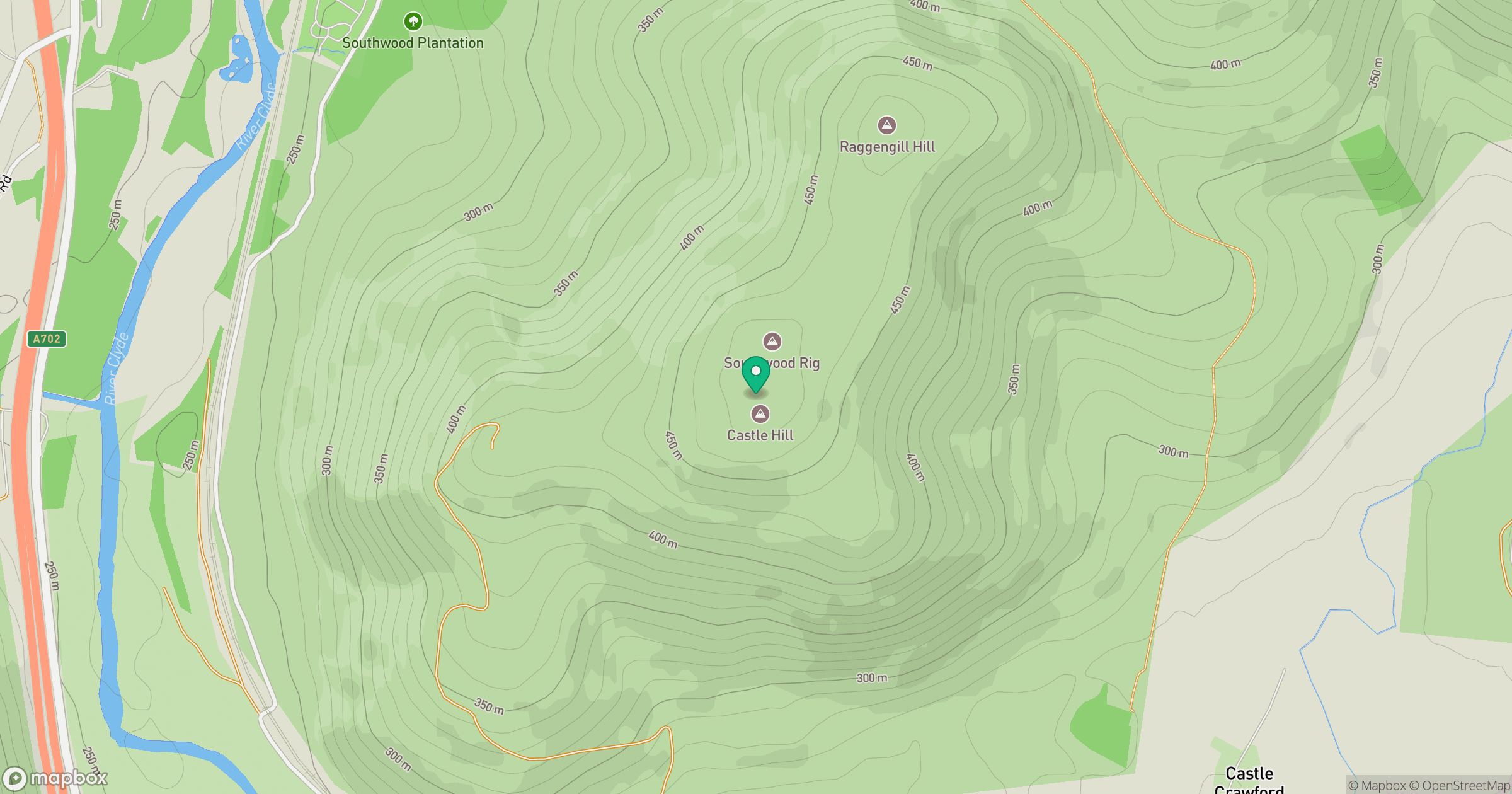
Grid reference: NS944222
View on OpenStreetMapOpens a map in a new tab, centred on the hill.
Hills within 30 km
Straight-line distance, not a walking route or confirmation of access.

No comments yet. Be the first.