
Castle Hill
Good walks are even better shared.
Overview
Castle Hill
Castle Hill is a prominent hill located in West Yorkshire, standing at an elevation of 260 metres. With its stunning views and rich history, it attracts hikers and tourists alike.
Geology
Castle Hill is predominantly made up of volcanic rock, offering a fascinating insight into the geological history of the area. Visitors can marvel at the remnants of ancient volcanic activity that formed the very earth beneath their feet.
Routes
One of the most popular routes is the Castle Hill Circular Walk, a pleasant 2.5 km loop that is suitable for all levels of hikers. It provides a combination of paved paths and grassy trails, ensuring everyone can join in on the fun without breaking a sweat.
Summit Features
At the summit, you'll find the Victoria Tower, a striking monument erected in 1894 to commemorate Queen Victoria’s Golden Jubilee. It’s not just a great photo opportunity, but also a fantastic viewpoint.
Terrain
The terrain comprises mainly grassy areas, complemented by well-maintained paths. This makes it accessible for families and less experienced walkers, but watch out for the odd muddy patch after persistent rain!
Views
From the top, you can enjoy some truly breathtaking views. On a clear day, the panorama extends to Huddersfield and the rolling moors beyond. The best times to experience these sights are during the Spring and Autumn months, when the scenery is at its most picturesque.
Hazards
While the paths are generally safe, it's wise to be cautious of muddy spots after rainfall—nobody wants to return home looking like a walking swamp!
Nearby Summits
Don't forget to check out Holme Moss, another stunning spot in the region, which stands at 525 metres and offers its own unique views and trails.
Access
Getting there is easy, with a dedicated car park at the hill's base. Public transport options are plentiful, with regular buses connecting from Huddersfield. Just keep an eye out for the iconic Victoria Tower looming in the distance!
Facilities
Once you've returned from your adventure, you can treat yourself at the nearby café, where refreshments await, along with public toilets for the post-hike necessities.
History
The name 'Castle Hill' evokes tales from centuries past, hinting at the remains of a medieval castle that once stood proud here. Its significance stretches back through time, playing a role in both Roman and medieval history.
Castle Hill is more than just a hike; it’s an experience steeped in history and surrounded by natural beauty. Grab your outdoor gear and head out for a day to remember!
Explore routes near Castle Hill
Walks starting near this hill. Open a route to check its map, distance and full itinerary.
Kiveton Park to Shireoaks Canal
View route
Rother Valley Two Lakes
View route
Thrybergh Reservoir Circuit
View route
Norfolk Heritage Park Avenues
View route
Route planning notes
These notes describe possible approaches. Check a route's map and access information when planning your walk.
Castle Hill Circular Walk
A popular circular route starting from the nearest parking area, offering a mix of paved paths and grassy trails.
Make a day of it, together
Find someone to share the walk with, or organise a day out along a route you like.
Hill facts and local notes
Classifications
Elevation
138m
454 ft
Prominence
32m
Coordinates
53.3882, -1.2255
SK516882
OS Map
111 120
Explorer: 279S
At the Summit
The summit features a prominent Victorian monument known as the Victoria Tower, which provides a unique focal point and a great spot to catch one's breath (and a selfie).
Terrain & Geology
Castle Hill is primarily composed of volcanic rock, giving it a rugged appearance. The geological history here offers a glimpse into the past, showcasing ancient volcanic activity.
Views & Scenery
From the top, you'll enjoy panoramic views of Huddersfield and the surrounding moorlands, with distant glimpses of the Pennines.
History & Heritage
Name Origin
The name 'Castle Hill' derives from the remains of a medieval castle that once stood in this very spot, giving a nod to its historical significance.
Historical Significance
Castle Hill has been a site of human activity for centuries, with archaeological finds suggesting its importance in both the Roman and medieval periods.
Getting There & Facilities
Parking
There is a dedicated car park at the base of Castle Hill, with ample spaces and a short walk to the start of the route.
Public Transport
Regular bus services run from Huddersfield town centre to the nearest stops, with a short walk from there, making it accessible.
Nearby Facilities
A small café located near the base serves refreshments, and there are public toilets available.
Safety Information
Known Hazards
- Occasional muddy patches after rain; be careful not to become a mud pie!
General Safety Tips
- Check weather conditions before setting out
- Carry appropriate clothing and equipment
- Let someone know your planned route
- Take a map, compass, and GPS device
- Carry emergency supplies: food, water, first aid kit, torch
Hills
Some common questions about the hills answered
Are there group walks up Castle Hill?
Many walkers use Walkmates to join or organise walks with others. You can check for group walks around Castle Hill through the maps
Are there other walkers around Castle Hill?
Activity varies by location and time, but Walkmates lets you see whether others have shared walks or shown interest in this area. Find other people through the walking friends search walking friends for Castle Hill search or of course create your own walk for Castle Hill
Can I organise a walk to Castle Hill?
Yes. If there aren’t any walks listed already, you can create a walk and make it available for others to join.
If you're signed up to Walkmates, you can create a walk to Castle Hill.
How do I find a walk up this hill?
There are often multiple ways to walk this hill, depending on experience and route preference. Walkmates helps you explore walks and routes that others have shared.
Can I suggest a new route up Castle Hill?
Yes. You can suggest or create routes to share with others. Walkmates focuses on the social side of walking, so routes are used to help people organise walks and explore areas together, rather than as detailed navigation tools or route libraries.
Other uses really appreciate knowledgeable walkers sharing their routes. Share your favourite route to Castle Hill here
The is an error or something incorrect about this hill. How do I let you know?
We always strive to keep the information on Walkmates as accurate as possible. If you find an error, please let us know through the contact form and we'll aim to correct it as quickly as possible
Community Discussion
Comments
Location
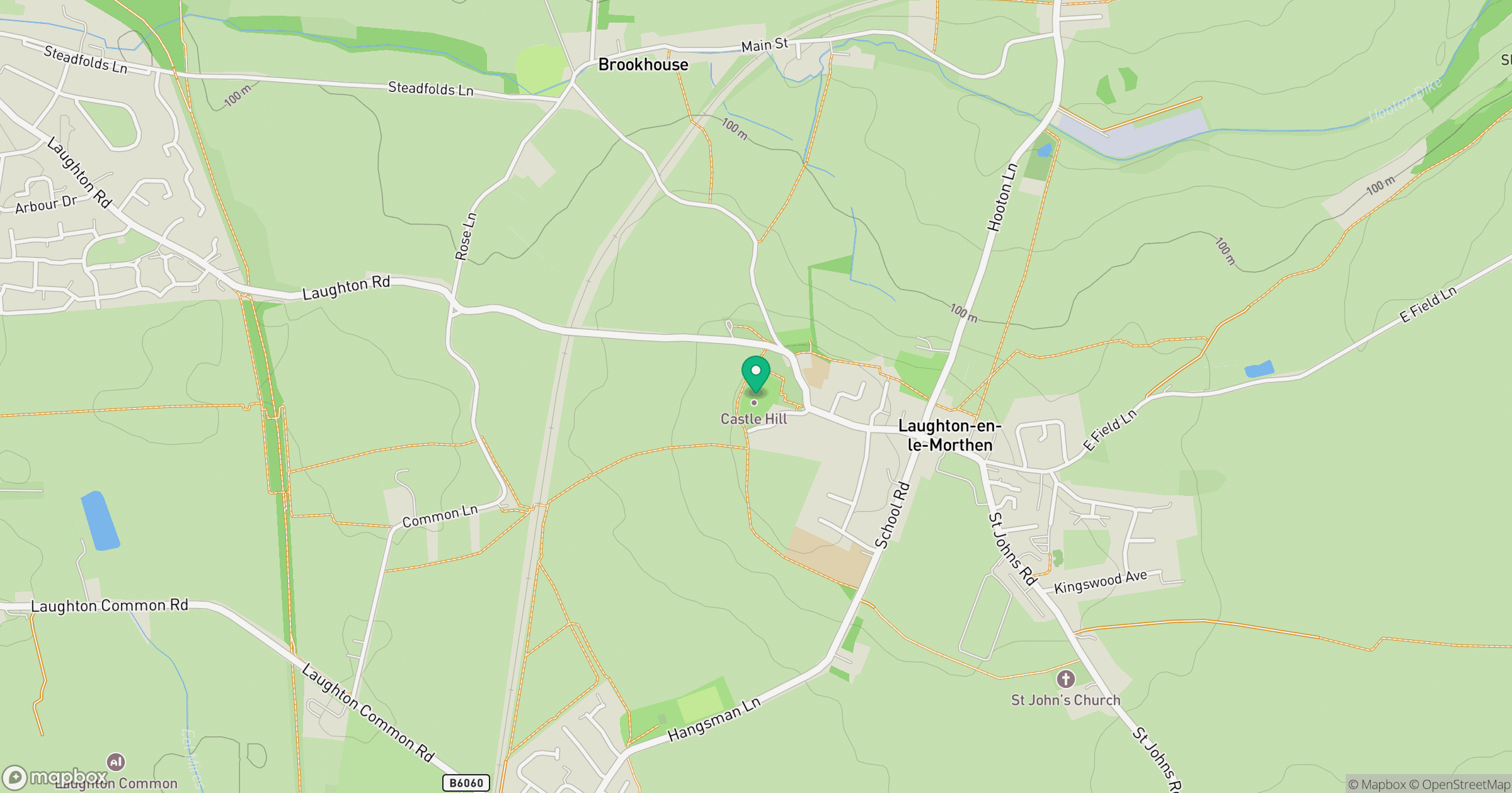
Grid reference: SK516882
View on OpenStreetMapOpens a map in a new tab, centred on the hill.
Nearby Hills

Kinder Scout
636m
Rombalds Moor [Ilkley Moor]
402m
The Roaches
505m
Buckden Pike
702m

Pendle Hill
557m
No comments yet. Be the first.