
Carn Brea
Good walks are even better shared.
Overview
Carn Brea
Nestled in the heart of Cornwall, Carn Brea stands majestically at 227 meters above sea level. Despite its modest height, it offers panoramic views that are nothing short of spectacular. The intriguing blend of geology and history on this hill makes it a must-visit for both hikers and history enthusiasts alike.
Geology
Carn Brea is primarily formed from granite, a resilient igneous rock that is as old as time itself—around 290 million years! As you navigate the rocky terrain, take a moment to appreciate the ancient wisdom embedded in these stones, fashioned by nature over millennia. And if you find yourself tripping over loose stones, just remember, they likely have a longer history than you do.
Routes
- Boscawen Park to Carn Brea - This moderate trek spans 5.6 km and takes approximately 2.5 hours. It's perfect for those looking to lazily saunter through picturesque Cornish landscapes.
- Carn Brea Castle Circuit - For an easy walk, this circular route of 3.2 km around the summit leads you past the castle and ancient stones, taking around 1.5 hours.
Summit Features
Upon reaching the summit, you’ll find striking historical features like a fogou (an underground stone chamber) and the remains of Carn Brea Castle. It's essential to bring your imagination along, as the eerie stones might just whisper tales of old.
Terrain Type
Be prepared for a mix of rocky and grassy terrain, with a few boggy patches that would certainly give your shoes a workout. So, maybe leave the flip-flops at home!
Views
Highlights: Stand atop Carn Brea and gaze out at the Atlantic; the Lizard Peninsula is a visual feast, and on exceptionally clear days, you might even spot the Isles of Scilly.
Best Seasons: For picture-perfect views, spring and autumn are your best bets, offering mild weather that enhances the colours of the landscape.
Hazards
As with any outdoor adventure, be wary of loose stones and slippery patches. Proper hiking footwear is recommended to avoid having an unplanned one-on-one with the ground.
Access
- Nearest Parking: Boscawen Park provides ample parking, just a hop, skip, and a jump from the trailhead.
- Public Transport: Lucky for you, local buses run from Redruth to Boscawen Park, allowing easy access for those without a car.
- Nearest Town: The bustling town of Redruth is a stone’s throw away, bustling with amenities.
Facilities
After your trek, why not treat yourself? There are delightful cafes in Redruth and ample opportunities to grab a pint or a pasty in nearby villages. Portable toilets are also conveniently located at the car park.
History
Name Meaning: The name 'Carn Brea' translates to 'Hill of the Large Stones' in the Cornish language, aptly describing its ancient structures.
Significance: With monuments dating back to the Neolithic era, Carn Brea isn't just a hill; it’s a doorway into the past, steeped in rich history waiting to be discovered.
Finally, arm yourself with a good pair of boots, a hearty lunch, and a sense of adventure. Carn Brea is beckoning, ready to etch its beauty into your memory.
Explore routes near Carn Brea
Walks starting near this hill. Open a route to check its map, distance and full itinerary.
Porthcurno and the Minack Theatre
View route
Helston to southern Loe Pool: Penrose lakeside woodland walk
View route
Tehidy lakes, Kennels Hill and North Cliffs woodland circuit
View route
Stithians Lake circular walk: dam, woodland and Penmarth
View route
Route planning notes
These notes describe possible approaches. Check a route's map and access information when planning your walk.
Boscawen Park to Carn Brea
A popular route that offers a leisurely ascent while taking in the stunning Cornish countryside.
Carn Brea Castle Circuit
A circular walk around the summit leading past Carn Brea Castle and the surrounding stones.
Make a day of it, together
Find someone to share the walk with, or organise a day out along a route you like.
Hill facts and local notes
Classifications
Elevation
199m
653 ft
Prominence
31m
Coordinates
50.0951, -5.6565
SW385280
OS Map
203
Explorer: 102
At the Summit
The summit boasts an impressive prehistoric fogou, Neolithic structures, and the remains of Carn Brea Castle, offering a remarkable glimpse into history.
Terrain & Geology
Carn Brea is primarily composed of granite, which dates back to the late Permian period, approximately 290 million years ago. The rugged landscape showcases fascinating geological features including exposed rock faces and boulders, which give the area a unique charm.
Views & Scenery
From the summit, walkers can enjoy breathtaking vistas of the Atlantic Ocean, the Lizard Peninsula, and on clear days, even the Isles of Scilly.
History & Heritage
Name Origin
The name 'Carn Brea' translates to 'Hill of the Large Stones' in Cornish, aptly reflecting the area's ancient stone constructions.
Historical Significance
Carn Brea is not just a natural icon but also a culturally significant site, with monuments that date back to the Neolithic period, making it a treasure trove for history enthusiasts.
Getting There & Facilities
Parking
Boscawen Park offers ample parking space and is just a short walk from the trailhead.
Public Transport
Local buses from Redruth stop near Boscawen Park, making it accessible for those relying on public transport.
Nearby Facilities
There are cafes in Redruth and pubs in nearby villages. Portable toilets are available at the car park.
Safety Information
Known Hazards
- Watch out for loose stones and slippery surfaces, especially after a rain. The terrain can be uneven, so proper footwear is essential.
General Safety Tips
- Check weather conditions before setting out
- Carry appropriate clothing and equipment
- Let someone know your planned route
- Take a map, compass, and GPS device
- Carry emergency supplies: food, water, first aid kit, torch
Hills
Some common questions about the hills answered
Are there group walks up Carn Brea?
Many walkers use Walkmates to join or organise walks with others. You can check for group walks around Carn Brea through the maps
Are there other walkers around Carn Brea?
Activity varies by location and time, but Walkmates lets you see whether others have shared walks or shown interest in this area. Find other people through the walking friends search walking friends for Carn Brea search or of course create your own walk for Carn Brea
Can I organise a walk to Carn Brea?
Yes. If there aren’t any walks listed already, you can create a walk and make it available for others to join.
If you're signed up to Walkmates, you can create a walk to Carn Brea.
How do I find a walk up this hill?
There are often multiple ways to walk this hill, depending on experience and route preference. Walkmates helps you explore walks and routes that others have shared.
Can I suggest a new route up Carn Brea?
Yes. You can suggest or create routes to share with others. Walkmates focuses on the social side of walking, so routes are used to help people organise walks and explore areas together, rather than as detailed navigation tools or route libraries.
Other uses really appreciate knowledgeable walkers sharing their routes. Share your favourite route to Carn Brea here
The is an error or something incorrect about this hill. How do I let you know?
We always strive to keep the information on Walkmates as accurate as possible. If you find an error, please let us know through the contact form and we'll aim to correct it as quickly as possible
Community Discussion
Comments
Location
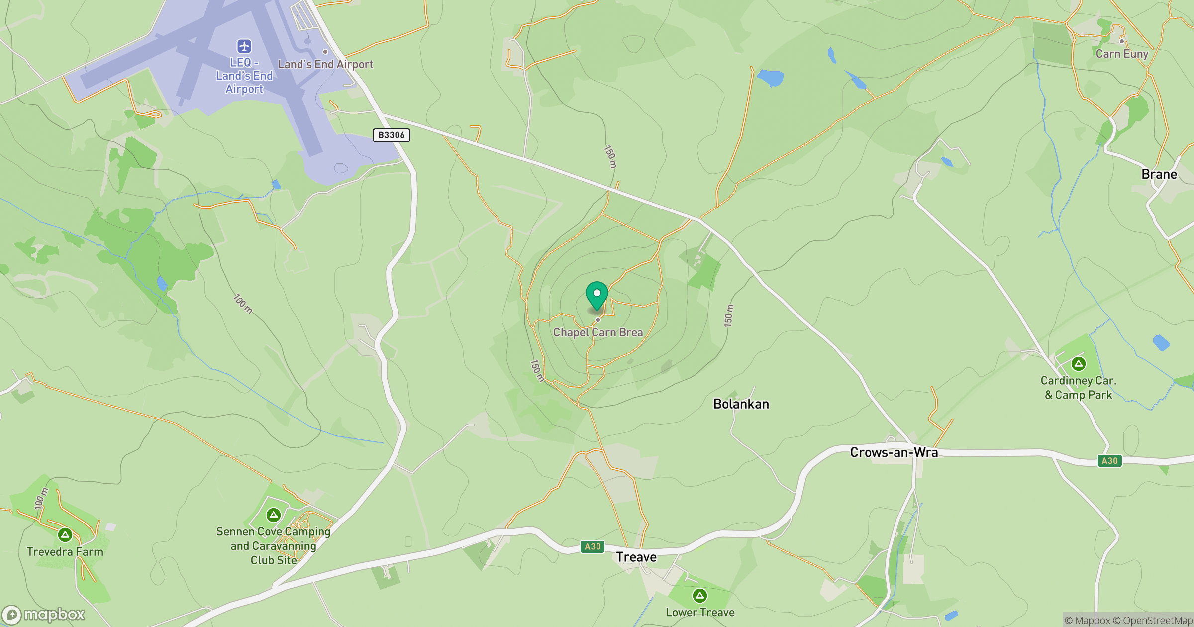
Grid reference: SW385280
View on OpenStreetMapOpens a map in a new tab, centred on the hill.


No comments yet. Be the first.