
Camaross Hill
Good walks are even better shared.
Overview
Camaross Hill
Nestled in the Southern Uplands of Scotland, Camaross Hill stands tall at 487 meters, offering not only a solid workout for the avid hiker but also delightful views that make every step worthwhile.
Geology
The rock here is primarily Upper Old Red Sandstone, showcasing a palette of reds and yellows reminiscent of a painter's palette — a true geological masterpiece. The sedimentation patterns tell tales of ancient rivers that once flowed through the landscape, giving a historical context to your hike!
Routes
The Route from Carsphairn is a highlighted pathway and is moderately challenging. At 8.5 km, it typically takes around 3.5 hours to trek up to the summit and back. As you stroll along, you'll meander through picturesque farmland, with a gradual ascent that won't leave you gasping for breath (unless you're really unfit!).
Summit Features
Upon reaching the summit, you're greeted by a humble stone cairn that nods to the many travelers who've braved the hill before you. Here, the panoramic views are simply breathtaking, with the Galloway Hills stretching out as far as the eye can see. If you squint just right, you might even spot the Isle of Man in the distance!
Terrain Type
Expect grassy slopes interspersed with rocky outcrops. It's a pleasant change from the boggy pitfalls that can often plague other hikes. But fair warning — be prepared for the odd patch that may try to swallow your boots!
Views
The views from Camaross Hill are best in Spring and Autumn, when the landscape is clad in vibrant greens and rich autumnal hues. It's a feast for the eyes, with the distant coast a shimmering line against the horizon.
Hazards
While the terrain is generally friendly, keep an eye out for those pesky boggy areas, especially after a good rain. The weather, too, can turn on a dime, so it's wise to carry a waterproof jacket — no one enjoys a surprise drenching!
Access
Parking is best found in the village of Carsphairn, where you'll find limited but sufficient spaces. Buses run infrequently, so plan your trip accordingly unless you've mastered the art of hitchhiking! The nearest town with more facilities is New Galloway, around 15 km away.
Facilities
For a post-hike pint, head over to the local pub, or for a quick refuel, check out the village shop. Public toilets are available nearby, because let's face it, even the most seasoned hikers have their limits.
History
The name 'Camaross' hints at a rocky heritage — a fitting title for this splendid hill. It’s steeped in history, having once been grazing grounds for local livestock, reminding us that our hills hold stories beyond just folks in hiking boots.
So strap on your boots and venture forth to Camaross Hill!
Conclusion
With its mix of manageable trails, stunning vistas, and a good dose of history, it proves to be a gem among the Southern Uplands.
Happy hiking and remember: if you find a large rock that looks like it’s lost, it might just be Camaross Hill’s own sense of humour trying to brighten your day!
Explore routes near Camaross Hill
Public walks starting within 80 km of this hill. Nearby does not mean a route reaches the summit; check its map and access before setting out.
No public routes are currently listed within 80 km of Camaross Hill on Walkmates. This does not mean there are no paths here. Explore the map and check local access information before planning a walk.
Route planning notes
These notes describe possible approaches, not verified navigable routes or permission to cross land. Check current paths, local access rules and conditions before setting out.
Camaross Hill from Carsphairn
A scenic route starting from the small village of Carsphairn, taking you through lush farmland and ascending gradually towards the summit.
Make a day of it, together
Find someone to share the walk with, or organise a day out along a route you like.
Hill facts and local notes
Classifications
Elevation
181m
594 ft
Prominence
104m
Coordinates
52.3807, -6.7025
S884262
OS Map
77
At the Summit
The summit features a compact stone cairn and offers a splendid view of the surrounding landscape, including the Galloway Forest Park.
Terrain & Geology
Camaross Hill is primarily composed of Upper Old Red Sandstone, a sedimentary rock that offers a rich tapestry of red and yellow hues. The geology indicates a history of sediment deposition in ancient river systems, providing a glimpse into Scotland's geological past.
Views & Scenery
Stunning panoramas of the Galloway Hills, the distant coast, and, on a clear day, the Isle of Man.
History & Heritage
Name Origin
The name 'Camaross' is believed to derive from Gaelic, possibly meaning 'the rocky hill'.
Historical Significance
The hill is part of ancient grazing lands historically used by local communities, adding to the cultural landscape.
Getting There & Facilities
Check current local access restrictions, parking rules and transport timetables before travelling. These notes do not confirm public access to the summit.
Parking
Carsphairn village has limited parking available. Please be considerate of local residents.
Public Transport
Buses travel to Carsphairn from larger towns such as Kirkcudbright, but services are limited, so check the schedule.
Nearby Facilities
The village of Carsphairn has a shop and a local pub for refreshments. Public toilets are also available.
Safety Information
Known Hazards
- Boggy patches can be found on the lower slopes. The weather can change quickly, so be prepared for rain or low visibility.
General Safety Tips
- Check weather conditions before setting out
- Carry appropriate clothing and equipment
- Let someone know your planned route
- Take a map, compass, and GPS device
- Carry emergency supplies: food, water, first aid kit, torch
Hills
Some common questions about the hills answered
Are there group walks up Camaross Hill?
Many walkers use Walkmates to join or organise walks with others. You can check for group walks around Camaross Hill through the maps
Are there other walkers around Camaross Hill?
Activity varies by location and time, but Walkmates lets you see whether others have shared walks or shown interest in this area. Find other people through the walking friends search walking friends for Camaross Hill search or of course create your own walk for Camaross Hill
Can I organise a walk to Camaross Hill?
Yes. If there aren’t any walks listed already, you can create a walk and make it available for others to join.
If you're signed up to Walkmates, you can create a walk to Camaross Hill.
How do I find a walk up this hill?
There are often multiple ways to walk this hill, depending on experience and route preference. Walkmates helps you explore walks and routes that others have shared.
Can I suggest a new route up Camaross Hill?
Yes. You can suggest or create routes to share with others. Walkmates focuses on the social side of walking, so routes are used to help people organise walks and explore areas together, rather than as detailed navigation tools or route libraries.
Other uses really appreciate knowledgeable walkers sharing their routes. Share your favourite route to Camaross Hill here
The is an error or something incorrect about this hill. How do I let you know?
We always strive to keep the information on Walkmates as accurate as possible. If you find an error, please let us know through the contact form and we'll aim to correct it as quickly as possible
Community Discussion
Comments
Location
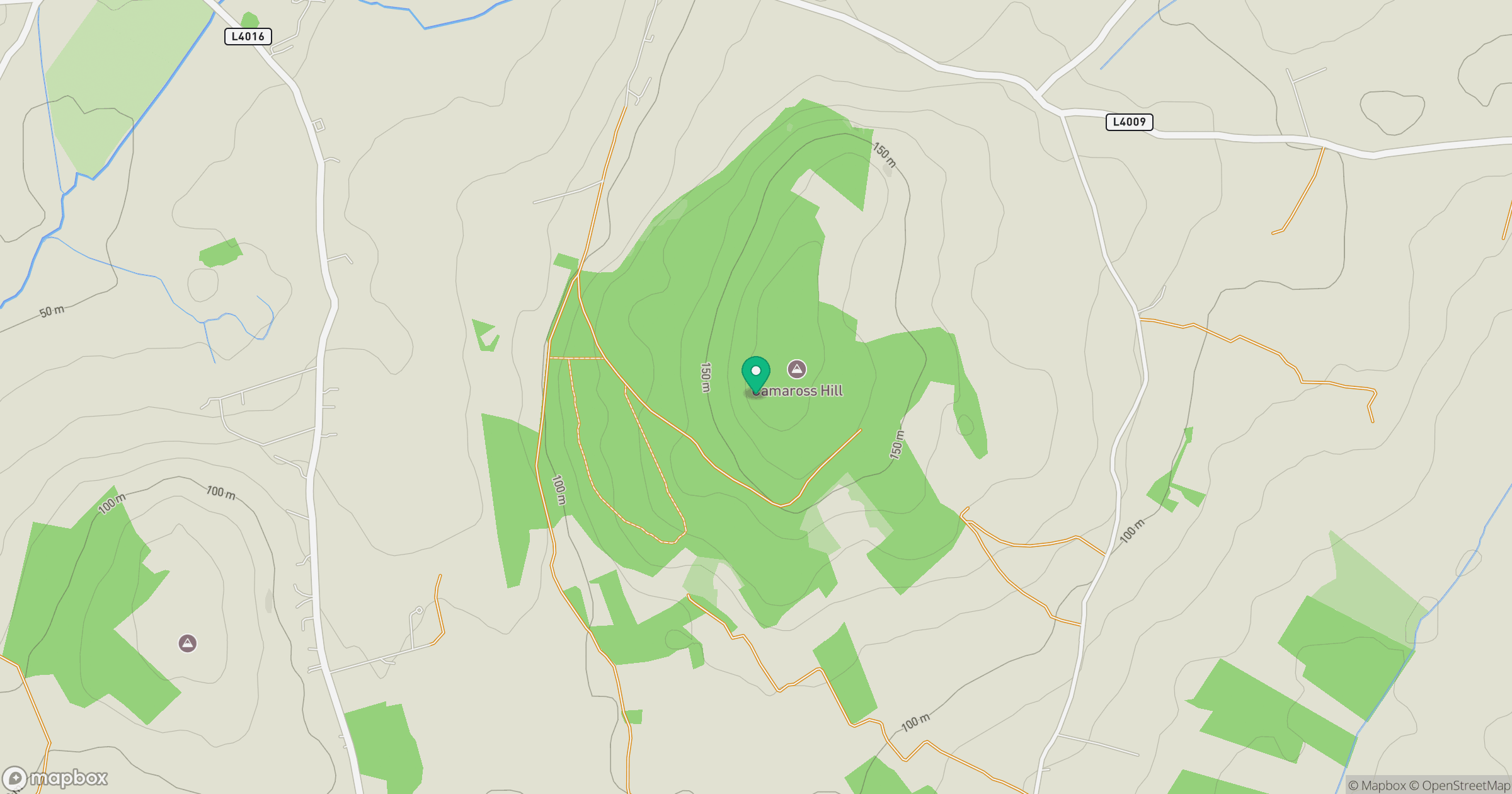
Grid reference: S884262
View on OpenStreetMapOpens a map in a new tab, centred on the hill.
Hills within 30 km
Straight-line distance, not a walking route or confirmation of access.
Carrickbyrne Hill [Carraig Bhrain]
234m
Bree Hill [Cnoc Bri]
179m
Forth Mountain [Sliabh Fothart]
237m
Lacken Hill
193m
Blackstairs Mountain [Na Staighri Dubha]
732m
No comments yet. Be the first.