

Borough Hill
Good walks are even better shared.
Overview
Borough Hill
Borough Hill, standing proudly at 191 meters, is a delightful Marilyn located in the scenic Northamptonshire countryside. Its noticeable prominence of 33 meters makes it a popular spot for both casual walkers and enthusiastic hikers alike.
Geology
Borough Hill is primarily comprised of Jurassic limestone, a sturdy rock type that has shaped the landscape over millennia. You'll notice fascinating rock formations and can explore remnants of historical quarrying that hint at the area's industrial heritage. It's a geology enthusiast’s dream – one part education, two parts adventure!
Routes
The Borough Hill Circular Walk is the most favoured route, stretching about 4 kilometers and ideal for all fitness levels. This easy trail takes you from the bustling town centre, through peaceful woodland paths, and ultimately to the summit, not too dissimilar from a leisurely Sunday stroll, but with slightly more elevation!
Time required: Approximately 1.5 hours
Summit Features
At the summit, you'll find a sturdy trig point and an impressive ancient earthwork that invites curious minds to ponder its past. Who were the early inhabitants that held picnics atop this lofty sentinel? Whatever the case, they certainly knew how to pick a view!
Terrain Type
The terrain here is primarily grassy, mixed with wooded paths, making it a friendly playground for hikers, families, and their four-legged companions despite the occasional muddy patch after a rain shower.
Views
The summit presents stunning panoramic views of the surrounding landscape. On a clear day, the historic town of Daventry comes into full view, intertwined with delightful agricultural vistas. If you're lucky enough, you might set your sights on the distant Cotswolds!
Best Season: Spring and Autumn are particularly appealing for the clearest views and magnificent foliage.
Hazards
While Borough Hill is generally safe, be cautious of muddy patches that may appear after rain, as well as the occasional rambunctious sheep who might want to inspect your rucksack!
Nearby Summits
One notable nearby summit is Whilton Lodge which reaches a height of approximately 190 meters, making for an interesting additional outing.
Access
Borough Hill is easily accessible, with parking available on its southern side. Here, a cozy little car park offers direct entry to the trails.
Public Transport
If you prefer public transport, the nearest bus stop resides in the heart of Daventry, providing good connections from surrounding towns.
Nearest Town
Daventry is your closest town and offers all the necessary amenities, including charming cafes and welcoming pubs to refuel after your adventures.
Facilities
In Daventry, you'll find a variety of facilities such as cafes where you can grab a bite, or public toilets to ensure your comfort.
History
The name 'Borough Hill' hints at its historical significance, correlating with its role as a fortified site in medieval times. The ancient earthworks present at the site date back to the Iron Age, showcasing its long-standing importance as a prominent landmark in the region.
In summary, Borough Hill is more than just a hill; it’s a piece of history, a splendid view, and a great place for a bit of fresh air. Pack your walking boots, grab your mates, and head out for an adventure that might just become a local legend in your hiking tales!
Explore routes near Borough Hill
Public walks starting within 80 km of this hill. Nearby does not mean a route reaches the summit; check its map and access before setting out.
Draycote Water Walk: Route Map and Current Closures
View route
Rugby Walk with Men Walking & Talking
View route
Pitsford Water reservoir circuit
View route
Salcey Forest: Elephant Pond and northern woodland
View route
Route planning notes
These notes describe possible approaches, not verified navigable routes or permission to cross land. Check current paths, local access rules and conditions before setting out.
Borough Hill Circular Walk
A pleasant circular route starting from the town centre, taking you up to the summit and back, offering a mix of woodland paths and open fields.
Make a day of it, together
Find someone to share the walk with, or organise a day out along a route you like.
Photo Gallery
View all Photo could not load
SP5862 : Daventry-Borough Hill
Ian Rob
 Photo could not load
SP5861 : Daventry-Borough Hill
Ian Rob
 Photo could not load
SP5861 : Daventry-Borough Hill
Ian Rob
 Photo could not load
SP5862 : Daventry-Borough Hill
Ian Rob
 Photo could not load
SP5862 : Daventry-Borough Hill
Ian Rob
 Photo could not load
SP5861 : Footpath on Borough Hill
Philip Jeffrey
 Photo could not load
SP5862 : Borough Hill looking towards the radio mast
Philip Jeffrey
 Photo could not load
SP5861 : Borough Hill mast viewed across a garden centre
Chris
 Photo could not load
SP5862 : Daventry-Borough Hill
Ian Rob
Hill facts and local notes
Classifications
Elevation
201m
659 ft
Prominence
47m
Coordinates
52.2536, -1.1409
SP587620
OS Map
152
Explorer: 222
At the Summit
The summit features a prominent trig point and an impressive ancient earthwork, which may leave you wondering who would have fancied a picnic at the top millennia ago.
Terrain & Geology
Borough Hill is composed mainly of Jurassic limestone, which provides a sturdy base and interesting rock formations. You'll also find evidence of historical quarrying in the area, showcasing the hill's industrial past.
Views & Scenery
From the summit, you can enjoy panoramic views of the surrounding countryside, including the historic town of Daventry and rolling agricultural landscapes. On a clear day, you might even spot the distant Cotswolds.
History & Heritage
Name Origin
The name Borough Hill likely refers to its historical role as a fortified site or 'borough', hinting at its medieval significance.
Historical Significance
The hill features ancient earthworks believed to date back to the Iron Age, indicating its long history as a significant landmark.
Getting There & Facilities
Check current local access restrictions, parking rules and transport timetables before travelling. These notes do not confirm public access to the summit.
Parking
There is parking available on Borough Hill's southern side, with a small car park providing easy access to the trails.
Public Transport
The nearest bus stop is in Daventry town centre, with services connecting to major towns in the region.
Nearby Facilities
Facilities in Daventry include cafes, pubs, and public toilets, ensuring that you can refuel before or after your hike.
Safety Information
Known Hazards
- While the terrain is generally safe, be mindful of muddy paths after rain and the occasional inquisitive sheep.
General Safety Tips
- Check weather conditions before setting out
- Carry appropriate clothing and equipment
- Let someone know your planned route
- Take a map, compass, and GPS device
- Carry emergency supplies: food, water, first aid kit, torch
Hills
Some common questions about the hills answered
Are there group walks up Borough Hill?
Many walkers use Walkmates to join or organise walks with others. You can check for group walks around Borough Hill through the maps
Are there other walkers around Borough Hill?
Activity varies by location and time, but Walkmates lets you see whether others have shared walks or shown interest in this area. Find other people through the walking friends search walking friends for Borough Hill search or of course create your own walk for Borough Hill
Can I organise a walk to Borough Hill?
Yes. If there aren’t any walks listed already, you can create a walk and make it available for others to join.
If you're signed up to Walkmates, you can create a walk to Borough Hill.
How do I find a walk up this hill?
There are often multiple ways to walk this hill, depending on experience and route preference. Walkmates helps you explore walks and routes that others have shared.
Can I suggest a new route up Borough Hill?
Yes. You can suggest or create routes to share with others. Walkmates focuses on the social side of walking, so routes are used to help people organise walks and explore areas together, rather than as detailed navigation tools or route libraries.
Other uses really appreciate knowledgeable walkers sharing their routes. Share your favourite route to Borough Hill here
The is an error or something incorrect about this hill. How do I let you know?
We always strive to keep the information on Walkmates as accurate as possible. If you find an error, please let us know through the contact form and we'll aim to correct it as quickly as possible
Community Discussion
Comments
Location
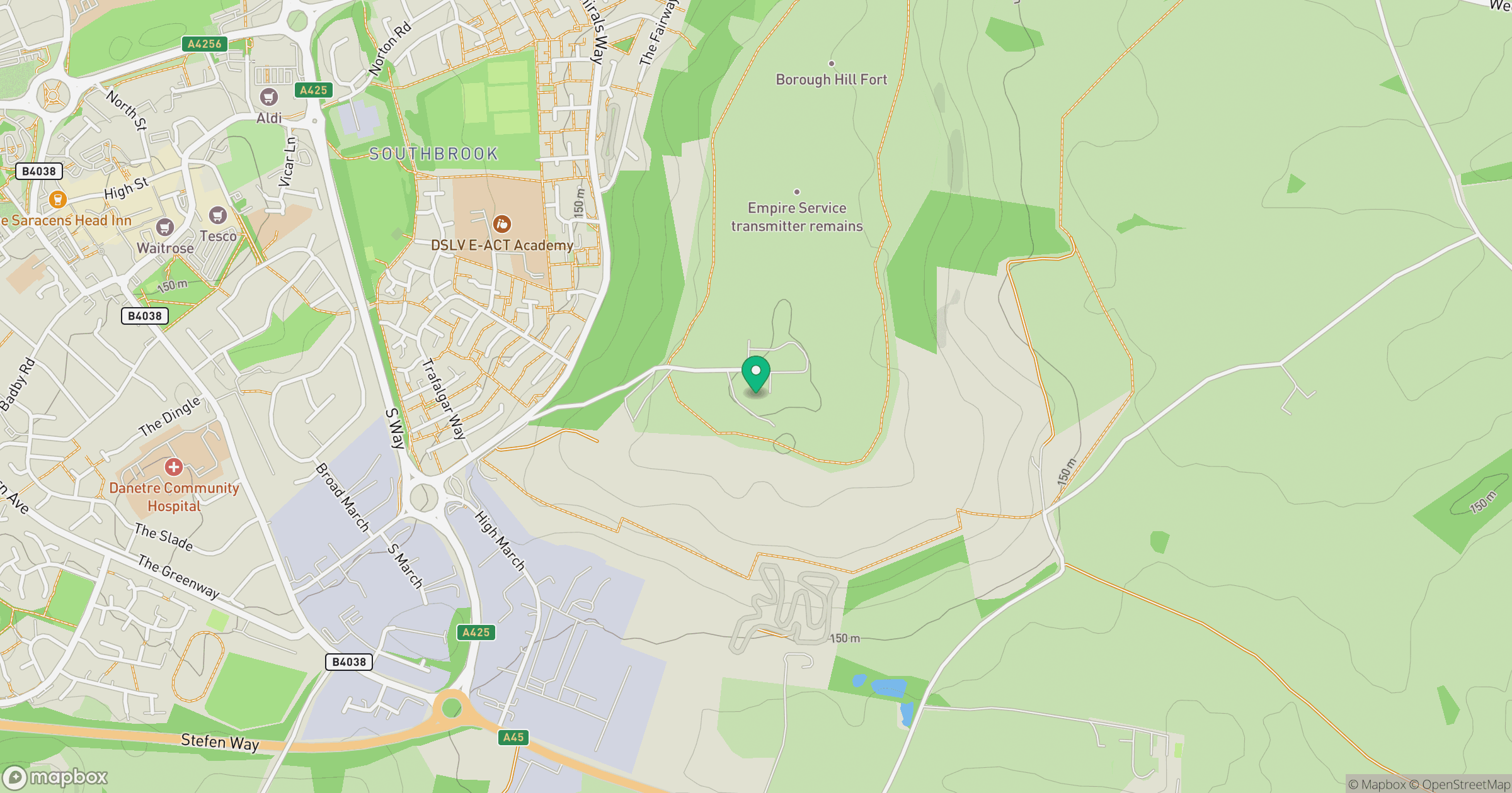
Grid reference: SP587620
View on OpenStreetMapOpens a map in a new tab, centred on the hill.
Hills within 30 km
Straight-line distance, not a walking route or confirmation of access.
No comments yet. Be the first.