

Boa Island
Good walks are even better shared.
H0962 : Mullans, Boa Island
Kenneth Allen Photo source
Overview
Welcome to Boa Island!
Nestled in the tranquil waters of Lough Erne, Boa Island offers a delightful mix of scenic beauty and historical intrigue. With an elevation of just 29 meters, it may not strike you as a towering giant, but what it lacks in altitude, it makes up for in charm.
Geology
The island's foundation is primarily formed from sedimentary rocks, particularly sandstone and limestone. These formations tell a tale of the earth's happenings over thousands of years. If you fancy yourself a bit of a geologist, take a moment to inspect the stratification; you might be surprised what you find!
Routes
For those keen on exploring, the Loop Trail from the Car Park is an easy 3.5 km trek that can be comfortably walked in around 1.5 hours. Perfect for families or those just looking to stretch their legs, this trail offers splendid views and a chance to observe the local flora and fauna.
Summit Features
At the summit, you’ll find a small yet proud cairn announcing your achievement. From this vantage point, the panoramic views of Lough Erne are nothing short of breathtaking. Grab your camera, and don’t forget to take a picture to prove you made it!
Terrain Type
The terrain varies between grassy meadows and rocky outcrops, interspersed with the occasional muddy path, particularly after a good ole Irish downpour. Let’s face it—if there’s one thing the Irish weather loves to do, it's to keep hikers on their toes!
Views
On a clear day, the views from Boa Island are simply stunning. You can see other nearby islands dotted around the lough and the rolling hills that frame the water. The best seasons to soak up these sights are spring and early autumn when the landscape bursts with vibrant colours.
Hazards
While the island is generally family-friendly, it’s prudent to watch your step, especially on slippery rocks and muddy areas. The last thing you want is a muddy tumble to mar your day out! Also, keep your eyes peeled for any wandering livestock that might have crossed your path—after all, they’re the true locals here!
Nearby Summits
If you're in the mood for more adventure, consider tackling Carrickreagh Hill, which boasts a height of 54 meters and provides an additional vantage point over the beautiful landscape.
Access
The small car park located near the island's entrance helps make access easy-peasy for all adventurers. While public transport options are scant, local bus services from Enniskillen will get you reasonably close to the area. If you’re coming from town, expect to drive about 10 km to get to the island.
Facilities
Despite its stunning nature, Boa Island is devoid of facilities. Thankfully, Enniskillen is just a short drive away, where you can find all the cafes, restaurants, and public conveniences you might need.
History
Boa Island holds historical significance beyond its beautiful landscapes. Its name, derived from Gaelic, literally translates to 'Cattle Island', a nod to its pastoral heritage. Additionally, the island is home to ancient artifacts, including the famed Boa Island figure, adding layers of intrigue to this picturesque spot.
In conclusion, Boa Island may be small, but it packs a punch with its incredible views, accessibility, and historical significance. Whether you’re a seasoned hiker or a casual walker, this little gem is worth a visit. Just remember to watch your step and maybe avoid deep conversations with any cattle you might encounter!
Last Updated
2023-10-10
Source
OpenStreetMap
Explore routes near Boa Island
Walks starting near this hill. Open a route to check its map, distance and full itinerary.
Route planning notes
These notes describe possible approaches. Check a route's map and access information when planning your walk.
Loop Trail from the Car Park
A pleasant circuit around the island with scenic views and opportunities to explore the local wildlife.
Make a day of it, together
Find someone to share the walk with, or organise a day out along a route you like.
Photo Gallery
View all Photo could not load
H0962 : Mullans, Boa Island
Kenneth Allen
Hill facts and local notes
Classifications
Elevation
70m
230 ft
Prominence
26m
Coordinates
54.5081, -7.8618
H090622
OS Map
17
At the Summit
The summit features a modest cairn, marking the highest point of the island, along with panoramic views of Lough Erne and the surrounding countryside.
Terrain & Geology
Boa Island is primarily composed of sedimentary rock, predominantly sandstone and limestone, which shaped its unique landscape through millennia of erosion. This geology provides fascinating insights into the region's geological history and contributes to the area's varied flora.
Views & Scenery
From the summit, visitors can catch sight of Lough Erne, the nearby islands, and rolling hills that create a picturesque backdrop.
History & Heritage
Name Origin
The name 'Boa Island' is derived from the Gaelic 'Inis Bó', meaning 'Cattle Island', highlighting its pastoral history.
Historical Significance
The island is home to several ancient sites, including the early Christian sculpture of the 'Boa Island figure' which adds to its cultural richness.
Getting There & Facilities
Parking
There is a small car park near the entrance to the island, providing easy access to the hiking trails.
Public Transport
Public transport options are limited; however, local bus services from Enniskillen can get you relatively close to the area.
Nearby Facilities
There are no direct facilities on the island, but Enniskillen offers various cafes, restaurants, and toilets for your convenience.
Safety Information
Known Hazards
- Watch out for slippery rocks and muddy paths, especially after rain. Also, keep an eye out for wildlife, including livestock that may roam the island.
General Safety Tips
- Check weather conditions before setting out
- Carry appropriate clothing and equipment
- Let someone know your planned route
- Take a map, compass, and GPS device
- Carry emergency supplies: food, water, first aid kit, torch
Hills
Some common questions about the hills answered
Are there group walks up Boa Island?
Many walkers use Walkmates to join or organise walks with others. You can check for group walks around Boa Island through the maps
Are there other walkers around Boa Island?
Activity varies by location and time, but Walkmates lets you see whether others have shared walks or shown interest in this area. Find other people through the walking friends search walking friends for Boa Island search or of course create your own walk for Boa Island
Can I organise a walk to Boa Island?
Yes. If there aren’t any walks listed already, you can create a walk and make it available for others to join.
If you're signed up to Walkmates, you can create a walk to Boa Island.
How do I find a walk up this hill?
There are often multiple ways to walk this hill, depending on experience and route preference. Walkmates helps you explore walks and routes that others have shared.
Can I suggest a new route up Boa Island?
Yes. You can suggest or create routes to share with others. Walkmates focuses on the social side of walking, so routes are used to help people organise walks and explore areas together, rather than as detailed navigation tools or route libraries.
Other uses really appreciate knowledgeable walkers sharing their routes. Share your favourite route to Boa Island here
The is an error or something incorrect about this hill. How do I let you know?
We always strive to keep the information on Walkmates as accurate as possible. If you find an error, please let us know through the contact form and we'll aim to correct it as quickly as possible
Community Discussion
Comments
Location
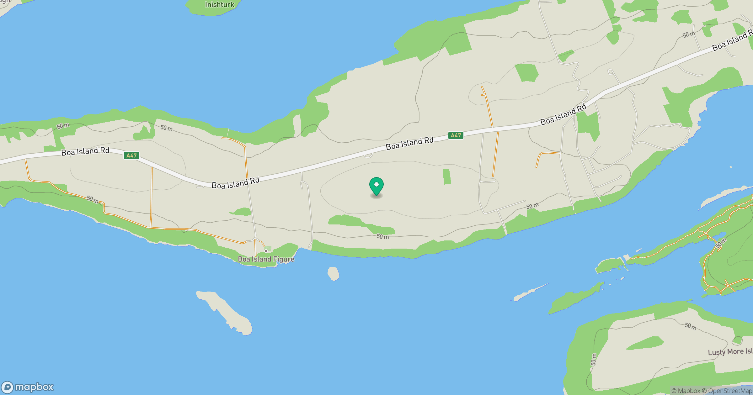
Grid reference: H090622
View on OpenStreetMapOpens a map in a new tab, centred on the hill.
No comments yet. Be the first.