
Meenseefin
Good walks are even better shared.
Overview
Meenseefin: A Hidden Gem in the Lake District
Nestled in the heart of the Lake District, Meenseefin is often overshadowed by its more illustrious siblings like Skiddaw and Blencathra. However, what it lacks in height, it more than makes up for with charm and stunning views.
Geography and Geology
Elevation: Meenseefin stands tall (or reasonably so) at 609 meters. Its geological feature, Skiddaw Slate, dates back hundreds of millions of years and offers a fascinating glimpse into the Earth's history. This area is renowned for its diverse topology, featuring rocky outcrops and grassy slopes interspersed with vibrant patches of heather and the occasional bog, which can catch out even the most seasoned hiker!
Routes
The most popular route is the Meenseefin Circular Route starting from the quaint village of Threlkeld. This moderate 7.5 km trek will have you encountering a blend of rocky and grassy terrains, with an expected time of about 3.5 hours. A perfect day out, don’t forget your camera!
Summit Features
Upon reaching the summit, you’ll be greeted by a small but mighty stone cairn – a perfect place to sit and enjoy the panorama. Just be sure to take a moment to catch your breath and marvel at the stunning views of the surrounding Lake District.
Terrain and Hazards
Expect rocky paths and grassy meadows, with the occasional bogginess that might make your shoes a bit muddier than when you started. As always in mountainous regions, take heed of potential hazards like sudden weather changes and slippery rocks.
Views
From the summit, the views are nothing short of breathtaking. With Skiddaw and Blencathra dominating the skyline, clear days reveal further-ranging vistas that will make your heart sing (or at least your eyes widen in awe). The best months for photography are spring and early autumn, when the weather is generally kinder, and the scenery is pure postcard material.
Access
For those driving, you can park at a small lot in Threlkeld, just a stone's throw from the trailhead. Public transport options include local buses that occasionally feel like a game of musical chairs – always check schedules to avoid missing your turn.
In Threlkeld, you'll find welcoming cafes and public toilets to prep for or recuperate from your adventure!
A Bit of History
The name Meenseefin might not roll off the tongue at first, but it harks back to its Norse roots suggesting ‘the mountain of the mossy seat’. With the lush surroundings, this meaningful etymology speaks volumes about the mountain's character!
Conclusion
So, if you’re looking for a hike that offers amazing views, pleasant trails, and a sprinkle of history, Meenseefin is the perfect choice. Laced with charm and a dash of modesty, this mountain reminds us that sometimes the quieter paths lead to the most memorable moments.
Explore routes near Meenseefin
Public walks starting within 80 km of this hill. Nearby does not mean a route reaches the summit; check its map and access before setting out.
Florence Court: Riverside and Forest Circuit, County Fermanagh
View route
Derry~Londonderry City Walls Circuit
View route
Banagher Glen and Forest: complete higher-return circuit
View route
Route planning notes
These notes describe possible approaches, not verified navigable routes or permission to cross land. Check current paths, local access rules and conditions before setting out.
Meenseefin Circular Route
A scenic circular route starting from the nearby village of Threlkeld, taking in less-trodden paths with splendid views.
Make a day of it, together
Find someone to share the walk with, or organise a day out along a route you like.
Hill facts and local notes
Classifications
Elevation
280m
919 ft
Prominence
109m
Coordinates
54.5891, -7.9311
H045712
OS Map
11
At the Summit
The summit features a small stone cairn, a testament to the many intrepid hikers who have made the trek. It's a lovely spot to catch your breath and take in the views, assuming you can remember how to breathe after that last hill!
Terrain & Geology
Composed largely of Skiddaw Slate, Meenseefin showcases the region's ancient rock formations. The slate is known for its fine-grained quality and is a key component of the area's geology.
Views & Scenery
The panoramic views extend across the Lake District, with sights of Skiddaw and Blencathra stealing the show. On a clear day, you might even see as far as Scotland!
History & Heritage
Name Origin
The name Meenseefin is derived from the old Norse for 'the mountain of the mossy seat', highlighting its lush, damp landscape.
Historical Significance
Meenseefin, while not the tallest, has captivated hikers for generations, serving as a great vantage point for exploring this stunning region.
Getting There & Facilities
Check current local access restrictions, parking rules and transport timetables before travelling. These notes do not confirm public access to the summit.
Parking
Parking is available in Threlkeld, with a small car park by the village hall. Spaces fill up quickly on sunny weekends, so arrive early to avoid disappointment.
Public Transport
Buses run regularly from Keswick to Threlkeld. Check the local timetable for service updates.
Nearby Facilities
Nearby in Threlkeld, you’ll find a delightful café for tea and cake, and public toilets to freshen up after your hike.
Safety Information
Known Hazards
- Be cautious of slippery rocks, especially after rain, and watch out for sudden weather changes typical of the region.
General Safety Tips
- Check weather conditions before setting out
- Carry appropriate clothing and equipment
- Let someone know your planned route
- Take a map, compass, and GPS device
- Carry emergency supplies: food, water, first aid kit, torch
Hills
Some common questions about the hills answered
Are there group walks up Meenseefin?
Many walkers use Walkmates to join or organise walks with others. You can check for group walks around Meenseefin through the maps
Are there other walkers around Meenseefin?
Activity varies by location and time, but Walkmates lets you see whether others have shared walks or shown interest in this area. Find other people through the walking friends search walking friends for Meenseefin search or of course create your own walk for Meenseefin
Can I organise a walk to Meenseefin?
Yes. If there aren’t any walks listed already, you can create a walk and make it available for others to join.
If you're signed up to Walkmates, you can create a walk to Meenseefin.
How do I find a walk up this hill?
There are often multiple ways to walk this hill, depending on experience and route preference. Walkmates helps you explore walks and routes that others have shared.
Can I suggest a new route up Meenseefin?
Yes. You can suggest or create routes to share with others. Walkmates focuses on the social side of walking, so routes are used to help people organise walks and explore areas together, rather than as detailed navigation tools or route libraries.
Other uses really appreciate knowledgeable walkers sharing their routes. Share your favourite route to Meenseefin here
The is an error or something incorrect about this hill. How do I let you know?
We always strive to keep the information on Walkmates as accurate as possible. If you find an error, please let us know through the contact form and we'll aim to correct it as quickly as possible
Community Discussion
Comments
Location
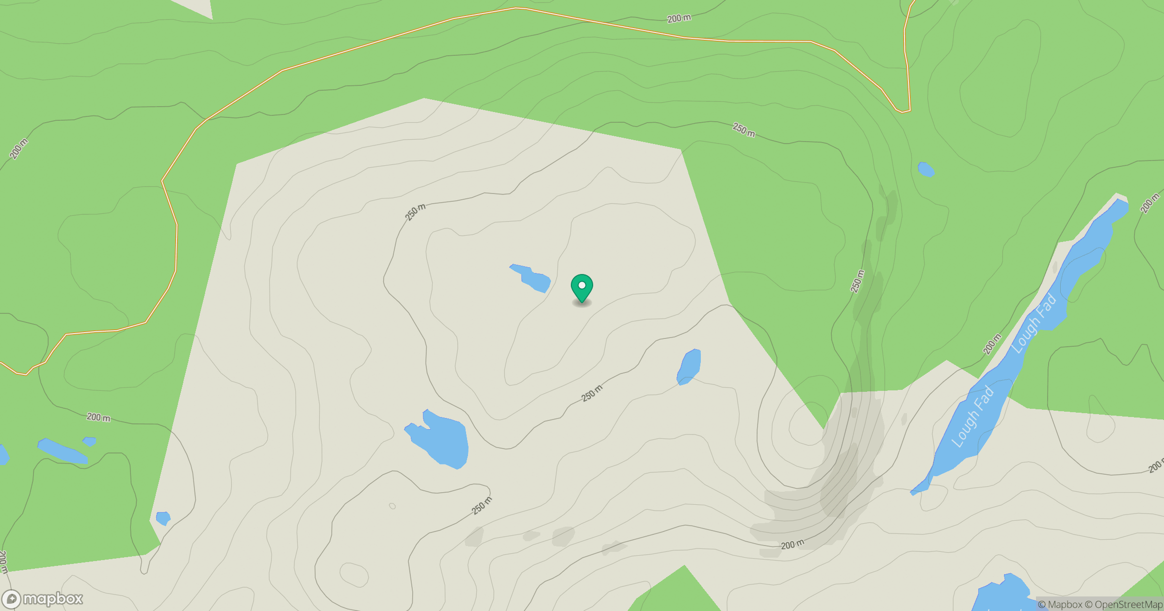
Grid reference: H045712
View on OpenStreetMapOpens a map in a new tab, centred on the hill.
Hills within 30 km
Straight-line distance, not a walking route or confirmation of access.
No comments yet. Be the first.