
Bleanbeg
Good walks are even better shared.
Overview
Bleanbeg: A Hidden Gem in the Brecon Beacons
Nestled snugly in the heart of the Brecon Beacons, Bleanbeg may not be the highest of its companions, but what it lacks in stature, it more than makes up for in character and charm. Standing proudly at 601 meters, it is a stalwart choice for hikers looking for adventure without the monumental challenge of higher peaks.
Geology
Bleanbeg’s indigenous rock, Old Red Sandstone, serves as a testament to the region's lengthy geological history. Its origins stretch back over 400 million years, showcasing the dance of time and elements that has given rise to the breathtaking landscapes we adore today.
Hiking Routes
For those eager to lace up their hiking boots, the Bleanbeg Circular Route is the jewel in the crown, spanning approximately 8.5 km with a leisurely walk time of around 3.5 hours. Designed for hikers looking for a moderate challenge, this route leads you through lush valleys and rugged paths, ensuring that you’re never short on stunning sights.
Summit Features
Upon reaching the summit, you’ll be greeted by a delightful stone cairn, a welcome sight for weary trekkers. Don't forget to sign the summit register, an amusing relic that showcases the wide variety of characters who have graced this peak.
Terrain Type
Expect your feet to tread through a delightful mix of rocky outcrops and grassy slopes. The varied terrain is not only invigorating but offers ample opportunity for spontaneous photo opportunities along the way - do your best 'What’s that in the distance?’ pose!
Views
From the summit, the panoramic views will leave you grinning from ear to ear. Look out upon the majestic mountains of the Brecon Beacons, with the famed Pen y Fan and Corn Du in close view. On clear days, one can even spot the Irish Sea, a remarkable guarantee that your effort has indeed been rewarded!
Hazards
As with all great adventures, caution is advised! Be wary of rapidly changing weather conditions; the Brecon Beacons are known for their unpredictability. And remember, rocks are not as friendly as they might appear – keep your footing and tread carefully.
Nearby Summits
If the hiking bug has bitten and you’re looking for more, nearby summits like Pen y Fan (886 meters) and Corn Du (873 meters) offer exciting extensions to your exploration.
Access
Cwm Clydach car park will be your trusted starting point (OS Grid Reference: SN 940 206); be sure to arrive early to snag a prime spot! If public transport is your preferred way of getting about, check the bus services from Brecon, as they provide a scenic route into the heart of the Beacons.
Facilities
Though Bleanbeg itself has no facilities, nearby Brecon has you covered with cafes, shops, and public toilets, so you can indulge in a well-deserved treat at the end of your adventure.
History
With a name meaning 'little', Bleanbeg is a beloved friend of the Brecon Beacons. Its significance is deeply rooted in local folklore and history, making it a charming addition to your hike.
Grab your walking sticks, and lace up those boots; Bleanbeg awaits, promising adventure, tranquillity, and perhaps just enough views to keep the Instagram likes rolling in!
Happy hiking!
Explore routes near Bleanbeg
Public walks starting within 80 km of this hill. Nearby does not mean a route reaches the summit; check its map and access before setting out.
No public routes are currently listed within 80 km of Bleanbeg on Walkmates. This does not mean there are no paths here. Explore the map and check local access information before planning a walk.
Route planning notes
These notes describe possible approaches, not verified navigable routes or permission to cross land. Check current paths, local access rules and conditions before setting out.
Bleanbeg Circular Route
A scenic circular route starting from the car park near Cwm Clydach, allowing hikers to enjoy the best that Bleanbeg has to offer, including a stunning ascent and panoramic views.
Make a day of it, together
Find someone to share the walk with, or organise a day out along a route you like.
Hill facts and local notes
Classifications
Elevation
368m
1,207 ft
Prominence
111m
Coordinates
52.7262, -8.3116
R790639
OS Map
59
At the Summit
The summit features a distinctive stone cairn, proudly standing as a landmark for weary hikers. Keep your eyes peeled for the summit register tucked away in a waterproof box, where you can leave your mark - or a questionable doodle.
Terrain & Geology
Bleanbeg is primarily composed of Old Red Sandstone, providing an interesting insight into the geological processes that shaped this area. The sandstone formations are around 400 million years old, giving a glimpse into the Earth's distant past.
Views & Scenery
From the summit, enjoy breathtaking views across the Brecon Beacons, with Anglesey to the north and the Black Mountains to the east. On a clear day, you might even catch a glimpse of the Irish Sea!
History & Heritage
Name Origin
The name 'Bleanbeg' is derived from the Welsh word 'blean', meaning 'little', combined with 'beg', leading to an endearing term for this petite peak.
Historical Significance
Bleanbeg is part of a larger range that is culturally significant to the Brecon Beacons, encompassing histories of ancient settlements and folklore that add charm to the exploration.
Getting There & Facilities
Check current local access restrictions, parking rules and transport timetables before travelling. These notes do not confirm public access to the summit.
Parking
Cwm Clydach car park (OS Grid Reference: SN 940 206), ample space available but fills up quickly on sunny weekends.
Public Transport
Bus services operate from nearby towns including Brecon; verify times in advance as services may vary.
Nearby Facilities
While there are no facilities directly on the mountain, Brecon provides an array of cafes, shops, and public toilets. Always nice to have a cuppa after a climb!
Safety Information
Known Hazards
- Watch out for sudden changes in weather; conditions can turn in a matter of minutes. Also, watch your step on the rocky areas to avoid trips and falls.
General Safety Tips
- Check weather conditions before setting out
- Carry appropriate clothing and equipment
- Let someone know your planned route
- Take a map, compass, and GPS device
- Carry emergency supplies: food, water, first aid kit, torch
Hills
Some common questions about the hills answered
Are there group walks up Bleanbeg?
Many walkers use Walkmates to join or organise walks with others. You can check for group walks around Bleanbeg through the maps
Are there other walkers around Bleanbeg?
Activity varies by location and time, but Walkmates lets you see whether others have shared walks or shown interest in this area. Find other people through the walking friends search walking friends for Bleanbeg search or of course create your own walk for Bleanbeg
Can I organise a walk to Bleanbeg?
Yes. If there aren’t any walks listed already, you can create a walk and make it available for others to join.
If you're signed up to Walkmates, you can create a walk to Bleanbeg.
How do I find a walk up this hill?
There are often multiple ways to walk this hill, depending on experience and route preference. Walkmates helps you explore walks and routes that others have shared.
Can I suggest a new route up Bleanbeg?
Yes. You can suggest or create routes to share with others. Walkmates focuses on the social side of walking, so routes are used to help people organise walks and explore areas together, rather than as detailed navigation tools or route libraries.
Other uses really appreciate knowledgeable walkers sharing their routes. Share your favourite route to Bleanbeg here
The is an error or something incorrect about this hill. How do I let you know?
We always strive to keep the information on Walkmates as accurate as possible. If you find an error, please let us know through the contact form and we'll aim to correct it as quickly as possible
Community Discussion
Comments
Location
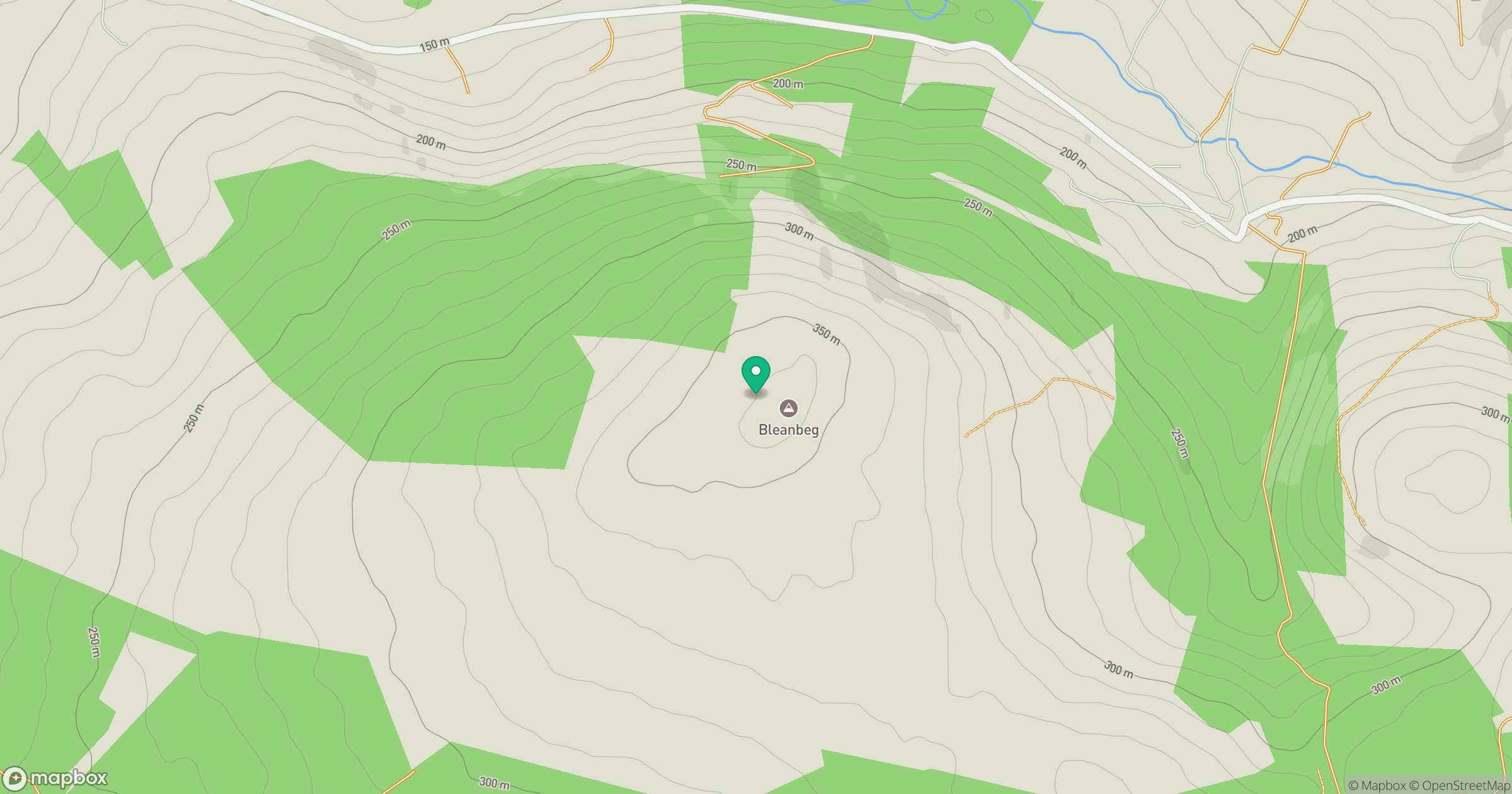
Grid reference: R790639
View on OpenStreetMapOpens a map in a new tab, centred on the hill.
Hills within 30 km
Straight-line distance, not a walking route or confirmation of access.
Devilsbit Mountain [Bearnan Eile]
480m
Keeper Hill
692m
Silvermine Mountains West Top [Silvermine Mountain] [Sliabh an Airgid]
489m
Mauherslieve [Motharshliabh]
543m
Knockastanna [Cnoc an Stanna]
444m
No comments yet. Be the first.