
Ben Lugmore West Top
Good walks are even better shared.
Overview
Ben Lugmore West Top
Located in the stunning wilderness of County Mayo, Ben Lugmore West Top stands at 675 meters, making it a prominent feature among the Nephin Beg mountains. As the name suggests, this summit is indeed a 'top,' and has a minor prominence of 32 meters that might challenge your claim to being majestic at parties, but make no mistake, the views will have you feeling as majestic as a king or queen!
Geology
The rock beneath your feet is primarily granite, a testament to the area's rich geological history shaped by glacial activity. If rocks could talk, these would spin tales of ancient landscapes and changing climates. Remember to give a nod to the ground, they’ve been around a bit longer than we have!
Routes
The most popular route is the Lugmore Loop, offering a circular trek that provides a taste of everything this area has to offer—from rocky paths to lush, grassy areas, and even a bit of bog here and there; just think of it as nature's very own slip 'n slide! The loop is about 8 km long and usually takes around 3.5 hours, rated as a moderate route perfect for the enthusiastic hiker.
Summit Features
Reaching the top, you'll be greeted by a sturdy cairn, where you can catch your breath and take in the breathtaking views. Don't forget to snap a selfie because if you didn't Instagram it, did you even hike it?
Terrain Type
Expect a mix of rocky terrain, grassy patches, and the occasional bog. A good pair of hiking boots is your best friend, especially those that can handle a little adventure.
Views
From the summit, the vistas are nothing short of spectacular. You can feast your eyes on the Nephin Beg mountains, Lough Conn, and if you squint just right, the Atlantic Ocean calls from a distance. The best views are often during late spring through early autumn, although winter's white blanket provides a fairy-tale scene.
Hazards
Be aware that the weather can change quicker than you can say 'Wow, look at that view!' and some patches can be quite slippery, so be sure to take it slow and steady. A good stick won’t just be an official walking aid but a handy tool for knocking back overzealous foliage.
Access
Parking is available at the Kilcommon Church car park, roughly 5 km from the trailhead. Public transport is scarce in these rugged parts, so it’s best to have a car. Ballycroy, the nearest town, is just a hop away, offering necessary amenities before you take off on your adventure.
Facilities
Ballycroy has a few cafes to recharge your batteries, along with toilet facilities—always a plus after a long hike!
History
The name 'Lugmore' translates from Gaelic to 'great ill'. One can't help but wonder if the local folklore involves the mountain playing tricks on unsuspecting hikers! This area is steeped in history with ancient stone structures whispering tales of the past.
Conclusion
Ben Lugmore West Top is a delightful adventure for those looking to explore the beauty of County Mayo. Each step brings you closer to understanding the land's history and enjoying its natural wonders. So pack your rucksack, lace up your boots, and prepare to make some memories high above the bogs!
Explore routes near Ben Lugmore West Top
Walks starting near this hill. Open a route to check its map, distance and full itinerary.
Route planning notes
These notes describe possible approaches. Check a route's map and access information when planning your walk.
Lugmore Loop
A popular circular route starting from the nearby car park, offering stunning views of the surrounding mountains and lakes.
Make a day of it, together
Find someone to share the walk with, or organise a day out along a route you like.
Hill facts and local notes
Classifications
Elevation
792m
2,598 ft
Prominence
47m
Coordinates
53.6454, -9.8065
L805676
OS Map
37
At the Summit
Ben Lugmore West Top boasts a prominent cairn at its peak, which serves as a great spot for a well-deserved rest and taking those obligatory summit selfies.
Terrain & Geology
The summit is composed mainly of granite, offering a rugged landscape with spectacular rock formations and glacial features, giving insight into the area's geological history.
Views & Scenery
Panoramic views of the Nephin Beg mountains, Lough Conn, and the vast expanse of the Atlantic Ocean in the distance.
History & Heritage
Name Origin
The mountain name 'Lugmore' derives from the Gaelic 'Leamhcóir', which translates to 'great ill,' likely referencing the challenging terrain.
Historical Significance
The area around Ben Lugmore has deep cultural roots and is known for its ancient stone structures and folklore.
Getting There & Facilities
Parking
Parking is available at the Kilcommon Church car park, approximately 5 km from the start of the hike.
Public Transport
Limited public transport options; best accessed by car. However, some local buses may operate seasonally.
Nearby Facilities
Cafes and toilets can be found in Ballycroy, but it's advisable to stock up on supplies before heading to the mountain.
Safety Information
Known Hazards
- Potential for rapidly changing weather conditions; be prepared for rain and wind. Some boggy areas can be slippery.
General Safety Tips
- Check weather conditions before setting out
- Carry appropriate clothing and equipment
- Let someone know your planned route
- Take a map, compass, and GPS device
- Carry emergency supplies: food, water, first aid kit, torch
Hills
Some common questions about the hills answered
Are there group walks up Ben Lugmore West Top?
Many walkers use Walkmates to join or organise walks with others. You can check for group walks around Ben Lugmore West Top through the maps
Are there other walkers around Ben Lugmore West Top?
Activity varies by location and time, but Walkmates lets you see whether others have shared walks or shown interest in this area. Find other people through the walking friends search walking friends for Ben Lugmore West Top search or of course create your own walk for Ben Lugmore West Top
Can I organise a walk to Ben Lugmore West Top?
Yes. If there aren’t any walks listed already, you can create a walk and make it available for others to join.
If you're signed up to Walkmates, you can create a walk to Ben Lugmore West Top.
How do I find a walk up this hill?
There are often multiple ways to walk this hill, depending on experience and route preference. Walkmates helps you explore walks and routes that others have shared.
Can I suggest a new route up Ben Lugmore West Top?
Yes. You can suggest or create routes to share with others. Walkmates focuses on the social side of walking, so routes are used to help people organise walks and explore areas together, rather than as detailed navigation tools or route libraries.
Other uses really appreciate knowledgeable walkers sharing their routes. Share your favourite route to Ben Lugmore West Top here
The is an error or something incorrect about this hill. How do I let you know?
We always strive to keep the information on Walkmates as accurate as possible. If you find an error, please let us know through the contact form and we'll aim to correct it as quickly as possible
Community Discussion
Comments
Location
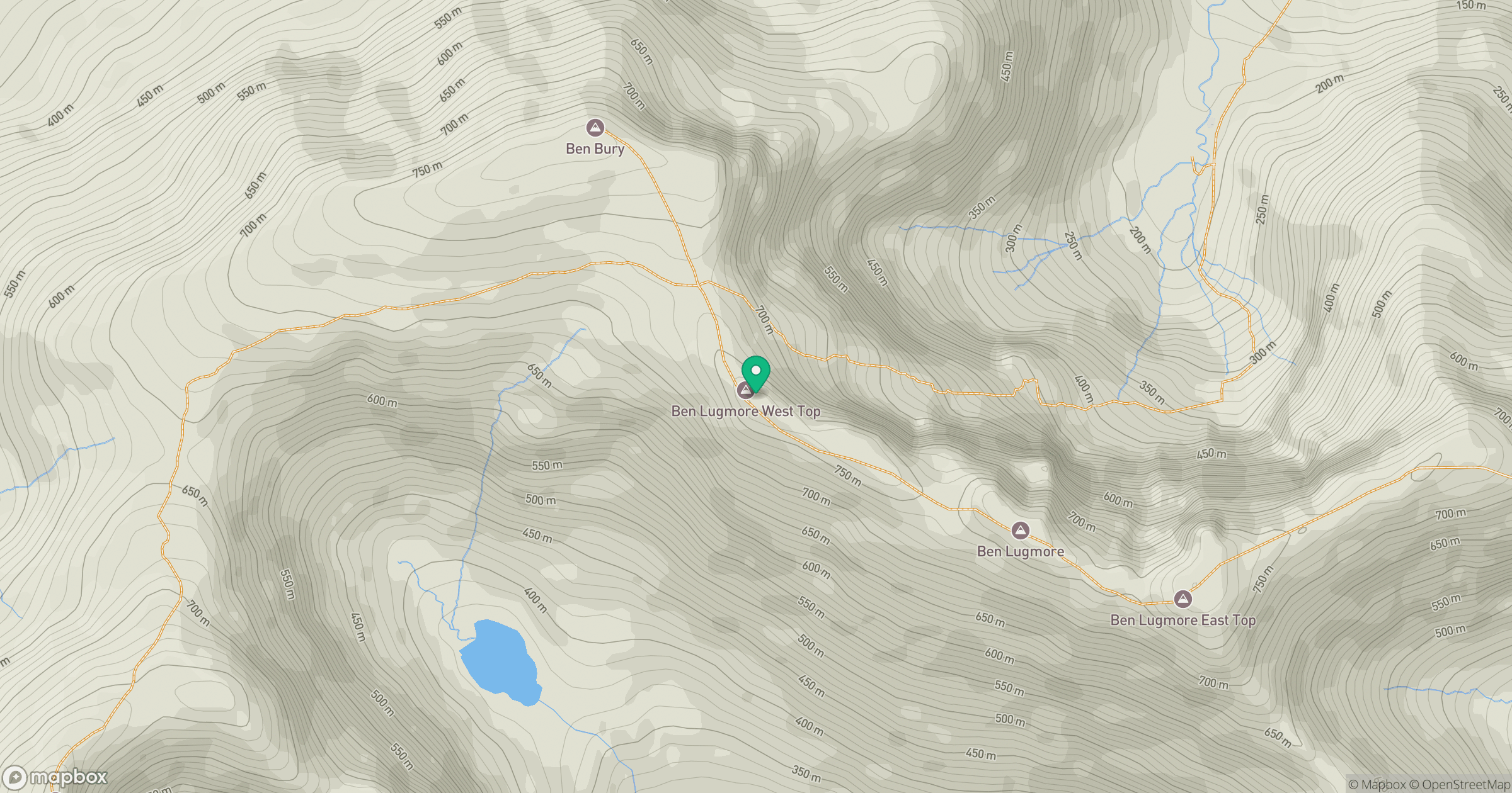
Grid reference: L805676
View on OpenStreetMapOpens a map in a new tab, centred on the hill.
No comments yet. Be the first.