

Ben Lugmore
Good walks are even better shared.
L8167 : View NW along the Ben Lugmore ridge
Colin Park Photo source
Overview
Ben Lugmore
Overview
Nestled in the stunning Mayo Mountains, Ben Lugmore stands tall at an elevation of 702 meters. It’s a beautiful Marilyn with plenty to offer, whether you're a seasoned summit seeker or just looking for a bite of nature.
Geology
The mountain boasts a mix of quartzite and schist, making it not just a sight to behold but also a topic of conversation for geology enthusiasts. Weathering has sculpted its rocky face into an array of shapes, providing both challenge and intrigue to the attentive hiker.
Hiking Routes
The Ben Lugmore Loop is a well-loved route that circles the mountain, taking approximately 4 hours to complete. At about 12 km long, this journey is marked as moderate, offering a splendid combination of rocky ascents and grassy descents. Just remember, as your grandmother used to say, “What goes up must come down!”
Summit Features
Reaching the summit rewards hikers with a stone cairn and a panorama that will make you feel like you’re on top of the world. It’s a fantastic spot for a picnic or a quick lie-down to appreciate nature's fine handiwork!
Terrain
The trek showcases a mix of rocky trails and grassy patches, along with sections that can be boggy—so choose your footwear wisely! Waterproof boots are often a hiker’s best friend here.
Views
The vistas from Ben Lugmore’s summit are widely regarded as some of the best in the region, showcasing landmarks like Croagh Patrick and the vast Clew Bay. Best do bring your camera for those Instagram moments—you might even catch the ocean winking in the distance!
Hazards
As with any mountain explorations, stay alert! The weather can change quicker than you can say “Where did I put my sandwiches?” Always be prepared with the right gear for evolving conditions.
Access
Parking is available at L812667, just off the R335 road, which is convenient for walkers. Public transport options are scarce—if you’re relying on bus services, it’s a bit like playing a game of charades to find your way here. Westport, about 24 km away, provides the nearest town action with facilities aplenty.
Facilities
While you won’t find cafes at the summit (can you imagine the queue?), nearby Westport has everything from exquisite eateries to public loos—always a bonus before a long hike!
History
Did you know that ‘Lugmore’ relates to Lugh, the sun god? Seems appropriate considering the stunning views that stretch before you. This mountain has seen its fair share of folklore and history, making it a significant place to visit.
So, lace up those hiking boots, grab your walking sticks, and prepare for a day of adventure amidst the beauty of Ben Lugmore. Definitely a mountain worth conquering!
Explore routes near Ben Lugmore
Walks starting near this hill. Open a route to check its map, distance and full itinerary.
Route planning notes
These notes describe possible approaches. Check a route's map and access information when planning your walk.
Ben Lugmore Loop
A scenic circular route starting from the car park at the base of the mountain, winding its way through beautiful heather-clad hills.
Make a day of it, together
Find someone to share the walk with, or organise a day out along a route you like.
Photo Gallery
View all Photo could not load
L8167 : View NW along the Ben Lugmore ridge
Colin Park
Hill facts and local notes
Classifications
Elevation
803m
2,635 ft
Prominence
161m
Coordinates
53.6429, -9.7975
L811673
OS Map
37
At the Summit
The summit is marked by a stone cairn and offers a stunning vista over the surrounding mountains and valleys.
Terrain & Geology
Ben Lugmore is primarily composed of quartzite and schist, giving it a rugged appearance. This geologically ancient mountain showcases a fascinating array of sedimentary processes, often with stunning striations and interesting weathering patterns.
Views & Scenery
From the summit you can see Croagh Patrick, the Nephin Beg Range, and the vast expanse of Clew Bay. On a clear day, even the distant Atlantic Ocean makes an appearance.
History & Heritage
Name Origin
The name 'Lugmore' is derived from the Irish 'Lugh', the god of the sun and light, suggesting an incredible view from the summit that lets the sun shine brightly.
Historical Significance
This mountain is a popular destination for both seasoned hikers and those seeking a leisurely stroll in nature, interwoven with local legends that speak of ancient rituals associated with the Irish gods.
Getting There & Facilities
Parking
There is a small parking area at L812667, just off the R335 road, which serves as the starting point for many hikers.
Public Transport
Public transport options are limited; consider using regional bus services that connect to Westport or Newport and then arrange for local transport.
Nearby Facilities
While there are no facilities on the mountain itself, Westport offers a range of cafes and shops where you can refuel before or after your hike.
Safety Information
Known Hazards
- Beware of sudden weather changes as conditions can shift rapidly. Ensure to stay on marked paths to avoid boggy areas.
General Safety Tips
- Check weather conditions before setting out
- Carry appropriate clothing and equipment
- Let someone know your planned route
- Take a map, compass, and GPS device
- Carry emergency supplies: food, water, first aid kit, torch
Hills
Some common questions about the hills answered
Are there group walks up Ben Lugmore?
Many walkers use Walkmates to join or organise walks with others. You can check for group walks around Ben Lugmore through the maps
Are there other walkers around Ben Lugmore?
Activity varies by location and time, but Walkmates lets you see whether others have shared walks or shown interest in this area. Find other people through the walking friends search walking friends for Ben Lugmore search or of course create your own walk for Ben Lugmore
Can I organise a walk to Ben Lugmore?
Yes. If there aren’t any walks listed already, you can create a walk and make it available for others to join.
If you're signed up to Walkmates, you can create a walk to Ben Lugmore.
How do I find a walk up this hill?
There are often multiple ways to walk this hill, depending on experience and route preference. Walkmates helps you explore walks and routes that others have shared.
Can I suggest a new route up Ben Lugmore?
Yes. You can suggest or create routes to share with others. Walkmates focuses on the social side of walking, so routes are used to help people organise walks and explore areas together, rather than as detailed navigation tools or route libraries.
Other uses really appreciate knowledgeable walkers sharing their routes. Share your favourite route to Ben Lugmore here
The is an error or something incorrect about this hill. How do I let you know?
We always strive to keep the information on Walkmates as accurate as possible. If you find an error, please let us know through the contact form and we'll aim to correct it as quickly as possible
Community Discussion
Comments
Location
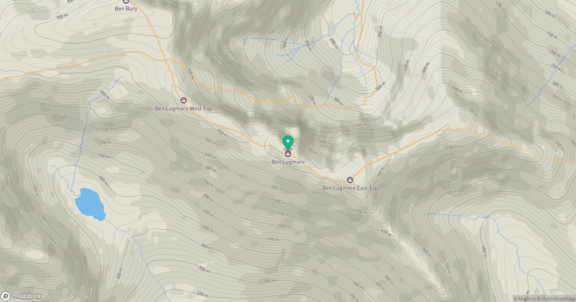
Grid reference: L811673
View on OpenStreetMapOpens a map in a new tab, centred on the hill.
No comments yet. Be the first.