
Beacon Hill
Good walks are even better shared.
Overview
Beacon Hill: A Hiker's Delight
Nestled in the delightful South Downs, Beacon Hill rises to a humble elevation of 119 meters. But don't let its size fool you; the views from the top are absolutely massive!
Geology
This little gem is primarily chalk, a rock type that has formed the stunning landscapes of the South Downs over millions of years. You'll often see this rock peeking through the grassy trails, reminding you of the geological history that shaped this elegant hill.
Routes
The Beacon Hill Trail is a beautiful circular route starting from the village of Beacon. This 5.5 km trail is perfect for those looking for a moderate adventure. Expect two hours of delightful walking, where you could stumble into ancient woodlands and hopscotch over some rocky outcrops.
Summit Features
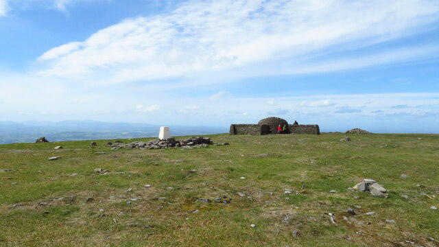
At the top, a trig point awaits, standing proud and offering a great backdrop for that iconic summit selfie. Don’t forget to check out the remnants of an Iron Age hillfort—just the sort of place you can channel your inner braveheart!
Terrain
The terrain varies from soft grass underfoot to a few rocky patches, making it suitable for families and seasoned walkers alike. Just watch those boots; once they start sliding, they can tango with the ground!
Views
The views from the summit are well worth the climb! You'll see the rolling hills of Sussex and, on particularly clear days, the shimmering waters of the English Channel. Late spring to early autumn is the prime season for the best vantage points, so plan your visit accordingly.
Hazards
As with any outdoor pursuit, hazards exist. Be prepared for unpredictable weather and steep drop-offs in certain locations. Always carry a map or use a reliable GPS; getting lost can turn your heroic summit story into something else entirely!
Access
Access is easy from a small car park near the village of Beacon, and regular buses serve the area. The nearest town, Petersfield, is just a hop away—perfect for grabbing a post-hike indulgence.
Facilities
While there are no facilities on the hill itself, the village's café can offer a refreshing break, since nothing quite beats tea after a strenuous hike!
History
The name “Beacon” has its roots in Old English, harking back to when signal fires were lit to communicate and keep watch against invaders. The historical significance of this hill lands it a small but notable spot on the map!
So lace up those walking boots, head to Beacon Hill, and prepare for a wonderful jaunt filled with fresh air, stunning views, and a sprinkle of history.
Happy hiking!
Explore routes near Beacon Hill
Walks starting near this hill. Open a route to check its map, distance and full itinerary.
Mitford Castle and the Wansbeck
View route
Borough Wood Quick Circular
View route
Morpeth, Carlisle Park and the River Wansbeck
View route
Ulgham Village and Western Fields
View route
Route planning notes
These notes describe possible approaches. Check a route's map and access information when planning your walk.
Beacon Hill Trail
A circular route starting from the village of Beacon, taking you through ancient woodlands and up towards the panoramic summit.
Make a day of it, together
Find someone to share the walk with, or organise a day out along a route you like.
Hill facts and local notes
Classifications
Elevation
195m
640 ft
Prominence
59m
Coordinates
55.2166, -1.7721
NZ146914
OS Map
81
Explorer: 325
At the Summit
The summit features a trig point and remains of an Iron Age hillfort, where you can pretend to be a noble warrior surveying your kingdom.
Terrain & Geology
Beacon Hill is primarily composed of Chalk, a sedimentary rock that gives rise to the rolling landscapes typical of the South Downs. The white cliffs you see are remnants from the Cretaceous period, until now continuing to erode gracefully.
Views & Scenery
From the summit, you can enjoy sweeping views of the South Downs National Park, the rolling fields of Sussex, and on a clear day, even the English Channel.
History & Heritage
Name Origin
The name 'Beacon' derives from the Old English word 'bēacen', meaning a signal fire or beacon used for communication.
Historical Significance
The hill has served as a lookout point for centuries and is part of the ancient network of beacons set up to warn of invasions.
Getting There & Facilities
Parking
There is a small car park near the village of Beacon, conveniently located for walkers.
Public Transport
Regular bus services run from Petersfield to Beacon, with a short walk to the trailhead.
Nearby Facilities
There are no facilities directly at Beacon Hill, however, the nearby village has a quaint café and public toilets available.
Safety Information
Known Hazards
- Watch out for sudden changes in weather, as conditions can be fickle. Also, be mindful of steep drop-offs in certain areas.
General Safety Tips
- Check weather conditions before setting out
- Carry appropriate clothing and equipment
- Let someone know your planned route
- Take a map, compass, and GPS device
- Carry emergency supplies: food, water, first aid kit, torch
Hills
Some common questions about the hills answered
Are there group walks up Beacon Hill?
Many walkers use Walkmates to join or organise walks with others. You can check for group walks around Beacon Hill through the maps
Are there other walkers around Beacon Hill?
Activity varies by location and time, but Walkmates lets you see whether others have shared walks or shown interest in this area. Find other people through the walking friends search walking friends for Beacon Hill search or of course create your own walk for Beacon Hill
Can I organise a walk to Beacon Hill?
Yes. If there aren’t any walks listed already, you can create a walk and make it available for others to join.
If you're signed up to Walkmates, you can create a walk to Beacon Hill.
How do I find a walk up this hill?
There are often multiple ways to walk this hill, depending on experience and route preference. Walkmates helps you explore walks and routes that others have shared.
Can I suggest a new route up Beacon Hill?
Yes. You can suggest or create routes to share with others. Walkmates focuses on the social side of walking, so routes are used to help people organise walks and explore areas together, rather than as detailed navigation tools or route libraries.
Other uses really appreciate knowledgeable walkers sharing their routes. Share your favourite route to Beacon Hill here
The is an error or something incorrect about this hill. How do I let you know?
We always strive to keep the information on Walkmates as accurate as possible. If you find an error, please let us know through the contact form and we'll aim to correct it as quickly as possible
Community Discussion
Comments
Location
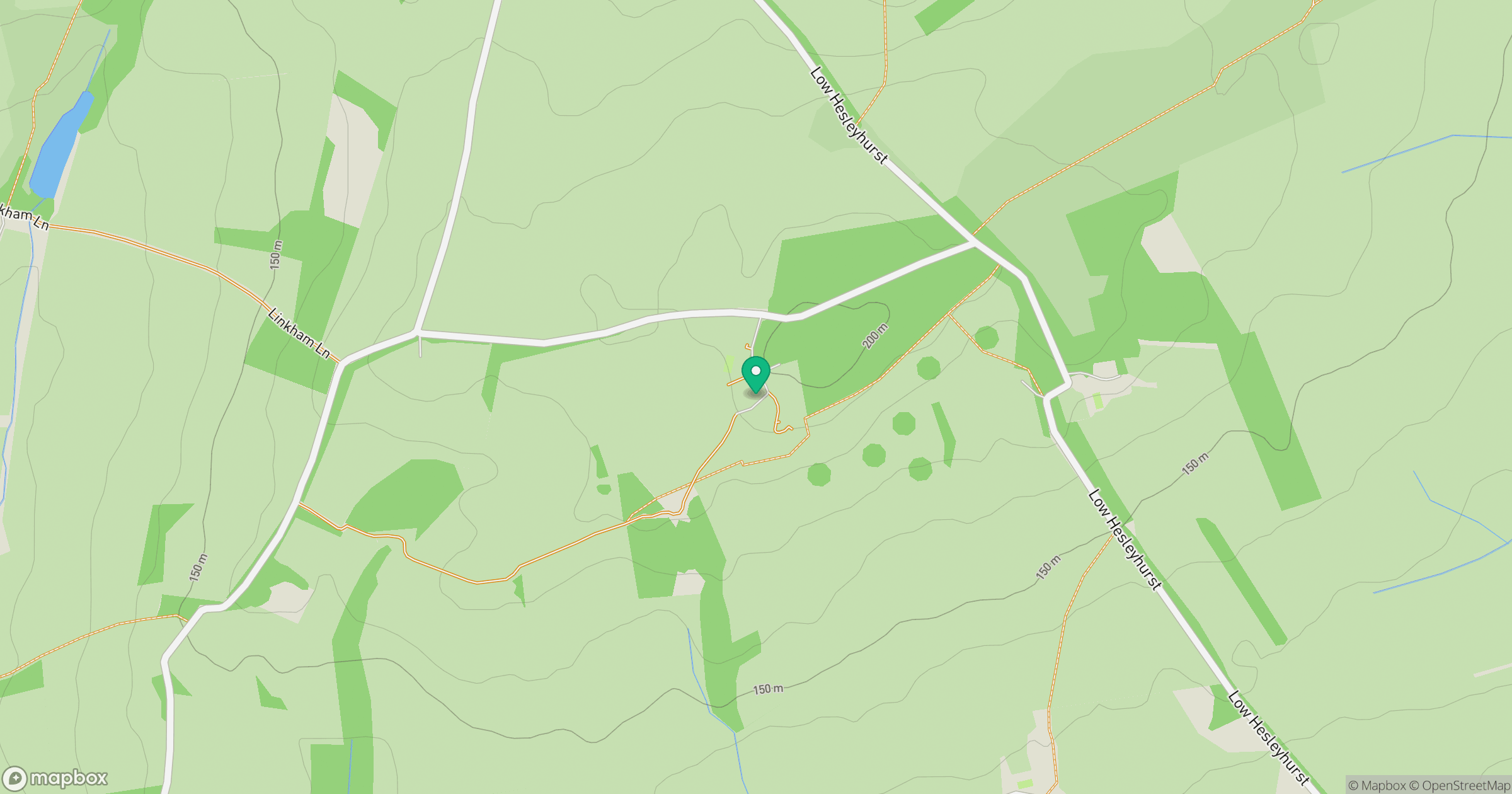
Grid reference: NZ146914
View on OpenStreetMapOpens a map in a new tab, centred on the hill.
No comments yet. Be the first.