

Bascadh
Good walks are even better shared.
Overview
Discovering Bascadh
Nestled within the enchanting Scottish Highlands, Bascadh stands gracefully at an elevation of 507 meters. Its position offers a unique vantage point over the unspoiled landscapes of the region, revealing the natural beauty that makes the Highlands a hiker's paradise.
Geology
Bascadh's geological formation is primarily comprised of schist and gneiss, remnants of the Earth’s ancient geological tumult. If you've ever wanted to be surrounded by millions of years of history, you're in the right place! The area boasts glacial features that tell tales of ice and time, making this hike a lesson in geology as well as a trek.
Routes
The main route, the Bascadh Circular Route, spans approximately 7.5 km. This moderate hike weaves through delightful woodlands before ascending to the summit. Total hiking time is about 3.5 hours. Remember to pack your snacks!
Summit Features
Reaching the top, you’ll be greeted by a monument of stone known as a cairn, marking your achievement. Keep an eye out for the trig point, which despite its solid demeanour, always seems to be hiding behind clouds.
Terrain
The terrain is a patchwork of grassy hillsides and rocky outcrops. Just the right amount of heather gives it a postcard-perfect touch, so don't forget your camera!
Views
The views from Bascadh are nothing short of spectacular! You can gaze down at Loch Fyne with the Cowal Peninsula's peaks gracing the horizon. Best visited in spring or autumn, the scenery is truly breathtaking, especially when the light dances just right.
Hazards
As with all hikes, stay vigilant! Watch out for loose rocks on steeper areas, expect the weather to change without warning, and enjoy the company of the local sheep—just don’t let them distract you on the trail!
Nearby Summits
If you’re feeling adventurous, consider extending your exploration to nearby peaks like Benmore and Beinn Bhuidhe.
Access
Parking is available near the start of the hike, but remember to arrive early during busy seasons. If you're relying on public transport, check those bus schedules—they can be like a game of hide and seek! The closest town is Tighnabruaich, which offers basic amenities and a warm cup of tea after your hike.
Conclusion
In a nutshell, Bascadh may not be the highest peak in the Highlands, but it offers a delightful blend of nature, culture, and adventure. Whether you’re a seasoned hiker or just looking for a lovely day out in the fresh air, Bascadh welcomes you with open arms.
And if you happen to meet a friendly sheep along the way, be sure to say hello! Happy hiking!
Explore routes near Bascadh
Public walks starting within 80 km of this hill. Nearby does not mean a route reaches the summit; check its map and access before setting out.
No public routes are currently listed within 80 km of Bascadh on Walkmates. This does not mean there are no paths here. Explore the map and check local access information before planning a walk.
Route planning notes
These notes describe possible approaches, not verified navigable routes or permission to cross land. Check current paths, local access rules and conditions before setting out.
Bascadh Circular Route
A pleasant circular route offering a mix of woodland trails and open hillsides, with a gradual ascent to the summit.
Make a day of it, together
Find someone to share the walk with, or organise a day out along a route you like.
Photo Gallery
View all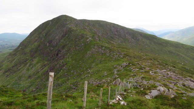 Photo could not load
V8276 : Following the ridge from Cnoc na gCapall towards Bascadh
Colin Park
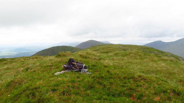 Photo could not load
V8276 : Summit of Bascadh - view west
Colin Park
Hill facts and local notes
Classifications
Elevation
595m
1,952 ft
Prominence
114m
Coordinates
51.9287, -9.7118
V823765
OS Map
78
At the Summit
At the summit, you will find a mighty cairn standing proud against the sky, and if you're lucky, a trig point that plays peekaboo with the clouds.
Terrain & Geology
Bascadh is primarily composed of metamorphic rocks, showcasing a tapestry of schist and gneiss layers that have been shaped by ancient geological forces. The surrounding landscape features fascinating glacial formations from the last Ice Age.
Views & Scenery
From the summit, hikers can enjoy sweeping views over Loch Fyne and the distant peaks of the Cowal Peninsula, not to mention the ever-charming Scottish countryside.
History & Heritage
Name Origin
The name 'Bascadh' is believed to derive from the Gaelic for 'the place of the bald hill', which is remarkably descriptive.
Historical Significance
Bascadh is a favorite among local walkers and has previously hosted orienteering events.
Getting There & Facilities
Check current local access restrictions, parking rules and transport timetables before travelling. These notes do not confirm public access to the summit.
Parking
There is a small parking area at the road end close to the start of the Bascadh Circular Route.
Public Transport
Regular bus services operate to nearby villages, although it's advisable to check schedules beforehand as they can be a bit erratic.
Nearby Facilities
Tighnabruaich offers a couple of cosy cafés and local shops, but be prepared: it's not exactly a metropolis!
Safety Information
Known Hazards
- Loose rocks on steep sections, sudden weather changes, and the occasional overly inquisitive sheep.
General Safety Tips
- Check weather conditions before setting out
- Carry appropriate clothing and equipment
- Let someone know your planned route
- Take a map, compass, and GPS device
- Carry emergency supplies: food, water, first aid kit, torch
Hills
Some common questions about the hills answered
Are there group walks up Bascadh?
Many walkers use Walkmates to join or organise walks with others. You can check for group walks around Bascadh through the maps
Are there other walkers around Bascadh?
Activity varies by location and time, but Walkmates lets you see whether others have shared walks or shown interest in this area. Find other people through the walking friends search walking friends for Bascadh search or of course create your own walk for Bascadh
Can I organise a walk to Bascadh?
Yes. If there aren’t any walks listed already, you can create a walk and make it available for others to join.
If you're signed up to Walkmates, you can create a walk to Bascadh.
How do I find a walk up this hill?
There are often multiple ways to walk this hill, depending on experience and route preference. Walkmates helps you explore walks and routes that others have shared.
Can I suggest a new route up Bascadh?
Yes. You can suggest or create routes to share with others. Walkmates focuses on the social side of walking, so routes are used to help people organise walks and explore areas together, rather than as detailed navigation tools or route libraries.
Other uses really appreciate knowledgeable walkers sharing their routes. Share your favourite route to Bascadh here
The is an error or something incorrect about this hill. How do I let you know?
We always strive to keep the information on Walkmates as accurate as possible. If you find an error, please let us know through the contact form and we'll aim to correct it as quickly as possible
Community Discussion
Comments
Location
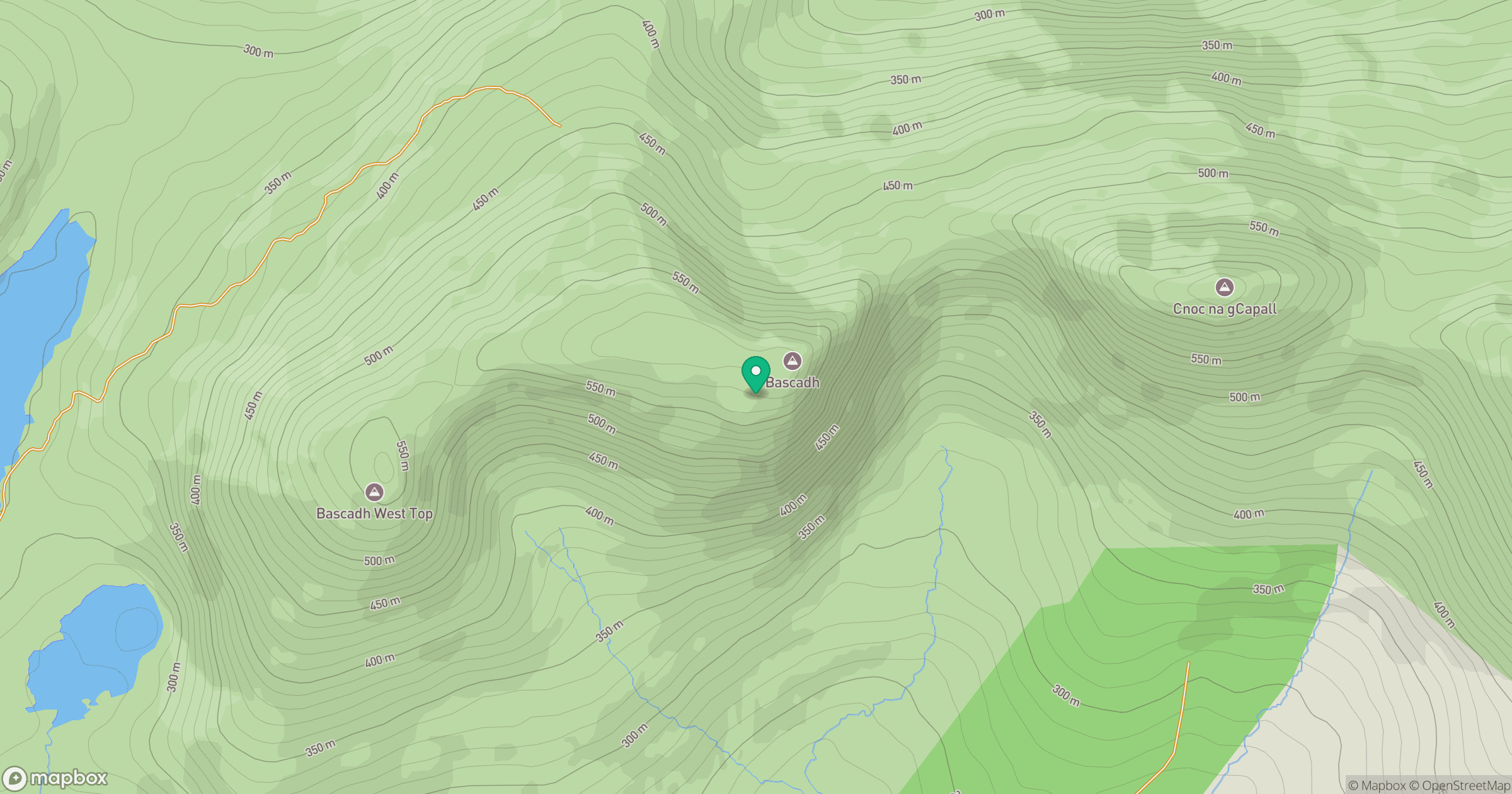
Grid reference: V823765
View on OpenStreetMapOpens a map in a new tab, centred on the hill.
Hills within 30 km
Straight-line distance, not a walking route or confirmation of access.
No comments yet. Be the first.