
Using a GPX file on a walk: checks before you follow it
Check a GPX download, inspect the imported route, test offline mapping and verify access before you follow the line on a walk.

A downloaded walk can look reassuringly complete: a neat loop, a distance and a promising filename. Before you follow it, check what has actually arrived on your device. Having the file, seeing the route and being ready to walk it are three different things.
This guide is about that handover from somebody else's download to your own walking plan. For interpreting contours, symbols and junctions, use our separate walking-map guide.
First, separate the file from the map
GPX stands for GPS Exchange Format. It can hold named points, routes and tracks: location data that compatible mapping software can display. It is not, by itself, a background map, a set of guaranteed spoken directions or an assurance that a path is open.
A track is often a recording, but it can also be generated or edited. A file labelled “track” does not prove somebody walked it. Nor does a timestamp tell you when the route was last inspected.
Think of the download as a line to investigate, not an instruction to obey.
Keep the source with the download
Save the original route-page link alongside the file. That page may contain qualifications that the line cannot explain: a seasonal restriction, a difficult descent, a required return journey or a warning about a crossing.
Before importing, answer these questions:
- Who supplied it? Prefer an identifiable route publisher or land manager over a loose file whose origin is unknown.
- Which version is it? Match the filename to the described start, finish and route variant. “Short loop” and “full circuit” are not interchangeable.
- What has changed? Look for current notices, not just the date the download was saved.
- Does it suit this outing? A route recorded by a runner or a very experienced walker is not automatically appropriate for your group.
A recent download can still contain an old route. If its source cannot explain a questionable section, choose a better-supported plan.
Check what the import actually shows
Use your app or device maker's current import instructions. OS's GPX introduction explains the basic workflow; menu names and supported features depend on the product.
After importing, look at the whole journey, then inspect the awkward bits:
- Find the intended start and finish. Do they match the route page, or has the file included someone's approach from elsewhere?
- Check the loop or return leg is present. A line that stops at a viewpoint may describe only the outward journey.
- Inspect crossings, sharp changes of direction and unusually straight sections. Compare them with the source map and surrounding terrain.
- Check distance units and the displayed total. An unexplained discrepancy is something to resolve, not round away.
- If using a watch or separate GPS, open the route on that device too. A successful import into a phone app is not the same as a successful transfer.
Do not assume that a blank space, odd jump or unexpected connecting line is a usable shortcut.
A fictional example: the missing bend
Imagine a route description says to follow a path around a lake. Your imported line instead cuts straight across the water between two points.
The useful question is not “how do I get back onto the line?” It is “what information is missing or being interpreted differently?” Compare the original description and map with the imported result. Until you understand the discrepancy, that file is not ready to navigate with.
This is an invented diagnostic example, not a real route or permission to cross water.
Test the map without a connection
Downloading a GPX and downloading mapping are separate checks. You want enough topographic detail to understand the route and nearby alternatives, not just a coloured trace on a blank screen.
At home, save the route and the relevant map area using your app's offline process. Temporarily switch off Wi-Fi and mobile data, reopen the app and inspect the route at useful zoom levels. Check the start, middle, finish and surrounding area. Then restore your normal connection settings.
If you are relying on this app for your map and only the line survives, the offline test has failed. Resolve the missing map before leaving. A breadcrumb-only watch can be a useful extra, but it does not replace the mapping you need. Features, subscriptions and storage requirements vary by app, so check its current help rather than assuming an import downloads everything.
Check access separately
A GPX line does not grant permission to walk across land. Consult current information from the relevant access authority or land manager and follow local restrictions. Access arrangements differ across the UK; do not transfer assumptions from one country to another.
For England and Wales, government access guidance explains public rights of way, open-access land and permissive access. A recorded journey is not a substitute for those checks.
On the day, a closed bridge or unsafe river does not become usable because the file goes that way. Do not improvise a crossing to preserve the planned loop.
Make a plan for the device failing
Start with a charged device, protect it from weather and carry a suitable independent navigation backup that you can use. For hill walking, that includes map-and-compass skills, not merely owning the equipment. Mountaineering Scotland's phone-navigation advice covers these limitations.
Leave your start, finish and expected return with someone reliable. Check weather and daylight, and be prepared to shorten or abandon the outing. Mountain Rescue's preparation guidance is a useful companion.
Your ready-to-walk check
- The file matches the intended route and its source.
- The imported line makes sense on the map.
- The route and surrounding mapping open offline.
- Current access and conditions fit the plan.
- You can cope if the screen stops working.
The aim is not to distrust every download. It is to turn a useful file into a plan you understand before you need it.
Last reviewed: 15 November 2026.
Keep reading
Related walking guides

Walking difficulty grades: what does ‘moderate’ really mean?
Understand walking difficulty labels, compare different grading systems and separate terrain, pace and access needs before choosing an outing.
Read guide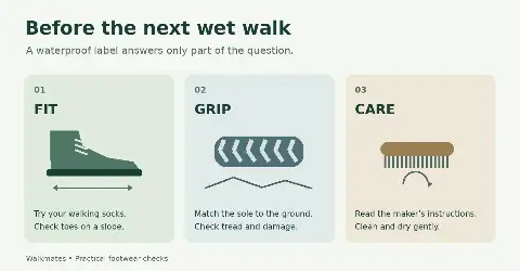
Waterproof walking footwear: fit, grip and care
How to check walking footwear for a comfortable fit, suitable grip and wet-weather use, with practical care advice and clear winter limits.
Read guideCattle, Dogs and Gates: A Practical Guide for Walkers
What to check before entering a field with cattle, how to manage a dog around livestock, and why gates should be left as you find them.
Read guide