
Coldingham Creel Path and St Abbs Bay
Walk
Saturday 21 November 2026 at 9:00 am
Check meeting details and the current arrangements before travelling.
Meeting Point
Walk Information
About This Walk
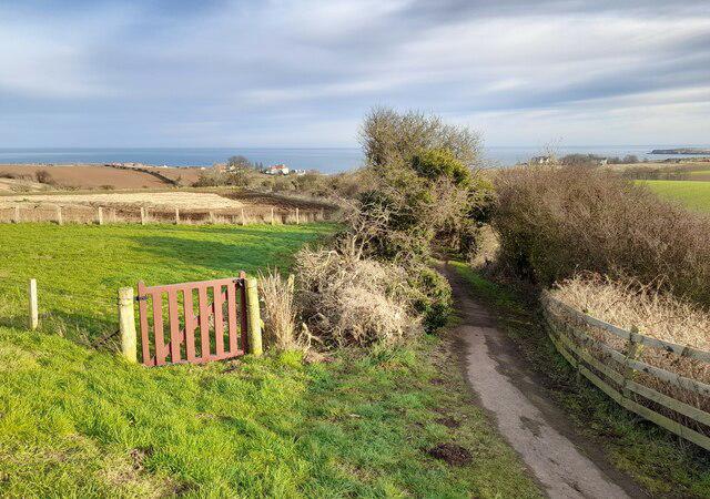
Start at the public Bridge Street car park beside Coldingham Priory. Walk through the Priory grounds towards Chariot Road, then turn right onto the pavement alongside St Abbs Road. At the signed Creel Path, leave the road for the old hedge-lined footpath used by fishing families between Coldingham and the coast.
Keep ahead on the main Creel Path and Creel Road into St Abbs. Turn right along Murrayfield, past the village shop, and follow the signed coastal footpath towards Coldingham Bay. This circuit uses the path above the bay and the steps down near its western end. Return by the beach access road and the pavement beside the road to Coldingham, then retrace the Priory approach to the car park.
Allow about two hours, with extra time for the Priory or a café stop. There are steady rises on the Creel Path, steps at the bay and stretches of uneven earth that can be muddy. The coastal section is exposed, so choose settled weather, keep back from edges and keep children and dogs close. Use the pavements on the road sections and take care where the beach access road has no footway. The mapped circuit stays off the tidal sands.
Coldingham has shops, pubs and community-run toilets at the car park; toilet opening follows the local shop or café hours. St Abbs and Coldingham Bay have cafés and further toilets, with seasonal opening possible. Check parking signs on arrival. Based on the council's Paths Around Eyemouth guide and current public footpath mapping, checked 3 October 2026.
Walkmates organiser

Walk Details
- Distance
- 3.1 mi (5.0 km)
- Duration
- 2h
- Difficulty
- Medium
- Type
- Circular
Member social walk
A social walk arranged by a Walkmates member. Check the meeting point and plans with the creator, and decide whether it suits your fitness, experience and equipment.