

Wanstead Flats
Good walks are even better shared.
TQ4086 : Jubilee Pond, Wanstead Flats
Des Blenkinsopp Photo source
Overview
Wanstead Flats
Overview
Wanstead Flats, an expansive stretch of green in the heart of Greater London, presents a delightful escape from the bustling city life. Located at TQ402860, it covers approximately 100 hectares and acts as a vital lung for the local community.
Geology
Unlike towering mountains, Wanstead Flats is mostly flat, underpinned by alluvial and sandy soils. It's ideal for various recreational activities—just be careful not to trip over your own excitement!
Routes
One popular route is the "Wanstead to Leytonstone Circular". It provides a gentle journey through the area's picturesque views. At 6.5 km, you can complete it in about two hours. Perfect for a weekend stroll, it’s as easy as pie (and far less calorie-laden!).
Terrain and Summit Features
The terrain is predominantly grassy, with patches of woodland waiting for an afternoon picnic. Unfortunately, there are no distinctive summit features to claim, but the sprawling fields make for perfect lounging spots.
Views
The views from Wanstead Flats can be quite striking. On a clear day, you may spot London’s iconic structures gleaming in the sunlight. Best seasons to visit for these views are spring and summer, when the entire area is decked out in greens and flowers.
Hazards
While exploring the beauty of the Flats, keep an eye out for muddy patches after rain—footwear selection is critical! And cyclists should be aware of walkers who might suddenly swerve in search of that elusive butterfly.
Access
Getting to Wanstead Flats is a breeze. Free parking lines the streets around the area, but make sure to claim your spot early! Public transport via Wanstead Park station is nearby, with bus routes connecting you easily from central London.
Facilities
Thirsty? The nearby cafes, including The Tea Hut, serve up delightful refreshments. Look out for public toilets at Wanstead Park, keeping your flow uninterrupted.
History
Interestingly, the term 'Wanstead' means ‘place of enjoyment’—quite fitting for this green retreat! Historically, these Flats were common land, used for grazing and as a social gathering spot for locals.
Conclusion
In summary, Wanstead Flats is a charming area that showcases the beauty of green spaces within an urban landscape. Whether you're up for a gentle stroll or a leisurely picnic, it's an absolute gem worth visiting.
Explore routes near Wanstead Flats
Walks starting near this hill. Open a route to check its map, distance and full itinerary.
Wanstead Park Chestnut Trail
View route
Roman London walk
View route
Samuel Pepys London walk
View route
Roman London walk
View route
Route planning notes
These notes describe possible approaches. Check a route's map and access information when planning your walk.
Wanstead to Leytonstone Circular
A leisurely loop through the scenic flats with views of the nearby lakes and woodlands.
Make a day of it, together
Find someone to share the walk with, or organise a day out along a route you like.
Photo Gallery
View all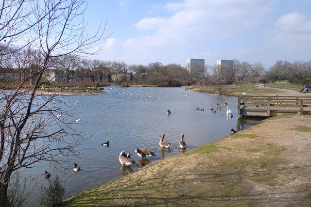 Photo could not load
TQ4086 : Jubilee Pond, Wanstead Flats
Des Blenkinsopp
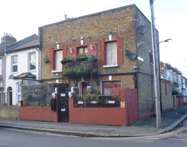 Photo could not load
TQ4085 : A distinctive house in Pevensey Road
Marathon
Hill facts and local notes
Classifications
Elevation
15m
49 ft
Prominence
0m
Coordinates
51.5555, 0.0209
TQ402860
OS Map
177
Explorer: 174
At the Summit
Being a flat area, there are no traditional summit features, but the Flats are adorned with beautiful grassy spaces, sparse woodlands, and ponds.
Terrain & Geology
Wanstead Flats is primarily composed of alluvial deposits, with areas of clay and sandy soil, offering a relatively flat terrain that contributes to its suitability as a recreational area.
Views & Scenery
From the Flats, you can catch glimpses of the London skyline, particularly the iconic Shard and Canary Wharf in the distance on clear days.
History & Heritage
Name Origin
The name 'Wanstead' is derived from the Old English word 'Wunstede', meaning 'place of enjoyment' or 'delight'.
Historical Significance
Wanstead Flats have a rich history as common land, traditionally used for grazing, and now serve as an important green space in urban London.
Getting There & Facilities
Parking
You can find free parking along the perimeter streets, but arrive early to secure a spot, especially on sunny weekends.
Public Transport
Wanstead Park station is nearby, served by the London Overground. Bus routes also connect the Flats to central London.
Nearby Facilities
There are several cafes nearby, including The Tea Hut, and public toilets are available at Wanstead Park.
Safety Information
Known Hazards
- Occasional muddy patches after heavy rain; cyclists should be mindful of walkers.
General Safety Tips
- Check weather conditions before setting out
- Carry appropriate clothing and equipment
- Let someone know your planned route
- Take a map, compass, and GPS device
- Carry emergency supplies: food, water, first aid kit, torch
Hills
Some common questions about the hills answered
Are there group walks up Wanstead Flats?
Many walkers use Walkmates to join or organise walks with others. You can check for group walks around Wanstead Flats through the maps
Are there other walkers around Wanstead Flats?
Activity varies by location and time, but Walkmates lets you see whether others have shared walks or shown interest in this area. Find other people through the walking friends search walking friends for Wanstead Flats search or of course create your own walk for Wanstead Flats
Can I organise a walk to Wanstead Flats?
Yes. If there aren’t any walks listed already, you can create a walk and make it available for others to join.
If you're signed up to Walkmates, you can create a walk to Wanstead Flats.
How do I find a walk up this hill?
There are often multiple ways to walk this hill, depending on experience and route preference. Walkmates helps you explore walks and routes that others have shared.
Can I suggest a new route up Wanstead Flats?
Yes. You can suggest or create routes to share with others. Walkmates focuses on the social side of walking, so routes are used to help people organise walks and explore areas together, rather than as detailed navigation tools or route libraries.
Other uses really appreciate knowledgeable walkers sharing their routes. Share your favourite route to Wanstead Flats here
The is an error or something incorrect about this hill. How do I let you know?
We always strive to keep the information on Walkmates as accurate as possible. If you find an error, please let us know through the contact form and we'll aim to correct it as quickly as possible
Community Discussion
Comments
Location
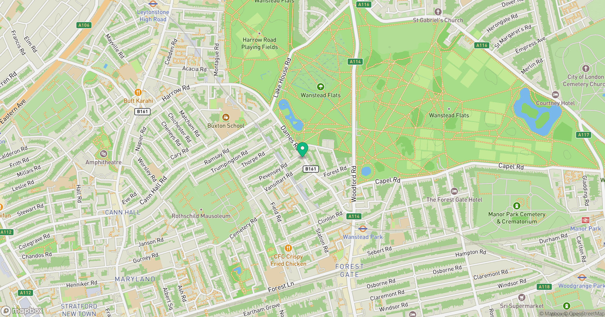
Grid reference: TQ402860
View on OpenStreetMapOpens a map in a new tab, centred on the hill.

No comments yet. Be the first.