
Srahataggle
Good walks are even better shared.
Overview
Srahataggle: A Hidden Gem in the Scottish Highlands
Introduction
Srahataggle, a Mike Tyson of a mountain, might not be the biggest around, but it packs a punch when it comes to breathtaking views and exhilarating experiences. With a modest elevation of 547 meters, this Hewitt offers far more than meets the eye.
Geology
The granite that makes up Srahataggle tells a story of erosion and glacial activity, leaving behind stunning outcrops. These geological features add to the charm of the ascent and provide excellent resting spots (and photo opportunities) along the way. The rich biodiversity in the area is a testament to the unique soil and rock composition that supports a variety of plant life.
Route Information
The most popular route to the summit is via the Loch Awe Path. This trek covers 8 km of scenic delights and takes roughly 3.5 hours to complete. The trail is classified as moderate, making it a great choice for families and enthusiastic hikers alike.
Tips for the Journey
- Start early to avoid the crowds and enjoy a peaceful ascent.
- Don’t forget your camera! The views at the top are worth a thousand words.
- Always check the weather; conditions can change faster than a hare on a sugar rush.
Summit Features
At the summit, you’ll be greeted by a sturdy stone cairn, a trusty compass point for the adventurous souls navigating these rugged hills. It’s also the perfect spot for a packed lunch while soaking in the panoramic views.
Terrain
Expect a variety of terrains: rocky pathways, soft grassy knolls, and the occasional boggy patch. A pair of good hiking boots is your best friend here to keep you steady on your feet.
Views
From the top of Srahataggle, not only will you feel on top of the world, but your eyes will feast on the breathtaking landscapes surrounding Loch Awe and beyond. If you're lucky, you might even catch a glimpse of a deer or two frolicking in the hills.
Best Time to Visit
Autumn and spring are particularly rewarding, as the weather is often mild, and the scenery is enhanced with the changing colours of nature. And if you fancy early mornings, a dawn trek is guaranteed to provide a magical experience.
Hazards
Beware of sudden weather changes—bring layers and waterproofs to cover all bases. Slippery rocks and unexpected bogs are the main hazards; so tread carefully!
Nearby Summits
When you’ve conquered Srahataggle, consider taking on nearby giants such as Ben Cruachan, reaching a lofty 1126 meters, or Meall nan Searc, a welcoming neighbor boasting an elevation of 629 meters.
Access and Facilities
Nearest Parking: Ben Cruachan Visitor Centre, with free parking available.
Public Transport: Local buses to Dalmally from the train station.
Nearest Town: Dalmally, boasting a few quaint cafes ready to refill your energy stores.
Conclusion
Srahataggle might not be the most well-known peak in the Highlands, but it's a hidden treasure that promises an adventure rich with striking landscapes and a bit of Scottish charm. Pack your bags, grab your boots, and set off for a day filled with nature’s splendour!
Happy hiking!
Explore routes near Srahataggle
Public walks starting within 80 km of this hill. Nearby does not mean a route reaches the summit; check its map and access before setting out.
No public routes are currently listed within 80 km of Srahataggle on Walkmates. This does not mean there are no paths here. Explore the map and check local access information before planning a walk.
Route planning notes
These notes describe possible approaches, not verified navigable routes or permission to cross land. Check current paths, local access rules and conditions before setting out.
Loch Awe Path
A scenic route starting from the shores of Loch Awe. The path meanders through gentle glades before ascending to the summit where you will be greeted with breathtaking views.
Make a day of it, together
Find someone to share the walk with, or organise a day out along a route you like.
Hill facts and local notes
Classifications
Elevation
182m
597 ft
Prominence
115m
Coordinates
54.3099, -9.6662
F916414
OS Map
23
At the Summit
The summit features a traditional stone cairn, which stands as both a marker and a shelter from the bracing winds that can whip across the top. From here, you can appreciate the rugged beauty surrounding the peak.
Terrain & Geology
Srahataggle is primarily composed of granite, which has weathered to form striking outcrops and boulders that provide both character and excellent viewpoints. The area surrounding the mountain is dotted with glacial scars, a nod to its tumultuous past.
Views & Scenery
From the top, one can see the breathtaking expanse of Loch Awe and the distant peaks of the Trossachs. The views are especially stunning when the sun sets, casting golden hues across the landscape.
History & Heritage
Name Origin
The name 'Srahataggle' derives from the Gaelic 'Srath-Thagail', which roughly translates to 'valley of the goats’. A fitting name due to the local wildlife!
Historical Significance
Srahataggle is steeped in both natural and cultural history, offering a glimpse into Scotland's rugged past and the extraordinary resilience of its flora and fauna.
Getting There & Facilities
Check current local access restrictions, parking rules and transport timetables before travelling. These notes do not confirm public access to the summit.
Parking
The nearest parking is located at the Ben Cruachan Visitor Centre, approximately 10 km from the starting trailhead. Parking is free but fills up quickly during peak season.
Public Transport
The closest train station is in the town of Dalmally, about 8 km away from the trailhead. Buses run periodically from the station towards the Loch Awe area.
Nearby Facilities
While facilities on the mountain are non-existent, Dalmally hosts a few charming cafes and public toilets. It’s recommended to hydrate and fuel up before the trek.
Safety Information
Known Hazards
- Sudden weather changes are common, so it's wise to pack a waterproof jacket and study the forecast before heading out. Additionally, be wary of slippery rocks, particularly after rain.
General Safety Tips
- Check weather conditions before setting out
- Carry appropriate clothing and equipment
- Let someone know your planned route
- Take a map, compass, and GPS device
- Carry emergency supplies: food, water, first aid kit, torch
Hills
Some common questions about the hills answered
Are there group walks up Srahataggle?
Many walkers use Walkmates to join or organise walks with others. You can check for group walks around Srahataggle through the maps
Are there other walkers around Srahataggle?
Activity varies by location and time, but Walkmates lets you see whether others have shared walks or shown interest in this area. Find other people through the walking friends search walking friends for Srahataggle search or of course create your own walk for Srahataggle
Can I organise a walk to Srahataggle?
Yes. If there aren’t any walks listed already, you can create a walk and make it available for others to join.
If you're signed up to Walkmates, you can create a walk to Srahataggle.
How do I find a walk up this hill?
There are often multiple ways to walk this hill, depending on experience and route preference. Walkmates helps you explore walks and routes that others have shared.
Can I suggest a new route up Srahataggle?
Yes. You can suggest or create routes to share with others. Walkmates focuses on the social side of walking, so routes are used to help people organise walks and explore areas together, rather than as detailed navigation tools or route libraries.
Other uses really appreciate knowledgeable walkers sharing their routes. Share your favourite route to Srahataggle here
The is an error or something incorrect about this hill. How do I let you know?
We always strive to keep the information on Walkmates as accurate as possible. If you find an error, please let us know through the contact form and we'll aim to correct it as quickly as possible
Community Discussion
Comments
Location
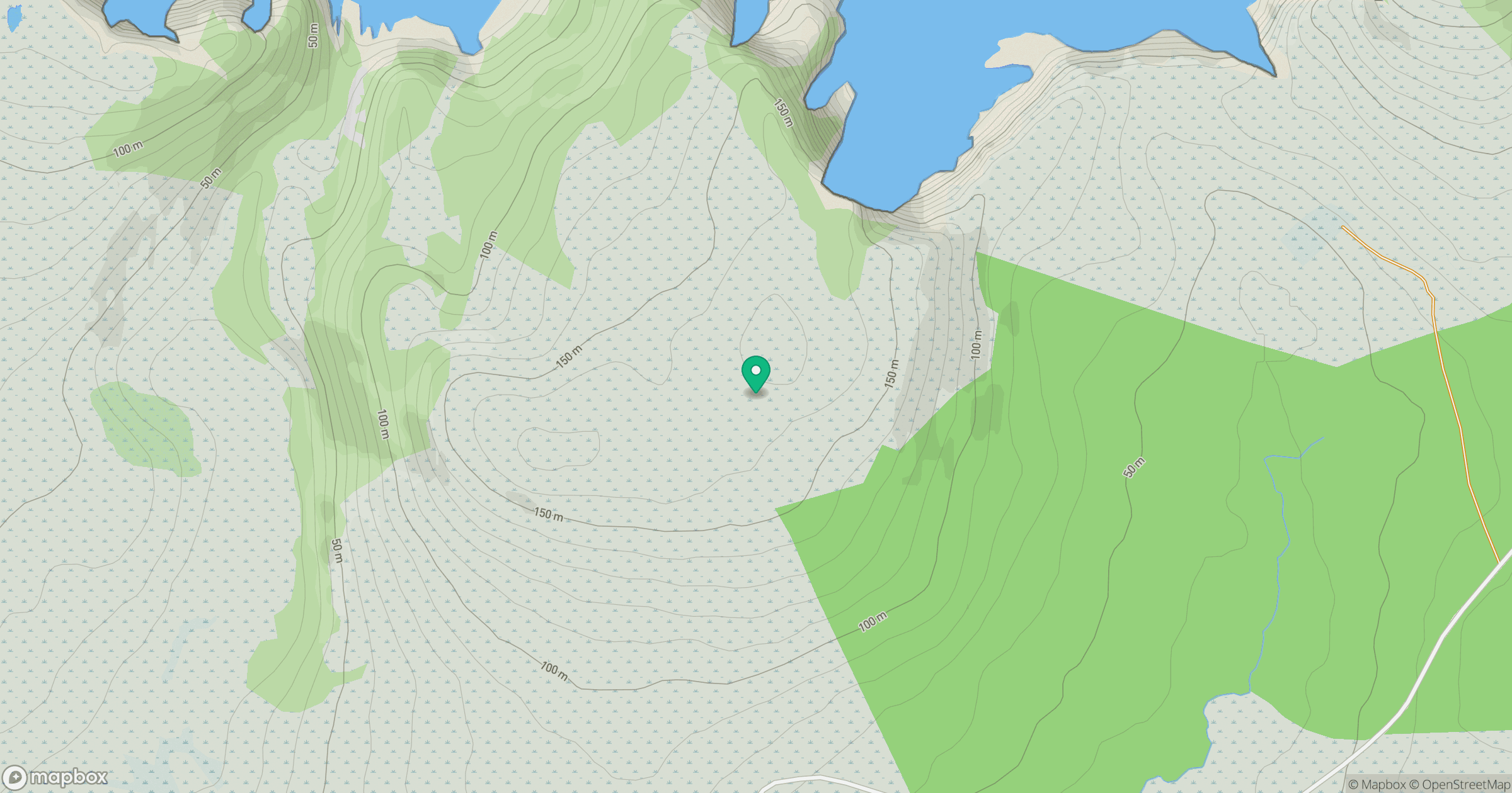
Grid reference: F916414
View on OpenStreetMapOpens a map in a new tab, centred on the hill.
Hills within 30 km
Straight-line distance, not a walking route or confirmation of access.
No comments yet. Be the first.