
Snelsmore East Common
Good walks are even better shared.
Overview
Snelsmore East Common
Snelsmore East Common is a delightful little area that spoils visitors with sprawling greenery and a variety of paths to explore. Unlike its lofty cousins in the mountains, it offers a more laid-back hiking experience, perfect for families and casual walkers alike.
Geology
The underlying geology of Snelsmore East Common features sandy soils and clay, contributing to the soft, grassy terrain. This geology supports a diverse mix of flora, creating a beautiful tapestry of green, particularly in the spring.
Routes
One of the most popular routes is the Snelsmore East Common Circular Walk. It’s about 4.5 km long and an easy stroll that rewards you with gentle slopes and wide-open areas. The estimated time to complete the circuit is around 1.5 hours, making it perfect for a quick jaunt or a leisurely afternoon with the family.
Summit Features
While the summit may not boast impressive peaks or glacial formations, it has its charm with a small mound and a few stones signifying the highest point. It’s not exactly a scene for selfies worthy of Instagram elites, but you might just want to sit and enjoy the view – and the grass won't bite you!
Terrain Type
The terrain here is predominantly grassy and open, offering a pleasant walking experience. You'll find dirt paths that meander through the landscape, but keep an eye out for uneven surfaces or the occasional muddy patch.
Views
From the summit, delight in the lovely views of the surrounding countryside. Marvel at the nearby woodlands and fields, or, if you're lucky on a clear day, catch a glimpse of the North Wessex Downs far away. Best seasons to enjoy these vistas are spring and autumn, where you’ll be treated to a symphony of colours and clearer skies.
Hazards
As with any outdoor experience, a few hazards exist. Uneven ground and muddy patches can pose light challenges, especially right after a downpour. Remember to stay on marked paths to keep your journey safe – and maybe bring a walking stick if you're not quite as spry as you once were!
Nearby Summits
For those looking to extend their adventure, nearby summits like Wash Common and Crown Wood offer further exploration with more incline and perhaps a more strenuous workout for your legs.
Access
Parking can be found conveniently at the Snelsmore Common car park, providing easy access from the main road. If you’re relying on public transport, there are bus routes running from Newbury to Hermitage, though it involves a bit of a walk from the nearest bus stop.
Facilities
After your walk, enjoy a nice sit-down in one of the many cafes in Newbury, where you can refuel and soak up the local culture. Toilets are available at the park, so there’s no need to worry about dashing off behind a bush!
History
The name 'Snelsmore' hints at the swift waters that likely ran through the area historically, and it has long served as communal grazing land, making it significant for local biodiversity. It’s not just a pretty space; it has a story to tell!
So grab your walking shoes, perhaps layer on some sunscreen, and head to Snelsmore East Common for a day of exploration. You may not be scaling peaks, but sometimes the best adventures lie just a stone's throw from home!
Explore routes near Snelsmore East Common
Walks starting near this hill. Open a route to check its map, distance and full itinerary.
Newbury to Donnington Castle: Lambourn Valley Way via Speen and Bagnor
View route
Thatcham short birding stroll
View route
Thatcham short birding stroll
View route
Burghfield and Mortimer Group with Men Walking & Talking
View route
Route planning notes
These notes describe possible approaches. Check a route's map and access information when planning your walk.
Snelsmore East Common Circular Walk
A scenic circular route that takes you around the common with a mixture of paths and grassy areas.
Make a day of it, together
Find someone to share the walk with, or organise a day out along a route you like.
Hill facts and local notes
Classifications
Elevation
143m
468 ft
Prominence
32m
Coordinates
51.4369, -1.3085
SU481711
OS Map
174
Explorer: 158
At the Summit
The summit is marked by a small mound with a few stones indicating the highest point; not quite Everest, but it has its charm!
Terrain & Geology
The area's geology primarily consists of sandy soils and clay, which can lead to some interesting landscape features and a diverse array of flora.
Views & Scenery
Lovely views of the surrounding countryside, including nearby woodlands and fields; on clear days, the North Wessex Downs can be seen in the distance.
History & Heritage
Name Origin
The name 'Snelsmore' is derived from the Old English 'snelle', meaning 'quick' or 'swift', suggesting fast-flowing water in the area.
Historical Significance
Historically used as common land for grazing animals, it's a vital part of local biodiversity.
Getting There & Facilities
Parking
Parking is available at the Snelsmore Common car park, easily accessible from the main road.
Public Transport
Buses run from Newbury to Hermitage; a bit of a walk from the bus stop to the common.
Nearby Facilities
There are picnic areas and nearby cafes in Newbury, as well as toilets available at the park.
Safety Information
Known Hazards
- Watch out for uneven ground and occasional muddy patches after rain; also, some areas may have hidden dips.
General Safety Tips
- Check weather conditions before setting out
- Carry appropriate clothing and equipment
- Let someone know your planned route
- Take a map, compass, and GPS device
- Carry emergency supplies: food, water, first aid kit, torch
Hills
Some common questions about the hills answered
Are there group walks up Snelsmore East Common?
Many walkers use Walkmates to join or organise walks with others. You can check for group walks around Snelsmore East Common through the maps
Are there other walkers around Snelsmore East Common?
Activity varies by location and time, but Walkmates lets you see whether others have shared walks or shown interest in this area. Find other people through the walking friends search walking friends for Snelsmore East Common search or of course create your own walk for Snelsmore East Common
Can I organise a walk to Snelsmore East Common?
Yes. If there aren’t any walks listed already, you can create a walk and make it available for others to join.
If you're signed up to Walkmates, you can create a walk to Snelsmore East Common.
How do I find a walk up this hill?
There are often multiple ways to walk this hill, depending on experience and route preference. Walkmates helps you explore walks and routes that others have shared.
Can I suggest a new route up Snelsmore East Common?
Yes. You can suggest or create routes to share with others. Walkmates focuses on the social side of walking, so routes are used to help people organise walks and explore areas together, rather than as detailed navigation tools or route libraries.
Other uses really appreciate knowledgeable walkers sharing their routes. Share your favourite route to Snelsmore East Common here
The is an error or something incorrect about this hill. How do I let you know?
We always strive to keep the information on Walkmates as accurate as possible. If you find an error, please let us know through the contact form and we'll aim to correct it as quickly as possible
Community Discussion
Comments
Location
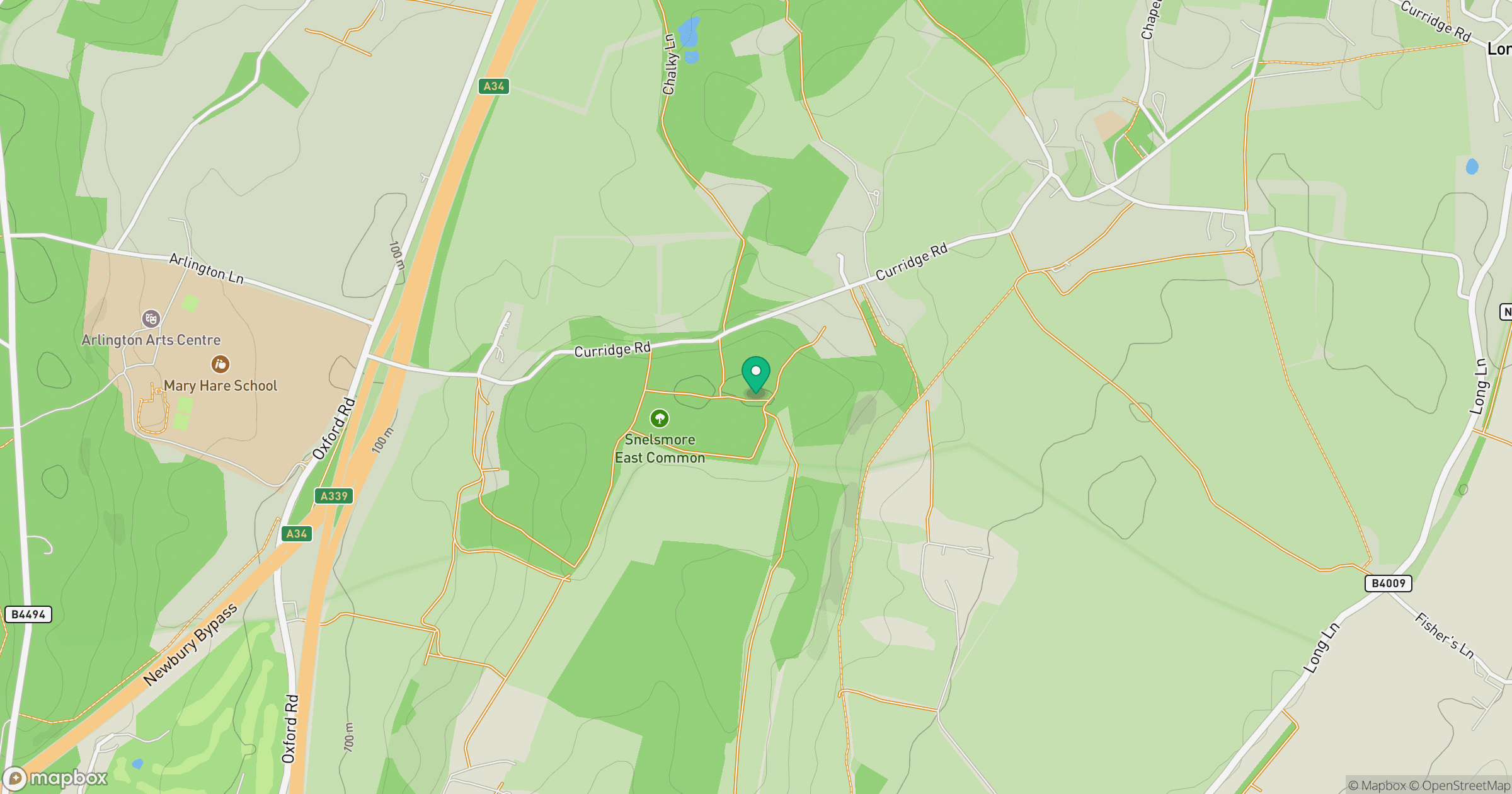
Grid reference: SU481711
View on OpenStreetMapOpens a map in a new tab, centred on the hill.
Nearby Hills
Leith Hill
294m
Worcestershire Beacon
425m
Ditchling Beacon
248m
Glastonbury Tor
158m
Titterstone Clee Hill
533m
No comments yet. Be the first.