

Pumlumon Fach
Good walks are even better shared.
SN7887 : Pumlumon Fach
Chris Andrews Photo source
Overview
Pumlumon Fach: A Hidden Gem in the Cambrian Mountains
Pumlumon Fach, perched at an elevation of 662 meters, might not be the tallest peak around, but what it lacks in stature, it makes up for in charm. Nestled within the spectacular Cambrian Mountains, it's often overshadowed by its more illustrious sister peak, Pumlumon. However, this Marylin truly has its own merit!
Geology
Geologically speaking, Pumlumon Fach is primarily composed of Old Red Sandstone. With its ancient layers, this mountain tells tales of the Earth’s past, despite how rocky things might get underfoot! Add in sporadic slate and siltstone deposits, and you've got a patchwork of history waiting to be explored.
Summit Features
Upon reaching the summit, you'll be greeted by a modest stone cairn. It's a great spot for that classic summit selfie or just to sit and enjoy the tranquillity of the surrounding valleys. Just remember to keep the sheep out of the frame—they have a habit of stealing the limelight!
The Routes
The most popular route is the Pumlumon Circular. This moderate 9.5 km trek starts at the end of the B4518 road. It winds its way around the hill, offering incredible panoramas at every turn.
Terrain Type
Expect a mix of grassy, rocky, and boggy terrain. The bogs can be sneaky, so watch your step—we wouldn't want you to make an unexpected splash while enjoying the views!
Views
The views from Pumlumon Fach are nothing short of spectacular. You're treated to sweeping vistas stretching across the Cambrian Mountains and, on a clear day, the dramatic peaks of Snowdonia. If you’re an early riser, the sunrise view is more than worth the early morning coffee.
Hazards
While generally accessible, the region can experience sudden weather changes. Bring appropriate gear to avoid soggy socks from unexpected rain or fog. Additionally, be cautious—some sections are rather muddy, especially if Mother Nature has recently unleashed her full fury.
Nearby Summits
For those adventurous souls keen on bagging a few peaks, Pumlumon and Pen Pumlumon Llygad Bychan are just a stone’s throw away, offering additional hikes and new challenges for you to consider.
Access
Finding your way here is fairly straightforward. The nearest parking is located at the end of the B4518, where a small car park awaits. Machynlleth, the nearest town, is around 12 miles away and offers plenty of cafes and pubs to help refuel after your adventure.
History
The name Pumlumon meaning 'five peaks' hints at its mythical significance in local folklore. It’s not only a place to stretch your legs, but dive into the local history and stories.
Conclusion
So, whether you're looking for a gentle ramble or a scenic summit, Pumlumon Fach is a delightful choice that’s sure to leave a smile on your face, not to mention a few fantastic photos for your album. Just don't forget to pack your sense of adventure (and a snack or two)!
Explore routes near Pumlumon Fach
Walks starting near this hill. Open a route to check its map, distance and full itinerary.
Elan Valley: Reservoir Trail to Pen y Garreg Dam
View route
Waun-oer, Maesglase and Cribin Fawr guided mountain walk
View route
Cadair Idris - Pony Path
View route
Mawddach Trail: Penmaenpool to Dolgellau Riverside Return
View route
Route planning notes
These notes describe possible approaches. Check a route's map and access information when planning your walk.
Pumlumon Circular
A popular route starting from the car park at the end of the B4518, this circular walk provides panoramic views and a leisurely ascent to the summit.
Make a day of it, together
Find someone to share the walk with, or organise a day out along a route you like.
Photo Gallery
View all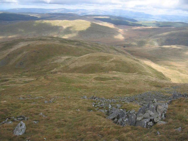 Photo could not load
SN7887 : Pumlumon Fach
Chris Andrews
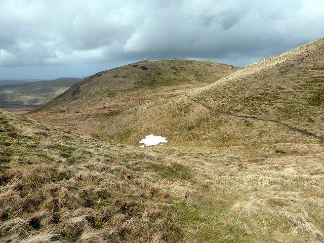 Photo could not load
SN7887 : On the ascent to Plynlimon
John Lucas
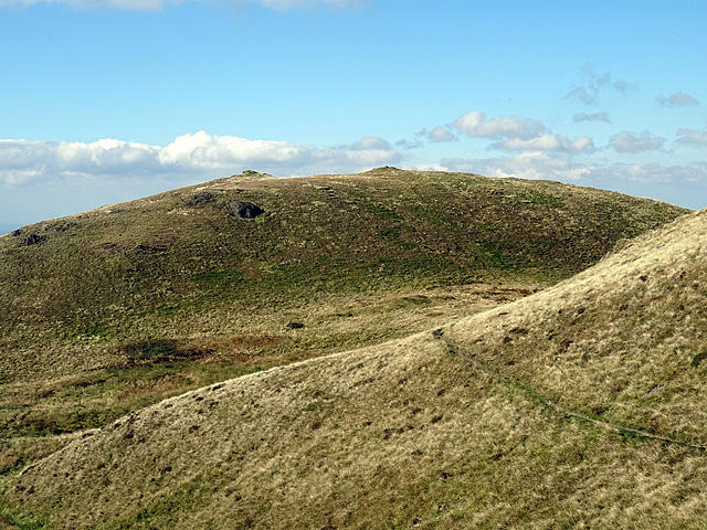 Photo could not load
SN7887 : Pumlumon Fach seen from the slopes of Plynlimon
John Lucas
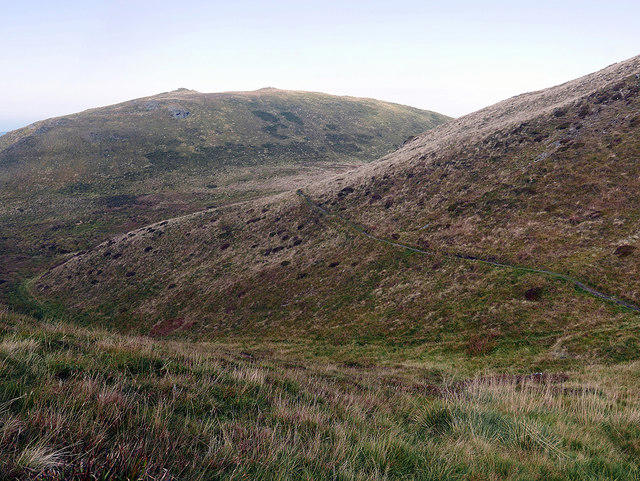 Photo could not load
SN7887 : Path on Pumlumon Fach
John Lucas
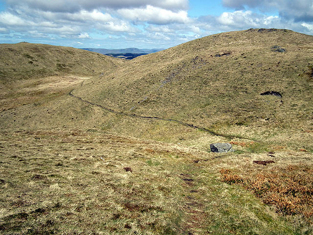 Photo could not load
SN7887 : Looking back down the Maesnant path to Plynlimon
John Lucas
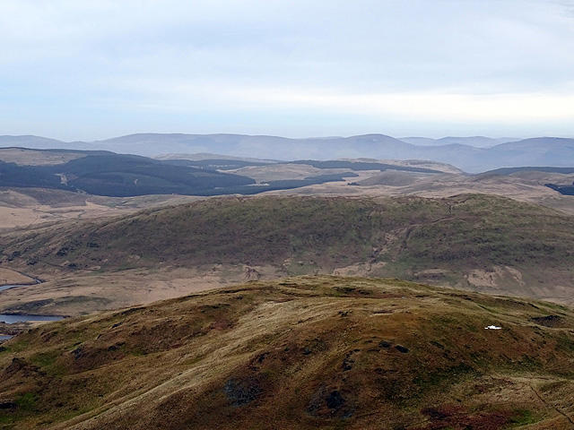 Photo could not load
SN7887 : Pumlumon Fach and Banc Llechwedd-mawr viewed from Plynlimon
John Lucas
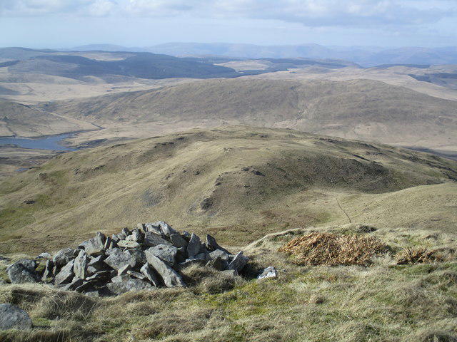 Photo could not load
SN7887 : Pumlumon Fach o Bumlumon Fawr / Pumlumon Fach from Pumlumon Fawr
Ceri Thomas
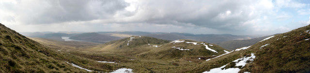 Photo could not load
SN7887 : Panoramic view of Pumlumon Fach from the final ascent of Plynlimon
John Lucas
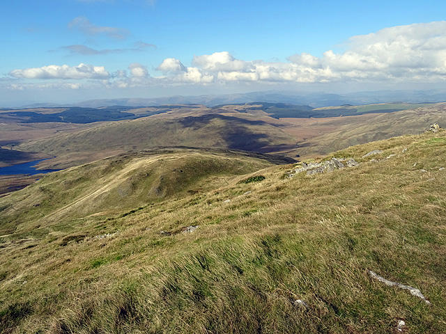 Photo could not load
SN7887 : Pumlumon Fach
John Lucas
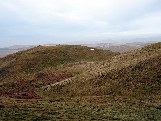
SN7887 : Looking back towards Pumlumon Fach on the ascent of Plynlimon
John Lucas
Hill facts and local notes
Classifications
Elevation
664m
2,178 ft
Prominence
19m
Coordinates
52.4713, -3.7868
SN787874
OS Map
135
Explorer: 213
At the Summit
The summit of Pumlumon Fach features a small stone cairn, offering a perfect photo opportunity with a backdrop of the stunning Cambrian Mountains.
Terrain & Geology
Pumlumon Fach is primarily composed of Old Red Sandstone, which forms the rugged terrain characteristic of this region. Some sections reveal slate and siltstone deposits, showcasing the diverse geological history of the Cambrian area.
Views & Scenery
From the summit, one can witness the sweeping vistas of the Cambrian Mountains, including the prominent Pumlumon towering nearby, as well as views extending to the Snowdonia range on clear days.
History & Heritage
Name Origin
The name Pumlumon is derived from Welsh, meaning 'five peaks', which is fitting considering the mountain's surrounding features.
Historical Significance
Pumlumon Fach is a significant destination for hikers completing the Welsh Marilyns, and it holds cultural importance in local folklore.
Getting There & Facilities
Parking
The nearest parking is at the end of the B4518 road, where there is a small car park. It can accommodate several vehicles but fills up quickly during weekends.
Public Transport
Public transport options are limited; the closest bus service is in the town of Machynlleth, which is approximately 12 miles away. A taxi may be required from there.
Nearby Facilities
There are no facilities directly on the mountain, but Machynlleth offers cafes, pubs, and shops for refreshments or restrooms.
Safety Information
Known Hazards
- Beware of sudden weather changes common in this region; carry appropriate gear. Some path sections may be muddy or slippery, particularly after rain.
General Safety Tips
- Check weather conditions before setting out
- Carry appropriate clothing and equipment
- Let someone know your planned route
- Take a map, compass, and GPS device
- Carry emergency supplies: food, water, first aid kit, torch
Hills
Some common questions about the hills answered
Are there group walks up Pumlumon Fach?
Many walkers use Walkmates to join or organise walks with others. You can check for group walks around Pumlumon Fach through the maps
Are there other walkers around Pumlumon Fach?
Activity varies by location and time, but Walkmates lets you see whether others have shared walks or shown interest in this area. Find other people through the walking friends search walking friends for Pumlumon Fach search or of course create your own walk for Pumlumon Fach
Can I organise a walk to Pumlumon Fach?
Yes. If there aren’t any walks listed already, you can create a walk and make it available for others to join.
If you're signed up to Walkmates, you can create a walk to Pumlumon Fach.
How do I find a walk up this hill?
There are often multiple ways to walk this hill, depending on experience and route preference. Walkmates helps you explore walks and routes that others have shared.
Can I suggest a new route up Pumlumon Fach?
Yes. You can suggest or create routes to share with others. Walkmates focuses on the social side of walking, so routes are used to help people organise walks and explore areas together, rather than as detailed navigation tools or route libraries.
Other uses really appreciate knowledgeable walkers sharing their routes. Share your favourite route to Pumlumon Fach here
The is an error or something incorrect about this hill. How do I let you know?
We always strive to keep the information on Walkmates as accurate as possible. If you find an error, please let us know through the contact form and we'll aim to correct it as quickly as possible
Community Discussion
Comments
Location
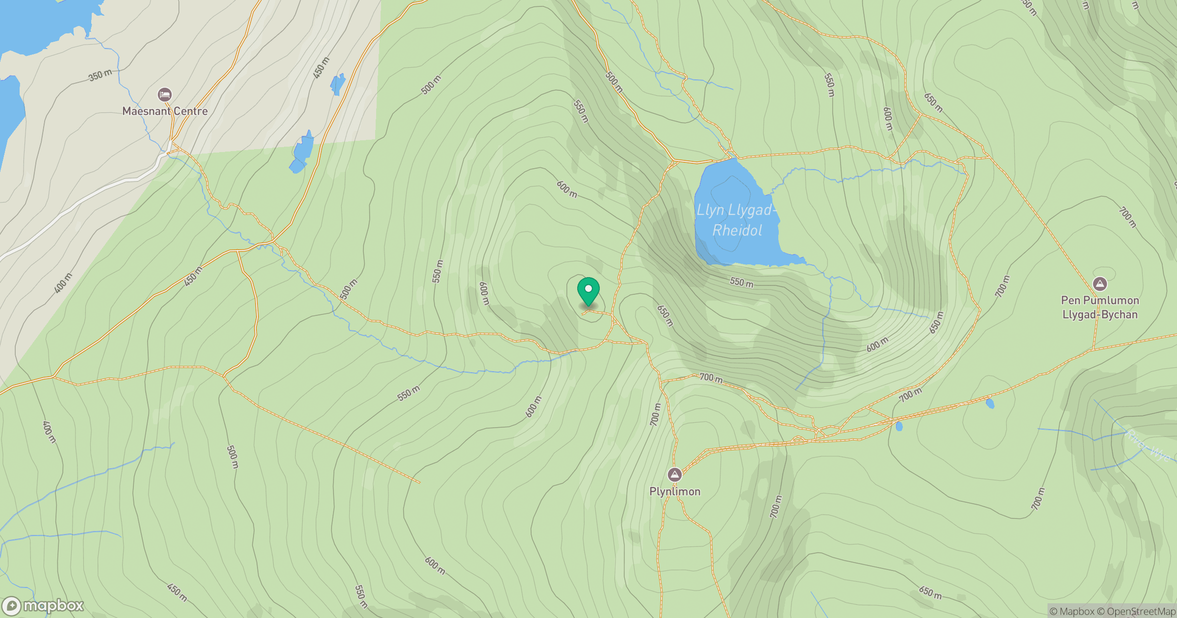
Grid reference: SN787874
View on OpenStreetMapOpens a map in a new tab, centred on the hill.
Nearby Hills
Pumlumon Fawr [Plynlimon]
753m
Cadair Idris - Penygadair
893m
Aran Fawddwy
906m
Y Garn
629m
Rhinog Fawr
721m
No comments yet. Be the first.