

Omey Island
Good walks are even better shared.
L5655 : Omey Island (Common/Open Land)
colm Photo source
Overview
Omey Island: A Hidden Gem in Co. Galway
Nestled off the west coast of Ireland, Omey Island is a treasure trove for hikers and outdoor enthusiasts alike. With its sandy beaches, rocky outcrops, and rich history, this small island promises an adventure that's as refreshing as a pint of Guinness on a sunny day.
Geology
Omey Island is primarily composed of sandstone and limestone rocks that tell a story spanning thousands of years. The island's geology features stunning coastal landscapes mixed with unique geological formations, creating a perfect playground for walkers and geologists alike.
Routes
The main route on Omey Island is the Omey Island Coastal Walk. This 5 km circular path is an easy trek that showcases the stunning natural beauty and the archaeological significance of the island. Expect to take about 1.5 hours, allowing you ample time to pause, snap a few photos, and maybe even spot a few seals basking in the sun.
Summit Features
While Omey Island lacks a traditional summit, various elevated points along the routes offer incredible vantage views. Be sure to pack your binoculars for the nearby Twelve Bens mountains, as they never fail to impress, especially during golden hour!
Terrain
The terrain is quite straightforward, with paths primarily consisting of sandy and rocky elements alongside fabulous coastal views. Just watch your step; slippery rocks can appear when least expected, so sturdy footwear is your best friend here.
Views
The views surrounding Omey Island are jaw-dropping. From various lookout points, hikers can witness the beauty of the Twelve Bens, the open Atlantic Ocean, and the distant hills of Inis Meain. Spring and summer are especially rewarding, as the views unfold like a card trick!
Hazards
As it is a coastal island, keep an eye on the tides! Certain paths may become submerged during high tide, so plan your visit accordingly. The terrain can be uneven, so it's wise to bring sturdy shoes to avoid any slips.
Access
Access to Omey Island is fairly straightforward. Parking is available at the entrance, with enough space for several vehicles. Clifden, the nearest town, is a reasonable 12 km away, offering services and amenities if needed.
Facilities
Being a small island, facilities are limited. It's advised to bring your own snacks and drinks. For a proper sit-down meal or toilet facilities, the nearest options can be found in Clifden.
History
The name 'Omey' descends from the Irish Oma, referring to the ‘place of the working people’—a nod to the island's vibrant past. With ancient ruins and remnants of early Christian settlements, the island holds strong cultural significance, giving you plenty to ponder as you ramble along its paths.
In summary, Omey Island offers a delightful escape for anyone keen on immersing themselves in nature and history. Just remember to take in the views and enjoy a bit of the local lore while you're there. Happy hiking!
Last Updated
2023-10-01
Explore routes near Omey Island
Walks starting near this hill. Open a route to check its map, distance and full itinerary.
Route planning notes
These notes describe possible approaches. Check a route's map and access information when planning your walk.
Omey Island Coastal Walk
A scenic circular route around Omey Island, showcasing its stunning natural beauty and archaeological sites.
Make a day of it, together
Find someone to share the walk with, or organise a day out along a route you like.
Photo Gallery
View all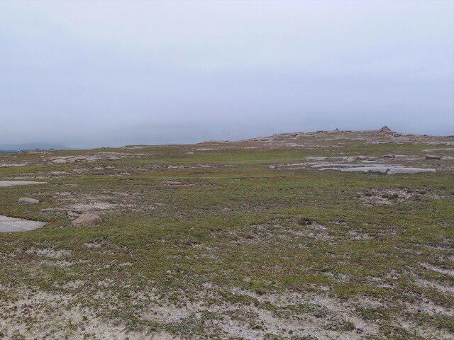 Photo could not load
L5655 : Omey Island (Common/Open Land)
colm
Hill facts and local notes
Classifications
Elevation
26m
85 ft
Prominence
26m
Coordinates
53.5327, -10.1680
L563558
OS Map
37
At the Summit
As an island, Omey doesn’t have a traditional summit but offers elevated viewpoints along its coastal paths, with breathtaking views of the Atlantic Ocean and surrounding landscape.
Terrain & Geology
Omey Island is primarily composed of sandstone and limestone, providing a fascinating glimpse into the geological history of the region. The island's unique coastal geology features sandy beaches and rocky outcrops, perfect for exploring during low tide.
Views & Scenery
From various points around the island, hikers can see the Twelve Bens mountain range, nearby Inis Meain, and the vast expanses of the Atlantic Ocean.
History & Heritage
Name Origin
The name 'Omey' is derived from the Irish 'Oma', meaning 'the place of the working, or laboring people'.
Historical Significance
Omey Island has a rich history, with ancient ruins and evidence of early Christian settlements scattered across its landscape. The island is also known for its unique culture and folklore.
Getting There & Facilities
Parking
Parking is available at the entrance to the island, just off the R336 road, with space for several vehicles.
Public Transport
Public transport is limited, but there are bus services from Clifden to nearby areas. A taxi or private vehicle is recommended for easier access.
Nearby Facilities
The island has minimal facilities, so it's wise to bring your own refreshments. The nearest cafes and toilets are located in Clifden.
Safety Information
Known Hazards
- Be cautious of the tide; certain paths may become submerged during high tide. Slippery rocks and uneven terrain can be encountered, so sturdy footwear is recommended.
General Safety Tips
- Check weather conditions before setting out
- Carry appropriate clothing and equipment
- Let someone know your planned route
- Take a map, compass, and GPS device
- Carry emergency supplies: food, water, first aid kit, torch
Hills
Some common questions about the hills answered
Are there group walks up Omey Island?
Many walkers use Walkmates to join or organise walks with others. You can check for group walks around Omey Island through the maps
Are there other walkers around Omey Island?
Activity varies by location and time, but Walkmates lets you see whether others have shared walks or shown interest in this area. Find other people through the walking friends search walking friends for Omey Island search or of course create your own walk for Omey Island
Can I organise a walk to Omey Island?
Yes. If there aren’t any walks listed already, you can create a walk and make it available for others to join.
If you're signed up to Walkmates, you can create a walk to Omey Island.
How do I find a walk up this hill?
There are often multiple ways to walk this hill, depending on experience and route preference. Walkmates helps you explore walks and routes that others have shared.
Can I suggest a new route up Omey Island?
Yes. You can suggest or create routes to share with others. Walkmates focuses on the social side of walking, so routes are used to help people organise walks and explore areas together, rather than as detailed navigation tools or route libraries.
Other uses really appreciate knowledgeable walkers sharing their routes. Share your favourite route to Omey Island here
The is an error or something incorrect about this hill. How do I let you know?
We always strive to keep the information on Walkmates as accurate as possible. If you find an error, please let us know through the contact form and we'll aim to correct it as quickly as possible
Community Discussion
Comments
Location
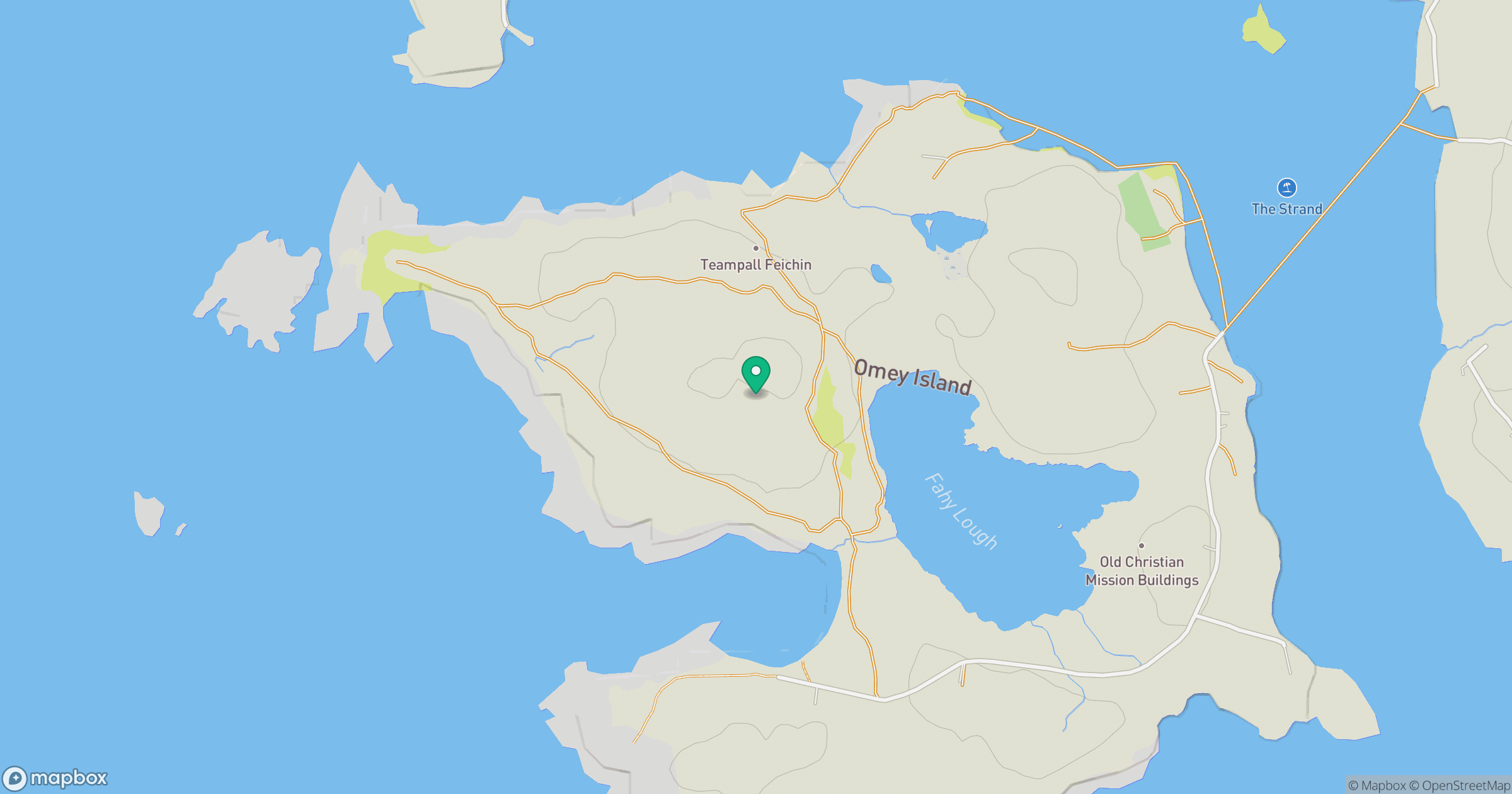
Grid reference: L563558
View on OpenStreetMapOpens a map in a new tab, centred on the hill.
No comments yet. Be the first.