

Meall a' Bhata
Good walks are even better shared.
Overview
Meall a' Bhata
Meall a' Bhata is a stunning Munro located in the heart of the Scottish Highlands, renowned for its breathtaking views and rich geological features. With an elevation of 1,037 meters, it's a perfect climb for those looking to tick off a Munro or simply enjoy the stunning Scottish landscape.
Geology
The mountain is primarily formed from ancient volcanic rock, providing rich insights into the geological history of the area. The unique formations created by glacial erosion result in crags and ridges that not only offer a challenge to climbers but also a feast for the eyes.
Routes
One of the popular approaches is through Drumbeg, a route that spans approximately 12 km and typically takes about 4.5 hours to complete. This moderate path snakes through awe-inspiring glens, allowing hikers to soak up the natural beauty that Scotland is famous for.
Summit Features
Reaching the summit, you'll be greeted by a sturdy cairn—crafted from local stones and standing in homage to all who have tackled this mighty Munro. It's a great place for a victory photo!
Terrain Type
The terrain varies significantly, providing a mix of rocky paths interspersed with grassy slopes. Hikers should also be prepared for boggy patches that may attempt to thwart their expedition; sturdy, waterproof footwear is highly recommended!
Views
On your ascent and at the summit, the views are nothing short of spectacular. You can relish the sight of the Assynt mountains, including the iconic Suilven and Canisp. The visual glory is particularly enchanting in late spring to early autumn, when wildflowers bloom and the skies usually clear up for some fantastic photos.
Hazards
As with all Highland hikes, be prepared for rapid weather changes. The paths can become slippery, especially after rain, so vigilance is key to enjoying your adventure safely.
Nearby Summits
While Meall a' Bhata is a fantastic destination on its own, you may wish to explore nearby summits such as Suilven and Canisp, both of which boast their own unique climbing experiences.
Access
Parking can be found at a small area at the end of the single track road leading to Drumbeg. Public transport from Ullapool provides a viable option for those without a vehicle; sightings of beautiful rural landscapes along the way make it worthwhile.
Facilities
Don’t forget to fuel up! Ullapool, the nearest town, offers a variety of cafes and restaurants where hikers can replenish their energy post-hike.
History
The name Meall a' Bhata translates to 'Hill of the Bath', hinting at the area's historical links to bathing spots in the nearby river. This Munro is not just a trek; it’s also a piece of the cultural fabric of the Highlands, cherished by locals and adventurers alike.
In conclusion, Meall a' Bhata offers a wonderful experience for both novice and seasoned hikers. With majestic views, a rich tapestry of geological features, and a sprinkling of local mythology, it’s a hill worth climbing!
Explore routes near Meall a' Bhata
Public walks starting within 80 km of this hill. Nearby does not mean a route reaches the summit; check its map and access before setting out.
Ben Klibreck
View route
Loch Migdale from Torroy: Spinningdale pinewood and loch shore walk
View route
Findhorn guided night walk
View route
Culbin Forest: Hill 99, Gravel Pit Ponds and Dragonfly Pool
View route
Route planning notes
These notes describe possible approaches, not verified navigable routes or permission to cross land. Check current paths, local access rules and conditions before setting out.
Approach from Drumbeg
This popular route winds through picturesque glens and offers great views as you ascend.
Make a day of it, together
Find someone to share the walk with, or organise a day out along a route you like.
Photo Gallery
View all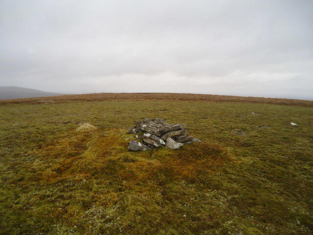 Photo could not load
NC6326 : The summit area of Meall a' Bhata, 583m
Michael Earnshaw
Hill facts and local notes
Classifications
Elevation
583m
1,913 ft
Prominence
130m
Coordinates
58.2055, -4.3233
NC635264
OS Map
16
Explorer: 443
At the Summit
The summit features a prominent cairn made from local stones, standing proudly against the stunning backdrop of the Highlands.
Terrain & Geology
Meall a' Bhata is primarily composed of ancient volcanic rock, typical of the region, with some stunning geological formations that could make a geologist weak at the knees. The crags and ridges have been shaped over millennia, showcasing the power of glacial erosion.
Views & Scenery
On a clear day, you can bask in the views of the Assynt mountains, including Suilven and Canisp—perfect for those Instagram shots!
History & Heritage
Name Origin
Meall a' Bhata can be translated as 'Hill of the Bath', possibly referring to local bathing spots in the river.
Historical Significance
This mountain has been a popular hiking destination for locals and tourists, often celebrated in local folklore.
Getting There & Facilities
Check current local access restrictions, parking rules and transport timetables before travelling. These notes do not confirm public access to the summit.
Parking
There is a small parking area at the end of the single track road leading to Drumbeg.
Public Transport
The nearest bus service operates from Ullapool, but check local schedules for the latest times.
Nearby Facilities
Ullapool offers a range of facilities including restaurants, cafes, and public toilets, so you can refuel before or after your adventure.
Safety Information
Known Hazards
- The terrain can be slippery, particularly after rain. Beware of sudden weather changes typical of the Highlands.
General Safety Tips
- Check weather conditions before setting out
- Carry appropriate clothing and equipment
- Let someone know your planned route
- Take a map, compass, and GPS device
- Carry emergency supplies: food, water, first aid kit, torch
Hills
Some common questions about the hills answered
Are there group walks up Meall a' Bhata?
Many walkers use Walkmates to join or organise walks with others. You can check for group walks around Meall a' Bhata through the maps
Are there other walkers around Meall a' Bhata?
Activity varies by location and time, but Walkmates lets you see whether others have shared walks or shown interest in this area. Find other people through the walking friends search walking friends for Meall a' Bhata search or of course create your own walk for Meall a' Bhata
Can I organise a walk to Meall a' Bhata?
Yes. If there aren’t any walks listed already, you can create a walk and make it available for others to join.
If you're signed up to Walkmates, you can create a walk to Meall a' Bhata.
How do I find a walk up this hill?
There are often multiple ways to walk this hill, depending on experience and route preference. Walkmates helps you explore walks and routes that others have shared.
Can I suggest a new route up Meall a' Bhata?
Yes. You can suggest or create routes to share with others. Walkmates focuses on the social side of walking, so routes are used to help people organise walks and explore areas together, rather than as detailed navigation tools or route libraries.
Other uses really appreciate knowledgeable walkers sharing their routes. Share your favourite route to Meall a' Bhata here
The is an error or something incorrect about this hill. How do I let you know?
We always strive to keep the information on Walkmates as accurate as possible. If you find an error, please let us know through the contact form and we'll aim to correct it as quickly as possible
Community Discussion
Comments
Location
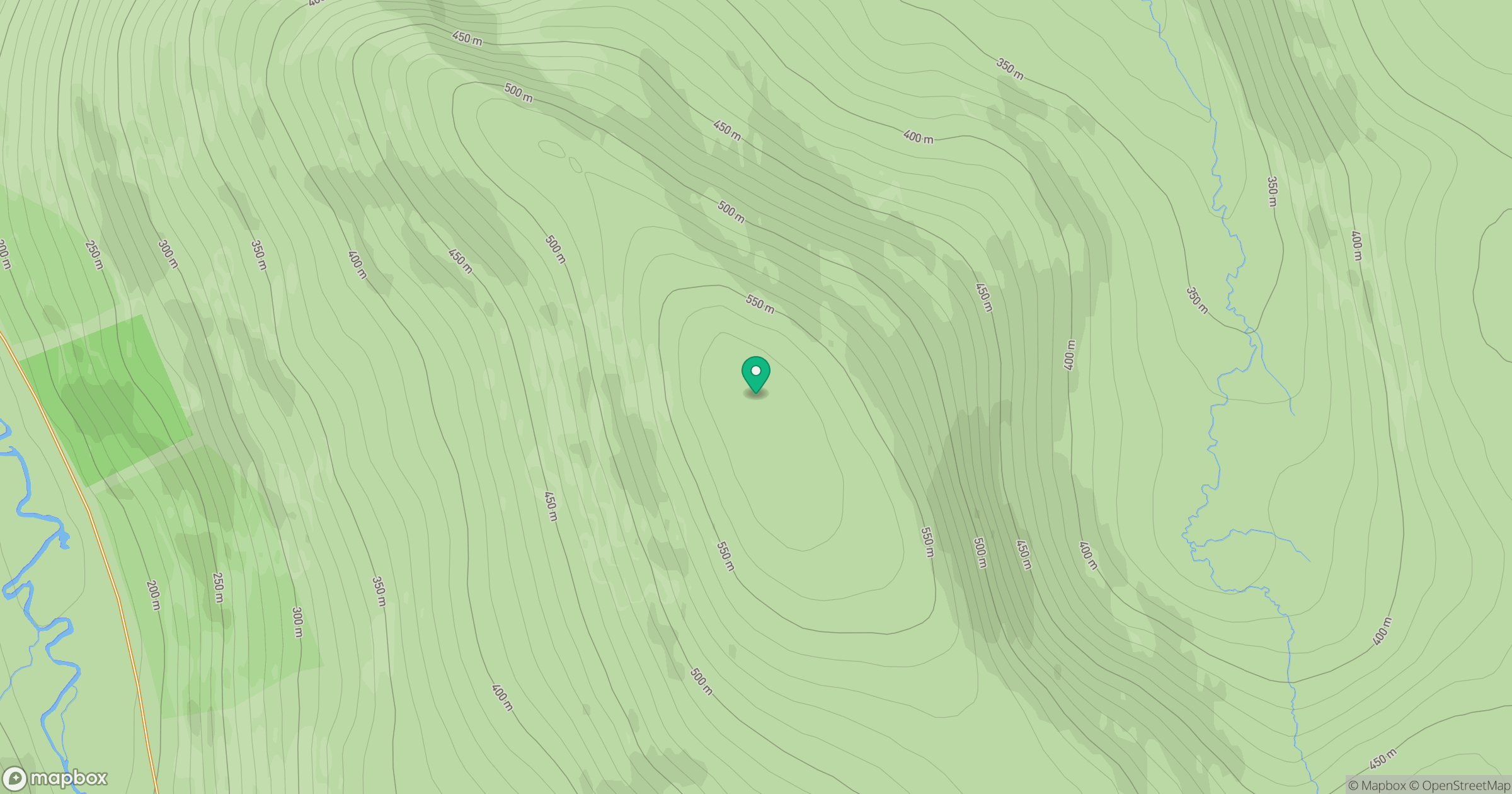
Grid reference: NC635264
View on OpenStreetMapOpens a map in a new tab, centred on the hill.
Hills within 30 km
Straight-line distance, not a walking route or confirmation of access.
Ben Loyal - An Caisteal
764m
Ben Hope
927m
Meall nan Aighean
697m
Meallan Liath Mor
463m
Ben Klibreck - Meall nan Con
962m
No comments yet. Be the first.