
Les Platons (Jersey)
Good walks are even better shared.
Overview
Les Platons (Jersey)
Overview
Les Platons is Jersey’s highest point. This page introduces the hill and its island setting; it is not a verified walking-route guide.
Geology
Made up of striking granite formations, the slopes of Les Platons tell a tale of geological activity that shaped the Channel Islands over millennia. When hiking, take a moment to appreciate the rugged beauty of these ancient rocks, perhaps wondering if they were formed before or after the invention of the fish and chips!
Routes
The most popular route, known as the Les Platons Loop, offers a fantastic introduction to the outdoor beauty surrounding this summit. It covers about 5 km and takes around 1.5 hours to complete, with well-marked paths that make it accessible to most hikers. Don your walking boots, pack a snack, and enjoy the serenity of Jersey’s countryside!
Summit Features
Upon reaching the summit, hikers are greeted by a solid trig point, standing as a silent guardian of the views that lay beyond. Make sure to snap a few photos; that trig point won’t be standing still for long!
Terrain Type
Expect a rocky and grassy trek, with patches of heather adding splashes of colour, especially in summer. It’s the kind of terrain that invites a good walking boot, not your fancy loafers!
Views
On a clear day, views from Les Platons take in Les Écréhous, Guernsey, Sark and the coast of France, as described by Visit Jersey.
Hazards
Always keep an eye on the weather; it can change faster than you can say 'tea and biscuits'. Be wise and watch your step on loose stones, especially when the ground is wet.
Access and Facilities
Parking is conveniently located at La Route du Platons, making it easy to kick off your adventure. Buses from St. Helier can get you close to the trailhead, and good old St. Helier offers plenty of facilities. Be sure to hydrate with a drink from a local café before or after your hike!
History
Les Platons has an intriguing etymology, derived from the French word for flat. The significance of this area stretches back in time, serving as a cherished landmark for both locals and visitors, linking them to the island’s rich historical tapestry.
In summary, whether you’re a seasoned hiker or just fancy an afternoon stroll, Les Platons in Jersey presents itself as a perfect destination. Now, grab that walking stick and get out there!
Happy hiking!
Explore routes near Les Platons (Jersey)
Public walks starting within 80 km of this hill. Nearby does not mean a route reaches the summit; check its map and access before setting out.
No public routes are currently listed within 80 km of Les Platons (Jersey) on Walkmates. This does not mean there are no paths here. Explore the map and check local access information before planning a walk.
Route planning notes
These notes describe possible approaches, not verified navigable routes or permission to cross land. Check current paths, local access rules and conditions before setting out.
Les Platons Loop
A scenic loop that begins at the nearest parking area, offering a well-marked path through the beautiful countryside.
Make a day of it, together
Find someone to share the walk with, or organise a day out along a route you like.
Hill facts and local notes
Classifications
Elevation
136m
446 ft
Prominence
136m
Coordinates
49.2479, -2.1055
WV651554
At the Summit
At the summit, you'll find a distinct trig point and panoramic views across the island and the surrounding sea.
Terrain & Geology
The geology of Les Platons is primarily composed of granite, with large boulders and rocky outcrops. The area features ancient rock formations that provide insights into Jersey's geological history and formation processes.
Views & Scenery
On a clear day, you can see the cliffs of Normandy in the horizon, along with views of the surrounding countryside, and the glistening sea.
History & Heritage
Name Origin
The name 'Les Platons' is derived from the French word 'plat,' meaning flat, possibly referring to the relatively gentle plateau at the summit.
Historical Significance
Les Platons hold cultural significance as a landmark for locals and visitors alike, with historical ties to the island's prehistoric sites.
Getting There & Facilities
Check current local access restrictions, parking rules and transport timetables before travelling. These notes do not confirm public access to the summit.
Parking
There is a small parking area at the base of Les Platons on La Route du Platons, allowing for easy access to trails.
Public Transport
Bus services run regularly from St. Helier to various points around the island, with a stop located near the base of the mountain.
Nearby Facilities
Cafés and toilets are available in St. Helier, while there are picnic areas near the trails for a quick bite before your hike.
Safety Information
Known Hazards
- Watch out for loose stones on the path, especially after rain. Also, beware of sudden weather changes typical of coastal areas.
General Safety Tips
- Check weather conditions before setting out
- Carry appropriate clothing and equipment
- Let someone know your planned route
- Take a map, compass, and GPS device
- Carry emergency supplies: food, water, first aid kit, torch
Hills
Some common questions about the hills answered
Are there group walks up Les Platons (Jersey)?
Many walkers use Walkmates to join or organise walks with others. You can check for group walks around Les Platons (Jersey) through the maps
Are there other walkers around Les Platons (Jersey)?
Activity varies by location and time, but Walkmates lets you see whether others have shared walks or shown interest in this area. Find other people through the walking friends search walking friends for Les Platons (Jersey) search or of course create your own walk for Les Platons (Jersey)
Can I organise a walk to Les Platons (Jersey)?
Yes. If there aren’t any walks listed already, you can create a walk and make it available for others to join.
If you're signed up to Walkmates, you can create a walk to Les Platons (Jersey).
How do I find a walk up this hill?
There are often multiple ways to walk this hill, depending on experience and route preference. Walkmates helps you explore walks and routes that others have shared.
Can I suggest a new route up Les Platons (Jersey)?
Yes. You can suggest or create routes to share with others. Walkmates focuses on the social side of walking, so routes are used to help people organise walks and explore areas together, rather than as detailed navigation tools or route libraries.
Other uses really appreciate knowledgeable walkers sharing their routes. Share your favourite route to Les Platons (Jersey) here
The is an error or something incorrect about this hill. How do I let you know?
We always strive to keep the information on Walkmates as accurate as possible. If you find an error, please let us know through the contact form and we'll aim to correct it as quickly as possible
Community Discussion
Comments
Location
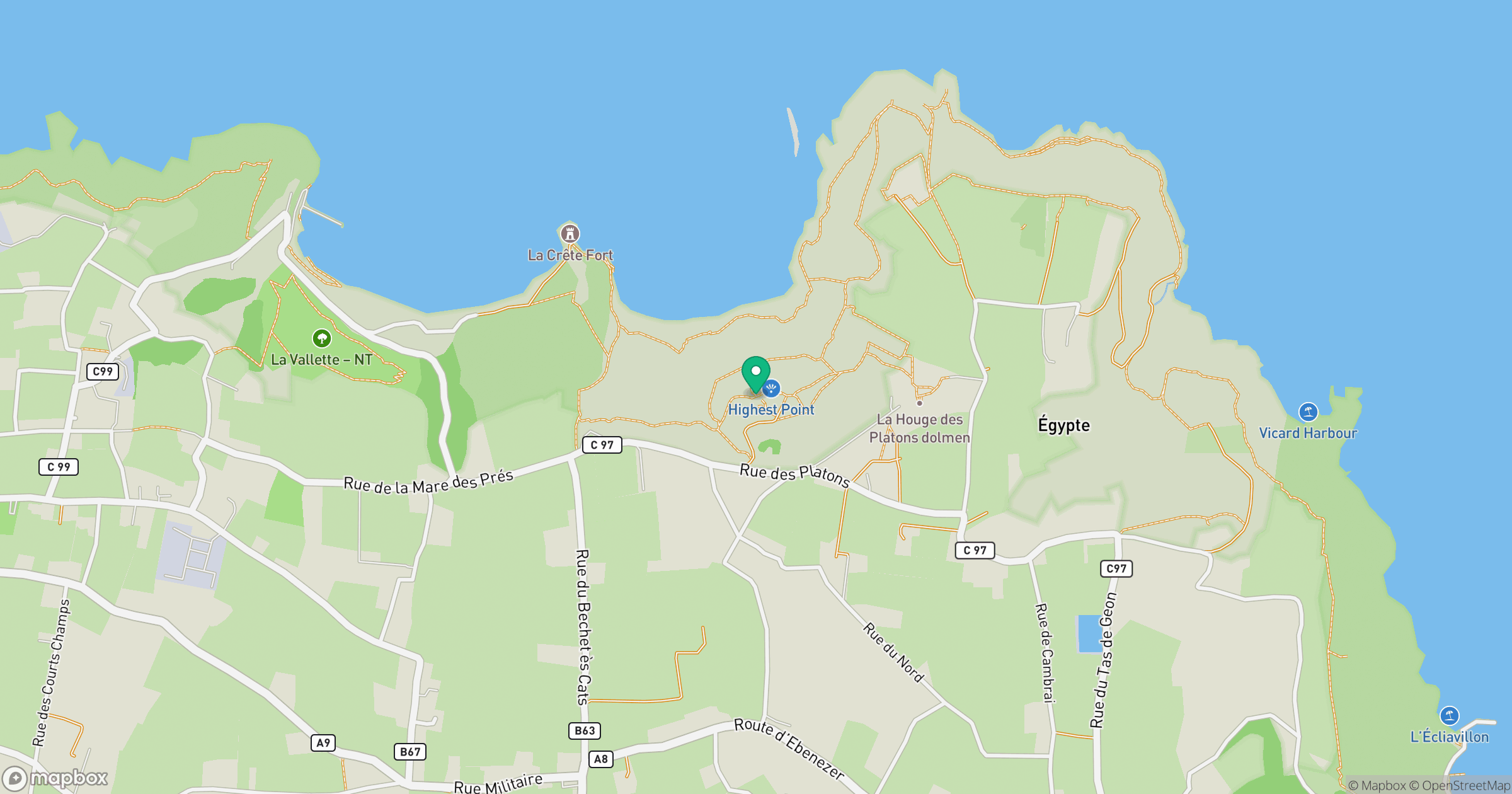
Grid reference: WV651554
View on OpenStreetMapOpens a map in a new tab, centred on the hill.
Hills within 30 km
Straight-line distance, not a walking route or confirmation of access.
No comments yet. Be the first.