

Ladle Hill
Good walks are even better shared.
SU4756 : Within Ladle Hill hillfort
Mr Ignavy Photo source
Overview
Ladle Hill: A Hidden Gem of the South Downs
Ladle Hill, standing proudly at 268 meters, is a Marilyn located in the stunning South Downs region of England. Known for its characteristic chalk landscape, this hill offers both a decent workout and unparalleled views of the surrounding countryside.
Geology
The hill is predominantly chalk, which gives it a unique ability to host various plant species and diverse wildlife. The exposed chalk often results in a fragile ecosystem, so tread lightly and enjoy the blooms without trampling them underfoot!
Routes
One of the most popular routes is the Ladle Hill Circular Walk, a lovely 4-kilometer trek that can typically be completed within 1.5 hours. This moderate hike features varied terrain, taking you through serene wooded paths and rolling chalk downs before reaching the summit. Don't forget your walking boots—unless you want to waltz right back down!
Summit Features
Upon reaching the top, hikers will find a small grassy area dotted with a few stones marking the summit. If you’ve made it up here, don’t forget to take a selfie; the views warrant a thousand Instagram likes!
Terrain
The terrain can be quite enjoyable; grassy stretches mixed with patches of exposed chalk provide a varied walking experience interspersed with the presence of flora and fauna that characterise the South Down’s landscapes.
Views
The views from the summit are nothing short of spectacular! Expect to see the sweeping vistas of the South Downs, with the coastal line of Brighton glimmering in the distance on clear days. The best time to take it all in is during spring or early summer when the wildflowers bloom, or in autumn when the leaves are ablaze with colour.
Hazards
As with many outdoor adventures, be mindful of the weather—it can change quicker than you can say ‘slippery chalk!’ Ensure you have a good map or GPS, as sudden weather changes can make visibility poor. Additionally, watch your step if it's been raining, as trails can become muddy.
Nearby Summits
If you consider extending your adventure, nearby Ditchling Beacon and Kingston Hill offer additional hiking opportunities and stunning panoramic views.
Access
Ditchling serves as the nearest town and is equipped with parking facilities. There are regular bus services from Brighton as well, ensuring that less adventurous companions can also tag along.
Facilities
Once you’re done slogging up Ladle Hill, treat yourself to a well-earned scone and cup of tea at one of the local cafes down in Ditchling. You’ll surely need to replenish your energy!
History
The name Ladle Hill has stirred curiosity among etymologists and locals alike, possibly relating to the hill’s shape or archaic dialect. The hill holds historical significance as indicated in old maps, making it a staple for local culture and a cherished landmark for centuries.
Ladle Hill is indeed a hidden gem in the South Downs, waiting for adventurers to embrace its beauty!
Explore routes near Ladle Hill
Walks starting near this hill. Open a route to check its map, distance and full itinerary.
Thatcham short birding stroll
View route
Thatcham short birding stroll
View route
Newbury to Donnington Castle: Lambourn Valley Way via Speen and Bagnor
View route
Burghfield and Mortimer Group with Men Walking & Talking
View route
Route planning notes
These notes describe possible approaches. Check a route's map and access information when planning your walk.
Ladle Hill Circular Walk
A delightful circular route starting from the nearby village, leading hikers through scenic chalk downland and woodland before ascending to the summit.
Make a day of it, together
Find someone to share the walk with, or organise a day out along a route you like.
Photo Gallery
View all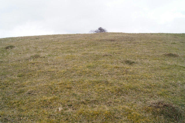 Photo could not load
SU4756 : Within Ladle Hill hillfort
Mr Ignavy
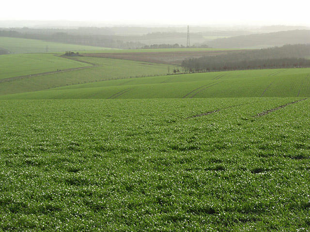 Photo could not load
SU4856 : Farmland, Ladle Hill
Andrew Smith
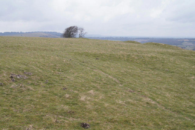 Photo could not load
SU4756 : Ladle Hill hillfort
Mr Ignavy
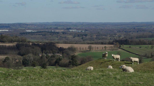 Photo could not load
SU4756 : Sheep on Ladle Hill, Hants
Colin Park
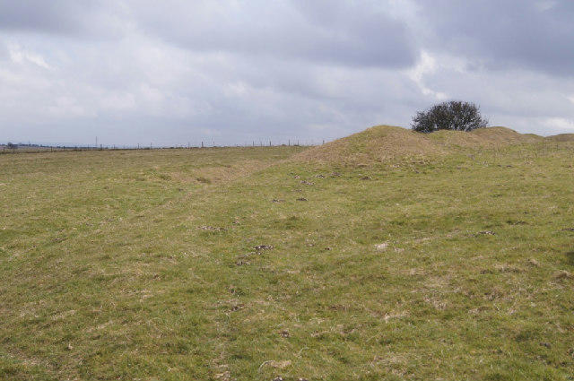 Photo could not load
SU4756 : Ladle Hill hillfort
Mr Ignavy
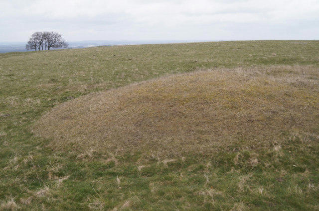 Photo could not load
SU4756 : Interior view - Ladle Hill hillfort
Mr Ignavy
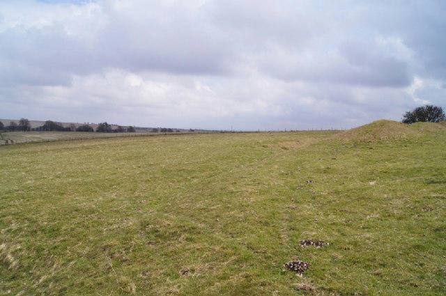 Photo could not load
SU4756 : Ladle Hill hillfort
Mr Ignavy
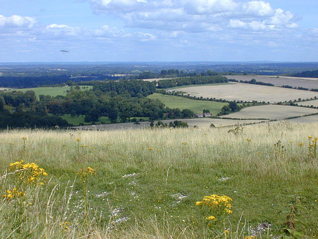 Photo could not load
SU4756 : View north east from Ladle Hill
Nigel Brown
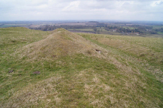 Photo could not load
SU4756 : Ladle Hill hillfort
Mr Ignavy
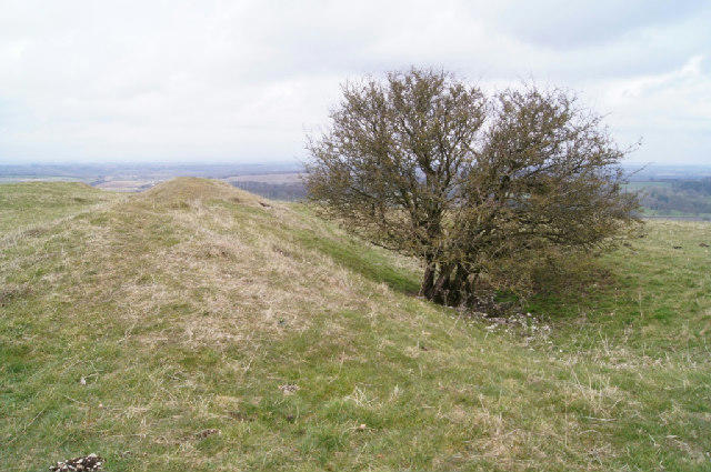
SU4756 : A slightly sheltered spot
Mr Ignavy
Hill facts and local notes
Classifications
Elevation
232m
761 ft
Prominence
41m
Coordinates
51.3078, -1.3142
SU479567
OS Map
174
Explorer: 144W
At the Summit
The summit features a small grassy area with a few stones signifying the peak, and panoramic views offering a great photo op (selfies encouraged!).
Terrain & Geology
Ladle Hill is primarily composed of chalk, characteristic of the South Downs, providing a unique habitat for various flora and fauna. The steep slopes and rolling chalk hills give an impression of the ancient seabed that shaped this landscape.
Views & Scenery
From the summit, you can enjoy views over the expansive South Downs, with the famous brighton coastline visible on clear days.
History & Heritage
Name Origin
Ladle Hill is thought to derive from an Old English term possibly relating to the shape of the hill or local dialect, though it's been open for interpretation over the centuries.
Historical Significance
The hill has been a landmark for local residents and features in historical maps, showcasing the significance of the South Downs in regional culture.
Getting There & Facilities
Parking
Parking is available in the village of Ditchling, approximately 2 km from the trailhead, with ample space for cars.
Public Transport
Regular bus services run from Brighton to Ditchling, making it accessible for those relying on public transport.
Nearby Facilities
Ditchling has several local cafes and pubs where thirsty hikers can quench their thirst and revisit their tales of adventure.
Safety Information
Known Hazards
- Watch out for sudden changes in the weather; the South Downs can be unpredictable. Trail conditions may vary after rain, so careful footing is advised.
General Safety Tips
- Check weather conditions before setting out
- Carry appropriate clothing and equipment
- Let someone know your planned route
- Take a map, compass, and GPS device
- Carry emergency supplies: food, water, first aid kit, torch
Hills
Some common questions about the hills answered
Are there group walks up Ladle Hill?
Many walkers use Walkmates to join or organise walks with others. You can check for group walks around Ladle Hill through the maps
Are there other walkers around Ladle Hill?
Activity varies by location and time, but Walkmates lets you see whether others have shared walks or shown interest in this area. Find other people through the walking friends search walking friends for Ladle Hill search or of course create your own walk for Ladle Hill
Can I organise a walk to Ladle Hill?
Yes. If there aren’t any walks listed already, you can create a walk and make it available for others to join.
If you're signed up to Walkmates, you can create a walk to Ladle Hill.
How do I find a walk up this hill?
There are often multiple ways to walk this hill, depending on experience and route preference. Walkmates helps you explore walks and routes that others have shared.
Can I suggest a new route up Ladle Hill?
Yes. You can suggest or create routes to share with others. Walkmates focuses on the social side of walking, so routes are used to help people organise walks and explore areas together, rather than as detailed navigation tools or route libraries.
Other uses really appreciate knowledgeable walkers sharing their routes. Share your favourite route to Ladle Hill here
The is an error or something incorrect about this hill. How do I let you know?
We always strive to keep the information on Walkmates as accurate as possible. If you find an error, please let us know through the contact form and we'll aim to correct it as quickly as possible
Community Discussion
Comments
Location
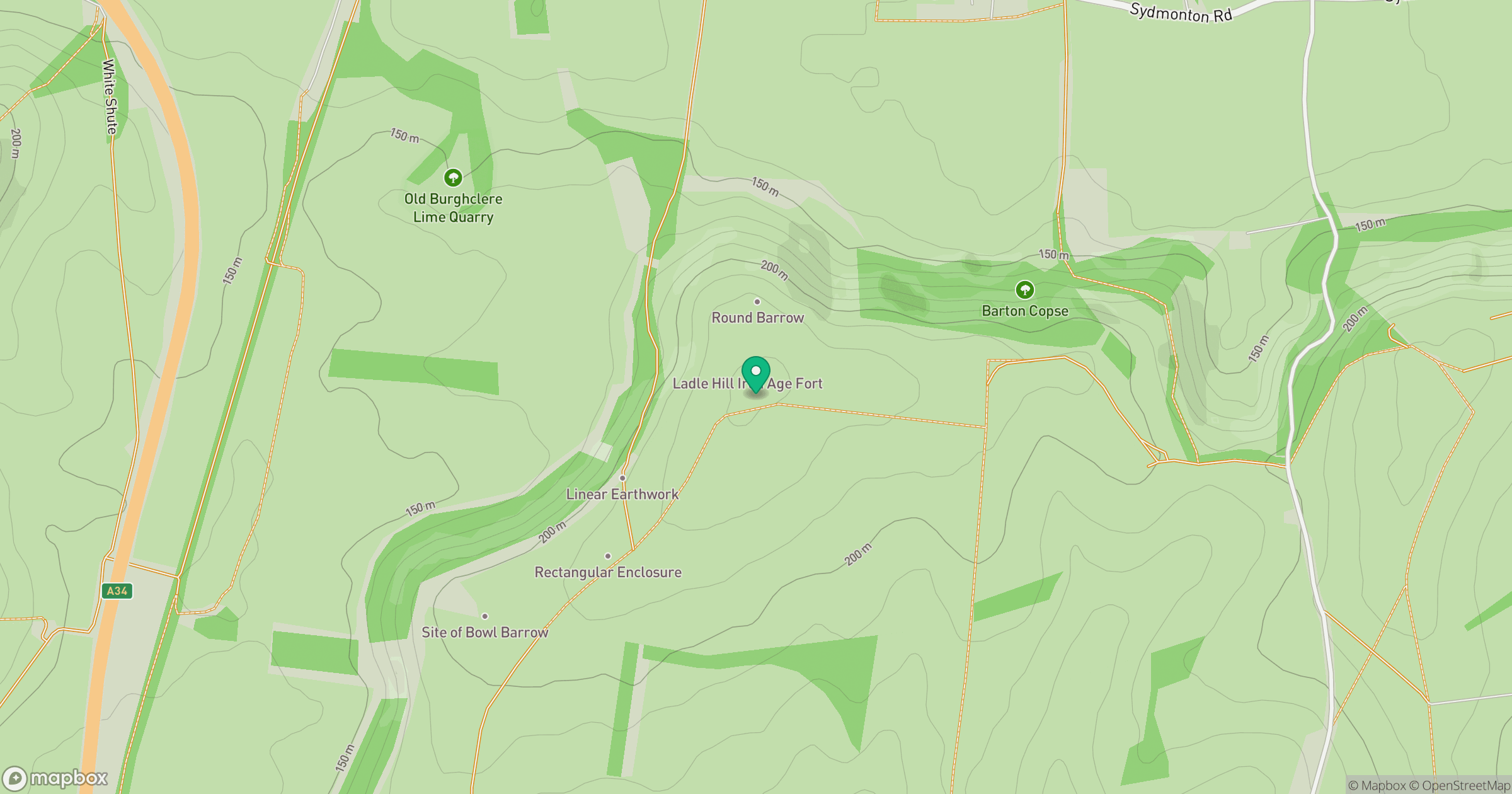
Grid reference: SU479567
View on OpenStreetMapOpens a map in a new tab, centred on the hill.
Nearby Hills
Leith Hill
294m
Ditchling Beacon
248m
Worcestershire Beacon
425m
Glastonbury Tor
158m
Titterstone Clee Hill
533m
No comments yet. Be the first.