
Knocknaman
Good walks are even better shared.
Overview
Knocknaman: An Adventurer's Paradise
Overview
Nestled in the scenic County Tyrone, Northern Ireland, Knocknaman stands at a respectable height of 623 meters. This Marilyn offers a modest challenge with the promise of majestic views that will make the climb well worth your while.
Geology
Knocknaman's geological structure is predominantly sandstone and shale. If you enjoy a bit of rock-watching, look out for fascinating sedimentary formations that tell the story of the Earth's history. You'll also find evidence of erosion that has shaped this area into the hill we see today.
Routes
The Trassey Track
This is the most popular route to reach the summit of Knocknaman. Spanning 8 km and boasting a moderate difficulty, it's perfect for active families and solo adventurers alike. The path is well trodden, meaning you won't have to dance around too many bushes!
Summit Features
Upon reaching the summit, you’re greeted by a cairn that offers a perfect spot to catch your breath and snap a photo. The views from up here are nothing short of breathtaking. It’s the ideal place for a picnic, just be wary of any cheeky birds trying to share your sandwiches!
Terrain Type
The mountain itself is a mix of grassy slopes and rocky outcrops. Expect a bit of heather underfoot in some places, which adds to the scenic charm, but remember to watch your footing!
Views
At the summit, you can admire the rolling hills of the Sperrin Mountains and, on especially clear days, gaze upon the shimmering waters of Lough Neagh. For the best views, aim to visit in spring or early summer, when nature is at its most vibrant.
Hazards
Watch out for the weather – it can change as quickly as you can say 'what's that dark cloud?!' Be prepared for mud in certain areas, especially after rain, so sturdy boots are a must.
Nearby Summits
Feeling adventurous? Why not check out Slieve Gallion and Sliabh Beagh, both relatively close and worth the visit.
Access
Turning your wheels towards the Trassey Track trailhead will get you started on your adventure. There’s plenty of parking available, but if you rely on public transport, you may need to arrange friends or family to give you a lift from the nearest bus stop in Draperstown, about 8 km away.
Facilities
While there are no toilets or cafes at the trailhead, Draperstown is just around the corner where you can stock up on supplies before or after your hike.
History
The mountain's name, 'Knocknaman', translates to 'Hill of the Women' in Irish, reflecting its historical and cultural significance in the region. Locals share stories of ancient gatherings here, making it a site steeped in folklore.
Conclusion
Knocknaman is a delightful destination for hiking enthusiasts, whether you’re looking for a leisurely ramble or a more strenuous challenge. With stunning views, rich geology, and a sprinkle of history, it's a mountain that beckons you to explore.
Happy Hiking!
Explore routes near Knocknaman
Public walks starting within 80 km of this hill. Nearby does not mean a route reaches the summit; check its map and access before setting out.
No public routes are currently listed within 80 km of Knocknaman on Walkmates. This does not mean there are no paths here. Explore the map and check local access information before planning a walk.
Route planning notes
These notes describe possible approaches, not verified navigable routes or permission to cross land. Check current paths, local access rules and conditions before setting out.
The Trassey Track
A well-defined path that winds its way up the eastern flank of Knocknaman, this route offers a gentle ascent with beautiful views along the way.
Make a day of it, together
Find someone to share the walk with, or organise a day out along a route you like.
Hill facts and local notes
Classifications
Elevation
337m
1,106 ft
Prominence
131m
Coordinates
53.0820, -7.6993
N202035
OS Map
54
At the Summit
At the summit of Knocknaman, you'll find a rustic cairn surrounded by expansive vistas. It's the perfect place for a sit and contemplate (or a photo op if that's more your style!).
Terrain & Geology
The mountain is primarily composed of sandstone and shale, indicative of sedimentary processes. The surrounding landscape showcases classic erosion effects, revealing the geological history dating back millions of years.
Views & Scenery
From the summit, gaze out over the rolling hills of the Sperrin Mountains and the distant outlines of the Donegal hills. On a clear day, you can even spot the shimmering waters of Lough Neagh.
History & Heritage
Name Origin
The name 'Knocknaman' is derived from the Irish 'Cnoc na mBan', meaning 'Hill of the Women', hinting at its cultural significance.
Historical Significance
This peak features in local folklore and is said to be a site of ancient rituals and gatherings.
Getting There & Facilities
Check current local access restrictions, parking rules and transport timetables before travelling. These notes do not confirm public access to the summit.
Parking
There is ample parking available at the Trassey Track trailhead, located just off the main road with clear signage.
Public Transport
Limited public transport is available; it's best accessed by car. The nearest bus stop is in the village of Draperstown, approximately 8 km away.
Nearby Facilities
There are no facilities directly at the site. However, Draperstown has cafes and shops for pre-hike snacks and post-adventure refreshments.
Safety Information
Known Hazards
- Potential for sudden weather changes: be prepared for a shower or two (or three!). The paths can also be muddy in certain areas, so sturdy footwear is a must!
General Safety Tips
- Check weather conditions before setting out
- Carry appropriate clothing and equipment
- Let someone know your planned route
- Take a map, compass, and GPS device
- Carry emergency supplies: food, water, first aid kit, torch
Hills
Some common questions about the hills answered
Are there group walks up Knocknaman?
Many walkers use Walkmates to join or organise walks with others. You can check for group walks around Knocknaman through the maps
Are there other walkers around Knocknaman?
Activity varies by location and time, but Walkmates lets you see whether others have shared walks or shown interest in this area. Find other people through the walking friends search walking friends for Knocknaman search or of course create your own walk for Knocknaman
Can I organise a walk to Knocknaman?
Yes. If there aren’t any walks listed already, you can create a walk and make it available for others to join.
If you're signed up to Walkmates, you can create a walk to Knocknaman.
How do I find a walk up this hill?
There are often multiple ways to walk this hill, depending on experience and route preference. Walkmates helps you explore walks and routes that others have shared.
Can I suggest a new route up Knocknaman?
Yes. You can suggest or create routes to share with others. Walkmates focuses on the social side of walking, so routes are used to help people organise walks and explore areas together, rather than as detailed navigation tools or route libraries.
Other uses really appreciate knowledgeable walkers sharing their routes. Share your favourite route to Knocknaman here
The is an error or something incorrect about this hill. How do I let you know?
We always strive to keep the information on Walkmates as accurate as possible. If you find an error, please let us know through the contact form and we'll aim to correct it as quickly as possible
Community Discussion
Comments
Location
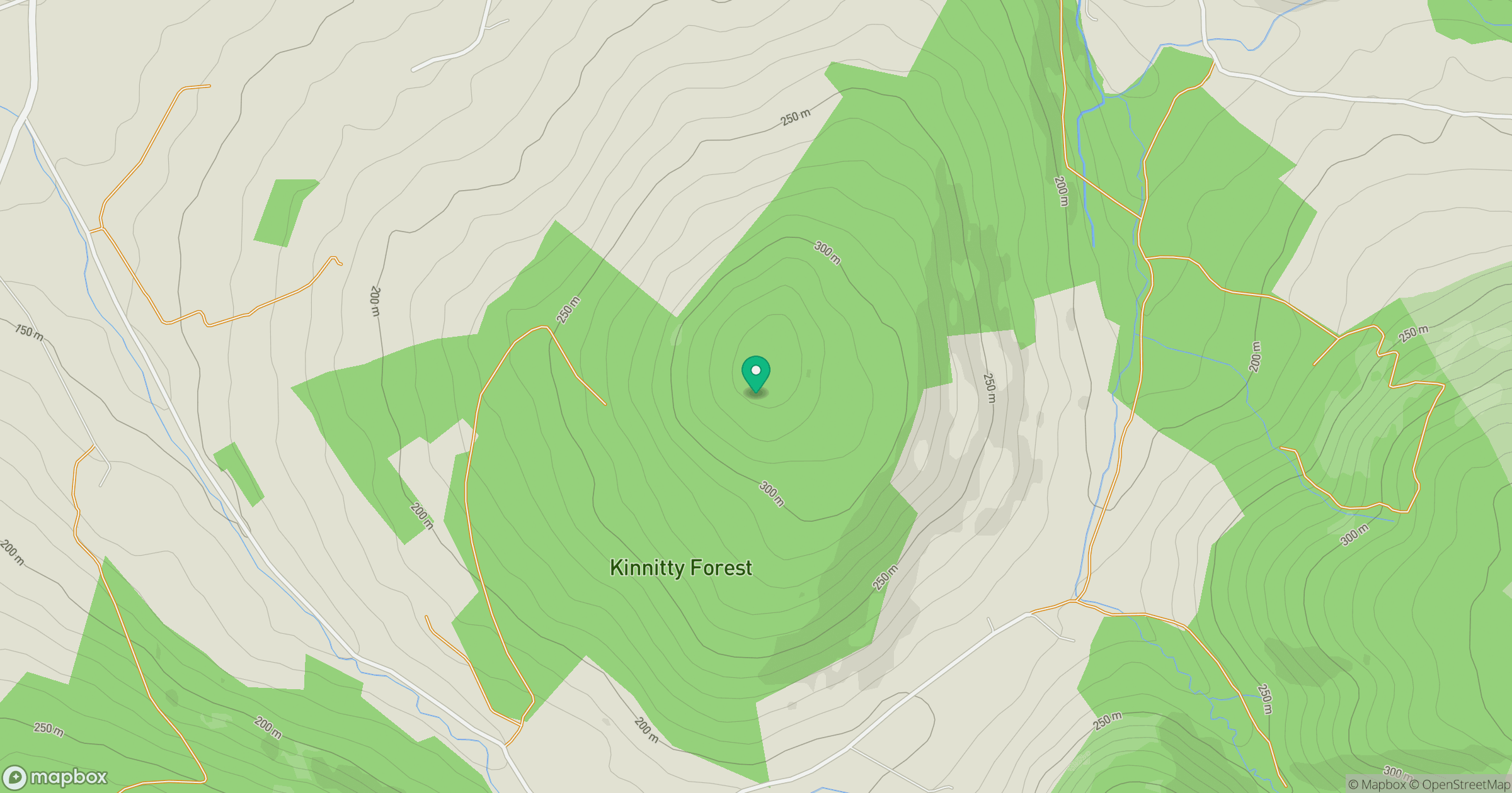
Grid reference: N202035
View on OpenStreetMapOpens a map in a new tab, centred on the hill.
Hills within 30 km
Straight-line distance, not a walking route or confirmation of access.
No comments yet. Be the first.