
Cumber Hill
Good walks are even better shared.
Overview
Cumber Hill
Cumber Hill, with its inviting summit soaring to 300 meters, offers an accessible yet fulfilling adventure for walkers and nature enthusiasts alike. Nestled in the stunning Peak District, it serves as both a gentle giant and a delight for those keen on a good hike.
Geology
The predominant sandstone making up Cumber Hill dates back to the Carboniferous period, giving it interesting sedimentary patterns. Erosion has worked its charm, creating natural terraces while revealing captivating geological features that are a joy to explore.
Routes
Cumber Hill Circular Trail
Starting from the quaint village of Cumberford, this 8.5 km circular trail takes about 3.5 hours, leaving you enough time to stop and marvel at the surrounding views. The route is classified as moderate, making it suitable for most walkers. Be sure to bring a camera, as the sights are worthy of remembrance.
Summit Features
At the summit, you’ll find a charming stone cairn, a testament to the countless hikers who have enjoyed the top. Plus, there's a lovely wooden bench for those seeking a peaceful moment with a view.
Terrain Type
The terrain varies as you ascend. Expect grassy slopes, rocky patches towards the summit, and some boggy areas lower down. Be sure to wear appropriate footwear because nature doesn't always put out a welcome mat!
Views
Once you reach the top, prepare to be awestruck! You'll have breathtaking views of Kinder Scout, Mam Tor, and the beautiful Edale Valley. Spring and early autumn are best for viewing, as the landscapes burst to life and the air is crisp – perfect for hiking! Don't forget to breathe deeply!
Hazards
Although generally safe, keep an eye out for slippery rocks, especially if it's been raining. The lower sections can have boggy patches, so wearing waterproof boots is highly recommended, lest you wish to give your socks an unwanted soak!
Nearby Summits
Cumber Hill is surrounded by other notable summits such as Burbage Edge (500 m) and Kinder Scout (636 m), making this area a hiker’s paradise!
Access
Nearest Parking
There's a small car park at the edge of Cumberford, with additional roadside parking available. Just remember to park responsibly!
Public Transport
You can easily get here via frequent bus services from nearby towns like Bakewell and Hope. The nearest bus stop is just a short downhill walk from the trailhead.
Nearest Town
Hope, approximately 4 km away, is the closest town and offers a charming atmosphere.
Facilities
While Cumberford itself doesn't boast many facilities, you’ll find a delightful little café offering local fare that’s perfect for refueling post-adventure.
History
Cumber Hill's name has roots in Old English, referencing kings, suggesting that this hill has seen many a historical event. It's a local meeting point, rich with stories, making it not just a hill, but a slice of history too.
With its striking views, friendly trails, and rich history, Cumber Hill stands as an inviting introduction to the Peak District. Whether you come for the hike, the view, or to say you've conquered a Marilyn, it’s a rewarding venture worth your while. Happy hiking!
Explore routes near Cumber Hill
Public walks starting within 80 km of this hill. Nearby does not mean a route reaches the summit; check its map and access before setting out.
No public routes are currently listed within 80 km of Cumber Hill on Walkmates. This does not mean there are no paths here. Explore the map and check local access information before planning a walk.
Route planning notes
These notes describe possible approaches, not verified navigable routes or permission to cross land. Check current paths, local access rules and conditions before setting out.
Cumber Hill Circular Trail
A popular circular route starting from the village of Cumberford, providing views of surrounding hills and valleys.
Make a day of it, together
Find someone to share the walk with, or organise a day out along a route you like.
Hill facts and local notes
Classifications
Elevation
316m
1,037 ft
Prominence
118m
Coordinates
53.0695, -7.7188
N189021
OS Map
54
At the Summit
The summit is adorned with a prominent stone cairn and offers a stunning panoramic view of the Peak District. A small wooden bench provides a spot to rest and take in the sights.
Terrain & Geology
Cumber Hill's geology primarily consists of sandstone, formed during the Carboniferous period. Erosion has shaped its contours, creating natural terraces and revealing interesting sedimentary features.
Views & Scenery
From the summit, hikers can spot Kinder Scout, Mam Tor, and the enchanting Edale Valley.
History & Heritage
Name Origin
The name 'Cumber' is derived from the Old English 'cyning', meaning king, indicating a hill of some historical significance.
Historical Significance
The hill has been a local meeting point for centuries, and its strategic position made it a lookout point during various historical conflicts.
Getting There & Facilities
Check current local access restrictions, parking rules and transport timetables before travelling. These notes do not confirm public access to the summit.
Parking
There is a small car park at the edge of Cumberford, and parking is also available on the roadside; just be mindful of the local parking regulations.
Public Transport
Frequent bus services from towns like Bakewell and Hope connect to Cumberford, with the nearest bus stop located just a short walk from the trailhead.
Nearby Facilities
Though nearby facilities are limited, the village of Cumberford has a small café serving delightful local fare, perfect for a post-hike treat.
Safety Information
Known Hazards
- Beware of the occasional slippery rocks, especially in wet weather. The lower trails can be boggy, so waterproof footwear is highly recommended.
General Safety Tips
- Check weather conditions before setting out
- Carry appropriate clothing and equipment
- Let someone know your planned route
- Take a map, compass, and GPS device
- Carry emergency supplies: food, water, first aid kit, torch
Hills
Some common questions about the hills answered
Are there group walks up Cumber Hill?
Many walkers use Walkmates to join or organise walks with others. You can check for group walks around Cumber Hill through the maps
Are there other walkers around Cumber Hill?
Activity varies by location and time, but Walkmates lets you see whether others have shared walks or shown interest in this area. Find other people through the walking friends search walking friends for Cumber Hill search or of course create your own walk for Cumber Hill
Can I organise a walk to Cumber Hill?
Yes. If there aren’t any walks listed already, you can create a walk and make it available for others to join.
If you're signed up to Walkmates, you can create a walk to Cumber Hill.
How do I find a walk up this hill?
There are often multiple ways to walk this hill, depending on experience and route preference. Walkmates helps you explore walks and routes that others have shared.
Can I suggest a new route up Cumber Hill?
Yes. You can suggest or create routes to share with others. Walkmates focuses on the social side of walking, so routes are used to help people organise walks and explore areas together, rather than as detailed navigation tools or route libraries.
Other uses really appreciate knowledgeable walkers sharing their routes. Share your favourite route to Cumber Hill here
The is an error or something incorrect about this hill. How do I let you know?
We always strive to keep the information on Walkmates as accurate as possible. If you find an error, please let us know through the contact form and we'll aim to correct it as quickly as possible
Community Discussion
Comments
Location
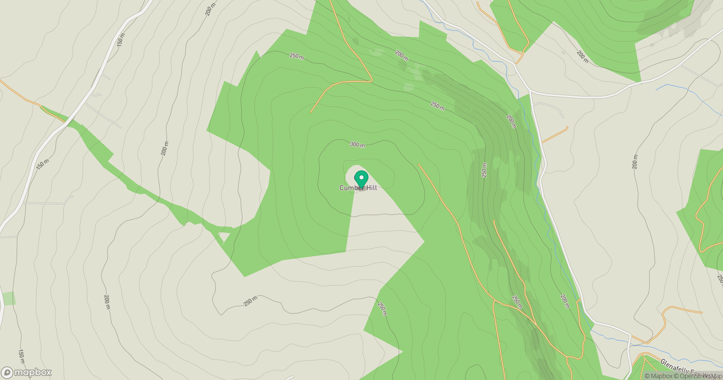
Grid reference: N189021
View on OpenStreetMapOpens a map in a new tab, centred on the hill.
Hills within 30 km
Straight-line distance, not a walking route or confirmation of access.
No comments yet. Be the first.