
Knockadav
Good walks are even better shared.
Overview
Knockadav: A Hidden Gem in the Highlands
Knockadav is a strikingly picturesque Marilyn located in the heart of the Scottish Highlands, boasting an elevation of 514 meters. This mountain may not be the tallest, but its charm and scenic views make it a delightful destination for both seasoned hikers and casual walkers alike.
Geology
The mountain's geology is primarily ancient sedimentary rock, giving it a rugged charm. As you ascend, you will encounter fascinating rocky outcrops and steep faces that tell stories of eons gone by. Keep your eyes peeled for interesting rock formations!
Routes
One of the most popular routes starts from Strathconon, embarking on a gentle incline through rolling hills and vibrant heather landscape. This 6.5 km hike can typically be completed in around 2 hours, making it an ideal choice for a leisurely day out. Just remember, every step counts, and they lead you to breathtaking views!
Summit Features
Upon reaching the summit, you'll be greeted by a modest stone cairn, a perfect endpoint for your adventure. It’s an ideal spot to rest your weary feet and snap a few pictures capturing the panoramic views of the surrounding highlands.
Terrain
Expect a mix of grassy fields and rocky patches, particularly as you approach the summit. Good hiking boots are advised, especially if the weather has been wet—nobody wants to leave a shoe behind in a bog!
Views
The views from the summit are a true highlight, with visibility extending across the A835 towards the Chanonry Point and the majestic peaks of Ben Wyvis. For the best experience, try to visit during late spring or early autumn when the skies are often clearer and the colours of nature are at their most vibrant.
Hazards
As with any highland hike, be prepared for sudden changes in weather. It's Scotland after all! The terrain can be slippery in wet weather, and boggy areas can conceal questionable footing. Proceed with caution and embrace the unpredictable nature of highland adventures!
Access
For your journey to Knockadav, park in a small layby on the A835 accommodating a few vehicles. If you prefer public transport, bus services run from Inverness to Ullapool, with a stop at a nearby junction, although frequency may vary. The nearest town, Garve, is about 10 km away, offering a small shop and cafe for refuelling post-hike.
Facilities
While amenities are limited, Garve provides what you need: a small shop and a charming cafe where you can refuel after conquering Knockadav. A toilet break is certainly in order!
History
The name 'Knockadav' translates from Gaelic to 'hill of the trees', a nod to its verdant surroundings. Though it might not boast a grand history, it remains a cherished spot for local walkers seeking the peace and tranquility of the Highland scenery.
When in the area, don’t forget to take a moment, breathe in the fresh Highland air, and appreciate the natural beauty that is Knockadav.
Happy hiking!
Explore routes near Knockadav
Public walks starting within 80 km of this hill. Nearby does not mean a route reaches the summit; check its map and access before setting out.
No public routes are currently listed within 80 km of Knockadav on Walkmates. This does not mean there are no paths here. Explore the map and check local access information before planning a walk.
Route planning notes
These notes describe possible approaches, not verified navigable routes or permission to cross land. Check current paths, local access rules and conditions before setting out.
East Route from Strathconon
A lovely ascent via rolling hills and heather, presenting a gentle incline that's rewarding for casual hikers.
Make a day of it, together
Find someone to share the walk with, or organise a day out along a route you like.
Hill facts and local notes
Classifications
Elevation
224m
735 ft
Prominence
101m
Coordinates
53.4141, -9.5934
L941416
OS Map
45
At the Summit
The summit boasts a small stone cairn, offering a great spot for a selfie with the Highland panorama in the background.
Terrain & Geology
Composed primarily of ancient sedimentary rocks, Knockadav showcases fascinating geological history with its steep faces and rocky outcrops.
Views & Scenery
From the summit, one can see views across the A835 towards the Chanonry Point and the distant peaks of Ben Wyvis.
History & Heritage
Name Origin
The name 'Knockadav' is derived from the Gaelic term meaning 'hill of the trees', hinting at its lush surroundings.
Historical Significance
While not extensively documented, the area has been a favourite for local walkers seeking solace in nature.
Getting There & Facilities
Check current local access restrictions, parking rules and transport timetables before travelling. These notes do not confirm public access to the summit.
Parking
There is a small layby at the start of the route on the A835, suitable for 3-4 cars.
Public Transport
Buses from Inverness to Ullapool stop at a nearby junction, though service is limited, so plan accordingly.
Nearby Facilities
The nearest facilities are found in Garve, which includes a small shop and a cafe for refreshments and toilets.
Safety Information
Known Hazards
- Potential for sudden weather changes, be mindful of slippery rocks and boggy areas in wet conditions.
General Safety Tips
- Check weather conditions before setting out
- Carry appropriate clothing and equipment
- Let someone know your planned route
- Take a map, compass, and GPS device
- Carry emergency supplies: food, water, first aid kit, torch
Hills
Some common questions about the hills answered
Are there group walks up Knockadav?
Many walkers use Walkmates to join or organise walks with others. You can check for group walks around Knockadav through the maps
Are there other walkers around Knockadav?
Activity varies by location and time, but Walkmates lets you see whether others have shared walks or shown interest in this area. Find other people through the walking friends search walking friends for Knockadav search or of course create your own walk for Knockadav
Can I organise a walk to Knockadav?
Yes. If there aren’t any walks listed already, you can create a walk and make it available for others to join.
If you're signed up to Walkmates, you can create a walk to Knockadav.
How do I find a walk up this hill?
There are often multiple ways to walk this hill, depending on experience and route preference. Walkmates helps you explore walks and routes that others have shared.
Can I suggest a new route up Knockadav?
Yes. You can suggest or create routes to share with others. Walkmates focuses on the social side of walking, so routes are used to help people organise walks and explore areas together, rather than as detailed navigation tools or route libraries.
Other uses really appreciate knowledgeable walkers sharing their routes. Share your favourite route to Knockadav here
The is an error or something incorrect about this hill. How do I let you know?
We always strive to keep the information on Walkmates as accurate as possible. If you find an error, please let us know through the contact form and we'll aim to correct it as quickly as possible
Community Discussion
Comments
Location
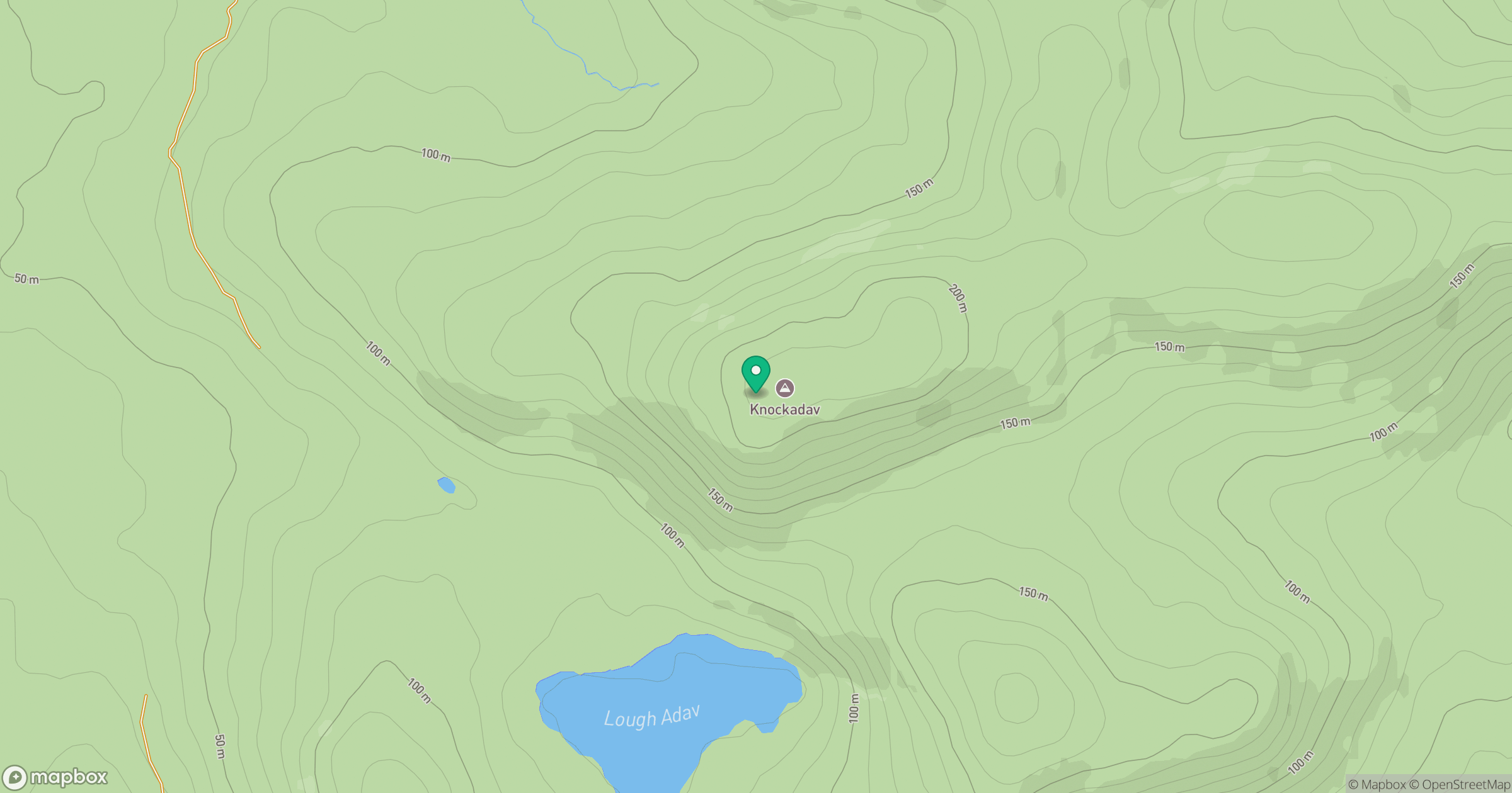
Grid reference: L941416
View on OpenStreetMapOpens a map in a new tab, centred on the hill.
Hills within 30 km
Straight-line distance, not a walking route or confirmation of access.
No comments yet. Be the first.