
Coumsallahaun
Good walks are even better shared.
Overview
Coumsallahaun: A Hiker's Heaven
Nestled within the stunning Knockmealdown Mountains, Coumsallahaun offers both a challenge and an invitation to enjoy nature's beauty. With an elevation of 670 meters (or about the height of a seven-storey building), this mountain is a delightful destination for outdoor enthusiasts.
Geology
Coumsallahaun is primarily composed of sandstone, limestone, and shale. This combination creates a captivating landscape filled with rugged terrain and interesting glacial formations, a remnant of the ice ages that shaped the land.
Routes
A popular route is the Coumsallahaun Loop from Clogheen, which spans approximately 10 kilometers and takes about 3.5 hours to complete. This moderate hike guides you through the scenic landscapes that define this area, ensuring you don’t just hurry to the top - take that selfie at the cairn!
Summit Features
The summit is home to a sturdy stone cairn, a traditional feature for many hills in Ireland. It provides a picturesque spot for a break, and to contemplate your life choices - like why you didn't bring enough snacks!
Terrain Type
Expect a mixture of rocky and grassy ground on your ascent. While there are well-defined paths to follow, you may encounter the occasional boggy patch. Waterproof footwear is advised - unless you fancy an unexpected footbath.
Views
The stunning views from the top are well worth the effort. Expect to see the Slieve Mish Mountains on the horizon and the picturesque Blackwater Valley unfolding below you. The best times for these breathtaking vistas are in Spring and Autumn, when the colours contrast vividly against the skyline.
Hazards
As with any hike in the mountains, be prepared for changing weather conditions. One moment you might be basking in bright sunshine, and the next you could be caught in a rain shower. Make sure to pack layers and keep an eye on the forecast!
Nearby Summits
If you’re feeling adventurous, consider tackling Knockmealdown Mountain, which stands at 794 meters, or Sliabh na mBan at 660 meters. Each provides their own unique views and trails.
Access
Parking is available at the community centre in Clogheen, making it handy to kick off your adventure. Local buses service the area, so you can leave the car behind and rely on public transport if you fancy.
Facilities
You’ll find cafes, shops, and public toilets in Clogheen, perfect for a pre- or post-hike refuel.
History
The name Coumsallahaun is derived from Irish, meaning “hollow of the cathedral”, hinting at its historical significance. This mountain and its surrounding landscapes were once home to ancient Celtic communities, and you might even feel their spirit amongst the hills.
So lace up those boots, pack a picnic, and get ready for an adventure that combines nature, history, and stunning landscapes. Happy hiking!
Explore routes near Coumsallahaun
Public walks starting within 80 km of this hill. Nearby does not mean a route reaches the summit; check its map and access before setting out.
No public routes are currently listed within 80 km of Coumsallahaun on Walkmates. This does not mean there are no paths here. Explore the map and check local access information before planning a walk.
Route planning notes
These notes describe possible approaches, not verified navigable routes or permission to cross land. Check current paths, local access rules and conditions before setting out.
Coumsallahaun Loop from Clogheen
A circular walk starting from the village of Clogheen, this route guides you through scenic landscapes with impressive views from the summit.
Make a day of it, together
Find someone to share the walk with, or organise a day out along a route you like.
Hill facts and local notes
Classifications
Elevation
320m
1,050 ft
Prominence
109m
Coordinates
52.7517, -8.0718
R952667
OS Map
59
At the Summit
The summit features a well-structured stone cairn, which is a great spot for a photo-op and a much-needed breather.
Terrain & Geology
Coumsallahaun is primarily composed of sandstone, limestone, and shale, giving its slopes a rugged appearance. The area also features interesting glacial formations, which tell a story of ancient ice ages.
Views & Scenery
From the summit, you can see the distant Slieve Mish Mountains and the broad sweep of the Blackwater Valley, not to mention the majestic panorama of the surrounding peaks.
History & Heritage
Name Origin
The name Coumsallahaun derives from Irish, meaning ‘hollow of the cathedral’, reflecting its religious significance in ancient Ireland.
Historical Significance
Historically, this region has been a site of settlement since prehistoric times, with evidence of ancient Celtic practices and communities.
Getting There & Facilities
Check current local access restrictions, parking rules and transport timetables before travelling. These notes do not confirm public access to the summit.
Parking
There is parking available at the community centre in Clogheen, providing easy access to the trailhead.
Public Transport
Local bus services run to Clogheen, with connections available from larger towns such as Clonmel and Cahir.
Nearby Facilities
In Clogheen, you will find several cafes and shops for provisions. Public toilets are available at the community centre.
Safety Information
Known Hazards
- Be mindful of the changing weather conditions, as they can turn from sunny to rainy faster than you can say ‘happy hiking’. Additionally, some rocky terrain may be slippery when wet.
General Safety Tips
- Check weather conditions before setting out
- Carry appropriate clothing and equipment
- Let someone know your planned route
- Take a map, compass, and GPS device
- Carry emergency supplies: food, water, first aid kit, torch
Hills
Some common questions about the hills answered
Are there group walks up Coumsallahaun?
Many walkers use Walkmates to join or organise walks with others. You can check for group walks around Coumsallahaun through the maps
Are there other walkers around Coumsallahaun?
Activity varies by location and time, but Walkmates lets you see whether others have shared walks or shown interest in this area. Find other people through the walking friends search walking friends for Coumsallahaun search or of course create your own walk for Coumsallahaun
Can I organise a walk to Coumsallahaun?
Yes. If there aren’t any walks listed already, you can create a walk and make it available for others to join.
If you're signed up to Walkmates, you can create a walk to Coumsallahaun.
How do I find a walk up this hill?
There are often multiple ways to walk this hill, depending on experience and route preference. Walkmates helps you explore walks and routes that others have shared.
Can I suggest a new route up Coumsallahaun?
Yes. You can suggest or create routes to share with others. Walkmates focuses on the social side of walking, so routes are used to help people organise walks and explore areas together, rather than as detailed navigation tools or route libraries.
Other uses really appreciate knowledgeable walkers sharing their routes. Share your favourite route to Coumsallahaun here
The is an error or something incorrect about this hill. How do I let you know?
We always strive to keep the information on Walkmates as accurate as possible. If you find an error, please let us know through the contact form and we'll aim to correct it as quickly as possible
Community Discussion
Comments
Location
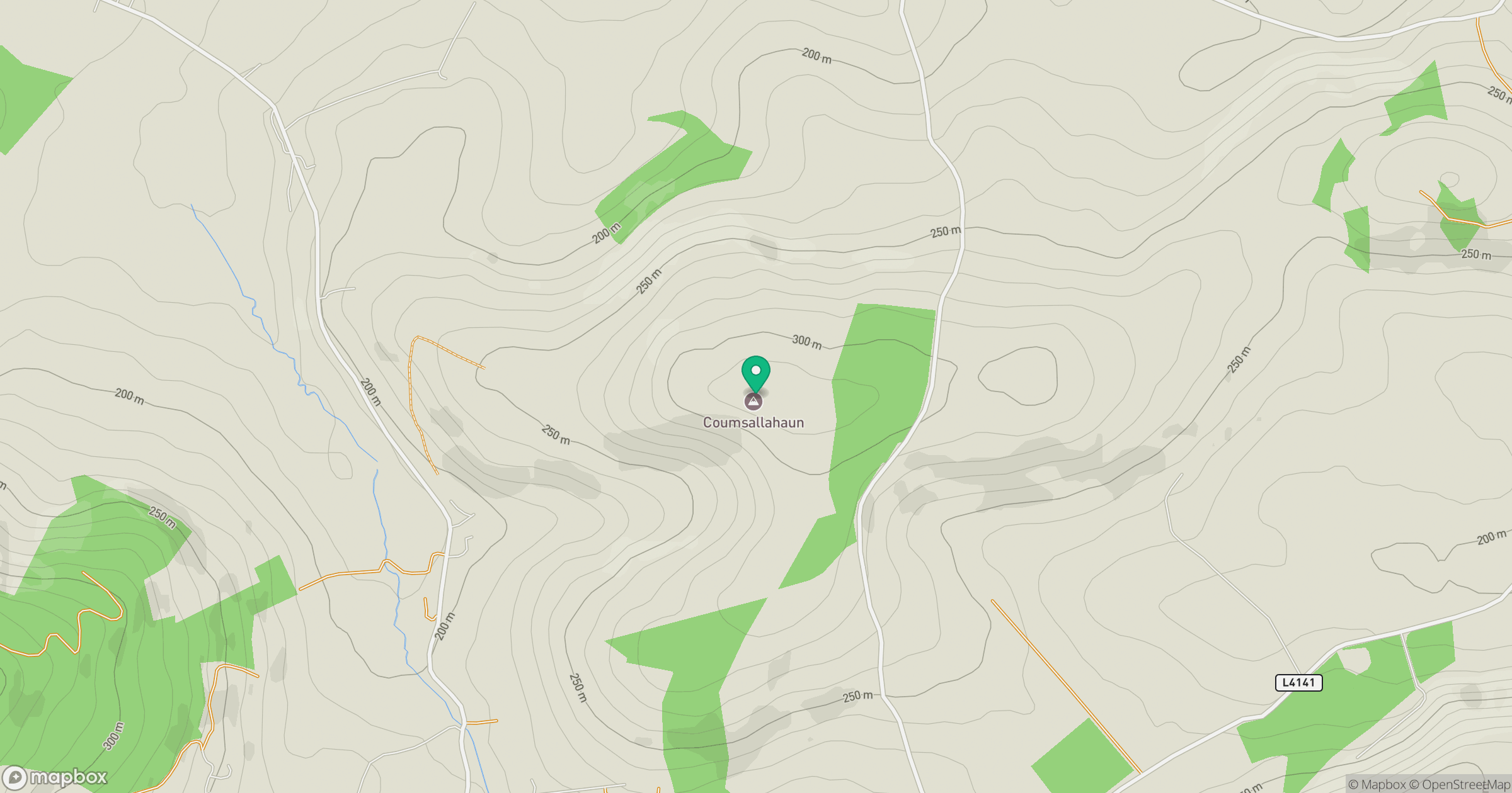
Grid reference: R952667
View on OpenStreetMapOpens a map in a new tab, centred on the hill.
Hills within 30 km
Straight-line distance, not a walking route or confirmation of access.
No comments yet. Be the first.