
Inchimore
Good walks are even better shared.
Overview
Inchimore: A Hidden Gem in the Scottish Highlands
Inchimore, standing proudly at 501 meters, is often overlooked in favour of its mightier neighbours, but don't let its modest height fool you! This Corbett offers a splendid escape for hiking enthusiasts seeking rewarding views and a bit of adventure.
Geology
Inchimore presents a fascinating geological tapestry, primarily formed from granite. This hard rock is why you'll find those characteristic rocky outcrops scattered along the trail. Add in the glacial deposits, remnants of the last Ice Age, and you have a landscape that tells a story of time gone by, quite literally etched in stone.
Routes
The most popular route is the Inchimore Loop. This 10.5 km circuit begins in Croe, taking about 4.5 hours for the average walker. The trail is marked, but keep your wits about you, especially when you encounter rocky sections and the occasional bog — it's not a 'mud bath' in the spa sense!
Summit Features
Reaching the summit reveals a humble yet sturdy stone cairn, perfect for selfies. Don’t be alarmed if you spot a goat or two nearby; they’re usually more interested in munching grass than hikers, but it’s always wise to keep your snacks close!
Terrain Type
The terrain alternates between rocky paths and grassy slopes, with bits of boggy ground to avoid. Good hiking boots will serve you well, ensuring your feet stay dry and your spirit remains high as you navigate the trail.
Views
Once atop Inchimore, the panoramic vistas unfold gloriously. You’ll be treated to views of Loch Awe, the majestic Ben Cruachan, and the rolling hills of the Southern Highlands. For those keen on capturing a postcard-perfect shot, consider hiking around dawn or sunset when the light dances across the landscape beautifully.
Hazards
Be mindful of the rocky terrain; it can be particularly slippery post-rain. Avoid the boggy patches unless you're feeling particularly adventurous; nobody wants to be that hiker who comes back a tad muddier than expected!
Nearby Summits
Inchimore is nestled among several notable neighbours, including:
- Ben Chonzie (931 meters)
- Ben Vorlich (985 meters)
Both present fantastic opportunities for further exploration.
Access
The nearest parking lies just off the A85 at the trailhead, accommodating several vehicles but expect some competition on sunny weekends. For public transport, local buses from Crianlarich can drop you near Croe, but check ahead as services may be scarce.
Taynuilt is the closest town, a pleasant 7 km away, with a café that serves delightful refuelling options after your adventure.
Facilities
After the hike, indulge in a well-deserved treat at the café in Taynuilt—strong coffee and sweet cakes will be waiting for you! Convenient public toilets are also available in the nearby villages.
History
The name 'Inchimore' stems from the Gaelic words meaning 'big island', aptly describing its standing out amid the lush landscape. Historically, it’s been steeped in local folklore, with tales of mountain spirits watching over those who traverse their land.
Prepare well, respect the environment, and engage with fellow hikers—Inchimore promises an adventure that may just steal a piece of your heart. Happy hiking!
Explore routes near Inchimore
Public walks starting within 80 km of this hill. Nearby does not mean a route reaches the summit; check its map and access before setting out.
No public routes are currently listed within 80 km of Inchimore on Walkmates. This does not mean there are no paths here. Explore the map and check local access information before planning a walk.
Route planning notes
These notes describe possible approaches, not verified navigable routes or permission to cross land. Check current paths, local access rules and conditions before setting out.
Inchimore Loop
A circular route starting from the nearby village of Croe, offering a scenic trek to the summit and back.
Make a day of it, together
Find someone to share the walk with, or organise a day out along a route you like.
Hill facts and local notes
Classifications
Elevation
256m
840 ft
Prominence
100m
Coordinates
51.9056, -9.5671
V922737
OS Map
78
At the Summit
The summit is adorned with a small stone cairn that offers a perfect photo op for your hiking scrapbook. Keep an eye out for the occasional curious goat looking for a snack!
Terrain & Geology
Inchimore is primarily composed of granite, which gives rise to its rocky outcrops and distinctive features. The area also showcases some glacial till deposits, revealing the mountain's fascinating geological history.
Views & Scenery
From the summit, enjoy breathtaking views of Loch Awe, Ben Cruachan, and the surrounding glens. On a clear day, you might even spot the distant peaks of the Southern Highlands.
History & Heritage
Name Origin
The name 'Inchimore' is derived from Gaelic, meaning 'big island', likely referring to the mountain standing out in the landscape like an island in a sea of green.
Historical Significance
Inchimore has been part of local folklore and history, often associated with stories of the spirits of the mountains that protect the land.
Getting There & Facilities
Check current local access restrictions, parking rules and transport timetables before travelling. These notes do not confirm public access to the summit.
Parking
The nearest parking area is located at the foot of the Inchimore Loop trail, just off the A85. There’s enough space for several vehicles, but it can get busy on weekends.
Public Transport
Buses run from nearby towns such as Crianlarich to the nearest village of Croe, but check timetables as they can be infrequent.
Nearby Facilities
There's a lovely café in Taynuilt that serves excellent coffee and cakes, perfect for re-fuelling after your trek. Public toilets are available in nearby villages.
Safety Information
Known Hazards
- Rocky terrain can be challenging, especially during wet conditions. Keep an eye out for loose stones and avoid the bogs unless you fancy a 'mud bath'.
General Safety Tips
- Check weather conditions before setting out
- Carry appropriate clothing and equipment
- Let someone know your planned route
- Take a map, compass, and GPS device
- Carry emergency supplies: food, water, first aid kit, torch
Hills
Some common questions about the hills answered
Are there group walks up Inchimore?
Many walkers use Walkmates to join or organise walks with others. You can check for group walks around Inchimore through the maps
Are there other walkers around Inchimore?
Activity varies by location and time, but Walkmates lets you see whether others have shared walks or shown interest in this area. Find other people through the walking friends search walking friends for Inchimore search or of course create your own walk for Inchimore
Can I organise a walk to Inchimore?
Yes. If there aren’t any walks listed already, you can create a walk and make it available for others to join.
If you're signed up to Walkmates, you can create a walk to Inchimore.
How do I find a walk up this hill?
There are often multiple ways to walk this hill, depending on experience and route preference. Walkmates helps you explore walks and routes that others have shared.
Can I suggest a new route up Inchimore?
Yes. You can suggest or create routes to share with others. Walkmates focuses on the social side of walking, so routes are used to help people organise walks and explore areas together, rather than as detailed navigation tools or route libraries.
Other uses really appreciate knowledgeable walkers sharing their routes. Share your favourite route to Inchimore here
The is an error or something incorrect about this hill. How do I let you know?
We always strive to keep the information on Walkmates as accurate as possible. If you find an error, please let us know through the contact form and we'll aim to correct it as quickly as possible
Community Discussion
Comments
Location
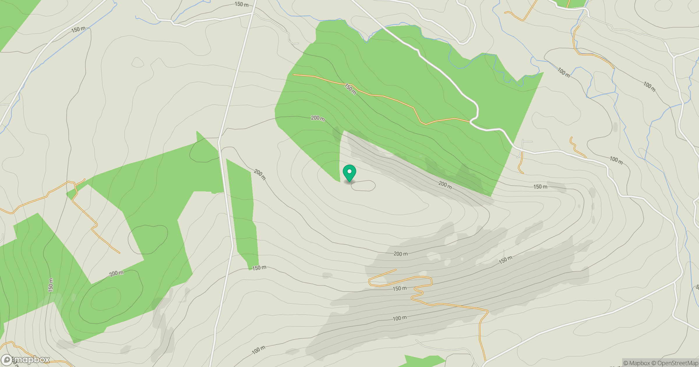
Grid reference: V922737
View on OpenStreetMapOpens a map in a new tab, centred on the hill.
Hills within 30 km
Straight-line distance, not a walking route or confirmation of access.
No comments yet. Be the first.