
Herm
Good walks are even better shared.
Overview
Herm
Nestled within the scenic Northumberland National Park, Herm is a modest yet delightful hill that offers both tranquility and stunning views. The land is steeped in ancient volcanic activity, making it a fascinating site for geology enthusiasts and casual hikers alike.
Geology
The intriguing volcanic rocks of Herm tell a tale of the Earth’s fiery past, leaving behind a rugged terrain that is both resilient and beautiful. The landscape features rolling grassy mounds interspersed with rocky outcrops, creating an inviting prospect for hikers.
Routes
The most popular route for eager adventurers is the Herm Hill Circular Route, a 6.5 km trek that can typically be completed in around 2.5 hours. Although it might require moderate effort, the gentle climbs and descents reward your efforts with breathtaking views.
Summit Features
Upon reaching the summit, you’ll be greeted by a small but reliable cairn and a lovely picnic spot that’s perfect for a bit of rest and refuelling. So pack your sandwiches and enjoy a well-earned break!
Terrain Type
The terrain predominantly consists of grassy patches with rocky bits, allowing a smooth trek interspersed with a few exciting scrambles that keep the journey engaging.
Views
The stunning vistas here enhance the walking experience significantly. On a clear day, the surrounding countryside opens up to reveal the majestic Cheviot Hills, a sight that is certainly worth the uphill effort. For the best views, consider visiting in the spring or autumn, when nature puts on its finest show.
Hazards
As with many outdoor adventures, caution is key. Be mindful of the changing weather conditions, which can turn from sunny to drizzly quicker than you can say 'Where’s my waterproof?'. Slippery paths can be a challenge, especially in winter.
Nearby Summits
If you’re up for more exploration, Cold Law, standing at 215 meters, is a worthy addition to your itinerary. An elevation gain is never a bad thing!
Access
Accessing Herm is relatively straightforward. The nearest parking is in Bellingham, a charming village that buzzes with fellow outdoor enthusiasts. Regular bus service from Newcastle can whisk you away if you'd rather leave the car at home.
Facilities
Bellingham also caters to your post-hike needs with various cafes and convenient toilet facilities, ensuring you’re well-equipped before and after your adventure.
History
The name 'Herm', translating to 'high place', carries significant weight in local culture, reflecting the importance of this hill through the ages. It’s a landmark that has served as a guiding beacon for countless walkers.
Whether you’re a seasoned hiker or just looking for a lovely day out in nature, Herm provides a delightful experience. Lace-up those boots, pack your lunch, and get ready for a day of adventure like no other!
Happy hiking!
Explore routes near Herm
Walks starting near this hill. Open a route to check its map, distance and full itinerary.
Route planning notes
These notes describe possible approaches. Check a route's map and access information when planning your walk.
Herm Hill Circular Route
A delightful circular walk that takes in the natural beauty of Herm.
Make a day of it, together
Find someone to share the walk with, or organise a day out along a route you like.
Hill facts and local notes
Classifications
Elevation
66m
217 ft
Prominence
66m
Coordinates
49.4680, -2.4474
WV400796
At the Summit
The summit features a modest cairn marking the top, with a delightful picnic area nearby for a well-deserved rest after the trek.
Terrain & Geology
Herm is predominantly composed of volcanic rocks, which contribute to its rugged landscape. The area showcases evidence of ancient volcanic activity, lending character to the surrounding environment.
Views & Scenery
From the summit, one can catch a glimpse of the Cheviot Hills in the distance, and on a clear day, the broad expanse of the Northumberland countryside unfolds beautifully.
History & Heritage
Name Origin
The name 'Herm' is derived from the Old English term for 'high place', aptly describing its elevated position within the landscape.
Historical Significance
Herm has been a significant landmark for generations, with its location serving as a navigation point for local walkers and adventurers.
Getting There & Facilities
Parking
Parking is available at the nearby village of Bellingham, where spaces are often filled with eager hikers and their four-wheeled companions.
Public Transport
Bellingham can be accessed via the Arriva bus services from Newcastle, offering convenient connections for those wishing to leave the car behind.
Nearby Facilities
Bellingham provides a selection of cafes and shops, in addition to public toilets, ensuring you won't be caught short after your hike.
Safety Information
Known Hazards
- Variable weather conditions can make paths slippery and visibility poor, especially in winter. Always carry sufficient gear.
General Safety Tips
- Check weather conditions before setting out
- Carry appropriate clothing and equipment
- Let someone know your planned route
- Take a map, compass, and GPS device
- Carry emergency supplies: food, water, first aid kit, torch
Hills
Some common questions about the hills answered
Are there group walks up Herm?
Many walkers use Walkmates to join or organise walks with others. You can check for group walks around Herm through the maps
Are there other walkers around Herm?
Activity varies by location and time, but Walkmates lets you see whether others have shared walks or shown interest in this area. Find other people through the walking friends search walking friends for Herm search or of course create your own walk for Herm
Can I organise a walk to Herm?
Yes. If there aren’t any walks listed already, you can create a walk and make it available for others to join.
If you're signed up to Walkmates, you can create a walk to Herm.
How do I find a walk up this hill?
There are often multiple ways to walk this hill, depending on experience and route preference. Walkmates helps you explore walks and routes that others have shared.
Can I suggest a new route up Herm?
Yes. You can suggest or create routes to share with others. Walkmates focuses on the social side of walking, so routes are used to help people organise walks and explore areas together, rather than as detailed navigation tools or route libraries.
Other uses really appreciate knowledgeable walkers sharing their routes. Share your favourite route to Herm here
The is an error or something incorrect about this hill. How do I let you know?
We always strive to keep the information on Walkmates as accurate as possible. If you find an error, please let us know through the contact form and we'll aim to correct it as quickly as possible
Community Discussion
Comments
Location
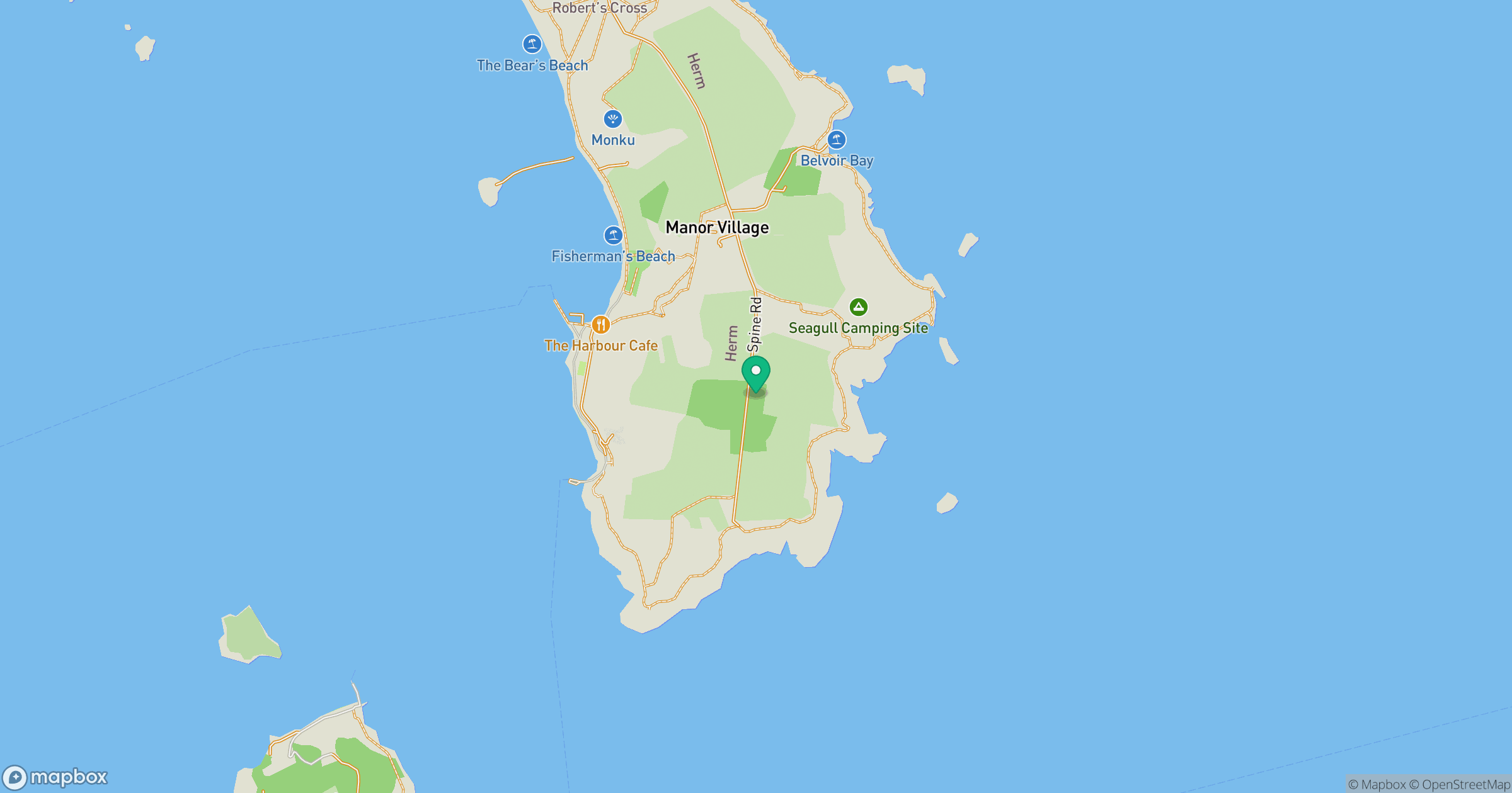
Grid reference: WV400796
View on OpenStreetMapOpens a map in a new tab, centred on the hill.



No comments yet. Be the first.