

Glennamong
Good walks are even better shared.
Overview
Glennamong: A Hiker's Delight
Welcome to Glennamong, proudly standing at a height of 756 meters within the stunning Bluestack Mountains of County Donegal. This peak is not just a dot on the map; it’s a treasure waiting to be explored!
Geology
The geological composition of Glennamong reveals a rich tapestry of granite and schist created millions of years ago by tectonic forces. This rocky terrain has been sculpted by glacial activity, presenting a rugged beauty that attracts geologists and climbers alike. Just be careful not to dig too deep - you might disturb a rock's long-lost nap!
Routes
One of the most popular routes is the Glennamong Loop. It covers approximately 10.5 km, taking around 4.5 hours to complete. This moderate trail is perfect for anyone who wants to enjoy the great outdoors without being sent back to the drawing board on their map skills. Just remember to wear sturdy boots - the terrain does have its rocky moments!
Summit Features
At the summit, adventurers are greeted with a modest stone cairn, a symbol of successful climbs and a landmark for wayward souls! You’ll find the views highly rewarding, providing excellent opportunities for that coveted summit selfie.
Terrain
Prepare for a mix of rocky outcrops and grassy slopes. Oh, and don’t forget the boggy patches, especially after rain; they’re just nature’s way of keeping you on your toes (or trainers!)
Views
The views from Glennamong are simply breathtaking. Look out over the Bluestack Mountains and Lough Eske, stretching out under the vast sky. For the best panoramic sights, late spring and early autumn are your golden tickets. Just keep an eye out for clouds - they can be sneaky!
Hazards
As exhilarating as it is to hike Glennamong, do keep in mind the potential for sudden weather changes. The Irish sky is famous for its moods; one minute it’s sunny, and the next you’re deep in fog. And beware of those slippery rocks!
Nearby Summits
Feeling ambitious? Nearby summits like Bincleave Mountain (737 m) and the sweeping beauty of Slieve League (601 m) are worth considering. Just remember to pack those extra snacks; a hiker’s gotta keep their energy up!
Access
Getting to Glennamong is relatively straightforward. Ample parking is available near the starting point in Fintown, but arrive early on weekends to secure a spot. If you prefer not to drive, local bus services from Donegal town can get you close, though they might not run as frequently as you’d like!
Facilities
While there are no facilities on the mountain itself, Fintown boasts a charming café to help you refuel post-hike. A slice of cake never tasted so good after a long walk!
History
The name Glennamong translates to 'the glen of the sows', linking its heritage to the wildlife that once roamed here. Whether you believe in legendary treasures or not, the Bluestack Mountains are riddled with tales that have woven their charm into the fabric of Donegal.
In conclusion, Glennamong combines adventure, stunning vistas, and a dash of Irish folklore. Your next hiking adventure beckons - don’t forget the camera!
Happy hiking!
Explore routes near Glennamong
Public walks starting within 80 km of this hill. Nearby does not mean a route reaches the summit; check its map and access before setting out.
No public routes are currently listed within 80 km of Glennamong on Walkmates. This does not mean there are no paths here. Explore the map and check local access information before planning a walk.
Route planning notes
These notes describe possible approaches, not verified navigable routes or permission to cross land. Check current paths, local access rules and conditions before setting out.
Glennamong Loop
This popular circular route starting from the eastern slopes is ideal for hikers looking to enjoy a blend of scenic views and moderate terrain.
Make a day of it, together
Find someone to share the walk with, or organise a day out along a route you like.
Photo Gallery
View all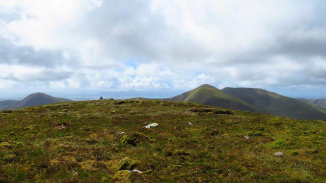 Photo could not load
F9105 : On summit of Glennamong - view southwest to Corr na Binne and Maol Rua
Colin Park
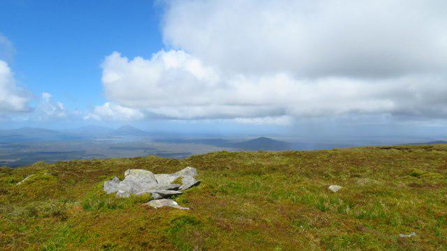 Photo could not load
F9105 : Summit cairn on Glennamong - view west towards Achill Island
Colin Park
Hill facts and local notes
Classifications
Elevation
628m
2,060 ft
Prominence
139m
Coordinates
53.9901, -9.6595
F912058
OS Map
23 30
At the Summit
At the summit, you’ll find a modest stone cairn and sweeping views that offer a perfect backdrop for a summit selfie.
Terrain & Geology
The area is primarily composed of granite and schist, which provides a fascinating insight into the region's geological history, showcasing rugged terrain formed by ancient glacial activity.
Views & Scenery
From the summit, enjoy views of the breathtaking Bluestack Mountains, Lough Eske, and, on a clear day, even the Wild Atlantic Way.
History & Heritage
Name Origin
The name Glennamong derives from the Irish 'Glean na Mong,' which roughly translates to 'the glen of the sows,' possibly referencing wildlife that once inhabited the region.
Historical Significance
The Bluestack Mountains hold cultural significance in local folklore, with tales of ancient tribes and hidden treasures that spark the imagination.
Getting There & Facilities
Check current local access restrictions, parking rules and transport timetables before travelling. These notes do not confirm public access to the summit.
Parking
Parking is available at the start of the trail near the small village of Fintown. The car park is free but fills up quickly on weekends.
Public Transport
Local bus services can be accessed from Donegal town, though service frequency can be variable.
Nearby Facilities
There are no facilities directly on the mountain. However, Fintown has a lovely café where you can fuel up before or after your hike.
Safety Information
Known Hazards
- Beware of sudden weather changes, especially fog and rain which can obscure paths. Watch for slippery rocks and boggy areas.
General Safety Tips
- Check weather conditions before setting out
- Carry appropriate clothing and equipment
- Let someone know your planned route
- Take a map, compass, and GPS device
- Carry emergency supplies: food, water, first aid kit, torch
Hills
Some common questions about the hills answered
Are there group walks up Glennamong?
Many walkers use Walkmates to join or organise walks with others. You can check for group walks around Glennamong through the maps
Are there other walkers around Glennamong?
Activity varies by location and time, but Walkmates lets you see whether others have shared walks or shown interest in this area. Find other people through the walking friends search walking friends for Glennamong search or of course create your own walk for Glennamong
Can I organise a walk to Glennamong?
Yes. If there aren’t any walks listed already, you can create a walk and make it available for others to join.
If you're signed up to Walkmates, you can create a walk to Glennamong.
How do I find a walk up this hill?
There are often multiple ways to walk this hill, depending on experience and route preference. Walkmates helps you explore walks and routes that others have shared.
Can I suggest a new route up Glennamong?
Yes. You can suggest or create routes to share with others. Walkmates focuses on the social side of walking, so routes are used to help people organise walks and explore areas together, rather than as detailed navigation tools or route libraries.
Other uses really appreciate knowledgeable walkers sharing their routes. Share your favourite route to Glennamong here
The is an error or something incorrect about this hill. How do I let you know?
We always strive to keep the information on Walkmates as accurate as possible. If you find an error, please let us know through the contact form and we'll aim to correct it as quickly as possible
Community Discussion
Comments
Location
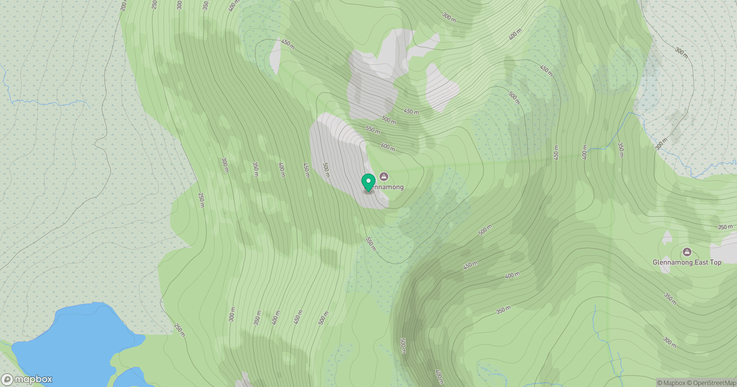
Grid reference: F912058
View on OpenStreetMapOpens a map in a new tab, centred on the hill.
Hills within 30 km
Straight-line distance, not a walking route or confirmation of access.
No comments yet. Be the first.