
Eagle Hill
Good walks are even better shared.
Overview
Eagle Hill: A Hidden Gem of the Pennines
Nestled within the rugged beauty of Greater Manchester, Eagle Hill may not hold the record for being the highest peak, but it certainly packs a punch when it comes to scenic views and hiking charm.
Elevation and Prominence
With an elevation of 100 meters, it's not a giant by any means, but its prominence of 50 meters makes it feel quite elevated when you’re standing atop!
Geological Features
The geology of Eagle Hill is primarily millstone grit, a sturdy rock that can create some interesting textures underfoot. It’s the same kind of stone that provides the foundation for many local buildings, so you're walking in the footsteps of history.
Routes to the Summit
One of the most popular routes is the Eagle Hill Circular Route, a moderate hike covering around 5 km. It typically takes about 2.5 hours to complete, allowing plenty of time for a snack break at the summit—best eaten while admiring views that are almost as tasty as your sandwich.
Summit Features
At the top, you’ll find a small stone cairn, which not only marks the summit but also serves as a reminder that some hikers prefer to “stone” a fellow adventurer. Just remember, the only rocks you should be stacking are the ones already arranged!
Terrain and Surroundings
The terrain varies from grassy fields to some rocky outcrops which can be a little tricky, so proper footwear is advised. There’s nothing like a bit of a scramble to keep you on your toes!
Views
The vistas from the summit are spectacular! On clear days, the rolling Pennines come into view, and don’t be surprised if you catch a glimpse of Manchester peeking through the distance, challenging you to consider its urban appeal.
Best Times to Hike
Spring and Autumn are particularly lovely here, with vibrant flowers in the springtime and stunning foliage in the autumn.
Hazards to Consider
As with many hikes, beware of the slippery rocks on the ascent, especially if they've had a good soaking from recent rain. And let's not forget about the local sheep—friendly as they may be, they don’t shy away from munching on your gear!
Nearby Summits
If you're feeling adventurous, why not pop over to Mount Burbage or Shining Tor? Both are within a short drive and offer their own unique views and trails.
Access Information
Finding your way to Eagle Hill is straightforward. The nearest parking is conveniently located at the Eagle Hill car park, just a short walk from the trailhead. For public transport users, there’s a tram stop about 2 km away, making it accessible if you've left the car at home.
Facilities
In addition to the car park, you'll find public toilets and a café in Greenfield, perfect for that well-deserved slice of cake post-hike.
A Final Thought
Eagle Hill may be small, but it’s mighty in spirit. Whether you’re after a gentle stroll or a family adventure, this wonderful little hill is waiting for you. So, lace up those hiking boots, pack some sandwiches, and go explore!
Explore routes near Eagle Hill
Public walks starting within 80 km of this hill. Nearby does not mean a route reaches the summit; check its map and access before setting out.
No public routes are currently listed within 80 km of Eagle Hill on Walkmates. This does not mean there are no paths here. Explore the map and check local access information before planning a walk.
Route planning notes
These notes describe possible approaches, not verified navigable routes or permission to cross land. Check current paths, local access rules and conditions before setting out.
Eagle Hill Circular Route
A delightful circular route that takes you up Eagle Hill and wraps around the surrounding countryside, offering a variety of sights.
Make a day of it, together
Find someone to share the walk with, or organise a day out along a route you like.
Hill facts and local notes
Classifications
Elevation
223m
732 ft
Prominence
134m
Coordinates
51.6657, -10.0777
V563479
OS Map
84
At the Summit
The summit features a small stone cairn and sweeping views of the surrounding area, making it a perfect spot for a picnic or a quick selfie.
Terrain & Geology
Eagle Hill is predominantly made up of millstone grit, a typical stone for this region, which is both durable and provides a rugged terrain.
Views & Scenery
From the summit, you can see far into the Pennines and on a clear day, Manchester is just about visible, full of its urban sprawl.
History & Heritage
Name Origin
The name 'Eagle Hill' is believed to originate from the area being a nesting ground for eagles in centuries past.
Historical Significance
Historically, the hill was often used for local events and gatherings, making it a focal point for the surrounding villages.
Getting There & Facilities
Check current local access restrictions, parking rules and transport timetables before travelling. These notes do not confirm public access to the summit.
Parking
The nearest parking is at the Eagle Hill car park, located just 500 meters from the start of the trail.
Public Transport
The nearest tram stop is about 2 km away, with regular services from Manchester city centre.
Nearby Facilities
There are public toilets at the Eagle Hill car park and a local café in Greenfield for a hearty post-hike treat.
Safety Information
Known Hazards
- Be cautious of slippery rocks in wet conditions, and watch your step as the terrain can be uneven in places. Always keep an eye out for the sheep!
General Safety Tips
- Check weather conditions before setting out
- Carry appropriate clothing and equipment
- Let someone know your planned route
- Take a map, compass, and GPS device
- Carry emergency supplies: food, water, first aid kit, torch
Hills
Some common questions about the hills answered
Are there group walks up Eagle Hill?
Many walkers use Walkmates to join or organise walks with others. You can check for group walks around Eagle Hill through the maps
Are there other walkers around Eagle Hill?
Activity varies by location and time, but Walkmates lets you see whether others have shared walks or shown interest in this area. Find other people through the walking friends search walking friends for Eagle Hill search or of course create your own walk for Eagle Hill
Can I organise a walk to Eagle Hill?
Yes. If there aren’t any walks listed already, you can create a walk and make it available for others to join.
If you're signed up to Walkmates, you can create a walk to Eagle Hill.
How do I find a walk up this hill?
There are often multiple ways to walk this hill, depending on experience and route preference. Walkmates helps you explore walks and routes that others have shared.
Can I suggest a new route up Eagle Hill?
Yes. You can suggest or create routes to share with others. Walkmates focuses on the social side of walking, so routes are used to help people organise walks and explore areas together, rather than as detailed navigation tools or route libraries.
Other uses really appreciate knowledgeable walkers sharing their routes. Share your favourite route to Eagle Hill here
The is an error or something incorrect about this hill. How do I let you know?
We always strive to keep the information on Walkmates as accurate as possible. If you find an error, please let us know through the contact form and we'll aim to correct it as quickly as possible
Community Discussion
Comments
Location
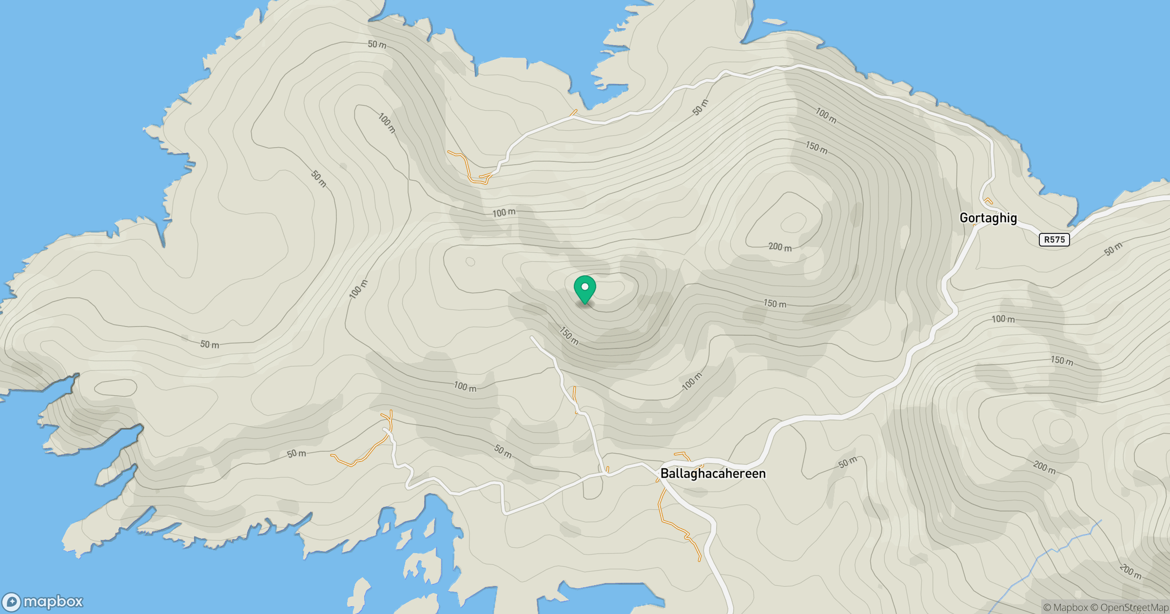
Grid reference: V563479
View on OpenStreetMapOpens a map in a new tab, centred on the hill.
Hills within 30 km
Straight-line distance, not a walking route or confirmation of access.
Knocknagallaun
376m
Knockoura [Cnoc Cumhura]
488m
An Rath [Eagle Hill]
155m
Miskish Mountain [Mioscais]
386m
Sliabh Chathair na Gaoithe [Cahernageeha Mountain]
499m
No comments yet. Be the first.