

Cnoc Bhuirgh
Good walks are even better shared.
NF9181 : Lazy Beds on Cnoc Bhuirgh
Stephen Darlington Photo source
Overview
Cnoc Bhuirgh: A Hidden Gem in the Scottish Highlands
Nestled within the breathtaking Scottish Highlands, Cnoc Bhuirgh is a delightful Marilyn that promises both adventure and scenic splendour. Standing at an elevation of 220 meters, it's a perfect outing for families and seasoned hikers alike.
Geology
Cnoc Bhuirgh's intriguing geological heritage dates back to ancient volcanic activity. The mountain's rugged terrain features remnants of volcanic rock and gives it an intriguing character that geology buffs will adore. Keep an eye out for the erosion patterns and small streams that twist their way through the landscape.
Routes
One of the most popular trails to the summit is the Cnoc Bhuirgh Circular Route, a moderate 7.5 km trek starting from the village of Ardgour. This route takes you through lush glens and provides views of sparkling streams. It typically takes about 3.5 hours to complete, so don’t forget to pack a picnic for your well-deserved summit break!
Summit Features
When you finally reach the summit, you’re greeted by a simple yet majestic cairn—a perfect spot to snap those all-important selfies. The views from the top are phenomenal! With sights of Loch Linnhe and the surrounding mountains, it’s a feast for the eyes and quite the reward after your hike.
Terrain Type
The mountain's terrain varies between grassy slopes and rocky outcrops. Be prepared for the occasional boggy patch that can catch unprepared hikers off guard. Walking boots are highly recommended!
Views
The vistas from Cnoc Bhuirgh are nothing short of breathtaking. On a clear day, you can revel in the beauty of Loch Linnhe and the striking Morvern hills. For the best views, consider visiting in late spring or early autumn—just when the setting sun paints the landscape in vibrant colours.
Hazards
As with any mountain hike, it’s essential to keep safety in mind. Weather can change rapidly, and paths may become slippery after rain. Always check forecasts before heading out and remain cautious, especially in boggy areas that may resemble innocent grassland but actually want to swallow your wellies whole.
Access
Accessing Cnoc Bhuirgh is relatively straightforward. The nearest parking is available in the quaint village of Ardgour, making it convenient for those driving up. If you're reliant on public transport, do note that options are limited, and the closest town, Fort William, is about 15 miles away.
Facilities
Given its mountain status, don’t expect any facilities on the trail—bring your snacks, water, and all the essentials. However, Fort William provides ample opportunities for refreshments, with plenty of cafes and shops waiting to cater to your post-hike hunger.
History
The name 'Cnoc Bhuirgh' or 'Hill of the Gorse' is steeped in Scottish Gaelic heritage, reflecting the region's natural flora. This area has been settled for thousands of years; numerous archaeological sites suggest a rich tapestry of human history.
So, whether you’re looking for an enjoyable family hike or a challenging day out, Cnoc Bhuirgh offers a delightful blend of nature, history, and stunning views—making it a lovely addition to any Highland adventure.
Happy hiking!
Explore routes near Cnoc Bhuirgh
Walks starting near this hill. Open a route to check its map, distance and full itinerary.
Berneray Community Hall to the beautiful beach
View route
Beautiful private beach walk Isle of Harris
View route
Dun Mhulan Broch Quick Walk
View route
Route planning notes
These notes describe possible approaches. Check a route's map and access information when planning your walk.
Cnoc Bhuirgh Circular Route
This pleasant circular route starts from the village of Ardgour, weaving through scenic glens and alongside tranquil streams before ascending to the summit of Cnoc Bhuirgh.
Make a day of it, together
Find someone to share the walk with, or organise a day out along a route you like.
Photo Gallery
View all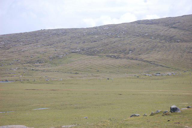 Photo could not load
NF9181 : Lazy Beds on Cnoc Bhuirgh
Stephen Darlington
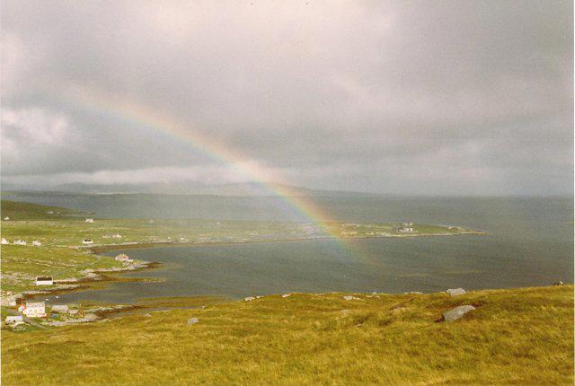 Photo could not load
NF9181 : Cnoc Bhuirgh
Richard Webb
Hill facts and local notes
Classifications
Elevation
85m
279 ft
Prominence
70m
Coordinates
57.7162, -7.1796
NF916814
OS Map
18
Explorer: 454E
At the Summit
The summit features a modest cairn marking the top, providing a panoramic view encompassing Loch Linnhe and the surrounding peaks, perfect for a celebratory snack break.
Terrain & Geology
Cnoc Bhuirgh is primarily composed of ancient volcanic rock, providing a rich tapestry for geological enthusiasts. The rugged features of the mountain reflect its volcanic origins, with scattered remnants of pyroclastic deposits.
Views & Scenery
From the summit, one can gaze upon the stunning Loch Linnhe, the majestic peaks of Morvern, and the rugged scenery of the surrounding Highlands.
History & Heritage
Name Origin
The name 'Cnoc Bhuirgh' translates to 'Hill of the Gorse' in Scottish Gaelic, a nod to the vibrant yellow gorse that flourishes in the area.
Historical Significance
Historically, the area around Cnoc Bhuirgh has been inhabited for thousands of years, with numerous archaeological sites hinting at its rich cultural heritage.
Getting There & Facilities
Parking
A small car park is located at the start of the route in Ardgour, accommodating approximately 10-12 vehicles. It’s advisable to arrive early during peak season.
Public Transport
Transport for the area is limited. The nearest bus route runs from Fort William to Ardgour approximately three times a day.
Nearby Facilities
There are no facilities on the mountain itself. Visitors should take packed lunches and ample water. The nearest facilities are located in Fort William, which boasts a range of cafes, shops, and public toilets.
Safety Information
Known Hazards
- Beware of sudden weather changes, as conditions can turn from sunny to stormy in the blink of an eye. The paths can be slippery after rainfall, particularly in boggy areas.
General Safety Tips
- Check weather conditions before setting out
- Carry appropriate clothing and equipment
- Let someone know your planned route
- Take a map, compass, and GPS device
- Carry emergency supplies: food, water, first aid kit, torch
Hills
Some common questions about the hills answered
Are there group walks up Cnoc Bhuirgh?
Many walkers use Walkmates to join or organise walks with others. You can check for group walks around Cnoc Bhuirgh through the maps
Are there other walkers around Cnoc Bhuirgh?
Activity varies by location and time, but Walkmates lets you see whether others have shared walks or shown interest in this area. Find other people through the walking friends search walking friends for Cnoc Bhuirgh search or of course create your own walk for Cnoc Bhuirgh
Can I organise a walk to Cnoc Bhuirgh?
Yes. If there aren’t any walks listed already, you can create a walk and make it available for others to join.
If you're signed up to Walkmates, you can create a walk to Cnoc Bhuirgh.
How do I find a walk up this hill?
There are often multiple ways to walk this hill, depending on experience and route preference. Walkmates helps you explore walks and routes that others have shared.
Can I suggest a new route up Cnoc Bhuirgh?
Yes. You can suggest or create routes to share with others. Walkmates focuses on the social side of walking, so routes are used to help people organise walks and explore areas together, rather than as detailed navigation tools or route libraries.
Other uses really appreciate knowledgeable walkers sharing their routes. Share your favourite route to Cnoc Bhuirgh here
The is an error or something incorrect about this hill. How do I let you know?
We always strive to keep the information on Walkmates as accurate as possible. If you find an error, please let us know through the contact form and we'll aim to correct it as quickly as possible
Community Discussion
Comments
Location
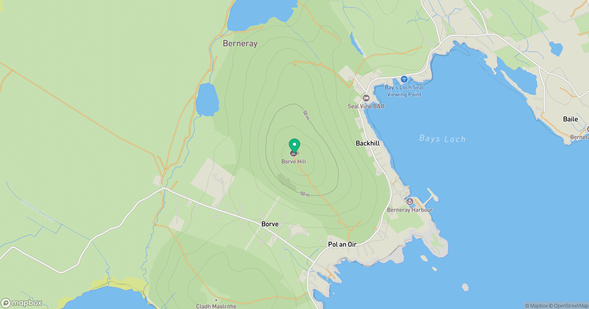
Grid reference: NF916814
View on OpenStreetMapOpens a map in a new tab, centred on the hill.
No comments yet. Be the first.