
Carrafull
Good walks are even better shared.
Overview
Explore Carrafull
Carrafull stands tall at 640 meters in the heart of the Scottish Highlands, a Marilyn that beckons hikers with its stunning vistas and rugged beauty. This mountain is not just a bump in the road; it's a delightful journey waiting for the adventurous spirit.
Geology
The rock formations of Carrafull are primarily granite and schist, remnants of ancient geological forces that shaped the Highlands millions of years ago. The granite outcrops are a climber's delight, while the schist offers a more delicate landscape that introduces wild flora and fauna along the way.
Routes
The popular Coire an t-Sneachda Route covers 8 km of moderate terrain, making it suitable for most hikers who have a reasonable level of fitness. Be prepared for a mix of rocky paths and lush grassy trails, noting that some sections can become boggy, especially after rainfall. Always keep an eye on the weather; it can change faster than a cat can lick its ear!
Summit Features
Upon reaching the summit, you'll be greeted by a grand granite cairn, a tribute to all those who have trekked before you. It's a perfect spot to snap a photo or enjoy your lunch while playing 'spot the landmark' with your pals.
Views
On a clear day, the view from Carrafull will leave you breathless (in a good way!). You can catch a glimpse of Ben Nevis looming majestically in the distance and the shimmering waters of Loch Ness. Late spring and early autumn offer the best visibility, so plan your visit accordingly.
Hazards
While Carrafull is inviting, it's essential to be aware of the potential hazards. Loose rocks and sudden shifts in weather can challenge even seasoned hikers. Always wear appropriate gear and carry the essentials to ensure a safe journey.
Nearby Summits
If you're feeling adventurous, consider extending your hiking journey to nearby peaks like Ben Nevis.
Access
To access Carrafull, you can find parking near the start of the Coire an t-Sneachda trail, just off the A82 road. For those relying on public transport, local buses from Fort William will get you to the trailhead.
Facilities
Post-hike, you can relax in one of Fort William's many cafes, where a warm cuppa awaits to refuel your energy.
History
Carrafull’s name, derived from Gaelic, evokes stories of yore, entwining climbers with the rich heritage of the Highlands. It is a mountain steeped in history and tales of adventure, from clan skirmishes to the echoes of the Jacobite era.
Packing your hiking boots for Carrafull is sure to make for a memorable outing. Remember: the mountains are calling, and you must go!
Explore routes near Carrafull
Public walks starting within 80 km of this hill. Nearby does not mean a route reaches the summit; check its map and access before setting out.
No public routes are currently listed within 80 km of Carrafull on Walkmates. This does not mean there are no paths here. Explore the map and check local access information before planning a walk.
Route planning notes
These notes describe possible approaches, not verified navigable routes or permission to cross land. Check current paths, local access rules and conditions before setting out.
Coire an t-Sneachda Route
This route takes you through the scenic Coire an t-Sneachda, offering stunning views of the surrounding peaks and a well-defined trail to the summit.
Make a day of it, together
Find someone to share the walk with, or organise a day out along a route you like.
Hill facts and local notes
Classifications
Elevation
269m
883 ft
Prominence
160m
Coordinates
54.1580, -9.7305
F870246
OS Map
23
At the Summit
The summit features a large granite cairn and a rocky plateau, ideal for enjoying a well-deserved snack while belting out your best mountain ballad.
Terrain & Geology
Carrafull is primarily composed of granite and schist rock, formed during the Caledonian orogeny. The rugged terrain gives the mountain its distinctive character, with rocky outcrops and boulder fields.
Views & Scenery
From the summit, you can see the majestic Ben Nevis, the sprawling expanse of Loch Ness, and the peaks of Glencoe.
History & Heritage
Name Origin
The name Carrafull is thought to derive from old Gaelic, meaning 'the place of the hollow', referencing the mountain's unique topography.
Historical Significance
Historically, the area is rich in tales of clan battles and was a strategic area during the Jacobite uprisings.
Getting There & Facilities
Check current local access restrictions, parking rules and transport timetables before travelling. These notes do not confirm public access to the summit.
Parking
There is a small car park at the start of the Coire an t-Sneachda trail, located approximately 3 km from the A82 road.
Public Transport
Local buses run from Fort William to the trailhead during peak season.
Nearby Facilities
Fort William offers a variety of cafes, restaurants, and toilet facilities for tired hikers. Remember, coffee before the climb, not after!
Safety Information
Known Hazards
- Loose rocks on the ascent, unpredictable weather, and boggy ground can pose risks. Make sure to wear appropriate footwear and carry necessary gear.
General Safety Tips
- Check weather conditions before setting out
- Carry appropriate clothing and equipment
- Let someone know your planned route
- Take a map, compass, and GPS device
- Carry emergency supplies: food, water, first aid kit, torch
Hills
Some common questions about the hills answered
Are there group walks up Carrafull?
Many walkers use Walkmates to join or organise walks with others. You can check for group walks around Carrafull through the maps
Are there other walkers around Carrafull?
Activity varies by location and time, but Walkmates lets you see whether others have shared walks or shown interest in this area. Find other people through the walking friends search walking friends for Carrafull search or of course create your own walk for Carrafull
Can I organise a walk to Carrafull?
Yes. If there aren’t any walks listed already, you can create a walk and make it available for others to join.
If you're signed up to Walkmates, you can create a walk to Carrafull.
How do I find a walk up this hill?
There are often multiple ways to walk this hill, depending on experience and route preference. Walkmates helps you explore walks and routes that others have shared.
Can I suggest a new route up Carrafull?
Yes. You can suggest or create routes to share with others. Walkmates focuses on the social side of walking, so routes are used to help people organise walks and explore areas together, rather than as detailed navigation tools or route libraries.
Other uses really appreciate knowledgeable walkers sharing their routes. Share your favourite route to Carrafull here
The is an error or something incorrect about this hill. How do I let you know?
We always strive to keep the information on Walkmates as accurate as possible. If you find an error, please let us know through the contact form and we'll aim to correct it as quickly as possible
Community Discussion
Comments
Location
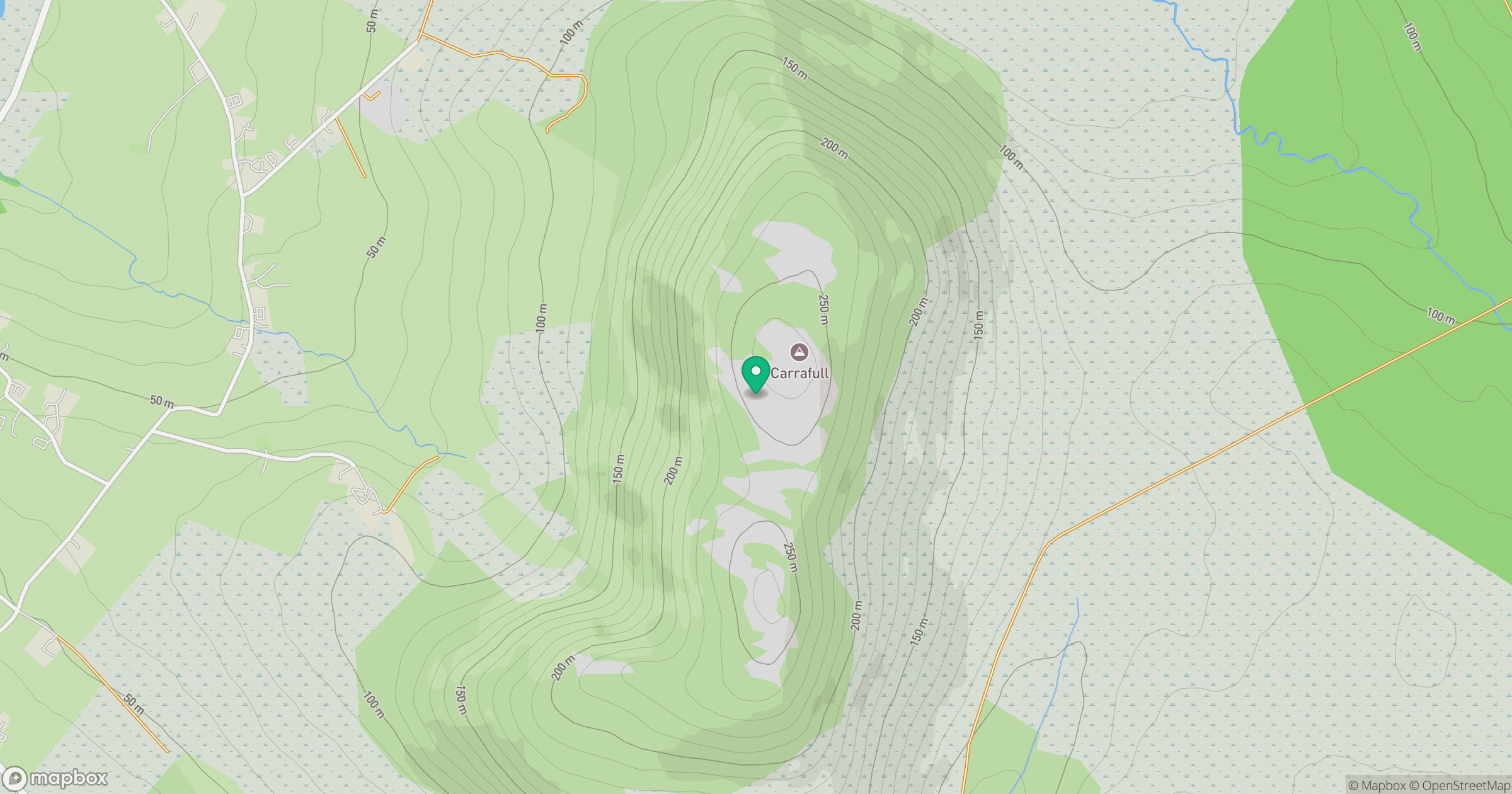
Grid reference: F870246
View on OpenStreetMapOpens a map in a new tab, centred on the hill.
Hills within 30 km
Straight-line distance, not a walking route or confirmation of access.
No comments yet. Be the first.