

Carn Marth
Good walks are even better shared.
SW7140 : Open Air Theatre - Carn Marth
Pete Cruse Photo source
Overview
Carn Marth
Nestled in the heart of Cornwall, Carn Marth stands proud at 265 meters, offering hikers a delightful jaunt with a splash of history and geology. Known as a Marilyn, it may not be the highest mountain around, but it certainly packs a punch in beauty and charm.
Geology
Carn Marth is predominantly granite, a rock type that has seen more than its fair share of geological drama. The boulders and crags at the summit provide excellent opportunities for rock enthusiasts and outdoor photographers alike to explore its ancient story. Being surrounded by softer rocks, the area boasts fertile soils that support a variety of flora and fauna, making it a prime spot for nature lovers.
Access
Getting to Carn Marth is as easy as pie. You can park at a small area near the village of Stithians, where there's even a pub to celebrate your conquest of the summit. Buses regularly trundle through from nearby towns like Redruth and Falmouth, so whether you’re driving or riding the bus, you won’t be left in the dust. The closest bustling town to grab a bite afterward is Falmouth, about 8 miles away.
Routes
The Carn Marth Circular route is a fabulous choice for everyone who fancies a gentle walk through picturesque farmland, culminating in splendid views. It spans about 6 km and typically takes around two hours to complete. Not a bad deal for a day out!
Summit Features
When you reach the top, you’ll be greeted by impressive granite tors and a stone cairn, sitting there like an old friend, eager to listen to your tales of adventure. Don’t forget to snap a selfie with the dramatic landscape as your backdrop!
Views
On a clear day, the summit of Carn Marth offers far-reaching views of the surrounding countryside, including Stithians Lake and even glimpses of the north Cornish coastline. For the best views, aim to visit during spring or autumn when the weather is generally more agreeable.
Hazards
Just a friendly reminder to keep your wits about you—while the ascent is mostly gentle, there are a few steep drops and the ground can be a bit dodgy after rainfall. The last thing you want is a muddy tumble!
Nearby Summits
For those looking to bag more peaks, nearby summits like Hawkes Point and Carnmenellis await your wholesome explorations.
Facilities
A trip to Carn Marth wouldn’t be complete without considering some refreshments afterwards! Stop by the pub in Stithians or venture into Falmouth for a proper treat. Conveniently, there are public toilets in Stithians, so you can bid farewell to those long car journeys!
History
The name 'Carn Marth', translating to 'Stone Hill', reflects its prominent rocky stature and has historical significance tied to local tin mining—an activity that shaped the landscape and the community.
In conclusion, Carn Marth may not tower above the clouds, but it certainly offers plenty to discover. So lace up those boots, grab a light snack, and prepare for a lovely day surrounded by nature—where every footfall is a step into the history of Cornwall. Don't forget to take your camera!
Explore routes near Carn Marth
Walks starting near this hill. Open a route to check its map, distance and full itinerary.
Stithians Lake circular walk: dam, woodland and Penmarth
View route
Tehidy lakes, Kennels Hill and North Cliffs woodland circuit
View route
Trelissick and Roundwood Quay: Fal estuary woodland circuit
View route
Falmouth Walk with Men Walking & Talking
View route
Route planning notes
These notes describe possible approaches. Check a route's map and access information when planning your walk.
Carn Marth Circular
This route offers a gentle ascent with beautiful views of the surrounding countryside and nearby mines. It can be started from the village of Stithians.
Make a day of it, together
Find someone to share the walk with, or organise a day out along a route you like.
Photo Gallery
View all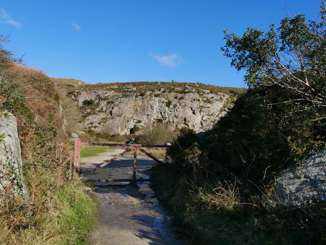 Photo could not load
SW7140 : Open Air Theatre - Carn Marth
Pete Cruse
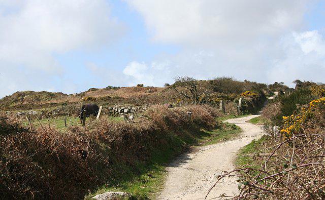 Photo could not load
SW7140 : Carn Marth
Tony Atkin
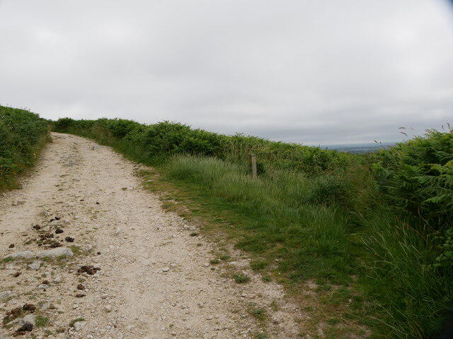 Photo could not load
SW7140 : Track leading up to Carn Marth, with designated footpath post and path leading off to the right
Pete Cruse
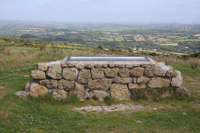 Photo could not load
SW7140 : Panoramic sign near the summit of Carn Marth
Graham Loveland
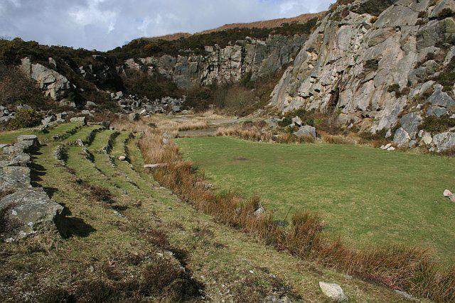 Photo could not load
SW7140 : Carn Marth Theatre Quarry
Tony Atkin
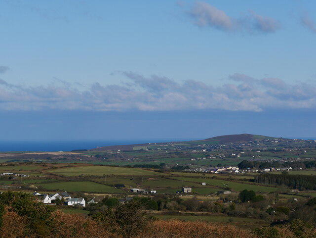 Photo could not load
SW7140 : View from the top of Carn Marth
Pete Cruse
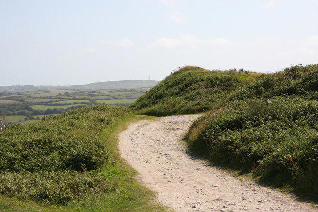 Photo could not load
SW7140 : Track near the summit of Carn marth
Graham Loveland
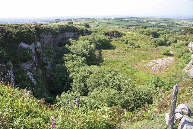 Photo could not load
SW7140 : Disused Quarry on Carn Marth
Graham Loveland
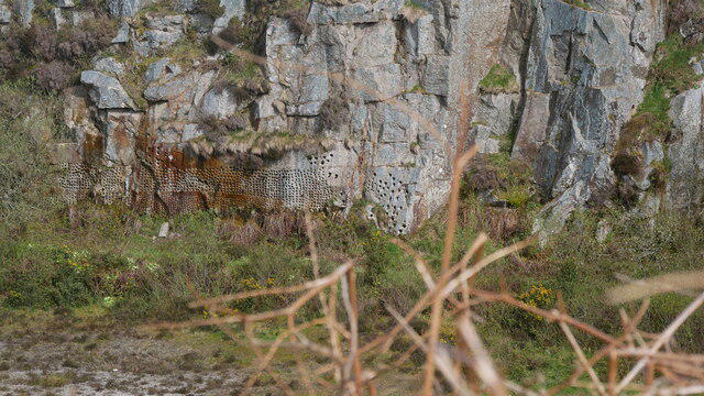 Photo could not load
SW7140 : Test Holes Carn Marth
Pete Cruse
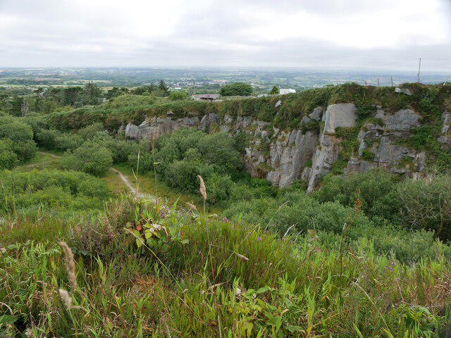
SW7140 : Disused quarry, overgrown with vegetation
Pete Cruse
Hill facts and local notes
Classifications
Elevation
235m
771 ft
Prominence
60m
Coordinates
50.2234, -5.2046
SW715408
OS Map
203
Explorer: 104
At the Summit
The summit features a large granite tor and a stone cairn, providing perfect photo opportunities. The surrounding heathland is also a scenic treat.
Terrain & Geology
Carn Marth is predominantly composed of granite, which forms unique outcrops and boulders, offering intriguing geological formations. The softer rock around it helps create a fertile landscape.
Views & Scenery
You can enjoy panoramic views of the surrounding countryside, including Stithians Lake and the distant north coast of Cornwall on a clear day.
History & Heritage
Name Origin
The name 'Carn Marth' derives from the Cornish language, roughly translating to 'Stone Hill', which is a fitting descriptor of the prominent rocky outcrop.
Historical Significance
Historically, the area has been used for tin mining, and the remnants of old mines can still be seen along the trails.
Getting There & Facilities
Parking
There is a small parking area near the village of Stithians, which is well signposted.
Public Transport
There are regular bus services from nearby towns such as Redruth and Falmouth.
Nearby Facilities
Local facilities include a pub in Stithians and several cafes in Falmouth, along with public toilets in Stithians.
Safety Information
Known Hazards
- Be mindful of steep drops at certain points on the path. Ground can be uneven and muddy, especially after rain.
General Safety Tips
- Check weather conditions before setting out
- Carry appropriate clothing and equipment
- Let someone know your planned route
- Take a map, compass, and GPS device
- Carry emergency supplies: food, water, first aid kit, torch
Hills
Some common questions about the hills answered
Are there group walks up Carn Marth?
Many walkers use Walkmates to join or organise walks with others. You can check for group walks around Carn Marth through the maps
Are there other walkers around Carn Marth?
Activity varies by location and time, but Walkmates lets you see whether others have shared walks or shown interest in this area. Find other people through the walking friends search walking friends for Carn Marth search or of course create your own walk for Carn Marth
Can I organise a walk to Carn Marth?
Yes. If there aren’t any walks listed already, you can create a walk and make it available for others to join.
If you're signed up to Walkmates, you can create a walk to Carn Marth.
How do I find a walk up this hill?
There are often multiple ways to walk this hill, depending on experience and route preference. Walkmates helps you explore walks and routes that others have shared.
Can I suggest a new route up Carn Marth?
Yes. You can suggest or create routes to share with others. Walkmates focuses on the social side of walking, so routes are used to help people organise walks and explore areas together, rather than as detailed navigation tools or route libraries.
Other uses really appreciate knowledgeable walkers sharing their routes. Share your favourite route to Carn Marth here
The is an error or something incorrect about this hill. How do I let you know?
We always strive to keep the information on Walkmates as accurate as possible. If you find an error, please let us know through the contact form and we'll aim to correct it as quickly as possible
Community Discussion
Comments
Location
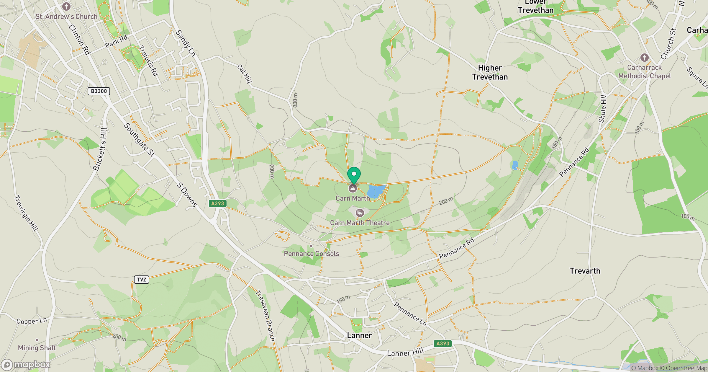
Grid reference: SW715408
View on OpenStreetMapOpens a map in a new tab, centred on the hill.


No comments yet. Be the first.