

Benmore
Good walks are even better shared.
Overview
Benmore: The Big Hill
Overview
Nestled in the stunning Argyll and Bute region of the Scottish Highlands, Benmore stands at an impressive 821 meters tall. With a name that translates to 'big hill' in Gaelic, it lives up to its title and then some, providing ample opportunities for outdoor enthusiasts and hikers alike.
Geology
The mountain is primarily made of porphyritic basalt, a gift from ancient volcanic activity. This makes not just for rugged beauty but also a fascinating geological study for those interested in the Earth's natural history. Don’t forget your geology guide; it’s cooler than it sounds!
Routes
Benmore via the Benmore Path
This popular route allows hikers to take in the breathtaking views without feeling completely knackered. The path is well-marked, covering a distance of 8 km and taking around 3.5 hours, making it perfect for a day out.
Benmore Circuit
For those keen on stretching their legs a bit more, the Benmore Circuit delivers with a 12 km challenge over 5 hours. This route offers various terrain and eye-catching panoramas, perfect for photography enthusiasts.
Summit Features
Upon reaching the summit, one is greeted by a sizeable cairn, a great spot to rest your legs and relish the accomplishment. It’s almost mandatory to take a selfie here – how else are you going to prove you made it?
Terrain Type
The terrain on Benmore is a delightful mix of grassy slopes and rocky outcrops, making it both beautiful and slightly tricky in places. It’s a good idea to wear sturdy boots unless you fancy an impromptu dance with gravity!
Views
Highlights
From the top, views of the Cowal Peninsula, the Firth of Clyde, and occasionally the distant Isle of Arran will steal your breath away—though this may also be due to the altitude.
Best Seasons
Late spring and early autumn are prime seasons for visiting. The heather blooms in summer bring colour, while autumn offers stunning, clear skies and crisp air—ideal for that long-awaited hike.
Hazards
As is often the case in the great outdoors, nature has its quirks. Be wary of loose rocks, rapidly changing weather, and engaging with local wildlife at a respectful distance.
Access
Nearest Parking
The closest parking is at the Benmore Botanic Garden, just a stone's throw from the trailhead.
Public Transport
Buses from Dunoon to Benmore make for easy access, with a short walk needed to hit the trails.
Nearest Town
Dunoon offers accommodations and cafes for post-hike recovery—perfect for indulging in a slice of cake after all that hard work!
Facilities
Facilities nearby include a café at the Benmore Botanic Garden and restrooms to freshen up before or after your hike. A good cup of coffee is never far away!
History
Name Meaning
Benmore’s name is quite fitting, as it directly translates to 'big hill' in Gaelic, a straightforward yet charming description.
Significance
Having been a cherished hiking spot for many locals for years, Benmore is steeped in folklore and cultural significance, adding a unique layer to your hiking experience.
So pack your bags, lace up your boots, and get ready to conquer Benmore. Just remember, the mountain doesn't care how long it takes you to reach the top—it only cares that you have a smashing time doing it!
Explore routes near Benmore
Public walks starting within 80 km of this hill. Nearby does not mean a route reaches the summit; check its map and access before setting out.
No public routes are currently listed within 80 km of Benmore on Walkmates. This does not mean there are no paths here. Explore the map and check local access information before planning a walk.
Route planning notes
These notes describe possible approaches, not verified navigable routes or permission to cross land. Check current paths, local access rules and conditions before setting out.
Benmore via the Benmore Path
A gentle ascent with stunning views of the surrounding landscape that also serves as a pleasant introduction to the Munro experience.
Benmore Circuit
This circuit provides a more challenging route, looping around the mountain with varying terrain and incredible vantage points.
Make a day of it, together
Find someone to share the walk with, or organise a day out along a route you like.
Photo Gallery
View all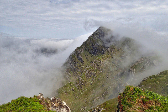 Photo could not load
F5404 : Gubastaduff from Benmore
Mick Garratt
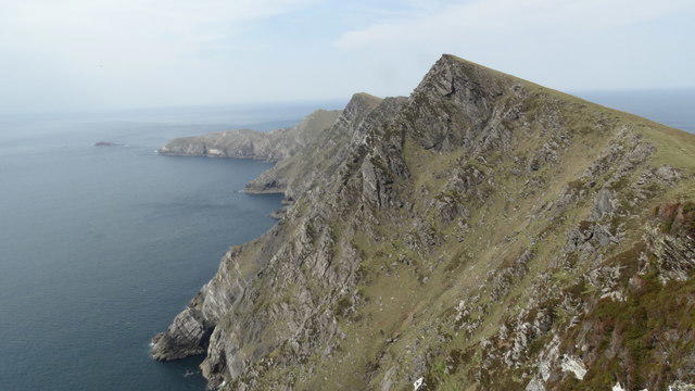 Photo could not load
F5404 : View towards Achill Head from cliffs at Benmore
Colin Park
Hill facts and local notes
Classifications
Elevation
332m
1,089 ft
Prominence
138m
Coordinates
53.9712, -10.2196
F544047
OS Map
22 30
At the Summit
The summit boasts a prominent cairn, offering a fine spot for a well-earned rest and a chance to ponder life’s mysteries – like why your socks always disappear in the wash.
Terrain & Geology
Benmore is primarily composed of ancient volcanic rock, specifically porphyritic basalt, creating a rugged landscape that captivates geologists and nature lovers alike.
Views & Scenery
From the summit, you'll enjoy sweeping views of the Cowal Peninsula, the Firth of Clyde, and on a clear day, the Isle of Arran stretches out beautifully in the distance.
History & Heritage
Name Origin
The name 'Benmore' translates to 'big hill' in Scottish Gaelic, aptly describing its stature and presence.
Historical Significance
Benmore has long been a favourite among local hikers and has a healthy share of folklore, often seen as a spiritual place for reflection.
Getting There & Facilities
Check current local access restrictions, parking rules and transport timetables before travelling. These notes do not confirm public access to the summit.
Parking
There is a small car park at the Benmore Botanic Garden with a short walk leading to the Benmore Path.
Public Transport
Local buses operate from Dunoon to Benmore, with a short walk required to reach the trailhead.
Nearby Facilities
Nearby facilities include the Benmore Botanic Garden café, toilets at the garden, and picnic areas for a hearty lunch break.
Safety Information
Known Hazards
- Loose rocks on steeper sections, changing weather conditions, and potential wildlife encounters.
General Safety Tips
- Check weather conditions before setting out
- Carry appropriate clothing and equipment
- Let someone know your planned route
- Take a map, compass, and GPS device
- Carry emergency supplies: food, water, first aid kit, torch
Hills
Some common questions about the hills answered
Are there group walks up Benmore?
Many walkers use Walkmates to join or organise walks with others. You can check for group walks around Benmore through the maps
Are there other walkers around Benmore?
Activity varies by location and time, but Walkmates lets you see whether others have shared walks or shown interest in this area. Find other people through the walking friends search walking friends for Benmore search or of course create your own walk for Benmore
Can I organise a walk to Benmore?
Yes. If there aren’t any walks listed already, you can create a walk and make it available for others to join.
If you're signed up to Walkmates, you can create a walk to Benmore.
How do I find a walk up this hill?
There are often multiple ways to walk this hill, depending on experience and route preference. Walkmates helps you explore walks and routes that others have shared.
Can I suggest a new route up Benmore?
Yes. You can suggest or create routes to share with others. Walkmates focuses on the social side of walking, so routes are used to help people organise walks and explore areas together, rather than as detailed navigation tools or route libraries.
Other uses really appreciate knowledgeable walkers sharing their routes. Share your favourite route to Benmore here
The is an error or something incorrect about this hill. How do I let you know?
We always strive to keep the information on Walkmates as accurate as possible. If you find an error, please let us know through the contact form and we'll aim to correct it as quickly as possible
Community Discussion
Comments
Location
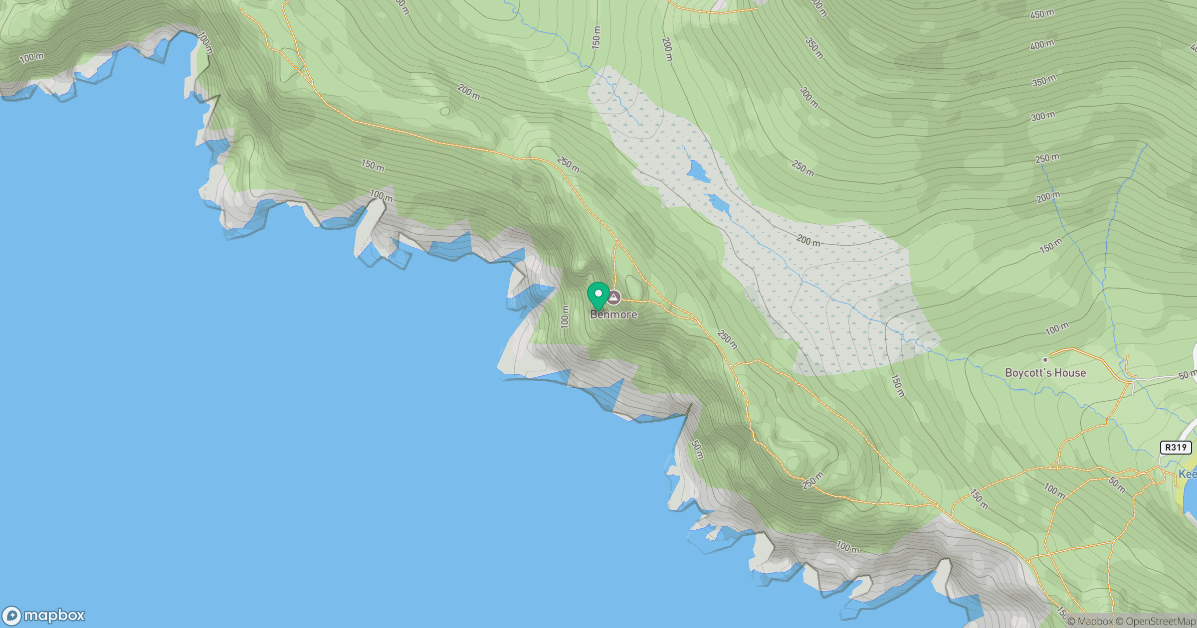
Grid reference: F544047
View on OpenStreetMapOpens a map in a new tab, centred on the hill.
Hills within 30 km
Straight-line distance, not a walking route or confirmation of access.
No comments yet. Be the first.