

Creag an Amalaidh
Good walks are even better shared.
NH7597 : East Sutherland Hills on an Autumn Afternoon
Andrew Tryon Photo source
Overview
Creag an Amalaidh
Creag an Amalaidh, a splendid Marilyn located in the Scottish Highlands, stands tall at 395 meters with a prominence of 65 meters. While it may overshadow some of the more illustrious Munros, this peak offers its own charm, as well as rewarding views and a less trodden path that many serious hikers appreciate.
Geology
The mountain is mainly composed of ancient schists, shaped through eons by the relentless forces of weathering and glaciation. For geology aficionados, exploring the strata here provides a peek into the Earth’s rich history.
Route
One popular route starts from the A831, a well-marked trail that is both easy to follow and visually rewarding. Covering approximately 4.5 kilometers, the round trip can be accomplished comfortably within 2.5 hours, making it a delightful jaunt for hikers of moderate skill.
Summit Features
At the summit, you'll find a generous stone cairn providing an ideal backdrop for photos and a resting point for a well-deserved snack. Sitting atop the rise, the views are breathtaking and certainly worth the climb.
Terrain Type
The terrain varies from grassy pastures to rocky outcrops, with some boggy areas that may test your agility. Be prepared – nature loves to keep you on your toes!
Views
On a clear day, expect panoramic vistas that include the iconic Loch Ness and the surrounding hills. Spring and early autumn are particularly advantageous for clear views, so plan your trip accordingly.
Hazards
While the path is not overly treacherous, hikers should exercise caution on wet rocks and during foggy conditions, as visibility can drop quickly.
Nearby Summits
For those looking to extend their adventure, consider summits such as Meall a' Ghiubhais (490 meters) and Càrn na h-Eaglaise (539 meters), both offering their own unique landscapes and stories.
Access
Nearest Parking
A small parking area exists near the A831, but do arrive early to secure a spot.
Public Transport
Buses from Drumnadrochit can drop you off not far from the trailhead, making public transport a viable option if time allows for waiting on schedules.
Nearest Town
Drumnadrochit is the closest settlement, providing amenities aplenty after your hike!
Facilities
Local cafes serve delightful brews and treats, while public toilets are available for those essential pre-hike preparations.
History
Name Meaning: The name in Gaelic suggests a land steeped in tales connected to kinship, hinting at the rich cultural narrative that envelopes this area.
Significance: Historically, this peak has echoed the legends of yesteryear, making it not just a climb but a step into Scotland’s storied past.
In summary, whether you're a seasoned hiker or a family out for a leisurely exploration, Creag an Amalaidh offers an accessible adventure with memorable views and an opportunity to delve into the captivating history of the Highlands. Lace up your boots and take to the hills!
Explore routes near Creag an Amalaidh
Walks starting near this hill. Open a route to check its map, distance and full itinerary.
Loch Migdale from Torroy: Spinningdale pinewood and loch shore walk
View route
Ben Klibreck
View route
Findhorn guided night walk
View route
Culbin Forest: Hill 99, Gravel Pit Ponds and Dragonfly Pool
View route
Route planning notes
These notes describe possible approaches. Check a route's map and access information when planning your walk.
From the A831
A straightforward route starting from the A831 road, leading through lush heather and grassy patches before the final ascent to the summit.
Make a day of it, together
Find someone to share the walk with, or organise a day out along a route you like.
Photo Gallery
View all Photo could not load
NH7597 : East Sutherland Hills on an Autumn Afternoon
Andrew Tryon
 Photo could not load
NH7697 : Loch Fleet, seen from Creag an Amalaidh
Richard Webb
 Photo could not load
NH7597 : Salt-marsh fringe and extensive tidal sand flats at Loch Fleet
Mick Crawley
 Photo could not load
NH7597 : On Creag an Amalaidh
Richard Webb
 Photo could not load
NH7597 : Creag an Amalaidh
Richard Webb
 Photo could not load
NH7597 : Princess' Cairn, Creag an Amalaidh
Richard Webb
Hill facts and local notes
Classifications
Elevation
261m
856 ft
Prominence
154m
Coordinates
57.9496, -4.0987
NH758975
OS Map
21
Explorer: 441E
At the Summit
The summit is crowned with a large stone cairn that offers a perfect spot for a well-deserved snack or photo opportunity. The views from here are nothing short of spectacular.
Terrain & Geology
The mountain is primarily composed of ancient metamorphic rocks known as schists, which have been shaped by glacial erosion over millennia. The landscape is a visual testament to the forces of nature, making it a fascinating area for geology enthusiasts.
Views & Scenery
On a clear day, you can enjoy sweeping views of Loch Ness and the surrounding hills, including the majestic peaks of the Great Glen.
History & Heritage
Name Origin
Creag an Amalaidh translates to 'Hill of the relation' in Gaelic, hinting at its historical significance.
Historical Significance
This mountain has been a silent witness to the many tales and legends of the Highlands, steeped in the folklore of the area.
Getting There & Facilities
Parking
There is a small parking area near the A831 where you can leave your vehicle. Arrive early, as it fills up quickly on nice days.
Public Transport
The nearest public transport options are available in Drumnadrochit, which is a short drive away. Buses run regularly, but be sure to check the timetable.
Nearby Facilities
In Drumnadrochit, you'll find several cafes and restaurants, as well as public toilets to freshen up before or after your hike.
Safety Information
Known Hazards
- Care should be taken on the rocky sections, especially in wet weather. The possibility of low visibility due to fog is also something to be aware of.
General Safety Tips
- Check weather conditions before setting out
- Carry appropriate clothing and equipment
- Let someone know your planned route
- Take a map, compass, and GPS device
- Carry emergency supplies: food, water, first aid kit, torch
Hills
Some common questions about the hills answered
Are there group walks up Creag an Amalaidh?
Many walkers use Walkmates to join or organise walks with others. You can check for group walks around Creag an Amalaidh through the maps
Are there other walkers around Creag an Amalaidh?
Activity varies by location and time, but Walkmates lets you see whether others have shared walks or shown interest in this area. Find other people through the walking friends search walking friends for Creag an Amalaidh search or of course create your own walk for Creag an Amalaidh
Can I organise a walk to Creag an Amalaidh?
Yes. If there aren’t any walks listed already, you can create a walk and make it available for others to join.
If you're signed up to Walkmates, you can create a walk to Creag an Amalaidh.
How do I find a walk up this hill?
There are often multiple ways to walk this hill, depending on experience and route preference. Walkmates helps you explore walks and routes that others have shared.
Can I suggest a new route up Creag an Amalaidh?
Yes. You can suggest or create routes to share with others. Walkmates focuses on the social side of walking, so routes are used to help people organise walks and explore areas together, rather than as detailed navigation tools or route libraries.
Other uses really appreciate knowledgeable walkers sharing their routes. Share your favourite route to Creag an Amalaidh here
The is an error or something incorrect about this hill. How do I let you know?
We always strive to keep the information on Walkmates as accurate as possible. If you find an error, please let us know through the contact form and we'll aim to correct it as quickly as possible
Community Discussion
Comments
Location
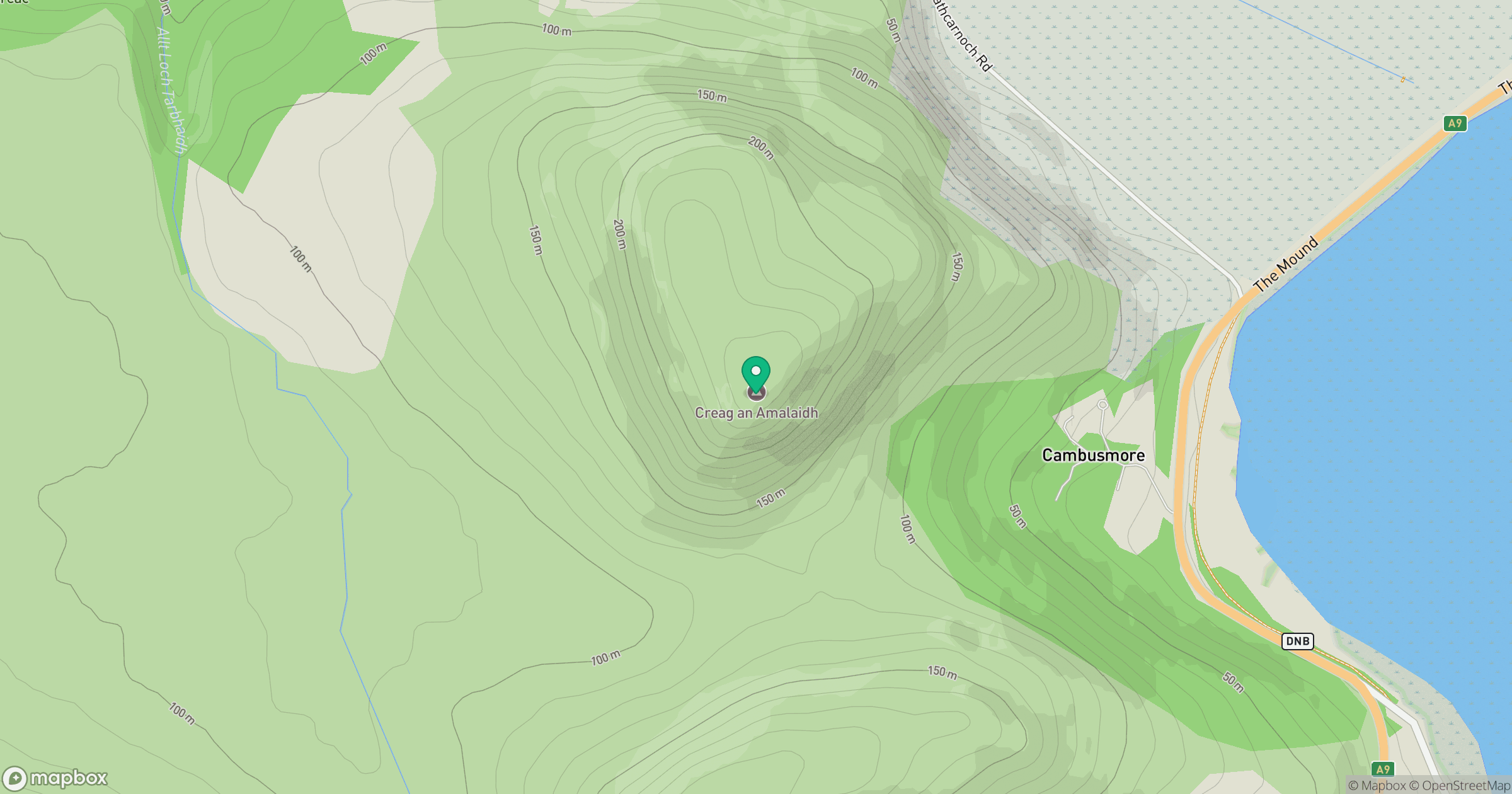
Grid reference: NH758975
View on OpenStreetMapOpens a map in a new tab, centred on the hill.
No comments yet. Be the first.