

Beinn na Laire
Good walks are even better shared.
NF8235 : Coire Buidhe headwall
Richard Webb Photo source
Overview
Beinn na Laire - A Highland Delight
Introduction
Nestled in the picturesque Scottish Highlands, Beinn na Laire is a must-visit for any outdoor enthusiast. Standing at an impressive 999 meters, it is classified as a Marilyn, offering both challenge and awe-inspiring views.
Geology
Beinn na Laire showcases fascinating geology, primarily composed of schists that bear witness to the region's metamorphic heritage. The landscape features classic U-shaped valleys, a testament to the powerful forces of glacial erosion that shaped this dramatic scenery.
Access and Parking
For those wishing to ascend this majestic peak, the best starting point is Loch na Dunaich. Ample parking can be found at a small layby, making it convenient for hikers eager to seize the day. While public transport directly to the area is limited, buses from Broadford provide a potential route; however, a friendly lift or driving is typically the best option.
Routes
The route from Loch na Dunaich is popular due to its manageable distance of approximately 8 km round trip. Expect to spend around 3.5 hours on this trek, which is rated as moderate in difficulty. Be prepared for a delightful mix of both scenic trails and the odd rough patch.
Summit Features
Upon reaching the summit, hikers are welcomed by a large stone cairn that stands proud against the sky. It’s the ideal spot for a celebratory selfie or to simply soak in the sweeping vistas.
Terrain
The terrain is primarily a blend of rocky outcrops and soft grassy slopes. Lower down, some sections can be boggy, so a sturdy pair of boots is highly recommended.
Views
The views from Beinn na Laire are nothing short of spectacular. On a clear day, you can see the Isle of Skye and the majestic peaks of the Cuillin Range. For the best views, consider hiking during late spring or early autumn when the skies are often bright and clear.
Hazards
As with any Highland adventure, be aware of potential hazards. Sudden weather changes are common, so always be prepared. Also, the rocks can be slippery after rain, so exercise caution, especially in less stable areas.
Nearby Summits
If you're feeling ambitious, nearby peaks such as Beinn a' Chroin and Beinn Dronaig are great for a mini-adventure. Both have their own charms and challenges!
Facilities
After your hike, a short drive to Elgol offers a selection of cafes and picturesque views that make for a perfect ending to a day of hiking. Just don't expect public toilets in the mountains, so plan accordingly.
Conclusion
Beinn na Laire is not just a mountain; it's an experience. Whether you're in it for the stunning views or a good workout, it does not disappoint. So lace up your boots, pack your snacks, and let the Highland air fill your lungs. Happy hiking!
Explore routes near Beinn na Laire
Walks starting near this hill. Open a route to check its map, distance and full itinerary.
Dun Mhulan Broch Quick Walk
View route
Berneray Community Hall to the beautiful beach
View route
Beautiful private beach walk Isle of Harris
View route
Route planning notes
These notes describe possible approaches. Check a route's map and access information when planning your walk.
From Loch na Dunaich
An accessible route starting from the scenic Loch na Dunaich, leading to the summit via a mix of trails and less trodden paths.
Make a day of it, together
Find someone to share the walk with, or organise a day out along a route you like.
Photo Gallery
View all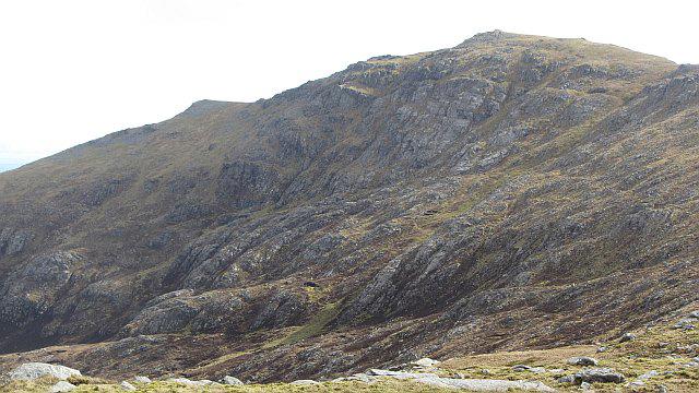 Photo could not load
NF8235 : Coire Buidhe headwall
Richard Webb
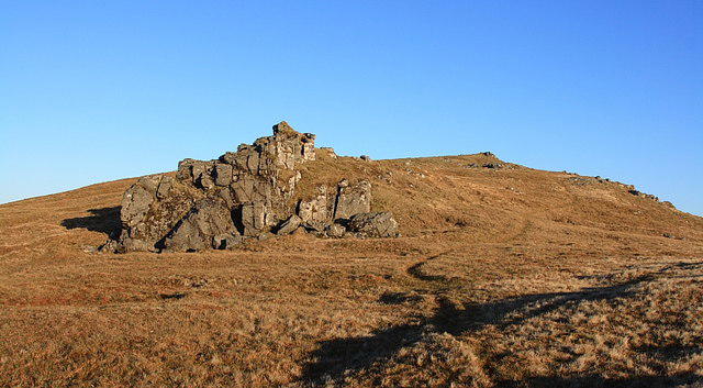 Photo could not load
NF8334 : Beinn na Laire
Rupert Fleetingly
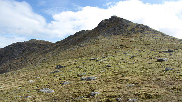 Photo could not load
NF8234 : Beinn na Laire and Hecla
Richard Webb
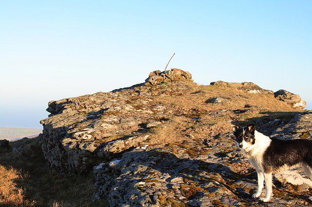 Photo could not load
NF8234 : Beinn na Laire
Rupert Fleetingly
Hill facts and local notes
Classifications
Elevation
564m
1,850 ft
Prominence
33m
Coordinates
57.2943, -7.2652
NF829349
OS Map
22
Explorer: 453S
At the Summit
The summit features a large stone cairn that serves as a perfect photo opportunity, alongside panoramic views of the surrounding hills.
Terrain & Geology
Beinn na Laire is largely composed of metamorphic rocks, particularly schists, which can be found throughout the region. The mountain is a classic example of glacial erosion, with characteristic U-shaped valleys surrounding it.
Views & Scenery
From the summit, you can enjoy breathtaking views of the Isle of Skye, the Cuillin Range, and a smattering of lochs, making it a photographer's paradise.
History & Heritage
Name Origin
The name 'Beinn na Laire' translates to 'Mountain of the Song' in Gaelic, which could either be a reference to the haunting quality of the landscape or perhaps to the sound of the wind whistling through rocks.
Historical Significance
The mountain has cultural importance in local folklore, often associated with stories of giants and mythical creatures.
Getting There & Facilities
Parking
The nearest parking is available at the small layby near Loch na Dunaich, providing easy access to the hiking trail.
Public Transport
Public transport is limited; however, some bus services operate from Broadford, making it necessary to drive or arrange a lift.
Nearby Facilities
In Elgol, there are a few cafes and restaurants, providing a lovely spot to refuel after a hike, though public toilets can be sparse.
Safety Information
Known Hazards
- Watch for sudden weather changes typical of the Highlands, and be cautious of slippery rock surfaces, particularly after rain.
General Safety Tips
- Check weather conditions before setting out
- Carry appropriate clothing and equipment
- Let someone know your planned route
- Take a map, compass, and GPS device
- Carry emergency supplies: food, water, first aid kit, torch
Hills
Some common questions about the hills answered
Are there group walks up Beinn na Laire?
Many walkers use Walkmates to join or organise walks with others. You can check for group walks around Beinn na Laire through the maps
Are there other walkers around Beinn na Laire?
Activity varies by location and time, but Walkmates lets you see whether others have shared walks or shown interest in this area. Find other people through the walking friends search walking friends for Beinn na Laire search or of course create your own walk for Beinn na Laire
Can I organise a walk to Beinn na Laire?
Yes. If there aren’t any walks listed already, you can create a walk and make it available for others to join.
If you're signed up to Walkmates, you can create a walk to Beinn na Laire.
How do I find a walk up this hill?
There are often multiple ways to walk this hill, depending on experience and route preference. Walkmates helps you explore walks and routes that others have shared.
Can I suggest a new route up Beinn na Laire?
Yes. You can suggest or create routes to share with others. Walkmates focuses on the social side of walking, so routes are used to help people organise walks and explore areas together, rather than as detailed navigation tools or route libraries.
Other uses really appreciate knowledgeable walkers sharing their routes. Share your favourite route to Beinn na Laire here
The is an error or something incorrect about this hill. How do I let you know?
We always strive to keep the information on Walkmates as accurate as possible. If you find an error, please let us know through the contact form and we'll aim to correct it as quickly as possible
Community Discussion
Comments
Location
View the hill's mapped position and surrounding paths.
Grid reference: NF829349
View on OpenStreetMapOpens a map in a new tab, centred on the hill.
No comments yet. Be the first.