
Beinn Ghot
Good walks are even better shared.
Overview
Beinn Ghot: The Highland Gem
Overview
Beinn Ghot, standing tall at 854 meters, is a formidable yet approachable Hewitt in the stunning Scottish Highlands. Its rugged terrain is a playground for outdoor enthusiasts, offering challenges and breathtaking scenery.
Geology
The mountain is primarily composed of Schiehallion-type granite, known for its striking formations that have been shaped by ancient glaciers. As you traverse its slopes, take a moment to appreciate the geological wonders beneath your feet.
Route Information
The route starting from Strathcroy is a favoured choice for many hikers. Covering roughly 11.5 km and taking around 4.5 hours, this moderate hike rewards adventurers with panoramic views and a good workout.
Summit Features
The summit is capped with a classic Highland cairn, inviting hikers to pause, take a selfie, and marvel at the stunning views. Don’t forget to bring a high-five for the fellow hikers!
Terrain
Expect rugged and rocky terrain, with heather-covered patches adding splashes of colour. The paths can be tricky, particularly in wet conditions, so best keep your eyes peeled!
Views
From atop Beinn Ghot, you’ll enjoy views stretching to Beinn Eighe and Liathach, among others. Spring and early summer offer the best conditions for clear views, and the vibrant heather will likely take your breath away.
Hazards
As with many Highland hikes, be aware of sudden weather changes. Pathways can become slippery, and visibility can vanish quicker than you can say 'Scottish drizzle.' Plan accordingly!
Nearby Summits
If you're feeling adventurous, consider tackling nearby peaks like Beinn Eighe or Liathach for an unforgettable Highland experience.
Access
- Nearest Parking: Strathcroy, where space is limited but finds a cosy hub of cars.
- Public Transport: Local buses from Inverness can take you close, but check schedules beforehand—sometimes they play hide and seek!
- Nearest Town: Kinlochewe is your best bet for eateries and pit stops. Don’t leave without grabbing a slice of cake!
Facilities
Remember to pack a snack, as the only facilities you’ll find are in Kinlochewe, with no toilets or cafés on the mountain itself.
History
The name Beinn Ghot translates to 'Hill of the Gout' in Gaelic, which could be a nod to the mountain's less-than-gentle terrain. Its presence in local folklore adds to its charm and allure to those who cherish stories of the Highlands.
Conclusion
Beinn Ghot may not be the largest mountain in the Highlands, but it is a gem for those looking for a rewarding adventure. So lace up those hiking boots, grab your walking pole (they're practically a fashion statement), and hit the trails—you won’t regret it!
Explore routes near Beinn Ghot
Public walks starting within 80 km of this hill. Nearby does not mean a route reaches the summit; check its map and access before setting out.
Dun Mhulan Broch Quick Walk
View route
Berneray Community Hall to the beautiful beach
View route
Beautiful private beach walk Isle of Harris
View route
Route planning notes
These notes describe possible approaches, not verified navigable routes or permission to cross land. Check current paths, local access rules and conditions before setting out.
Starting from Strathcroy
A popular route for hikers, this path meanders through the scenic valleys leading to the summit, providing a combination of moderate elevation gain and breathtaking views.
Make a day of it, together
Find someone to share the walk with, or organise a day out along a route you like.
Hill facts and local notes
Classifications
Elevation
177m
581 ft
Prominence
128m
Coordinates
57.2929, -7.2099
NF862345
OS Map
22
Explorer: 453S
At the Summit
The summit of Beinn Ghot features a prominent cairn, which serves as a traditional marker for hikers. On clearer days, the view from the top reveals the dramatic silhouette of surrounding peaks, encouraging many to rest a while and soak it all in.
Terrain & Geology
Beinn Ghot is primarily composed of the rugged Schiehallion-type granite, which creates a stunning landscape featuring glacially shaped hills and occasional rocky outcrops. These formations tell the story of ancient geological processes that have sculpted the Highlands into their current form.
Views & Scenery
From the summit, one can see the expansive beauty of the surrounding Glen Ghot, as well as impressive peaks like Beinn Eighe and Liathach on a clear day.
History & Heritage
Name Origin
The name 'Beinn Ghot' comes from the Gaelic meaning 'Hill of the Gout', possibly referring to the shape of the hill or its rugged terrain.
Historical Significance
The mountain holds local cultural significance and is often referenced in stories of Highland folklore.
Getting There & Facilities
Check current local access restrictions, parking rules and transport timetables before travelling. These notes do not confirm public access to the summit.
Parking
Parking is available at Strathcroy, with a small parking area that can accommodate several vehicles. Arrive early to secure a spot, especially on weekends!
Public Transport
Access via local bus services from Inverness. Buses run several times a day, but check the latest timetable as services can be infrequent.
Nearby Facilities
Facilities are limited to Kinlochewe, where you can find a café and public toilets. No facilities are available on the mountain itself, so pack your own snacks!
Safety Information
Known Hazards
- Beware of sudden weather changes typical in the Highlands. Loose rocky paths can be slippery when wet, and visibility can drop due to fog.
General Safety Tips
- Check weather conditions before setting out
- Carry appropriate clothing and equipment
- Let someone know your planned route
- Take a map, compass, and GPS device
- Carry emergency supplies: food, water, first aid kit, torch
Hills
Some common questions about the hills answered
Are there group walks up Beinn Ghot?
Many walkers use Walkmates to join or organise walks with others. You can check for group walks around Beinn Ghot through the maps
Are there other walkers around Beinn Ghot?
Activity varies by location and time, but Walkmates lets you see whether others have shared walks or shown interest in this area. Find other people through the walking friends search walking friends for Beinn Ghot search or of course create your own walk for Beinn Ghot
Can I organise a walk to Beinn Ghot?
Yes. If there aren’t any walks listed already, you can create a walk and make it available for others to join.
If you're signed up to Walkmates, you can create a walk to Beinn Ghot.
How do I find a walk up this hill?
There are often multiple ways to walk this hill, depending on experience and route preference. Walkmates helps you explore walks and routes that others have shared.
Can I suggest a new route up Beinn Ghot?
Yes. You can suggest or create routes to share with others. Walkmates focuses on the social side of walking, so routes are used to help people organise walks and explore areas together, rather than as detailed navigation tools or route libraries.
Other uses really appreciate knowledgeable walkers sharing their routes. Share your favourite route to Beinn Ghot here
The is an error or something incorrect about this hill. How do I let you know?
We always strive to keep the information on Walkmates as accurate as possible. If you find an error, please let us know through the contact form and we'll aim to correct it as quickly as possible
Community Discussion
Comments
Location
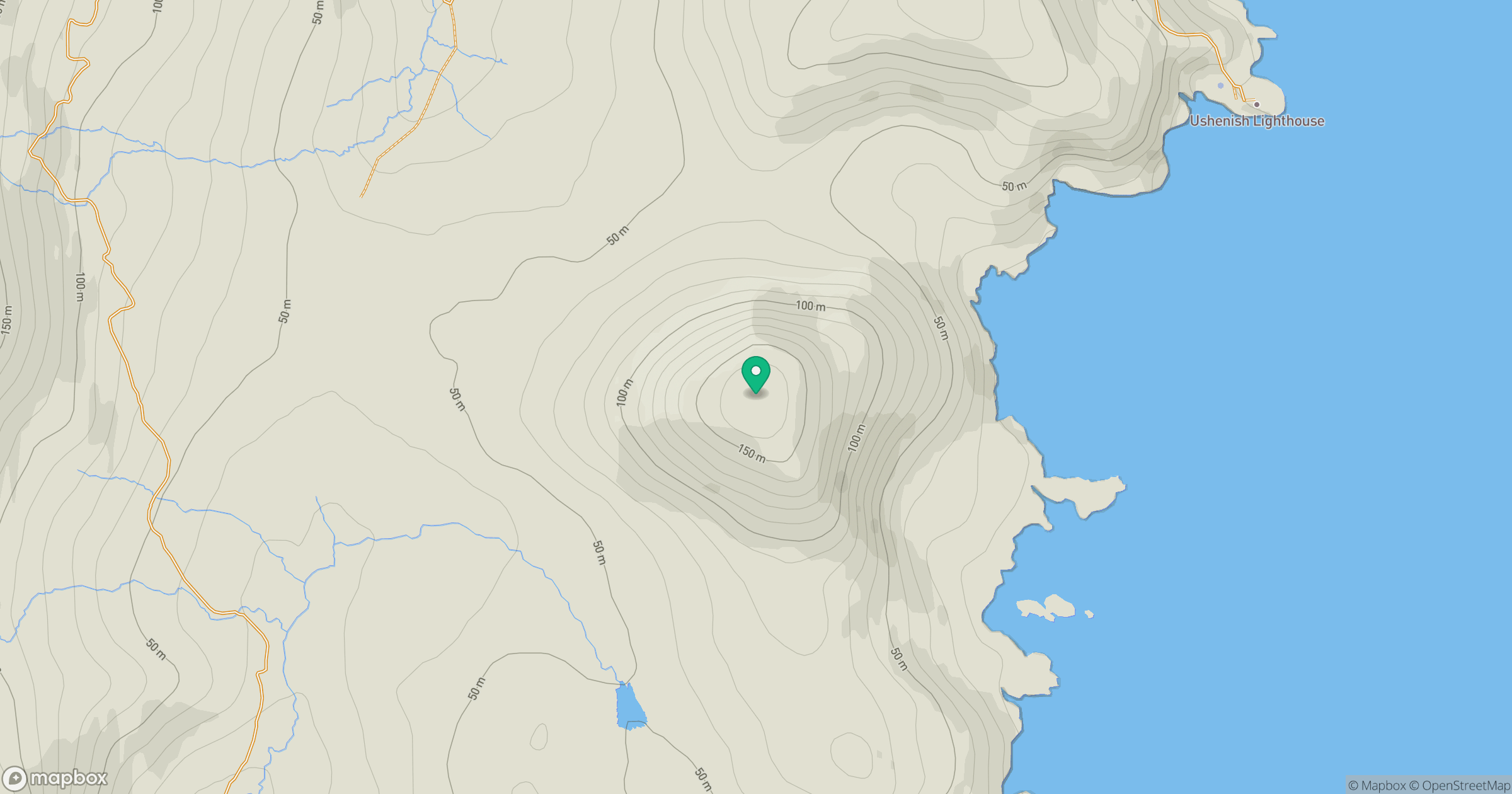
Grid reference: NF862345
View on OpenStreetMapOpens a map in a new tab, centred on the hill.
Hills within 30 km
Straight-line distance, not a walking route or confirmation of access.
Eabhal [Eaval]
347m
Hecla [Thacla]
607m
Beinn Choradail [Ben Corodale]
526m
Beinn Mhor
620m
Beinn a' Tuath
102m
No comments yet. Be the first.