

Badby Down
Good walks are even better shared.
SP5558 : Woods by Badby Road West
David Howard Photo source
Overview
Badby Down
Nestled in the heart of Northamptonshire, Badby Down is a splendid hill that’s not only a joy for hikers but also a treasure for those with a penchant for rural escapades. At an elevation of 119 meters, it may not be the highest peak around, but it certainly packs a punch with its captivating views and gentle terrain.
Geology
The geological composition of Badby Down is primarily Ironstone and limestone, offering a rich, diverse ecosystem. If you’re into rock collecting or geology, watch carefully—the ground might yield interesting specimens!
Routes
One of the most popular routes is the Badby Down Circular Walk. This 4.5 km trail takes about 1.5 hours to complete and is an easy stroll that winds through charming meadows, making it ideal for families. Don’t forget to take a moment at the summit to capture the panoramic views!
Summit Features
The summit features a trig point, a beloved landmark among hill walkers. If you’re feeling cheeky, perhaps balance your picnic atop the trig point for a photo op that’ll make your friends wonder why they didn’t join!
Views
From the top, you’ll be rewarded with views of the rolling hills typical of Northamptonshire, the majestic ancient woodlands of Badby Forest, and even the distant peaks of the Cotswolds on a fine day. Aim for Spring or Autumn, when the landscape is at its most vibrant, adding splashes of colour to the views.
Hazards
While traversing Badby Down, be mindful of the occasional muddy patches, especially after a rain. Also, due to the farm fields around, you might encounter livestock, so keep your dog on a lead.
Nearby Summits
For those who wish to extend their adventure, nearby Borough Hill rises to 200 meters and is another excellent destination for hikers.
Access
Getting to Badby Down is straightforward. The nearest parking is at Badby village hall, just a short stroll away from the various trailheads. If you prefer public transport, bus services regularly operate to Daventry, followed by a quick taxi to the village.
Facilities
While the area itself is quite rural, the nearest facilities can be found in Daventry, which boasts a range of cafes and necessary amenities, including public toilets.
History
The name 'Badby' is believed to have roots tied to early Anglo-Saxon England, deriving from 'Bede's estate', hinting at its historical significance. The landscape is peppered with remnants of medieval history, including poorly preserved village remains, giving it that air of historical curiosity.
Conclusion
In conclusion, Badby Down is a hidden gem perfect for those looking to escape the hustle and bustle of modern life. Whether you fancy a leisurely stroll or a day of contemplation at the summit, this hill is well worth a visit. So, lace up your boots and set off on a delightful adventure—it’s a down worth climbing!
Remember
Always respect the countryside, leave no trace, and enjoy the splendid natural world around you!
Explore routes near Badby Down
Walks starting near this hill. Open a route to check its map, distance and full itinerary.
Draycote Water Walk: Route Map and Current Closures
View route
Ryton Pools: lakeside and southern Ryton Wood circuit
View route
Cubbington circular walk
View route
Salcey Forest: Elephant Pond and northern woodland
View route
Route planning notes
These notes describe possible approaches. Check a route's map and access information when planning your walk.
Badby Down Circular Walk
A scenic route offering panoramic views of the surrounding countryside, perfect for a leisurely hike with family.
Make a day of it, together
Find someone to share the walk with, or organise a day out along a route you like.
Photo Gallery
View all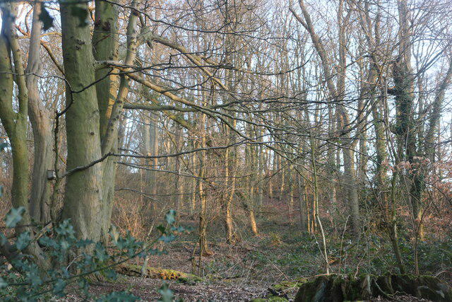 Photo could not load
SP5558 : Woods by Badby Road West
David Howard
Hill facts and local notes
Classifications
Elevation
196m
643 ft
Prominence
33m
Coordinates
52.2193, -1.1896
SP554582
OS Map
152
Explorer: 206 207W
At the Summit
A prominent trig point marks the summit of Badby Down, offering a perfect photo opportunity that will surely impress your social media followers.
Terrain & Geology
Primarily composed of Ironstone and limestone, Badby Down features a mix of clay and loamy soils, which can prove beneficial for the growth of native vegetation.
Views & Scenery
The rolling hills of Northamptonshire, the ancient woodlands of Badby Forest, and on a clear day, as far as the Cotswolds.
History & Heritage
Name Origin
The name 'Badby' is thought to derive from 'Bede's estate', referring to the influence of early Anglo-Saxon settlement.
Historical Significance
The area has historical importance due to its ancient woodlands and proximity to the deserted medieval village remains nearby.
Getting There & Facilities
Parking
Badby Down has parking available at the Badby village hall, a short walk from the start of the trails.
Public Transport
Buses run regularly to Daventry with a short taxi ride to Badby village.
Nearby Facilities
The nearest facilities can be found in Daventry, including cafes and public toilets.
Safety Information
Known Hazards
- Occasional muddy sections after rainfall, and livestock may be present in the fields.
General Safety Tips
- Check weather conditions before setting out
- Carry appropriate clothing and equipment
- Let someone know your planned route
- Take a map, compass, and GPS device
- Carry emergency supplies: food, water, first aid kit, torch
Hills
Some common questions about the hills answered
Are there group walks up Badby Down?
Many walkers use Walkmates to join or organise walks with others. You can check for group walks around Badby Down through the maps
Are there other walkers around Badby Down?
Activity varies by location and time, but Walkmates lets you see whether others have shared walks or shown interest in this area. Find other people through the walking friends search walking friends for Badby Down search or of course create your own walk for Badby Down
Can I organise a walk to Badby Down?
Yes. If there aren’t any walks listed already, you can create a walk and make it available for others to join.
If you're signed up to Walkmates, you can create a walk to Badby Down.
How do I find a walk up this hill?
There are often multiple ways to walk this hill, depending on experience and route preference. Walkmates helps you explore walks and routes that others have shared.
Can I suggest a new route up Badby Down?
Yes. You can suggest or create routes to share with others. Walkmates focuses on the social side of walking, so routes are used to help people organise walks and explore areas together, rather than as detailed navigation tools or route libraries.
Other uses really appreciate knowledgeable walkers sharing their routes. Share your favourite route to Badby Down here
The is an error or something incorrect about this hill. How do I let you know?
We always strive to keep the information on Walkmates as accurate as possible. If you find an error, please let us know through the contact form and we'll aim to correct it as quickly as possible
Community Discussion
Comments
Location
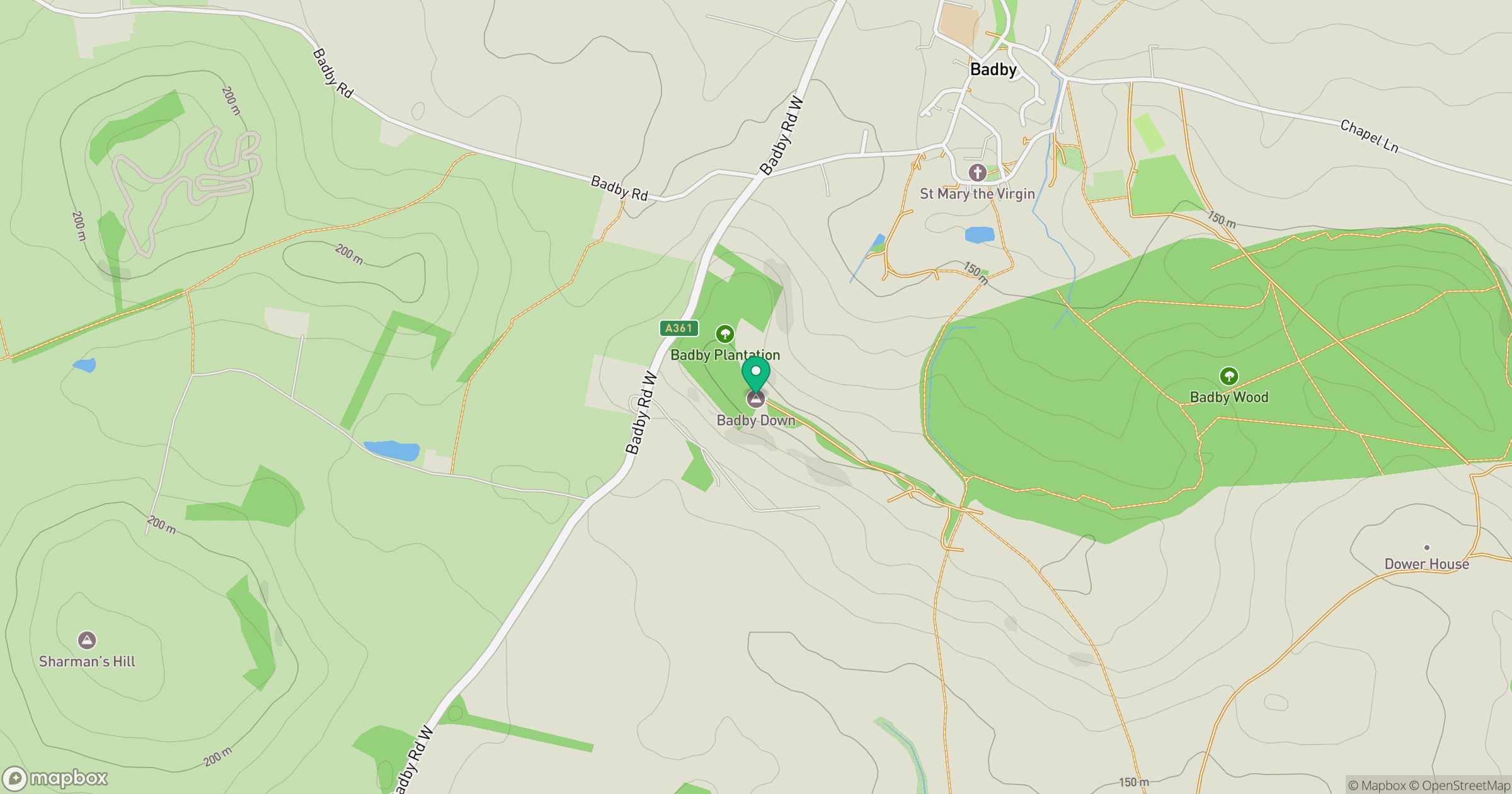
Grid reference: SP554582
View on OpenStreetMapOpens a map in a new tab, centred on the hill.

No comments yet. Be the first.