
Walking guides
Kielder walks: choose your trail before you leave home
Compare Kielder Castle trails, Bakethin and Bull Crag, with practical checks for forestry closures, storm damage, parking and your return.
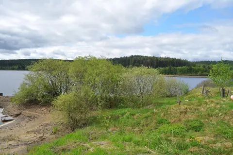
Kielder can mean a short woodland outing beside the Castle, time watching the water at Bakethin, or a much longer walk around a reservoir peninsula. Those are very different days. Picking the right starting point matters more than arriving with a vague plan to “walk in the forest”.
It is also a working landscape. Forestry operations and storm damage can change the usable route without changing the line on an old map. Start with the outing you want, then check that specific trail and its return—not simply whether Kielder is open.
Check these notices before choosing a route
Access check: 29 October 2026. The Reiver Trails Lakeside Way page currently shows no upcoming scheduled closures. That is useful planning information, not a guarantee that every section is clear or suitable for your party. Read the latest notices before relying on a complete reservoir circuit.
Northumberland Wildlife Trust’s Bakethin page separately marks the Castle-and-Bakethin walking route closed. This is not the same itinerary as the shorter visit to Bakethin Hide. Do not assume a downloadable leaflet, a general opening-hours statement or a different open trail cancels that closure notice.
These are dated checks, not a live status board. Read the latest notices again before travelling and follow the signs when you arrive.
Two woodland choices from Kielder Castle
For a compact outing, the Castle is a useful place to start comparing routes. The visitor base is at Kielder Castle, NE48 1ER; use the trail’s map and on-site signs for the actual departure point rather than a pin for Kielder generally.
Dukes Trail for the shorter option
Forestry England lists the Dukes Trail at 1.5 miles / 2.5 km, graded Moderate, through the Castle grounds and adjoining woodland. Use that trail-specific listing rather than older summaries advertising a one-mile walk.
There is a helpful, limited access description: the first half-mile has fine-graded stone and tarmac, with slight inclines, and is designed for wheelchair users with assistance and families with buggies. That does not describe the whole route. If those surfaces are important to your visit, check where that section ends and how you will return before setting out.
Duchess Trail for a little more distance
The Duchess Trail is listed at 2 miles / 3 km, graded Moderate, with green markers. Its route takes in the old packhorse bridge. It is a different option, not an extra half-mile that should automatically be bolted onto the Dukes Trail.
Compare the mapped routes and choose one complete outing. Do not infer step-free access or a smooth surface throughout from the distance or the shared starting area. The official walking page provides the Castle trail map; use it for orientation alongside current notices, not as evidence that every marked path is open.
Bakethin for a wildlife stop
If your reason for coming is to linger by the water rather than cover miles, look at the reserve’s separate hide route. The Welcome Point car park is signposted off the C200 near Butteryhaugh Bridge, rather than being the Castle car park.
Northumberland Wildlife Trust describes mainly wide, well-surfaced tracks, but also steep slopes on either side of the viaduct. The hide has a ramp to its raised Lake View area. Those details are more useful than treating the whole reserve as uniformly accessible.
Keep dogs on a lead. Reserve entry is free, but that is not a promise of free parking. Check the reserve information and the route you actually intend to use; do not turn a hide visit into the closed Castle-and-Bakethin itinerary. Allow time to watch quietly rather than promising yourself a particular wildlife sighting.
Bull Crag when you want a longer reservoir walk
The Bull Crag Trail starts and finishes at Kielder Waterside. Reiver Trails lists this loop at 10.14 km / 6.30 miles. That is a substantial outing, even though it is much shorter than the 26-mile Lakeside Way around the whole reservoir.
The appeal is a day with water views, woodland and features such as Freya’s Cabin. Most of the surface is fine compacted dust, with a loose-stone section and some old tarmac roadway. There are gentle climbs and descents; “lakeside” does not mean completely flat.
Choose it because the distance and surfaces suit your party, not because a website supplies a quick completion time. Build in pauses and your own pace. A route page showing no upcoming scheduled closures does not establish that the ground is clear today. Check current information before committing to the loop, and check any extension separately rather than assuming the rest of the reservoir circuit is suitable.
When a sign changes the day
A closed path is a reason to change the plan, not to squeeze past machinery or invent a shortcut through the trees. Read the notice from a safe position. Use a signed diversion only when you understand where it takes you and whether the longer outing still works. Otherwise, return by a known open route or choose another verified walk.
An offline route trace is useful navigation information, but it cannot know that a harvesting operation or fallen tree has closed the next section. Our guide to reading a walking route map explains how to separate the route line from access information. Follow the Countryside Code, including local signs and consideration for people working in the countryside.
Do not choose woodland as shelter from strong winds. Check the forecast and warnings, and change the day if conditions make the outing unsuitable. The Met Office’s strong-wind advice specifically warns against walking or sheltering close to trees in high winds. Calmer weather does not, by itself, mean storm-damaged trails have reopened.
Sort the small practical details before the drive
- Parking: Forestry England currently lists £2.50 for up to an hour and £6.50 for all-day parking at the main site. Kielder Castle is card-only. Check the current tariff and payment arrangements for your chosen car park, rather than assuming every forest parking area works alike.
- Food and facilities: the Castle is being refurbished and its café is closed. Do not make the walk depend on finding a staffed information point or a café there. Check the facilities you need at your intended base before leaving.
- The return: include time for the drive between bases, finding the trail start, stops and any verified diversion. Choose a finish with daylight to spare; our daylight-planning guide helps budget the whole outing.
- By the reservoir: stay out of the water. Visit Kielder prohibits unauthorised swimming and also asks visitors not to light fires or barbecues.
The current visitor-planning information and Forestry England’s Kielder page are worth saving with your map. Take the food, water, clothing and navigation you need rather than depending on a last-minute download or an open refreshment stop.
A good Kielder day need not cover a huge distance. A clearly chosen trail, an honest check of what is open and time to enjoy the place will serve you better than a longer circuit that only works on paper.
Last reviewed: 29 October 2026. This is a route-selection guide, not turn-by-turn navigation or a guarantee of current access.