

Wallasea Island
Good walks are even better shared.
TQ9494 : Road to Grapnells Farm and beyond
Robin Webster Photo source
Overview
Wallasea Island
Introduction
Nestled in the picturesque Essex Marshes, Wallasea Island offers a unique outdoor experience for those seeking tranquility and natural beauty. While it might not boast towering peaks, the island's allure lies in its thriving wildlife and picturesque landscapes.
Geology
The geology of Wallasea Island is primarily shaped by alluvial deposits from the River Crouch, which has created a rich marshland environment. This makes it a hotspot for diverse flora and fauna, particularly bird species.
Walking Routes
One of the most popular routes is the Wallasea Island Circular Walk, spanning approximately 6.5 km and taking around 2 hours to complete. This easy walk is perfect for families and those looking to enjoy the stunning views of the estuary while keeping a keen eye out for local wildlife.
Terrain and Views
You’ll find the terrain predominantly flat and marshy, with grassy expanses that invite you to take a stroll and soak in the expansive views. Look out for the charming landscapes, especially at dawn and dusk when wildlife is most active.
The best views can be had in spring and autumn, when migrating birds flock to the area and nature comes alive with colours and sounds.
Hazards to Consider
Although Wallasea Island is relatively safe, do keep an eye on the tides. They can affect accessibility, so check the tide times to avoid getting caught out!
Access and Facilities
Getting to Wallasea Island is straightforward, with limited parking available at the entrance, free of charge. For those relying on public transport, bus services from Benfleet bring you close to the island, which is roughly 5 miles away from the nearest town. However, brace yourself, as there are no facilities on the island itself, so bring your own snacks unless you fancy a coffee run in Benfleet post-hike!
History and Meaning
The origins of the name Wallasea may surprise you; it’s thought to come from Old English, indicating a historical connection that adds a bit of intrigue to your visit. Historically significant for agriculture and birdwatching, the island has recently gained attention due to the RSPB Wallasea Island Wild Coast Project, aiming to create new habitats for wildlife.
In conclusion, while it may not be a mountain in the traditional sense, Wallasea Island certainly delivers a rich experience for any outdoor enthusiast looking for a peaceful retreat amidst the striking marshlands of Essex.
Final Thoughts
So pack your binoculars, a decent sandwich, and perhaps a good book. While you may not find a mountain to climb, you will certainly find a world of natural beauty to explore!
Explore routes near Wallasea Island
Walks starting near this hill. Open a route to check its map, distance and full itinerary.
Goldhanger coastal walk
View route
Chelmsford Walk with Men Walking & Talking
View route
Fingringhoe Wick ranger walk
View route
Sandylay and Moat Woods fungi walk
View route
Route planning notes
These notes describe possible approaches. Check a route's map and access information when planning your walk.
Wallasea Island Circular Walk
A leisurely walk that takes you around the island, offering stunning views of the estuary and abundant wildlife.
Make a day of it, together
Find someone to share the walk with, or organise a day out along a route you like.
Photo Gallery
View all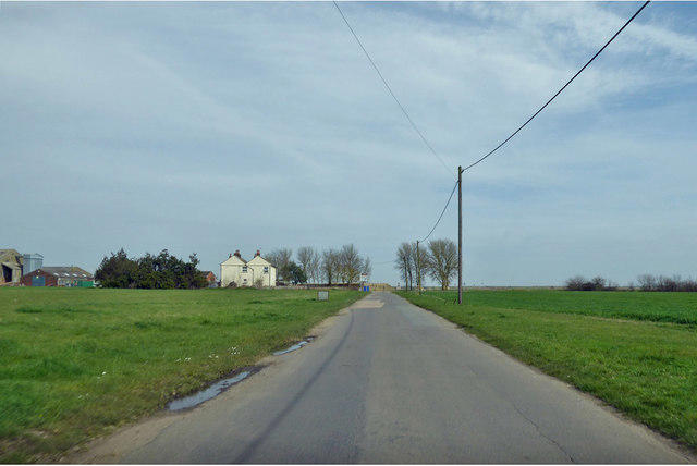 Photo could not load
TQ9494 : Road to Grapnells Farm and beyond
Robin Webster
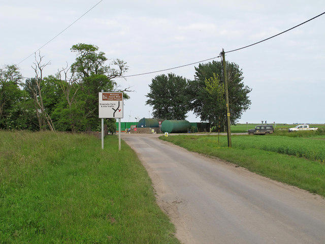 Photo could not load
TQ9494 : Road to Grapnells farm & Wallasea Island Wild Coast Project
Roger Jones
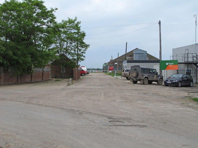 Photo could not load
TQ9494 : Grapnells farm and Wallasea Island Wild Coast project Site office
Roger Jones
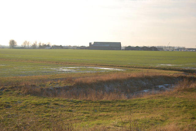 Photo could not load
TQ9494 : View towards Grapnells
Trevor Harris
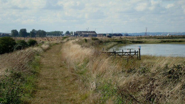 Photo could not load
TQ9494 : Grapnells Farm
John Myers
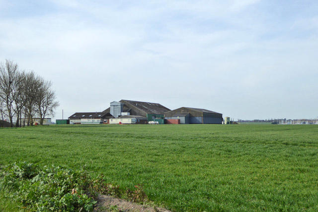 Photo could not load
TQ9494 : Grapnells Farm, Wallasea Island
Robin Webster
Hill facts and local notes
Classifications
Elevation
4m
13 ft
Prominence
1m
Coordinates
51.6190, 0.8043
TQ942948
OS Map
178
Explorer: 176
At the Summit
The island is relatively flat with no defined summit features, but offers plenty of charming landscapes and marshy vistas.
Terrain & Geology
Wallasea Island primarily consists of alluvial deposits created by the River Crouch, providing a unique ecosystem that blends both land and sea.
Views & Scenery
Great views of the River Crouch, various bird species, and the surrounding marshlands.
History & Heritage
Name Origin
The name Wallasea likely derives from the Old English word 'walha', meaning 'foreigner' or 'Welshman', suggesting an interesting historical connection.
Historical Significance
Historically, Wallasea Island has served as an important site for agriculture and birdwatching, particularly with the introduction of the RSPB Wallasea Island Wild Coast Project.
Getting There & Facilities
Parking
There is limited parking available at the entrance to Wallasea Island. Spaces are free but can fill quickly during the weekends.
Public Transport
The nearest public transport options are available in Benfleet, with bus services running to nearby areas.
Nearby Facilities
There are no facilities directly on the island; however, refreshments can be found in nearby Benfleet.
Safety Information
Known Hazards
- Tides can significantly affect accessibility; ensure to check tide times.
General Safety Tips
- Check weather conditions before setting out
- Carry appropriate clothing and equipment
- Let someone know your planned route
- Take a map, compass, and GPS device
- Carry emergency supplies: food, water, first aid kit, torch
Hills
Some common questions about the hills answered
Are there group walks up Wallasea Island?
Many walkers use Walkmates to join or organise walks with others. You can check for group walks around Wallasea Island through the maps
Are there other walkers around Wallasea Island?
Activity varies by location and time, but Walkmates lets you see whether others have shared walks or shown interest in this area. Find other people through the walking friends search walking friends for Wallasea Island search or of course create your own walk for Wallasea Island
Can I organise a walk to Wallasea Island?
Yes. If there aren’t any walks listed already, you can create a walk and make it available for others to join.
If you're signed up to Walkmates, you can create a walk to Wallasea Island.
How do I find a walk up this hill?
There are often multiple ways to walk this hill, depending on experience and route preference. Walkmates helps you explore walks and routes that others have shared.
Can I suggest a new route up Wallasea Island?
Yes. You can suggest or create routes to share with others. Walkmates focuses on the social side of walking, so routes are used to help people organise walks and explore areas together, rather than as detailed navigation tools or route libraries.
Other uses really appreciate knowledgeable walkers sharing their routes. Share your favourite route to Wallasea Island here
The is an error or something incorrect about this hill. How do I let you know?
We always strive to keep the information on Walkmates as accurate as possible. If you find an error, please let us know through the contact form and we'll aim to correct it as quickly as possible
Community Discussion
Comments
Location
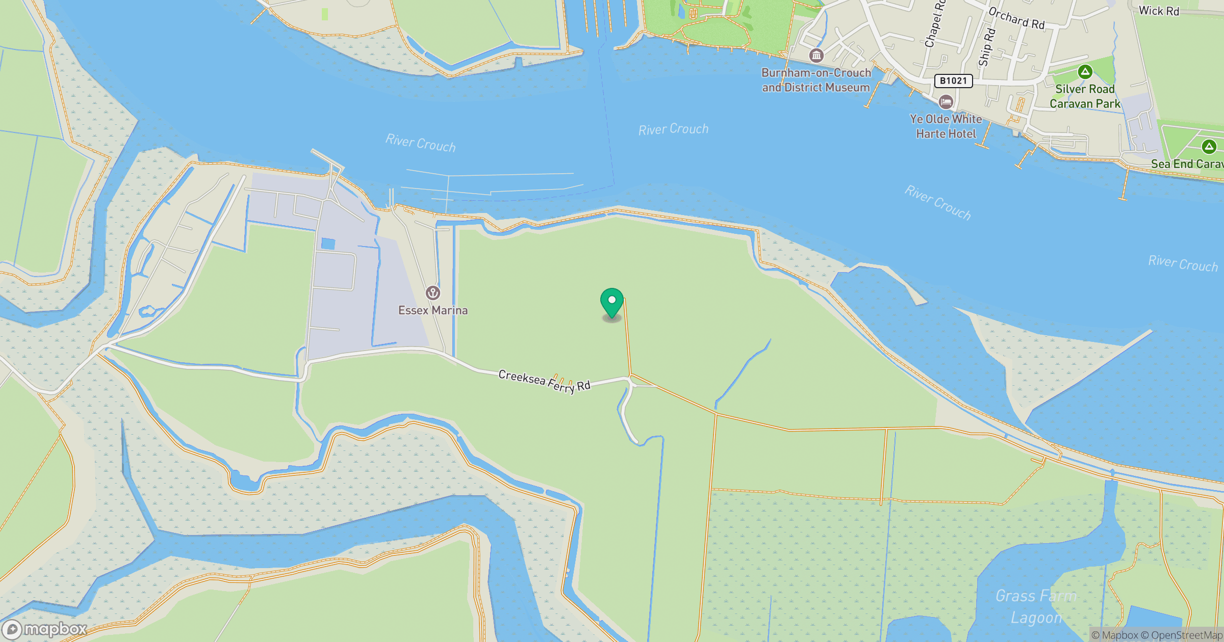
Grid reference: TQ942948
View on OpenStreetMapOpens a map in a new tab, centred on the hill.

No comments yet. Be the first.