

Northey Island
Good walks are even better shared.
TL8706 : Clouded Yellow
Glyn Baker Photo source
Overview
Northey Island: A Hidden Gem for Nature Lovers
Nestled in the heart of Essex, Northey Island is a charming slice of tranquility away from the hustle and bustle of modern life. With a flat terrain that will leave your knees breathing sighs of relief, it’s the perfect spot for a gentle stroll or a serious birdwatching jaunt.
Geology
Northey Island is primarily characterized by its wetland and coastal silt formations. These sedimentary features not only create a unique landscape but also support diverse flora and fauna. This geological composition is crucial for the numerous migratory birds that frequent the area, making it a hotspot for bird watchers.
The Walk
If you’re looking to embark on a peaceful stroll, the Northey Island Circular Walk is just the ticket. Stretching approximately 3 kilometres, the route is relatively flat and will take about an hour to complete. Don’t forget to bring your binoculars; you might just spot a little egret or the majestic buzzard!
Views
The views at Northey Island are nothing short of picturesque, with the serene Maldon estuary laying out before you. The highlight is undoubtedly watching the tidal changes transform the landscape and attract a variety of bird species throughout the seasons. Spring and autumn are particularly fruitful times for spotting our feathered friends.
Access and Facilities
Getting to Northey Island couldn’t be easier. The nearest parking can be found at Maldon Promenade Park, just a 10-minute walk away from the access point to the island. For those relying on public transport, frequent bus services from Chelmsford and Colchester make it accessible for everyone. While facilities on the island are limited, the town of Maldon boasts a range of cafes and restaurants where you can refuel after your adventure.
A Bit of Caution
As with any coastal area, be mindful of the rapidly changing tides. Stick to the paths, and be aware that muddy conditions can make your trek feel a bit more like a workout than a walk. But hey, it’s all part of the adventure!
Conclusion
Northey Island may not be a towering peak, but its flat expanse offers a delightful escape for hikers and nature lovers alike. Whether you're a seasoned birdwatcher or just after a lovely day out in nature, this island is sure to deliver a happy heart and some scenic snaps!
So lace up your walking boots and don’t forget those binoculars!
Happy hiking!
Explore routes near Northey Island
Walks starting near this hill. Open a route to check its map, distance and full itinerary.
Goldhanger coastal walk
View route
Chelmsford Walk with Men Walking & Talking
View route
Sandylay and Moat Woods fungi walk
View route
Fingringhoe Wick ranger walk
View route
Route planning notes
These notes describe possible approaches. Check a route's map and access information when planning your walk.
Northey Island Circular Walk
A leisurely circuit around the island that offers stunning views of the Maldon estuary and the surrounding natural scenery.
Make a day of it, together
Find someone to share the walk with, or organise a day out along a route you like.
Photo Gallery
View all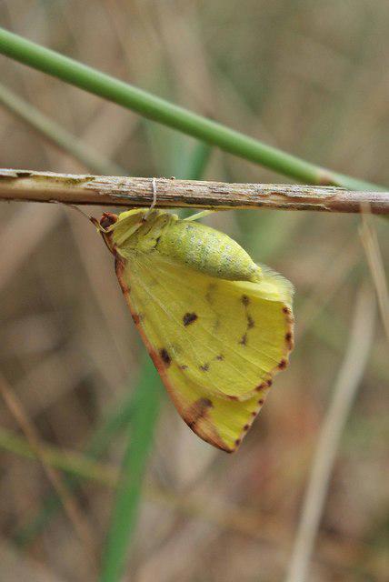 Photo could not load
TL8706 : Clouded Yellow
Glyn Baker
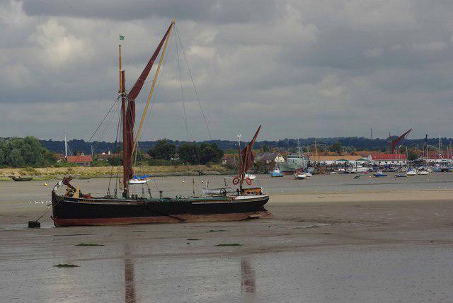 Photo could not load
TL8705 : Northey island to Haybridge
Glyn Baker
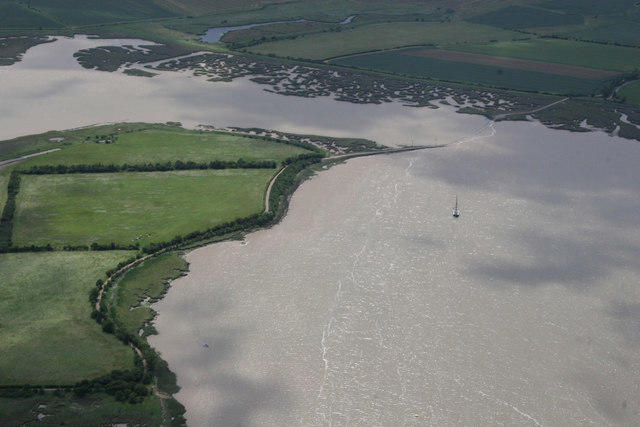 Photo could not load
TL8705 : Northey Island
terry joyce
Hill facts and local notes
Classifications
Elevation
8m
26 ft
Prominence
8m
Coordinates
51.7206, 0.7119
TL874059
OS Map
168
Explorer: 176 183E
At the Summit
Northey Island lacks a traditional summit but features an elevated area with birdwatching hides that provide excellent vantage points for nature enthusiasts.
Terrain & Geology
Predominantly made up of marshland and coastal silt, Northey Island exhibits interesting sedimentary deposits that provide vital habitats for a variety of wildlife. Notably, the island's geology plays a crucial role in its biodiversity, especially concerning migratory birds.
Views & Scenery
From the island, you can enjoy views of the nearby Heybridge Basin, the River Blackwater, and extensive marshland where various bird species thrive.
History & Heritage
Name Origin
The name 'Northey' is thought to derive from Old English, meaning 'northern island', indicative of its geographical positioning.
Historical Significance
Historically, the island was used for salt production, and it plays a role in local heritage concerning marshland farming practices.
Getting There & Facilities
Parking
Maldon Promenade Park offers ample parking spaces (approximately a 10-minute walk to the island access point).
Public Transport
Regular bus services connect to Maldon from Chelmsford and Colchester.
Nearby Facilities
There are no facilities directly on the island, but the town of Maldon provides cafes, restaurants, and public toilets.
Safety Information
Known Hazards
- Beware of the high tidal ranges that can affect footpaths. Sticky mud in wet conditions can also be a bit of a slog!
General Safety Tips
- Check weather conditions before setting out
- Carry appropriate clothing and equipment
- Let someone know your planned route
- Take a map, compass, and GPS device
- Carry emergency supplies: food, water, first aid kit, torch
Hills
Some common questions about the hills answered
Are there group walks up Northey Island?
Many walkers use Walkmates to join or organise walks with others. You can check for group walks around Northey Island through the maps
Are there other walkers around Northey Island?
Activity varies by location and time, but Walkmates lets you see whether others have shared walks or shown interest in this area. Find other people through the walking friends search walking friends for Northey Island search or of course create your own walk for Northey Island
Can I organise a walk to Northey Island?
Yes. If there aren’t any walks listed already, you can create a walk and make it available for others to join.
If you're signed up to Walkmates, you can create a walk to Northey Island.
How do I find a walk up this hill?
There are often multiple ways to walk this hill, depending on experience and route preference. Walkmates helps you explore walks and routes that others have shared.
Can I suggest a new route up Northey Island?
Yes. You can suggest or create routes to share with others. Walkmates focuses on the social side of walking, so routes are used to help people organise walks and explore areas together, rather than as detailed navigation tools or route libraries.
Other uses really appreciate knowledgeable walkers sharing their routes. Share your favourite route to Northey Island here
The is an error or something incorrect about this hill. How do I let you know?
We always strive to keep the information on Walkmates as accurate as possible. If you find an error, please let us know through the contact form and we'll aim to correct it as quickly as possible
Community Discussion
Comments
Location
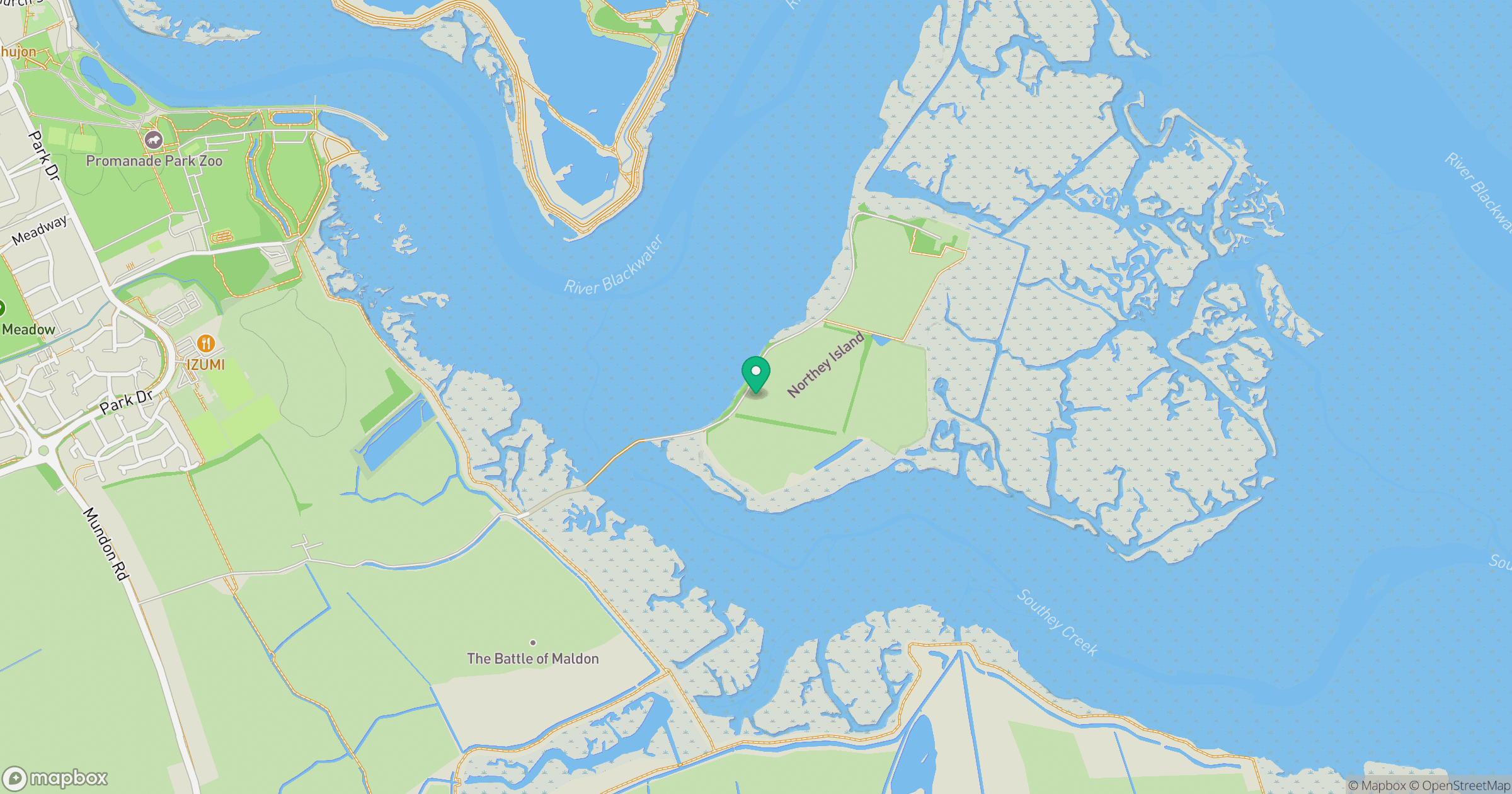
Grid reference: TL874059
View on OpenStreetMapOpens a map in a new tab, centred on the hill.

No comments yet. Be the first.